June 2, 2025
Sturgeon Bay, WI to Aqualand Campground, WI
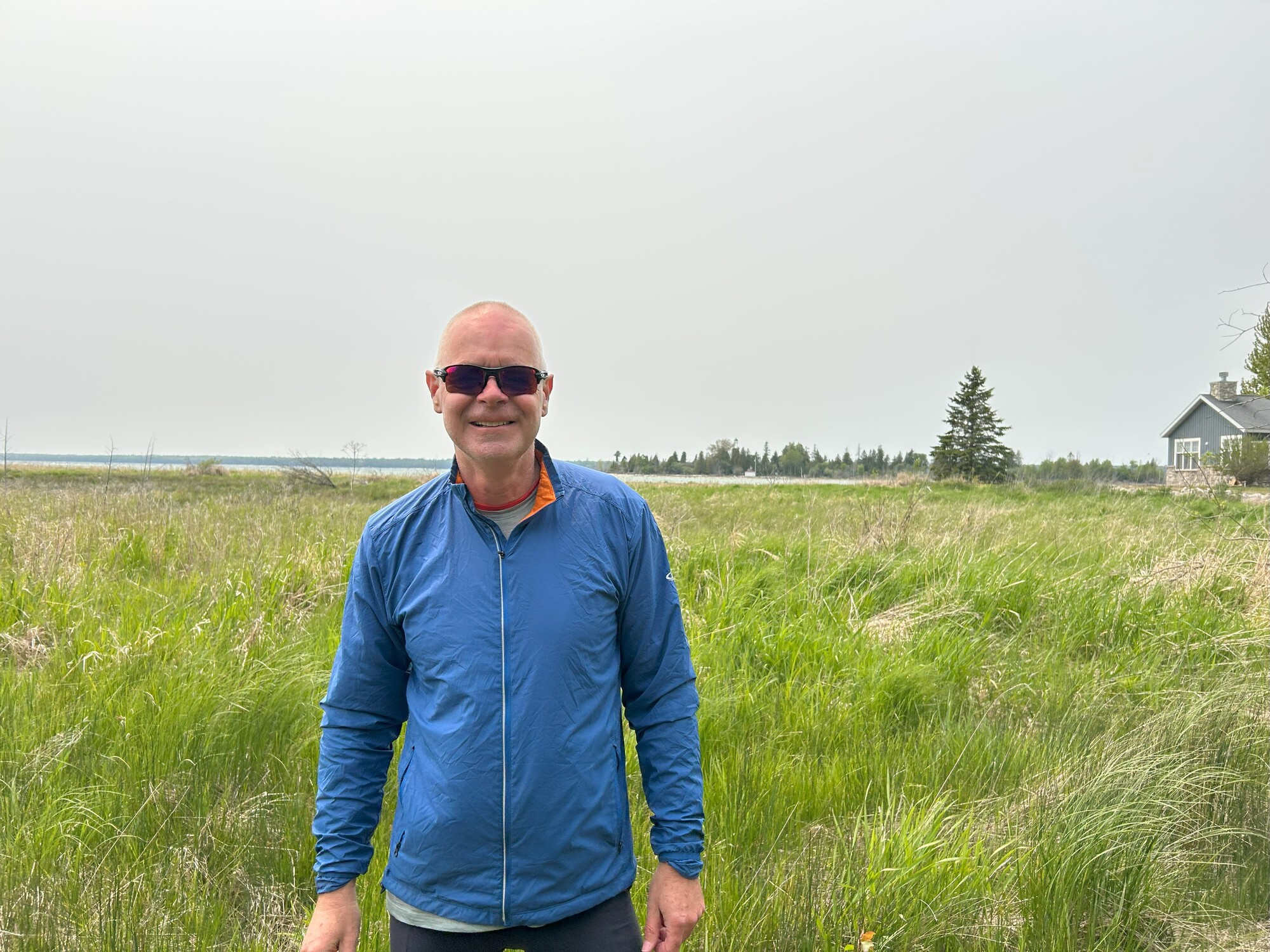
Day 5 - Monday
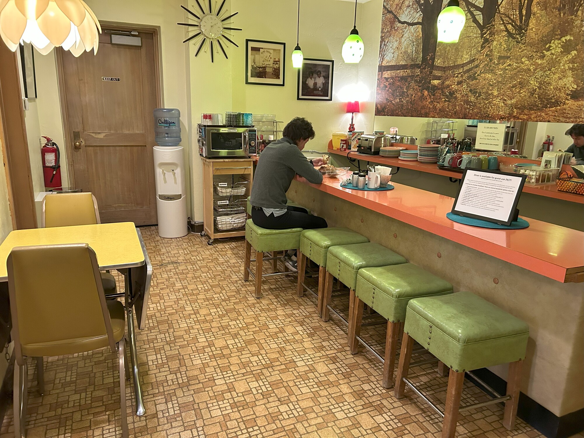
We got up at 7 a.m., and it was nice to have a small sleep in. Going down to the diner area, I made coffee and we ate our muffins for breakfast.
| Heart | 0 | Comment | 0 | Link |


We found a postcard station and as they offered to post the postcards for us, we each wrote a postcard home. I took some more photos of the reception area. The owners have done a good job of outfitting the place for the time period.

After transferring everything out of the room, we left the motel about 8:15 a.m. I was wearing shorts and a T shirt, the first time starting with only this many clothes on since the start of the trip.
A couple of streets over on 4th Street was the Dunlap Lighthouse that had been moved there years before. After some quick photos, we headed out of Sturgeon Bay towards the canal.

Dunlap Reef Rear Range Lighthouse
Dunlap Reef in Sturgeon Bay was first marked by buoys in in 1873.
In 1881, near the completion of the Sturgeon Bay Ship Canal, a pair of range lights was established on the reef.
The front light was a fourteen-foot-tall wooden octagonal pyramidal tower, and the rear light was a two-story frame house with a square tower rising from the northern roof gable.
The lights were first lit on October 15, 1881.
The Dunlap Reef Range was discontinued at the opening of navigation in 1924.
The lighthouse was moved onshore and used as a residence.
The steel tower that marked Dunlap Reef after the 1924 tower is in the grounds of the Door County Maritime Museum in Sturgeon Bay.
A replica of Dunlap Reef Lighthouse was built and stands outside the Door County Maritime Museum.


6 miles later we passed where I had envisioned camping last night. It looked like a nice place where we could have set up. Just down the road we arrived back at the Sturgeon Lighthouses but now we were on the north side of the canal.
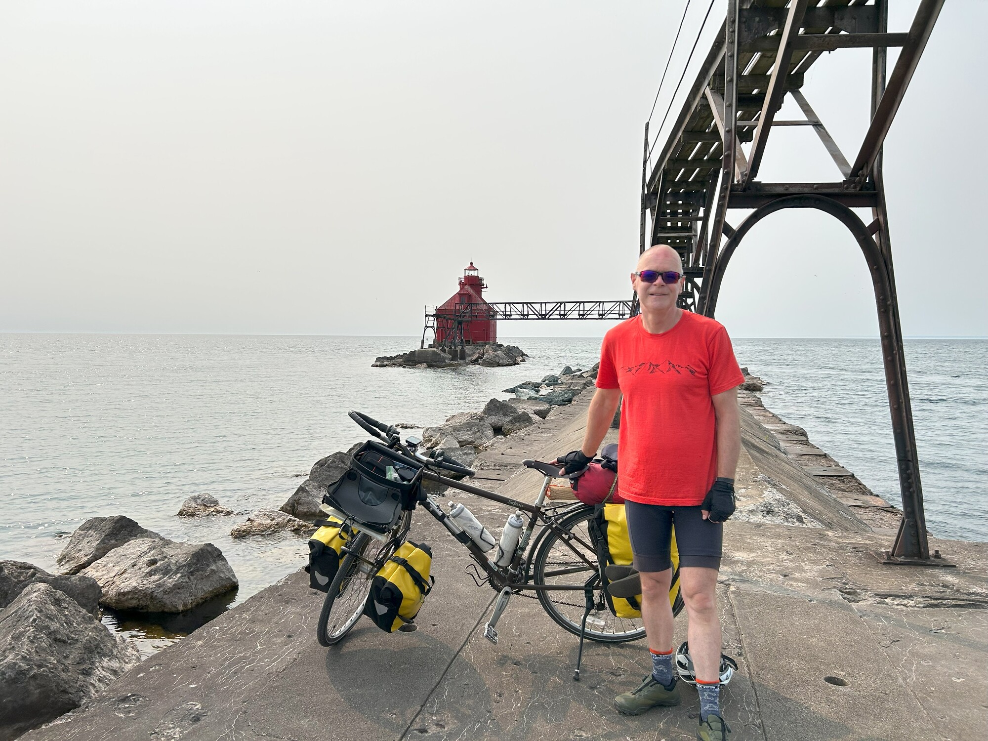
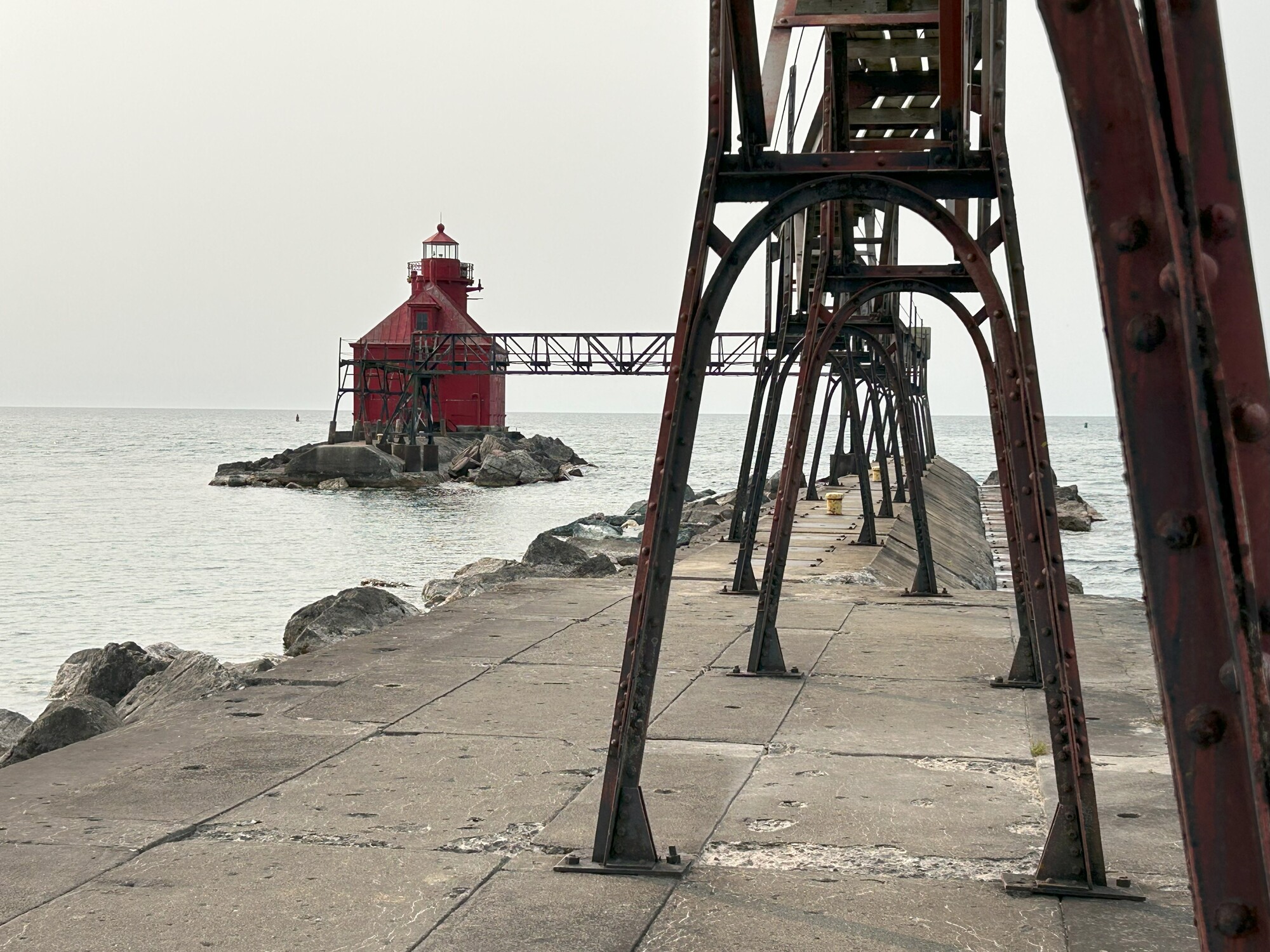
We rode out to the Sturgeon Bay Ship Canal Pierhead Front Lighthouse and took some photos. The Sturgeon Bay Canal Rear light is an active coast guard site so off limits but we still able to get good photos to accompany yesterdays photos from across the canal.
| Heart | 2 | Comment | 0 | Link |
| Heart | 0 | Comment | 0 | Link |


Sturgeon Bay Ship Canal Pierhead Lighthouse
Established in 1872, the Sturgeon Bay and Lake Michigan Canal and Harbor Company constructed a seven mile canal from across the Door Peninsula providing a shortcut to Green Bay, avoiding the dangerous Northern Passage around the Door Peninsula commonly referred to as “Death’s Door.”
Constructed on the northern pier at the east end of the canal the Sturgeon Bay Ship Canal Pierhead Lighthouse was first lit March 1882.
In 1886, a wooden, two-story keeper’s house was bult along with a lifesaving station.
In 1884, a fog signal was established on the pier.
The Sturgeon Bay Ship Canal Lighthouse to serve as a coastal lighthouse was erected in 1898.
By 1902, it was necessary to construct a new combined fog signal and light.
A twenty-four by thirty-three-foot building, with a hipped roof and a circular light tower at its eastern end was constructed and a fifth-order Fresnel installed. This was completed in September 1903.
Five keepers were needed to maintain the fog signal, two lighthouses, and minor lights along the canal.
In 1930, the light was electrified.
Surplus to requirements, the Coast Guard offered the lighthouse, the lighthouse was auctioned in July 2014. Four bids were received with the winning bid of $48,500.

Heading north again, County Road TT hugged the coast winding our way through trees, over slight undulations, with glimpses of the lake. We remarked that this was the best road so far on our trip.

County Road TT headed inland and we continued around the coast on County Road T then onto Bark Road. Remarkedly there were quite a few houses along these roads. People living quite some distance from any services.

At Whitefish Bay and we stopped briefly at a rest area.

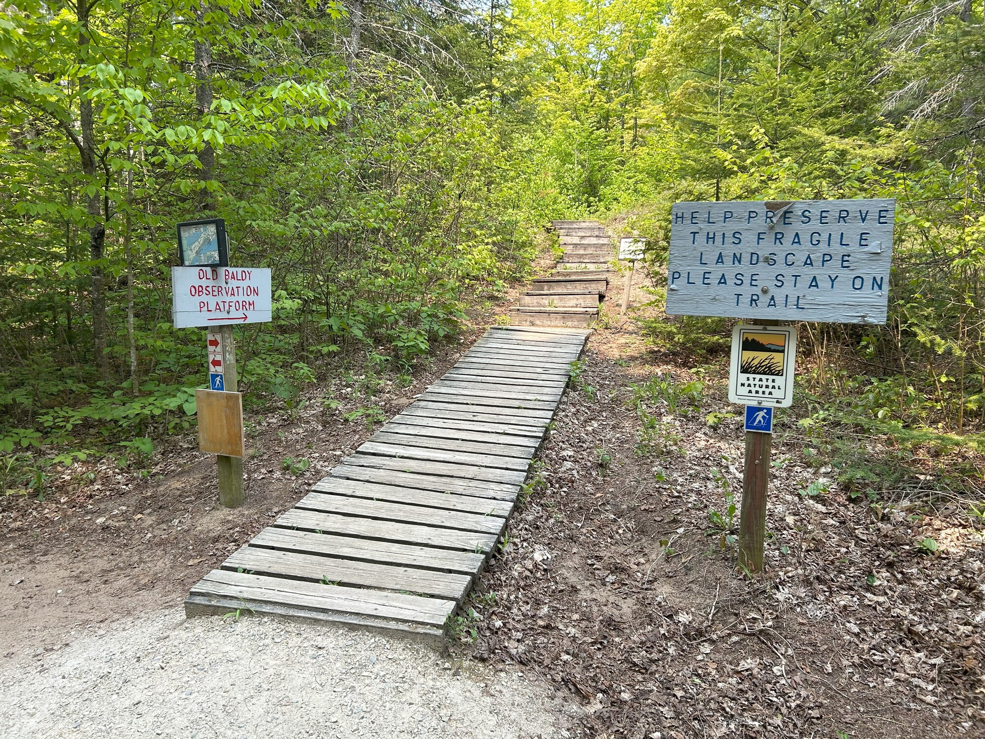
The road came to a dead end at Whitefish Dunes State Natural Area but we were able to continue on a trail where we found the Old Baldy Observation Tower platform, which we climbed for a view from the highest sandhill in Wisconsin.

| Heart | 0 | Comment | 0 | Link |


The trail came out at the Whitefish Dunes State Park and we stopped at the beach and rest area there and briefly spoke to a huge group of cyclists out for a group ride.


Further down the road I saw a sign for Geographic Marker, suspecting it was the 45 parallel we pulled in at the wayside. So we are now officially halfway to the North Pole.


We passed through Jacksonport and thought about stopping at the diner but didn’t see it so carried on to Baileys Harbor where we found a picnic spot next to the beach and had our lunch.


The wind was cold off the lake, so I layered up with a long sleeve shirt.
After lunch we stopped at The Toft House where they had lighthouse stamps but unfortunately it wasn’t open until Wednesday.


Our plans were for the rest of the day were to go out and visit 4 lighthouses and then return to Baileys Harbor to camp for the night. Looking at the time (1:30 p.m.), I decided that we wouldn’t stop to unload our gear at the campsite and just come back later. This proved to be a good decision, but I will get to that later.
The first lighthouse was the Baileys Harbor Front Range Light where we stopped to take photos.


As the Old Baileys Lighthouse was on the same road, we ventured out there before returning and visiting the Baileys Harbor Rear Range Light.
Old Baileys Lighthouse is on an island and is privately owned. This is the best photo I could get.

| Heart | 0 | Comment | 0 | Link |
At the rear light we were able to go inside and look around and take photos. The two docents are volunteers and this was their first day of their week long assignment. They were very nice and eager to show off the lighthouse.


How a range light works: The rear light is taller than the front light and if you are sailing up a harbor you want to keep the two lights vertically aligned.


Baileys Harbor Lighthouse
Baileys Harbor Range Lights Lighthouse
A lighthouse was constructed at the southeast side of Baileys Harbor in 1853. However, the placement of the lighthouse caused frequent groundings within the harbor.
Just as work was set to begin on Baileys Harbor Lighthouse, the Lighthouse Board reconsidered its plan. Realizing that the station’s location within the bay prevented it from serving as either an effective coast light or as a guide to vessels seeking the safety of the harbor, the Board proposed that a new station be constructed on exposed Cana Island, three miles northeast of the harbor, and that a pair of range lights be established to light the way into the harbor.
To aid navigation, a front and rear range light were constructed and first lit in 1870.
On August 25, 1922, automatic acetylene lights were placed in both range lights with the front light flashing white every three seconds and the rear light flashing red every two seconds. Later the following month the last lighthouse keeper Henry Gattie was transferred to nearby Cana Island Lighthouse.
The Bailey Harbor Range Lights were electrified in 1930.
The Ridges Sanctuary was formed in 1937, and the former keeper’s residence was used to house a naturalist for the sanctuary starting in 1965.
In 1969, a new light was established on a metal tower just south of the front tower. In 1996, the historic lights were rewired, and two replacement beacons were placed in the lantern rooms.
In 2015, metal tower was removed and the historical range lights put back into operation.
The sixth-order Fresnel lens used in the front tower is on display at the Wisconsin Maritime Museum in Manitowoc, while a lens used in the rear tower is displayed on site.
On December 1, 1869, the final day of navigation for the season, Keeper Darling extinguished the light in Baileys Harbor Lighthouse for the last time. The range lights in the harbor and the lighthouse on Cana Island were completed during 1869 and would take over the function of marking Bailey Harbor and lighting the coast starting in early 1870.
Baileys Harbor Lighthouse and the attached dwelling remain standing today thanks largely to the workmanship of Alanson Sweet, though the lantern is in an advanced state of decay. Today, the island is privately owned, and the dwelling serves as a summer cottage.

Leaving at 2:30 p.m., we cycled the 8 miles out to Cana Island Lighthouse. On the way Cameron asked as we were still early in the day, were there any campsites further north. Thinking this was a good idea, we checked when we arrived and found the Aqualand Campground just off tomorrow’s route 8 miles further north.
With a new plan in place, we walked across the causeway to Cana Island.
At the lighthouse we were able to climb the tower and get a stamp. This lighthouse and location have been the highlight so far.


Cana Island Lighthouse
Once it was decided that the original Baileys Harbor Light was not in a proper location to serve as both a coast and harbor light a new light was proposed on Cana Island.
The lighthouse was built in 1869, consisting of a one-and-a-half-story house. Five rooms on the first floor was reserved for the head keeper, while three rooms on the second floor served as the residence for the assistant keeper.
The sixty-five-foot tower is connected to the keeper house by a passageway.
The light was first lit on January 24, 1870.
In 1890 improvements were made at the light station, half an acre of the lowest areas of the island were filled with dirt and stone. A four-hundred-foot breakwater was contracted to stop waves from coming ashore, a hand railing was added to the tower stairs, and a footbridge was constructed to connect Cana Island to the mainland.
In 1902, metal plates were riveted together around the tower, and the space between the tower and casing was filled with concrete.
An acetylene light was installed at Cana Island in 1924 and the keepers at Cana Island were also responsible for the lights at Baileys Harbor and Eagle Bluff, which had both been converted to unmanned acetylene lights.
The lighthouse was electrified in 1934, and the lighthouse was automated in 1941.


By this time we had also heard from the tour operator that tomorrows trip to Pilot and Plum Island was cancelled due to rough seas.
We arrived at the Aqualand Campground around 5 p.m. and met Josh the owner. As he didn’t take credit cards and I was low on cash, he just told me to mail him a check when we got home. You don’t see this sort of trust and honesty much anymore. He was a great guy.

We were located on site A, next to the highway, but by 10 p.m. it was all quiet.
While I cooked spaghetti for dinner I managed to update some of my journal, and later we had showers and retired to our tents as the wind started to cool off the evening.
Today's ride: 52 miles (84 km)
Total: 232 miles (373 km)
| Rate this entry's writing | Heart | 3 |
| Comment on this entry | Comment | 0 |