September 6, 2022
In Exmouth: the Pebblebed Heath loop
The weather apps tell us that we should get three or four bikeable hours this morning, so we dispense with breakfast early and plan a 9:30 departure. 9:30 approaches and I give a last look at the irl weather report:

The weather is really mercuric here. It can look fine one minute and be pouring fifteen minutes later. Or improve just as abruptly, as it soon does. Rachael sets off on a walk again, for some reason not tempted by the loop I’ve penciled out to go inland into the hills to check out the nearest pebblebed heath. I’ve never heard of pebblebed heaths before yesterday, and now that I have I’m vexed that I was so close to one without knowing it.
There’s a whole band of them along the west side of the Otter where small patches of lowland heath have survived fairly undisturbed by the encroachments of civilization. There aren’t many roads crossing them, but the one I’m aiming at is Colaton Raleigh Common. An unpaved road traverses it, as well as a number of tracks and bridle paths. The unpaved section is allegedly less than two miles, not enough to deter me from checking the place out.
It’s an easy ride out of town - Exmouth is quite navigable but bike once you’ve found your routes - and I’m soon slowly climbing away from the Exe and cross over the watershed to the Otter side. I’m not far into the ride though when I come to a junction with Exe View Road, a name that tempts me into a short diversion.
I’d like to come to a viewpoint across the mouth of the Exe from the top of the ridge, so it’s worth a short detour to check it out. Quizzically though, Exe View Road never makes it back to the summit of the ridge where you could see across to the Exe side. I think I biked the whole length of the road and there’s never a viewpoint. I have no idea why it was given the name it has.
But that’s fine. I had a fairly short ride mapped out anyway, one that should comfortably fit into the three or four hour window I assume I’ve still got.

| Heart | 4 | Comment | 0 | Link |

| Heart | 2 | Comment | 1 | Link |
The non-view detour ends up adding almost five miles to the ride. It also takes me well off course and now I’m on a busy, stressful stretch for a short ways getting back on to my mapped route again. I survive that though and soon I’m on quiet singletrack until I come to the turnoff to the heath and the pavement immediately ends. I expected this of course, and I’m pleased to see that the road surface is rough but reasonably bikeable.


| Heart | 2 | Comment | 0 | Link |

| Heart | 0 | Comment | 1 | Link |
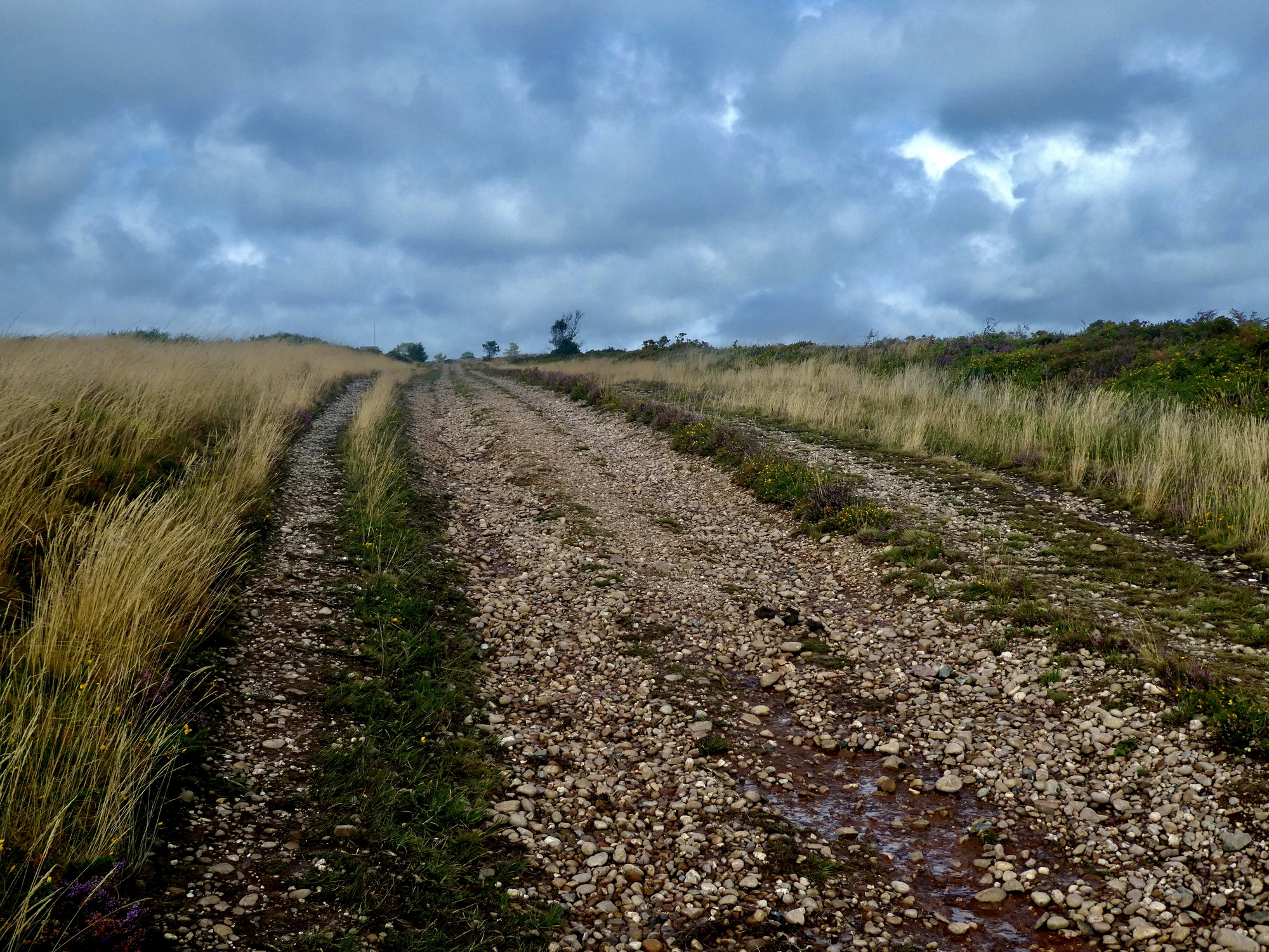
The first few hundred yards aren’t representative though. Not at all. Pebblebed heaths are characterized by pebbles, which shouldn’t surprise you. It shouldn’t have surprised me either that an unpaved track through here would be pebbly. This one’s very pebbly for pretty much all of the next mile and a half, about 80% of which I end up walking because biking is out of the question.
One thought that’s constantly in my mind as I tiptoe through the pebbles keeping an eye out for misplaced hand grenades is the weather. I won’t like finding myself out here in the middle of this shelterless expanse if a cloudburst comes my way.

| Heart | 3 | Comment | 1 | Link |

| Heart | 0 | Comment | 1 | Link |

| Heart | 0 | Comment | 0 | Link |

| Heart | 4 | Comment | 0 | Link |

| Heart | 2 | Comment | 3 | Link |
1 year ago
1 year ago
| Heart | 2 | Comment | 0 | Link |

| Heart | 2 | Comment | 1 | Link |

| Heart | 0 | Comment | 0 | Link |

| Heart | 2 | Comment | 0 | Link |
So I know that’s a peck of pebbled path pictures, but I decided to include them all to make Rocky insanely jealous once she sees the fun she’s missed out on today. Finally I’m out of it though, back on pavement and wondering about time and weather. I’m happy to come to a bench in Hawkerland, where I sit down to check the app and map. I see that I could shave some miles from the ride if I take a shortcut through Newton Poppleford, but weather.com says the weather looks good until late afternoon now. Who knows what that the road to Newton Poppleford is like though, and since I know the one I have mapped out is paved the rest of the way I stick with the plan.

| Heart | 3 | Comment | 2 | Link |

| Heart | 4 | Comment | 0 | Link |

| Heart | 0 | Comment | 0 | Link |
One pebbly path is an annoying feature. Two pebbly paths are more vexing, especially when RideWithGPS tells us this half mile of mud and rock is paved.

| Heart | 3 | Comment | 0 | Link |

| Heart | 3 | Comment | 0 | Link |
Then, finally I’m back on firm ground again, with fifteen miles of pavement between me and our hotel. Not bad - I’ve only been out for three hours and I’m halfway done with the day’s hike&bike already! The last miles pass quickly as I follow the Otter downstream for a few miles and then join in with yesterday’s route for the remaining way home. I make it back before three, happy that the weather has cooperated once again.


| Heart | 5 | Comment | 0 | Link |
Rachael’s been back over an hour by the time I’m back home. She’s been tracking my progress on Garmin, wondering why I’ve been going so excruciatingly slowly much of the way. She shares her experience for the day, an 11 mile out and back walk along the estuary toward Exeter. In her telling the first half was fine, but the return was awful as she fought a 20-30 mph direct headwind the whole way. She’s been struggling with her nasal congestion again, and it was a tough, unpleasant slog. The forecast said there could be 40 mph gusts today, and she believes it.


We’re down to the waterfront for dinner again tonight, and when it comes time to go it looks like the situation is the reverse of last night’s - it’s dry when we leave the room but the sky looks ominous and I won’t be surprised at all if we get dumped on by the time we arrive. We make it dry though, and in fact the rains never come until later in the evening. The sun even breaks out, and for a brief moment a weak rainbow arcs above the harbor before fading out a few minutes later.
It’s been an interesting experience holed up here in Exmouth, watching the weather conditions and forecasts change so rapidly. As it turns out we probably would have been fine to bike through from Bridport over the last two days, but it could just as easily have been horrible. We’re quite happy with our decision and how it’s worked out.


Ride stats today: 31 miles, 2,800’; for the tour: 2,496 miles, 154,200’
Today's ride: 31 miles (50 km)
Total: 2,496 miles (4,017 km)
| Rate this entry's writing | Heart | 9 |
| Comment on this entry | Comment | 2 |
1 year ago
1 year ago