August 15, 2016
Lauterbrunnen Valley and Brienz
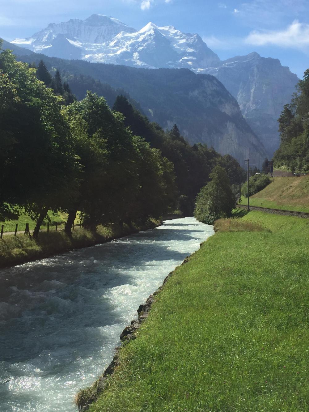
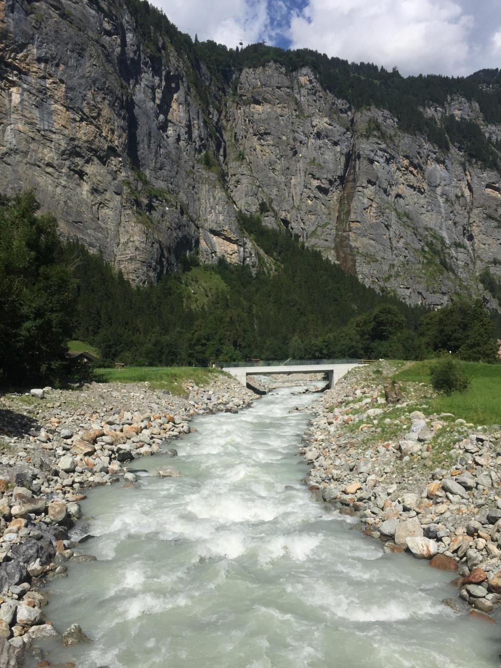
Today was a teaser day. A run up the Lauterbrunnen Valley and back and then a short trek to Brienz located at the end of Brienzersee and our "gateway" to Grimselpass. A teaser day because the valley is accessible and beautiful, taking you right up to the face of the towering Alps but also giving you vistas down the valley that are stunning.

| Heart | 0 | Comment | 0 | Link |
Our hotel did not offer breakfast. For some reason, we were in an "apartment," which means we had a kitchenette and I guess were expected to fend for ourselves. So we packed up and checked out around 9:00 AM and headed downtown to look for eats.
We discussed leaving our panniers at the hotel for the day and picking them up on the return before heading for Brienz. Not a bad idea . . . the expected climb to the head of the valley was 3200 feet over about 10-12 miles. That turned out to be wrong, but at the time, we didn't know that. What really killed the idea was food. I was not sure what kind of breakfast we would get . . . croissants and coffee . . . or something more substantial? So I wanted to pack food for the day, and that wouldn't really be possible without panniers. Plus, it just seemed right. On the return, we would be able to head straight for Brienz without having to detour back to the hotel.
As it turned out, we found a good buffet-style, all-you-can-eat breakfast at a hotel downtown. Expensive by US standards (25 CHF each) but reasonable for Interlaken. So we fueled up for the anticipated workout.
| Heart | 0 | Comment | 0 | Link |
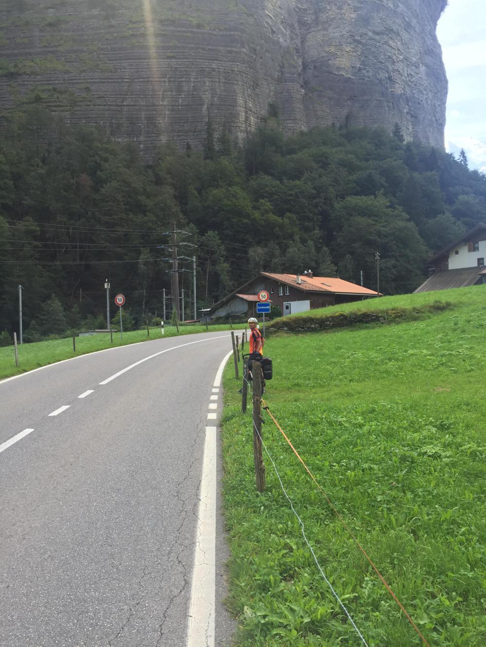
Which really never came. The road up follows the Weisse Lütschine, the primary and very white river that courses through the valley, making for a generally gradual ascent. Not to say there aren't some steep climbs. We had to tackle one notable climb of 8%. Overall though, we only ascended 1300 feet before hitting the Lauterbrunnen Wall (as the impenetrable Alps here are called) and had refreshments and a dessert lunch to reward ourselves. It's a stunning ride, although the first five miles or so might be considered a disappointment. The good stuff starts after you pay some dues first, around MP 7.

| Heart | 1 | Comment | 0 | Link |

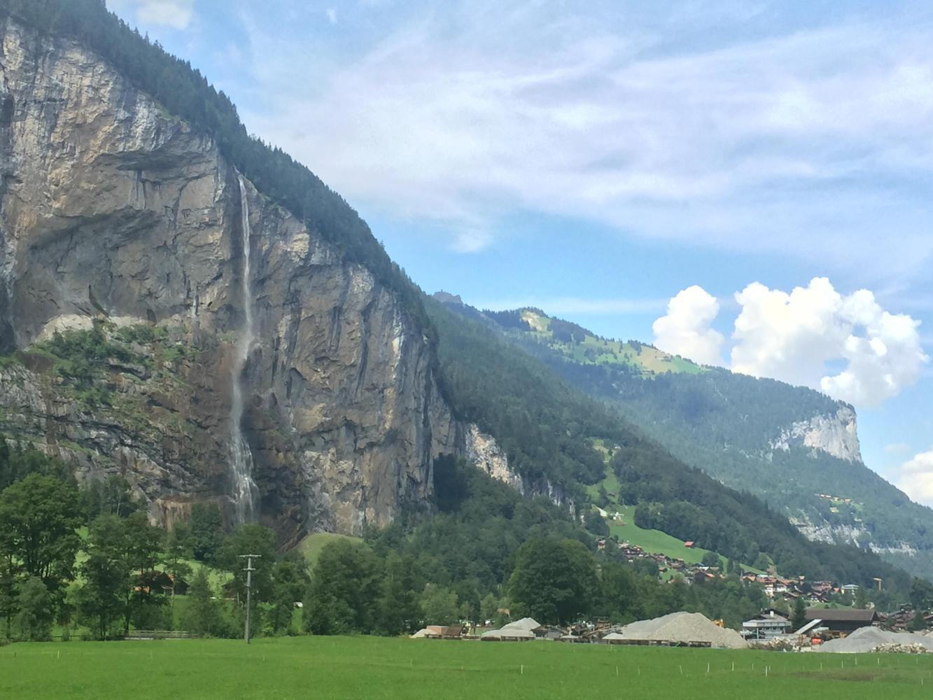
The first and only real town you ride to, and through if you want to reach the head of the valley, is Lauterbrunnen. It seems many people only go this far since that is where the train stops, and there are many attractions within walking distance, including the Staubbach Falls.

But we pushed on beyond all that congestion and discovered what was really the best cycling part of the valley, especially since it narrows the further up you go.

| Heart | 1 | Comment | 0 | Link |
Mark had promised me lunch at the top of the "climb," so we did the loop road and returned to the hotel for drinks and dessert. We were still fairly full from breakfast, and the return would be mostly downhill.

Traffic up the valley was a bit heavy as far as Lauterbrunnen, but it calmed down beyond as most, if not all, cars diverted at that point to the opposite side of the river. And after lunch, the morning rush was over, so we returned on the opposite side of the river, if for no other reason than the different viewpoints and different route.

| Heart | 1 | Comment | 0 | Link |
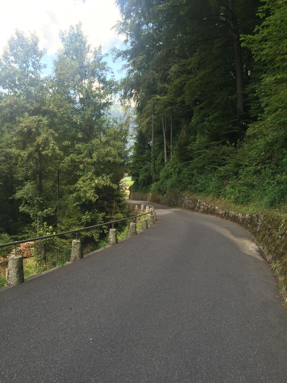
That road takes you back to Lauterbrunnen after a stiff climb up from the river, but we diverted again at Hintisberg to the far side of the river. It started out promising, including passage through a covered bridge. But the detour also meant two miles of natural terrain road (i.e., a dirt road). However, it was worth the effort, as we could see the main road was more and more congested the closer you returned to Interlaken.
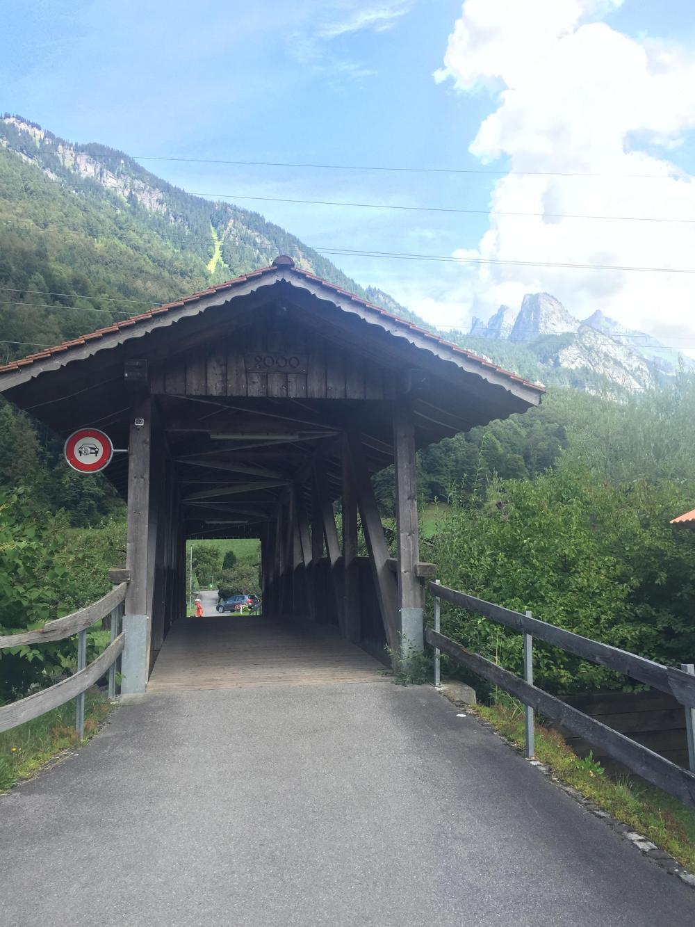
| Heart | 0 | Comment | 0 | Link |

| Heart | 0 | Comment | 0 | Link |

All in all, this was a great side trip. The ride to Brienz was uneventful but very different than yesterday's ride along Thunersee. Brienzersee is more "wild" with less development. Plus, the road is offset from the lake by several hundred feet and higher in elevation for about half the distance to Brienz, at which point the railroad and highway switch alignments. Still, the lake is not the recreational center of attention that you might expect.


Today's ride: 35 miles (56 km)
Total: 660 miles (1,062 km)
| Rate this entry's writing | Heart | 2 |
| Comment on this entry | Comment | 0 |