April 23, 2018
Day 28: Donzere to Avignon
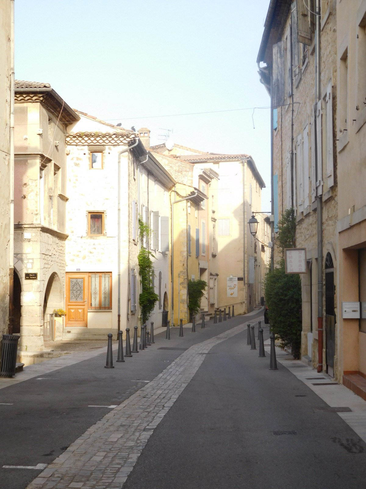
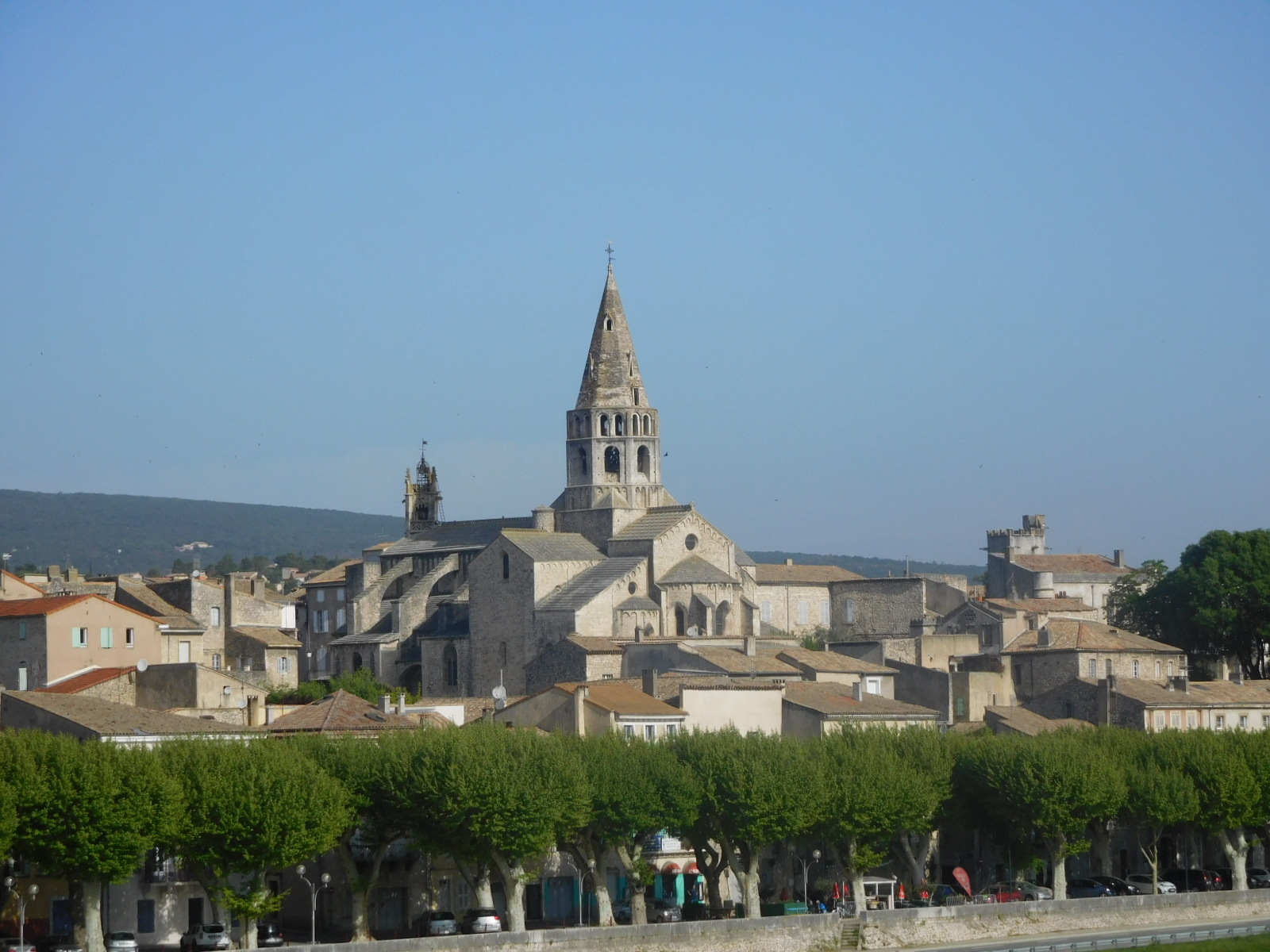
We had an easy start, with our bikes right in front of our garden level room, making them so easy to load. We continued on in to Donzere for a quick peek and found the typical French crumbly town, with some impressively narrow streets or lanes. We just cruised through and quickly crossed the town's bridge, to continue down the Rhone on the other side.
"Continue down the Rhone" sounds so simple, and actually it looks simple on a zoomed out map. But the reality of 100 km of actual pedaling is mind boggling for the number of twists, turns, ups, downs, and times when you have no idea where the darn river actually is. But we'll come to that.
| Heart | 2 | Comment | 0 | Link |
Donzere is still too far north on the river to be in the famous "Cotes du Rhone" wine region. That starts about 30 km south, near Pont St Esprit. What we got at first was quiet riding on the flat through forest and field.
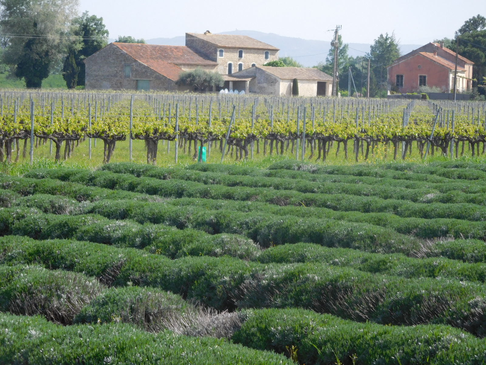
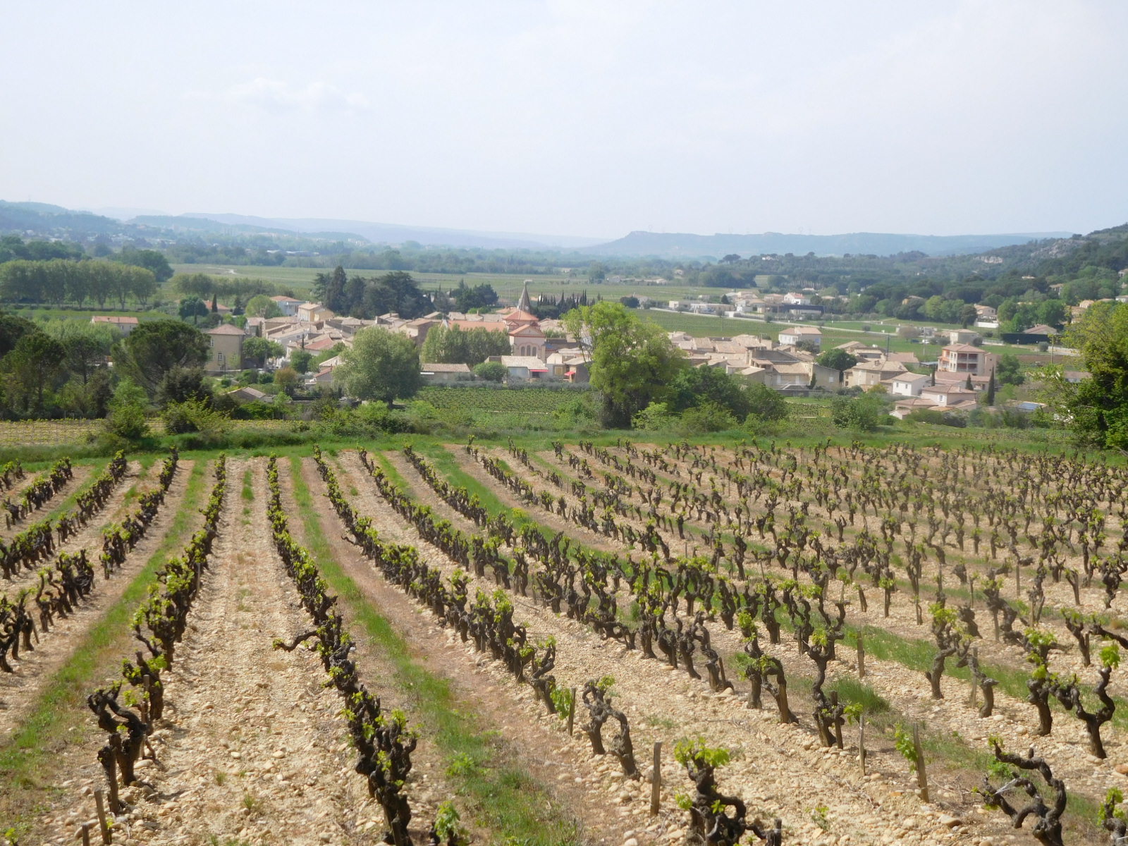
Actually, in another 15 km (after Bourg St. Andeol) we did start to see more of what we had come to Provence for. Of course, you need lavender and grape vines, like this:
| Heart | 2 | Comment | 1 | Link |
5 years ago
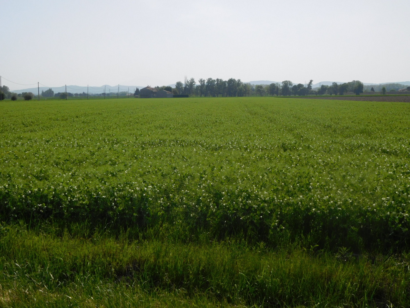
The most common trailside crops were actually cherries, but we also saw olives, pears, and apples in abundance. There was also asparagus, which was a big temptation, and field peas that were only just in flower. We know from experience that these are very edible once the pods are the right size. It's amazing just how many peas can fit into a field:
We had a very pleasant time cycling along and just looking at crops (wishing the season were more advanced, so we could pilfer some, or thinking about how when we get home we should try to make our land look as great as what we were seeing). During this, the signage for the Via Rhona was fine, and it was all sweetness and light.
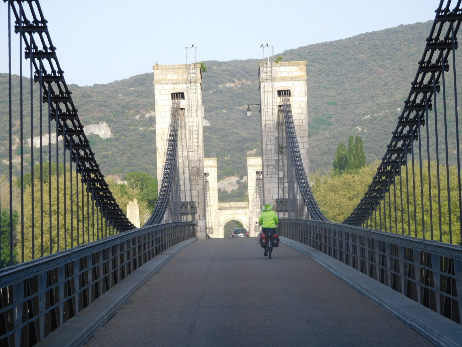
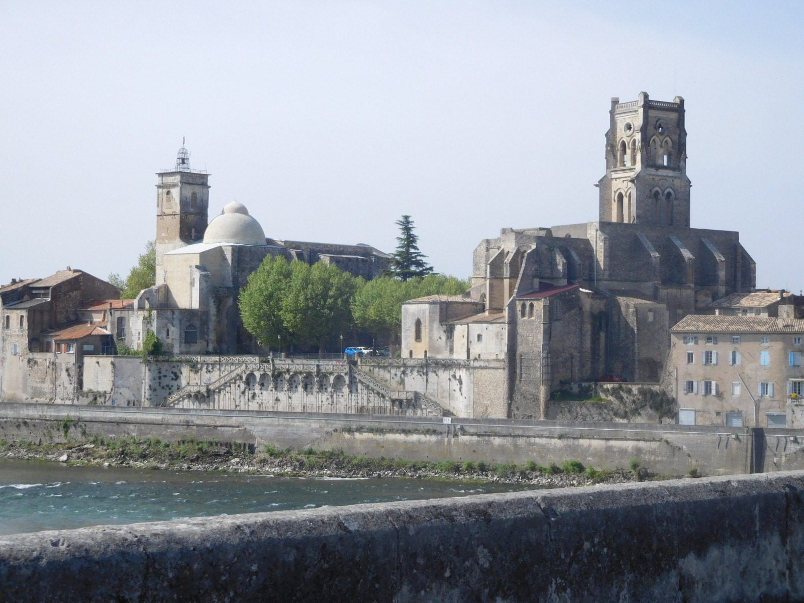
The first sign of something amiss came just before the bridge, at Pont-St. Esprit. There was no signage to indicate how to get to and on the bridge. But ok, we did that, and the bridge really is spectacular for the view it gives you of the town:
Our luck held out as we found Intermarche in the town and Dodie was able to replenish our food stores. She also came out with a chocolate eclair, which kept me quiet and happy for quite a while!
In the back of my mind I had been thinking that based on a past visit there was something not right about Pont St Esprit. We soon found out what that was. This is a point at which Via Rhona totally drops. There are no further signs until just before Avignon, at which point they reappeared, erratically.
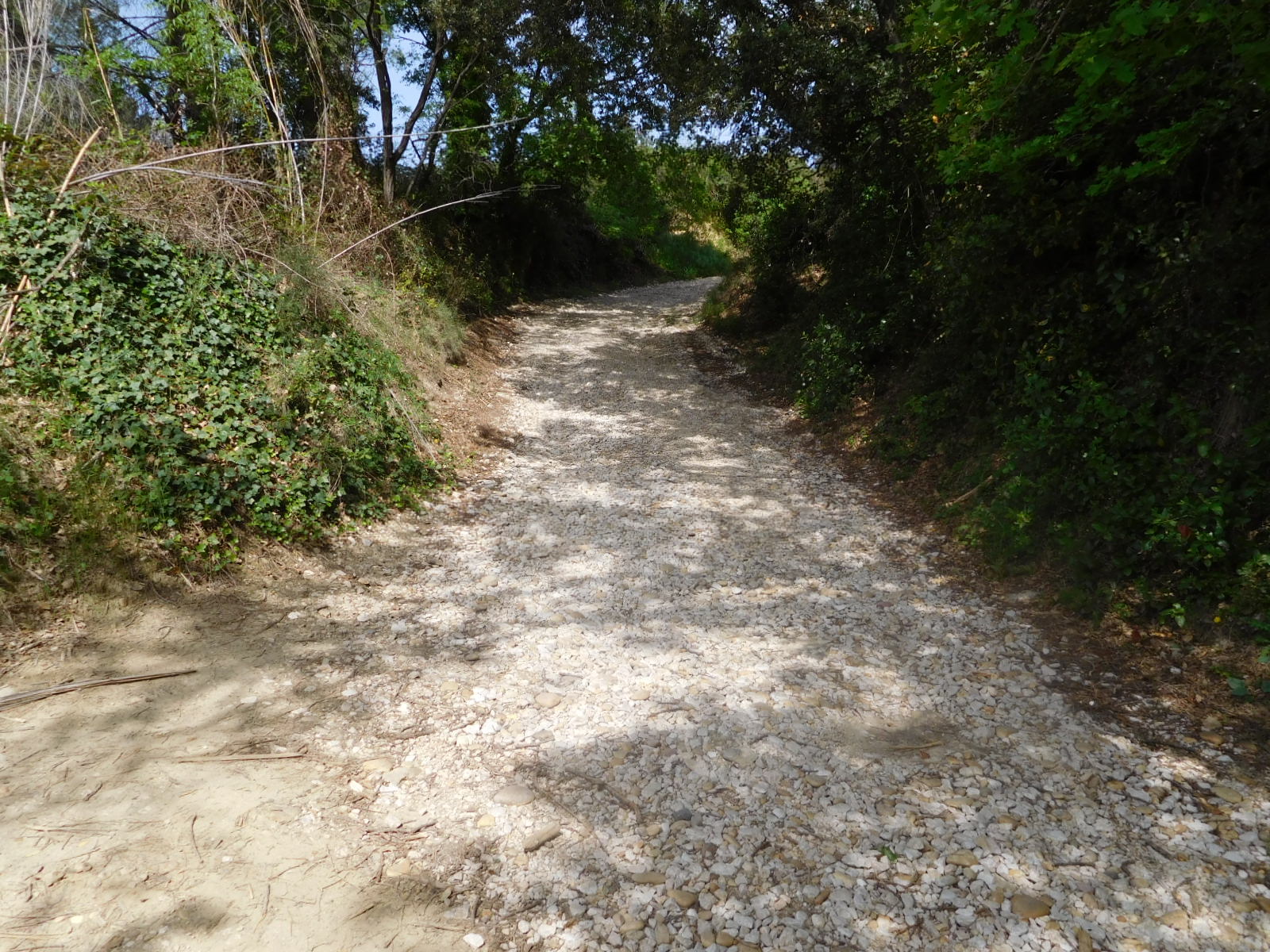
We used the GPS, which is loaded with the track that matches the Bikeline route. Darn, once again we should have read the previous Grampies blog on the subject. The Bikeline route is terrible, diddling around up in the hills. But no, off we went into the hills and all around. It's not really so easy, because the GPS is very hard to see in the sun, and its battery does not last all that many hours. So it came to pass that we found ourselves on this road:
| Heart | 0 | Comment | 4 | Link |
5 years ago
5 years ago
5 years ago
A quick check of the GPS (A Galaxy S3 smartphone with Osmand +) showed we were off track. But we only knew this because the blue dot was not on the blue line. The underlying detail map had disappeared (leaving only the crude world map) ! Maybe I had failed to download the detail map for this part of France? If so, it would need wifi to patch up.
One of the advantages of being lost in a busy area is McDonalds. We spotted one nearby and pulled in to take advantage of their wifi. To be fair we figured we ought to buy something, and selected something that should be cheap - "small fries". Yikes, 2 euros 10. That's way over double the Canadian price. It would be interesting to make a study of the whole menu, and the subject of French restaurant prices in general, but we're here trying to fix that GPS, right?
It turned out the GPS did have the map, it just wasn't displaying it. There was not obvious immediate fix. So we pulled out a tablet that has the same program and maps. It's hard to use, because there is not handlebar mount for it. Our first chore was to get out of the McDonalds parking lot, which was surprisingly tricky. Then we worked to make our way back to the track. Also tricky. From there we were stopping to pull the tablet at many intersections, a time consuming process. And the track, once we were on it, was taking us to some quite implausible spots. Like a steep slope of rough stones above the town of Chuscian.
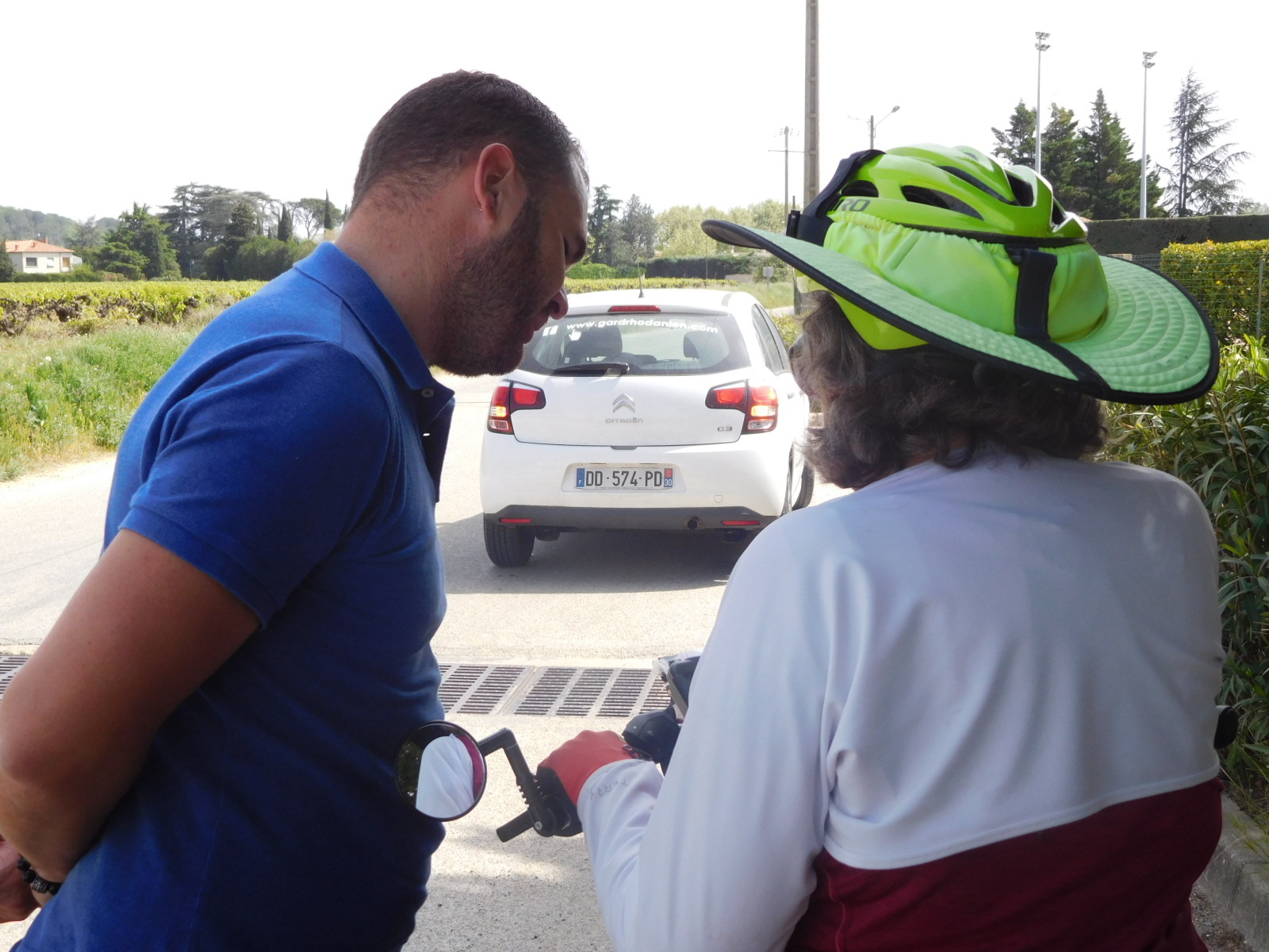
We just continued to struggle along, until at one point a white official car pulled up in front of us. It was from the Gard department, and the man inside wanted to ask us how we were doing with the route! It turned out he was part of the project to put in the signs. We of course were glad to tell him where we had been and what we thought, and he gave advice on how best to get to Avignon from here. He also said comforting things like "Oh no, the McDonald's".
| Heart | 1 | Comment | 0 | Link |
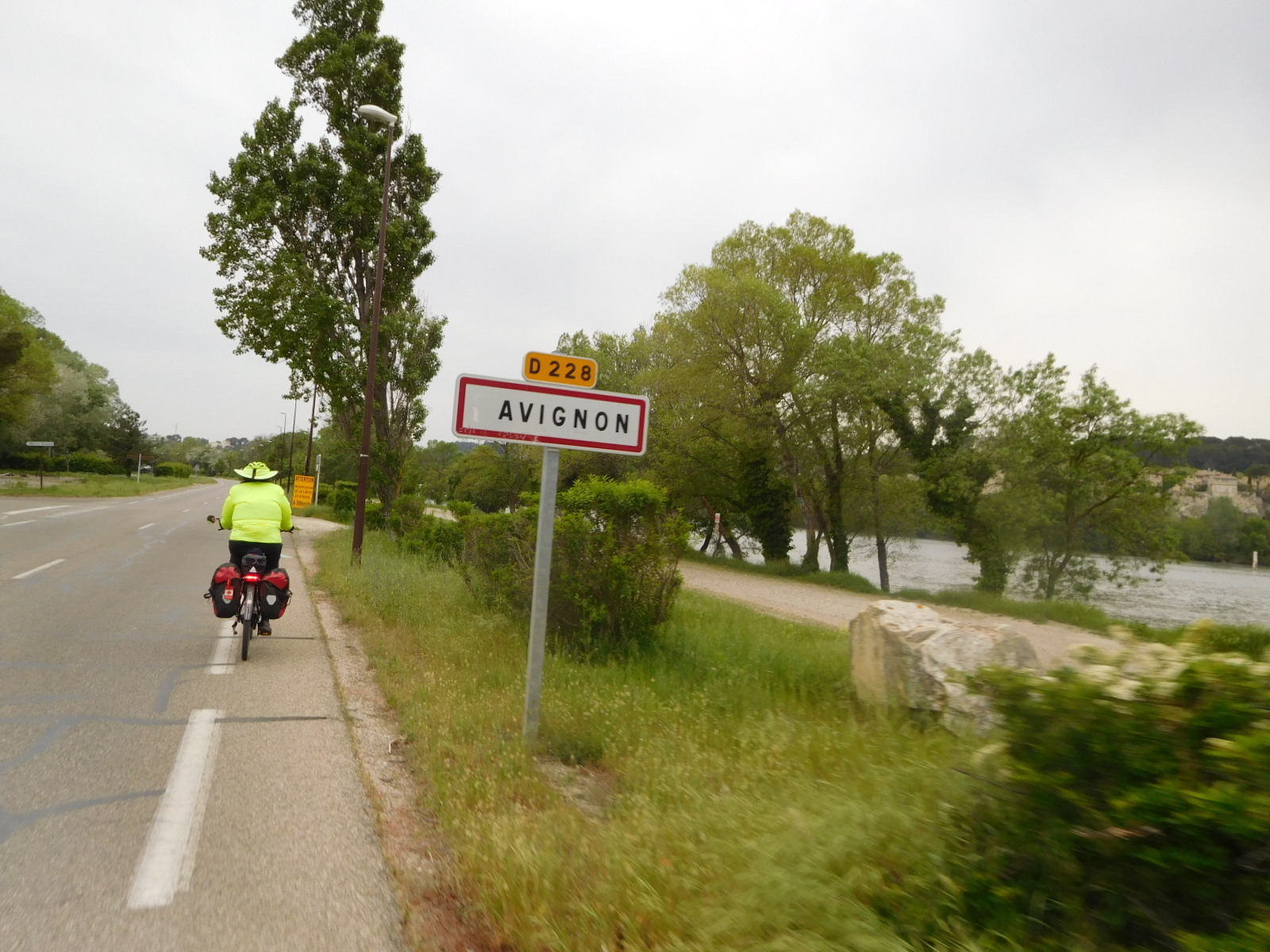
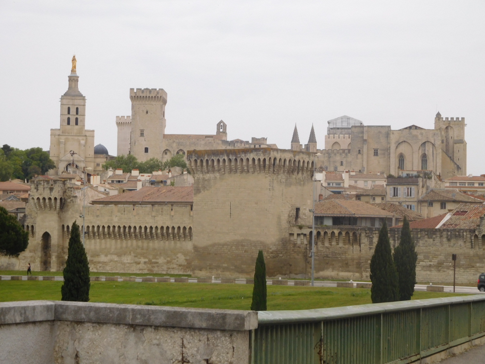
Even with the advice from the "expert", it was not totally easy to get safely to Avignon. But we did it! It had taken until after 7 p.m. and we did an insane 99 km. But there was still that thrill of coming over the bridge and seeing the papal palaces, not to mention the famous and broken "Pont d'Avignon".
Our hotel, the Hotel Central, is yes, central. It is close to the covered market and the Tourist Information. So tomorrow we will go out to see what TI has to offer, and to look at the town a bit, including the covered market. That market will not be the bigger Saturday outdoor affair, but then we hope to be in Arles for theirs. A little later in the day we will leave Avignon for Cavaillon, which we plan to have as a base for exploring the villages we have come to see.
Today's ride: 99 km (61 miles)
Total: 1,834 km (1,139 miles)
| Rate this entry's writing | Heart | 9 |
| Comment on this entry | Comment | 0 |