February 28, 2019
A Training Day Close to Home
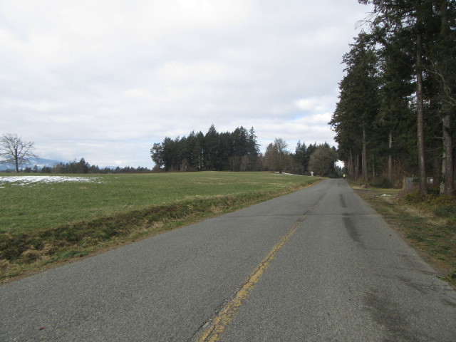
Incredibly, the weather forecast calls for gradually decreasing temperatures over the next week. It is really unusual to see snowbanks beside our roads here. You would think they would have the decency, with March almost here, to just quietly slink away. But no, they are really hanging on.
Yesterday we put on quite a bit of the warm stuff we have planned to bring on the trip. And we were freezing. After 10 km I was starting to shiver, and was really glad to duck into a cafe for a quick warm up. Today was just as cold. Dodie, who is generally the tough one, stuck with the same clothes, but I put on another fleecy layer. This staved off any shivering, but actually both of us complained of frozen feet.
Cold or not, we are gradually lengthening our daily rides. That we can find quiet road to do this in is mildly surprising, since I generally maintain that North America down to and including near our place lacks decent places to ride.
| Heart | 0 | Comment | 0 | Link |

| Heart | 0 | Comment | 1 | Link |
5 years ago
We have been experimenting for a while with the system of providing live maps of each daily ride, which is a feature of Cycleblaze. Actually, Cycleblaze provides for it, but there are a number of steps involving the hardware and an outside web site, before it can actually happen. Some of our other bloggers seem to just casually throw maps like this in, but nothing is ever exactly simple.
In case any other blogger reading this is interested, I will just kind of vomit out what is involved. Anyone foolish enough to then ask a question of course risks pages of explanation!
It starts for us with Osmand+, the mapping app running in our Android phone. You need to enable an add-in that get Osmand+ to sleep but wake up every few seconds to see and record where it is. In the end you ask it to write a .gpx showing the track (this included elevation, which is cool!)
I then transfer the .gpx file using Bluetooth to the Windows 10 tablet that I use for writing the blog. Then I fire up the web site Ride With GPS and upload the .gpx to it. Ride With GPS then has a (not that easy to find) "share" button, that includes the option of getting "imbed code". I copy that code and run over to Cycleblaze, which has a button for receiving such code. A quick paste into the box provided and voila, the casually interested reader can see exactly where the events described on the day actually unfolded.
One great thing about the maps done this way, is that you can zoom in and out. I like the zoom out, because I often find myself trying to refresh my memory on where in the world the riders actually are at the moment. Another great thing is the map shows the elevation profile. So no matter how much whining the blogger has done about the hills in a day, you can actually see them. In fact, if you have a computer with a mouse, you can mouse along the profile chart and get a foot by foot account of what the gradient of the road was. For example, in the map below, which shows our little ride today, there are two hills that reach about 5% slope. Well, la dee dah!
| Heart | 1 | Comment | 3 | Link |
5 years ago
One of the uses of this that I like is to see the distance between chosen towns when following the exact track. This can help a lot when planning a trip using a track from a source like Bikeline.
5 years ago
5 years ago
So there you have it. Today's ride, 22.6 km, through the Snow Drops!
| Rate this entry's writing | Heart | 5 |
| Comment on this entry | Comment | 1 |
5 years ago