August 29, 2021
Day 11
Is it worth riding up a mountain for one picture?
Along with the Drei Zinnemann, the famous rock formation in the Dolomites, the other sight I was quite interested in seeing this trip was the sunken church tower in the Reschen See.
The steeple of St Anne’s church is all that’s left of the town of Graun which, along with the town of Reschen, were submerged in 1950 when the Reschen Stausee was formed. The Stausee was originally planned a couple decades earlier, but WW2 got in the way of the fascist plans to create the Reschensee. Originally the fascists had snuck an announcement into the local papers in such a short timeframe and manner that no one saw it. By the time they learned of the plan it was beyond the allotted timeframe to complain. Devious, sneaky, and very fascist. With the advent of democracy after WW2 the townspeople figured they were in the clear, but nope. The plans went ahead anyway. The residents went so far as to appeal to the pope to save their towns but to no avail. Even allies in the government were unable to help them out. The area had been fertile farmland and given the population of Europe and its size, there wasn’t much anyplace for the displaced residents to go that would allow them to continue their way of life. Some of the villagers were relocated up the mountain out of the flooded plain to the present day towns of Reschen and Graun. However, there was no fertile farmland there for them. Just mountain. There wasn’t enough space for everyone though so others had to move away from their homeland to completely different areas. Now all that’s left is the church tower as a reminder of what once was. The rest of the buildings in the towns were blown up. Then the valley was flooded. Sad story.
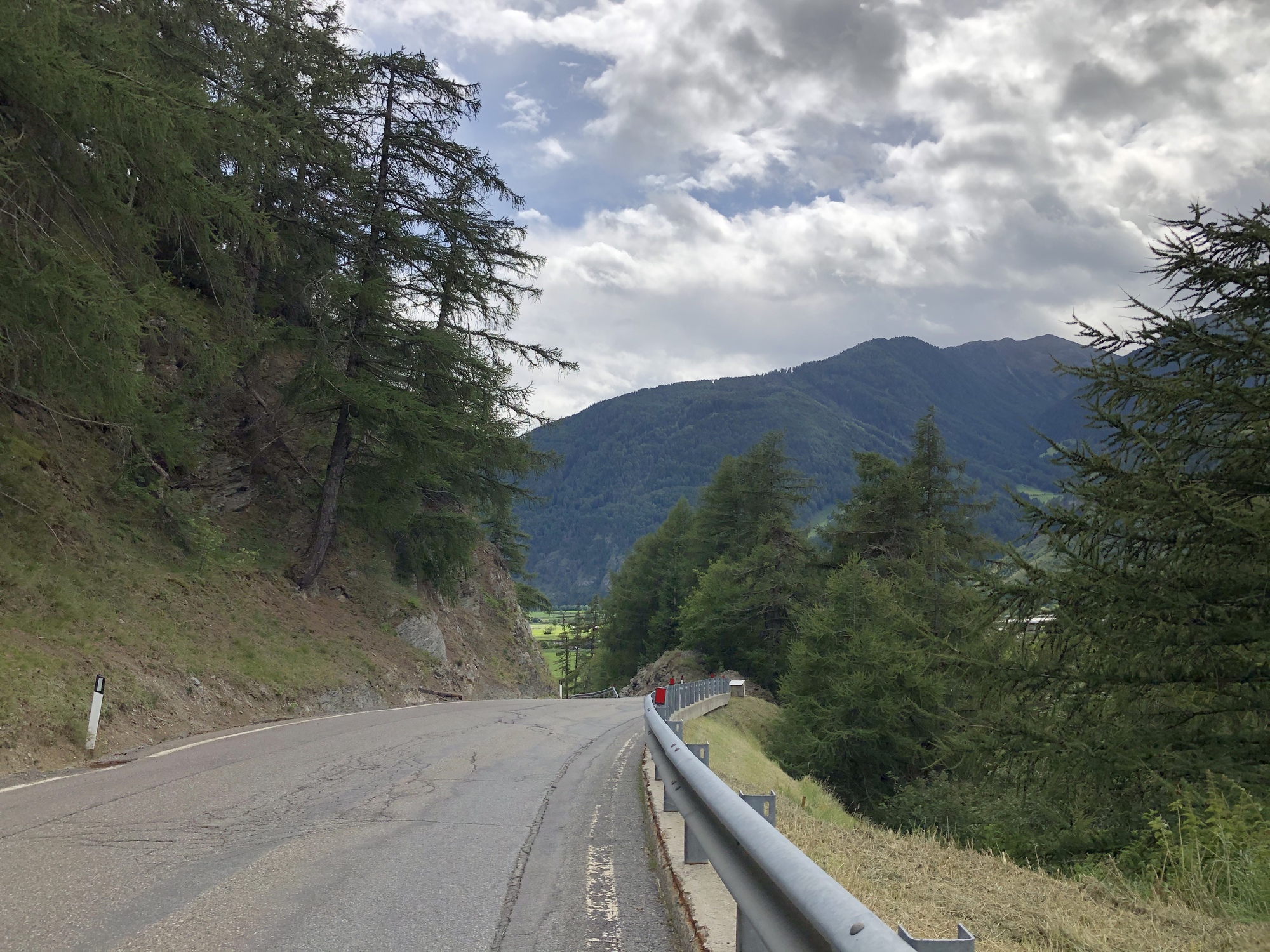
Now let’s talk about the ride to the Reschensee. Or more accurately UP to the Reschensee. By up I mean 1,200 feet over 3 brutal miles. I knew this was coming and I knew it would be hard. So I did lots of hill riding to train for it. Except the hills where I live are 1/2 long at most and are not lengthy double digit grades. So basically nothing could prepare me for just how brutal these 3 miles would be. The climb up to Burgeis was mean. I got passed by a lot of people on ebikes who were clearly not even trying. I got passed by some huffing and puffing spandex clad race bikers who clearly were trying and suffering (we’re at 4,000’; you’re going to suffer at that elevation.) I might have even been passed by hikers, but my memory gets fuzzy at that point. I rode as much as I could but after awhile it just gets in your head when you see that hill going up an sup so I did my share of walking and pushing the bike.


| Heart | 1 | Comment | 0 | Link |

| Heart | 2 | Comment | 0 | Link |
Then I got to the town of Burgeis. Supposedly it’s a charming little town. Well, not to me. It’s built on a hillside which means even more going up. And I was tired of going up. Burgeis is roughly halfway up the big horrible hill. It’s also followed by the steepest part of the big hill along the edge of the forest. Except we can’t have nice things. There was an Umleitung. That means the path ahead was closed. Instead they send you in a detour to the other side of the valley across the Malser Haide. The Haide is a giant pasture, probably what the Reschensee flooded further up the valley (of sorts.) Now you would think this would equate to flatter riding, but no. It did not. Uphill across the Haide with no wind break. Remember how I had a headwind yesterday? Well that same wind was blowing today. Sometimes as a headwind, sometimes as a crosswind, but never as a tailwind. There are no trees anywhere on the Malser Haide it was brutal. And the further I climbed, the colder it got. My legs were not in the mood to cycle the whole way so instead I had to alternate riding and walking. Neither kept me warm enough and both made me sweat in my raincoat and rain pants. As I struggled across the Haide I tried to think of another cycling experience this brutal and awful. I couldn't think of anything to top it. This is how memories as made. Actually, more like nightmares. I thought of how lovely and warm it must be back in my hotel room with a nice hot shower instead of being stuck out here in the cold and wind of the Haide. I watched as the occasional ebike flew past along with the occasional car. They all looked like they were having a more pleasant time.


| Heart | 1 | Comment | 0 | Link |

| Heart | 1 | Comment | 0 | Link |

After what felt like an eternity, and probably was more like 45 minutes of hell, I reached the other end of the Haide by Ulten. Here started a steep section of climb up along the east edge of the Haide through Alsack to St Valentin. There was ample pushing of the bike through this section as well, though some spots were reasonable enough to ride. In fact beyond Alsack things got more reasonable and I was mostly able to ride to St Valentin. Unfortunately for me things actually went downhill to St Valentin which meant I’d have to ride back up when I headed back.


| Heart | 1 | Comment | 0 | Link |
St Valentin resides on the north end of the Haidersee. Originally the Reschensee area was two smaller lakes. I’m not clear if the Haidersee was a third one, or is another smaller Stausee. I was considering stopping at a pizza place I passed to eat and thaw my poor hands and face and body and feet, but it started sprinkling. I really did not want to go to this much effort to get here, be so close, and get rained out so I rode on to the southern end of the Reschensee. Up ahead I could see the dam wall. And the path angling cruelly uphill. Yes, one more hill before the lake. (Insert head slap emoji here....)
I did survive the grueling ride up the path to the top of the wall. I can report that you cannot see the church tower from the dam wall. Not even close. No, you must first ride close to another 2 miles on either rough pavement or nasty gravel. Into a headwind. With occasional cold rain. These Italians make you earn your tourist photo opportunities. I cannot and really should not tell you what things I uttered about Italians during my ride today. The ride today did not give me cozy feelings about their inclination to tear up areas of trail and send you off across exposed pastureland. I do give them points for actually doing a decent job of signing this detour. It’s the first one this trip I haven’t gotten lost during. I got turned around instead in Burgeis when I tried to find a flatter way through town (spoiler: there isn’t one.)
My ride along the See must have been entered oddly into my gps because I got taken on some unnecessary bits of wandering tracks along the lake which merely prolonged my utter agony. I was very chilled by this point having removed my 2nd thermal shirt earlier in the day when I was sweating up hill after hill. Or actually just sweating up the one long hill. Ultimately all good things must come to and end and I finally reached the famous church tower. It was spitting rain at that point which just seemed entirely unnecessary. It got the lens of my big camera wet so I had to dig through my bags to find the lens polishing cloth to clean it up.


The rain started coming down harder so I retreated to a cafe across the busy road. All the covered tables were taken so I took one of the more exposed tables and sat and waited. And waited. Finally I went inside to ask for a hot chocolate and a piece of cake. The lady at the counter said to go sit outside and wait for the server. So I did. And I waited awhile more. I was starting to think no one would ever serve me. Finally she walked by and I caught her attention and asked for a hot chocolate and a piece of cake. She pointed out that it was raining. I pointed out that I was aware of that. The cake and hot chocolate were decidedly average, but at least the hot chocolate was hot.
When I finished my “lunch” I headed back across the road. Originally I was going to ride around the whole lake, but at this point I’d had enough and headed back the 12 miles to my hotel. I was looking forward to a downhill ride when I recalled that actually it would not all be downhill. I had to ride the uphill for a few miles from St Valentin. Cruel, really. I did survive that section between St Valentin and Alsack and managed to ride all but one short bit. Then I got my long awaited downhill back to Mals. I was expecting to freeze so I had both thermal shirts on plus a fleece sweater. In the end I was overdressed. Once I lost some elevation things did warm up and I got back to my hotel reasonably warm instead of frozen to the bone. That hot shower still felt really good though.


Would I do this ride again with my bike? Not on your life. Some people enjoy this type of suffering. I do not. I got my photo, but it’s not likely going to be the most featured photo in my house. That photo is still the hut in the mountains that I recall seeing a sign on warning about snakes hanging out in the hut (that sign is not visible in the picture.) So if you like riding steeply uphill into a cold headwind, this is the ride for you. If not, then I recommend enjoying the substantial number of photos of the church tower posted all over the internet and save yourself the torment of riding uphill from Mals (the train does not go this route and if I recall you can’t take a bike on the bus from here either.)


As an interesting addendum, I mapped out the climb up the Reschen Pass from Austria, essentially the other side of the mountain from the See. It is a very similar climb, at least mathematically, to what it took to ride from Mals to the Reschensee. I’m thinking next year I might seek out a flatter route....
Today's ride: 25 miles (40 km)
Total: 306 miles (492 km)
| Rate this entry's writing | Heart | 3 |
| Comment on this entry | Comment | 1 |