May 17, 2021
Day 7: Auburn to Placerville
Today is a strenuous 2-river day. First I cross the North Fork American river with a 900 foot descent and 800 foot ascent. Later I cross the South Fork American river with 800 foot descent and 1200 foot ascent.
Breakfast at McDonald's. On the road at 8:30, following Lincoln avenue back towards downtown Auburn. But this time I turned left onto CA 49 to descend into the river canyon. The 900 foot descent has good views.

| Heart | 2 | Comment | 0 | Link |
At the bottom I wandered around a bit for river views. I turned onto Old Foresthill road and followed it a short distance upstream for views of the river forks and Foresthill bridge high above.

| Heart | 2 | Comment | 0 | Link |

| Heart | 2 | Comment | 0 | Link |

| Heart | 0 | Comment | 0 | Link |
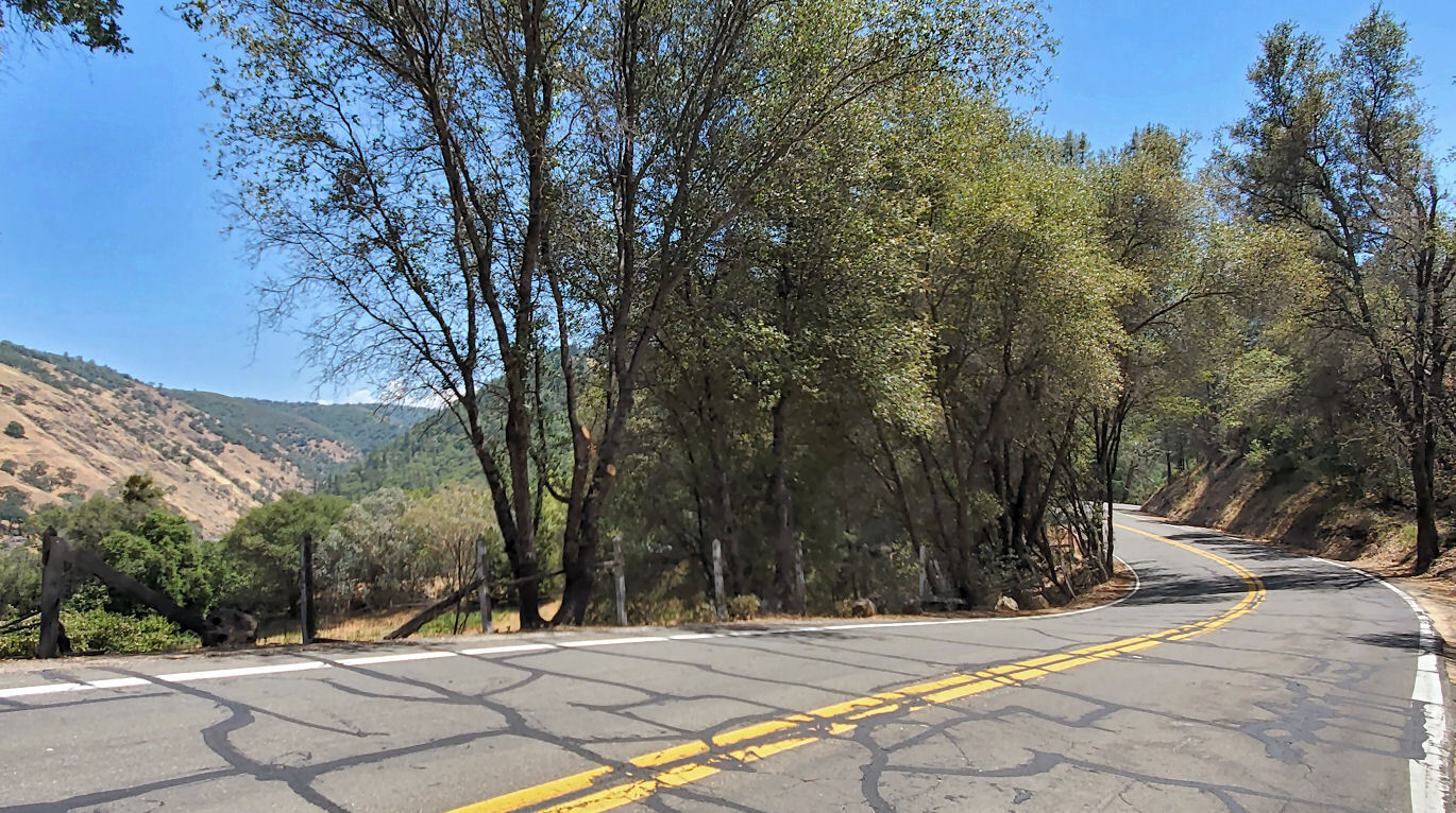
Then back to CA 49 where I began the 800 foot climb out of the canyon.

| Heart | 0 | Comment | 0 | Link |
Near the beginning of the climb is a good view looking down on the Middle Fork American river.

| Heart | 2 | Comment | 0 | Link |
Traffic was moderate going into the canyon around 9 AM. Traffic was much heavier after 10 AM when climbing out of the canyon. Truck traffic and commuter traffic. The 800 foot climb has no shoulder and it's mostly 7-8% grade. After the climb CA 49 has a narrow shoulder in open areas, but it always disappears in the frequent hill cuts.

Today's route passes through the old gold mining towns of Cool, Pilot Hill, and Coloma. Few gold rush era buildings are visible from highway.

| Heart | 0 | Comment | 0 | Link |

| Heart | 0 | Comment | 0 | Link |
After a long 1200 foot descent CA 49 follows the the South Fork American river upstream for several miles before crossing the river.

| Heart | 0 | Comment | 0 | Link |
CA 49 goes through Marshall Gold Discovery State Park where I took a long stop. Gold was first discovered in January 1848. James Marshall was an employee of John Sutter, doing maintenance on the millrace when he accidentally discovered a nugget of gold.

John Sutter had no interest in gold and tried to keep the discovery secret. That didn't last long, of course. The subsequent gold rush destroyed John Sutter's dream of building a utopian agricultural community along the South Fork American river.
The park built a replica of John Sutter's sawmill. Water from the river is diverted through a gate into the millrace. Water flowing in the canal spun a wooden wheel that powered a saw. Uncut logs were skidded up to the saw with a winch.

| Heart | 1 | Comment | 0 | Link |
The replica is not in the same location as the original sawmill. This one is far enough from the river than it won't be washed away by floods. Historical research has determined the location of the original mill and millrace. They believe they located the exact location where the first gold nugget was found. It doesn't really matter if they are wrong by 100 feet.

| Heart | 1 | Comment | 0 | Link |
CA 49 finally crosses the South Fork American river south of Sutter's Mill, still in the park.

| Heart | 0 | Comment | 0 | Link |

| Heart | 1 | Comment | 0 | Link |
A short distance later I turned onto an inviting looking 1-lane bridge across the river, built in the 1930's. It connects to the park campground.

| Heart | 0 | Comment | 0 | Link |

| Heart | 1 | Comment | 0 | Link |
Then CA 49 turns away from the river and begins the 1200 foot climb to Placerville. Much of the climb is 8-10% grade. One of the steepest grades of the trip.
Traffic was surprisingly light south of the Gold Discovery park. Apparently most motorists want to get to the I-80 expressway in Auburn, not the US 50 expressway in Placerville. That's good because CA 49 has no shoulder.
| Heart | 0 | Comment | 2 | Link |
That works out to 18.3 gear-inches. Way lower than most "stock" recumbents.
4 years ago
Today's route is mostly oak forested. Orchards and vineyards were rare. The weather was mostly sunny with a high temperature of only 72F (22C). Cooler than normal but very pleasant for the climbs.

| Heart | 0 | Comment | 0 | Link |
In Placerville I cross the US 50 expressway which is the last of 3 expressways that connect the gold country to the megalopolis below. I'm hoping the traffic will decrease soon.
I arrived in Placerville at 3 PM, surprisingly early considering the amount of climbing and a long delay for road construction. I explored downtown for a few minutes before checking into my hotel.

| Heart | 1 | Comment | 0 | Link |
The name Placerville refers to "placer" mining which is a polite term for hydraulic mining, where a water cannon blasts away entire hillsides to find small bits of gold. It's so destructive to the environment that the government banned the practice in the 1890's by making it illegal to dispose of mine tailings in rivers.
Fortunately, most gold mining activity was "hard rock" mines where tunnels access buried seams of quality ore.

Placerville is the county seat of El Dorado (The Golden) county.

| Heart | 0 | Comment | 0 | Link |
Tonight I stay at Cary House Hotel which was built in 1857. I'm pretty sure it will be the oldest place I have ever slept. It's the only operating hotel in downtown Placerville. Visually it's obvious that it was built as a 3-story building and the 4th floor was added later.

| Heart | 0 | Comment | 0 | Link |
The lobby definitely has a 19th century vibe.

My $131 room is well equipped considering the age of the hotel. It has A/C, TV, a private bath, and a kitchenette. But no microwave, coffee maker, or breakfast.
I stored my bike in the hotel's conference room.

The hotel's 2nd floor balcony is popular with guests. It has one of the best views of downtown Placerville, directly across from the famous Hangman's Tree tavern.
I felt strong when I arrived. I had an early dinner at an Italian restaurant, with 2 beers. After dinner I felt much more tired so I took a 1.5 hour nap before going back out to see the town at sunset.

| Heart | 1 | Comment | 0 | Link |
Placerville is known as Hangtown, presumably because there were so many hangings in the early days. Most of the hangings took place before there was a county sheriff and a county court. The hangings were vigilante "justice".
I noticed several stores in Placerville that claim to be the oldest in the west, or something similar. The 1852 hardware store claims to be the oldest west of the Mississippi river. I'm skeptical.

| Heart | 0 | Comment | 0 | Link |
I enjoyed walking around downtown Placerville. I pedaled through Placerville in 2010 during my Sacramento to Loveland bike tour but didn't stop to see the historic downtown. Now is the time.
Placerville was founded in 1848. Every town on this route was founded in 1848 or 1849, at the beginning of the gold rush.


The day's first climb had miserable traffic bursts but the larger second climb had light traffic. Overall the traffic wasn't as bad as I thought it would be. Traffic didn't get heavy until 10 AM. I should have started an hour earlier to get to the top of the first climb before peak traffic.
Distance: 30.7 miles (49 km)
Ascent/Descent: +3194/-2943 feet (+974/-897 m)
Average Speed: 7.6 mph (12.2 km/h)
Today's ride: 30 miles (48 km)
Total: 261 miles (420 km)
| Rate this entry's writing | Heart | 2 |
| Comment on this entry | Comment | 2 |
4 years ago
Bisbee is more arid, so it more resembles Virginia City, Nevada.
Virginia City, Tombstone, and Oatman are all excellent places to walk the boardwalks in a desert mining town.
There seem to be more old mining towns in deserts than in forests.
4 years ago