October 15, 2014
Day 37: To Waldron
Up at 7:50, breakfast nearby at a coffee shop run by handicapped adults. Out of Ozark at 9 AM. Sunny morning, much warmer than yesterday morning.
The day started going west into downtown Ozark to get to the long bridge across the Arkansas river. Obviously there aren't very many bridges across a river this wide.
Today will be my 3rd day going south on AR 23. It's been nice so far, but today the highway has more traffic and fewer hills. Traffic was especially heavy for the first 10 miles going south from Waldron. This area has more houses and more farms. A different universe from the unpopulated forested hills north of the Arkansas river.
| Heart | 0 | Comment | 0 | Link |
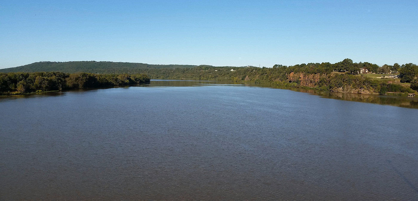
I took a long stop on the bridge to take pictures of the Arkansas river. It's a major river that goes from high in the Colorado Rocky mountains to the Mississippi river in southeast Arkansas. I saw the river far upstream during my Sacramento to Loveland tour. It looks much different there!
The terrain is noticeably more gentle today. No more 10% grades, and there are long segments of nearly flat road.

| Heart | 0 | Comment | 0 | Link |
Today's route has occasional 200 foot hills, but is mostly gentle terrain. More farms, more houses, more cross roads, and more traffic. The pavement is not good and there is often a rumble strip. When it existed, the paved shoulder was cracked and weedy.

| Heart | 0 | Comment | 0 | Link |
After 3 days on AR 23 it finally ends at US 71. The last 11 miles to Waldron had heavy traffic.
I arrived at Waldron at 4:30 PM. Sort of early for me. I got a $65 room at Southern Nights Motel on the bypass that goes around town. Good motel, next to McDonald's. I never saw downtown. Waldron is probably like the last several towns, where downtown is mostly boarded up and all the business are on the bypass highway.
Today I saw a Methodist church and a Cumberland Presbyterian church, but mostly Baptist churches. Still the Bible Belt.
Today was mostly sunny with a high of 70F. Nice touring weather. The terrain is more gentle but the scenery is not as spectacular and there is more traffic.
Distance: 57.4 mi. (92 km)
Climbing: 2303 ft. (698 m)
Average Speed: 10.7 mph (17 km/h)
Today's ride: 57 miles (92 km)
Total: 1,790 miles (2,881 km)
| Rate this entry's writing | Heart | 1 |
| Comment on this entry | Comment | 0 |