April 24, 2015 to April 28, 2015
The Roosevelt Loop
April, 2015
This five day loop is the third of a series that included our loop tours to Walla Walla and Bickleton. This one begins and ends at Roosevelt, a tiny community on the Washington side of the Columbia. We based ourselves here even though it's about the furthest point from home because there's no lodging anywhere around. It's the only way we could complete this loop and stay in a motel every night, our preferred mode of touring.
Day 1: To Goldendale (61 miles)
We drove from PDX to Roosevelt this morning on the leading edge of a weather front that brought fresh snow in the mountains and some heavy rains in the gorge. We were relieved to break free of the rain by the time we reached The Dalles and stopped for breakfast. With luck, we looked forward to a cold and windy but dry outing today.
It was still dry and partly cloudy when we set out on our bikes from Roosevelt a bit after 10. Our route for the first half of the day was up East Road to Bickleton, starting with a gradual 1500' climb up Roosevelt Grade. The ride up the grade is beautiful, gradually climbing eastward on the south face of the ridge, with beautiful views up and down the gorge that improved with every mile. Finally the road broke through the top of the ridge and turned northward for a more or less straight shot until Bickleton.


| Heart | 2 | Comment | 0 | Link |


This is another terrific cycling route - great scenery, good paved surface, virtually no traffic - perhaps 1-2 cars per hour. It is a good season to be here - there is still a lot of green in the hills, and an abundance of wildflowers - lupines, everlasting and balsamro ot lit up the meadows as we cycled past. As we neared Bickleton, the Bluebird Capitol of the World, western and mountain bluebirds became a common sighting.


| Heart | 0 | Comment | 0 | Link |

The weather gradually grew more unsettled, with showery spots and a stiff crosswind. It was still only 51 degrees when we arrived in Bickleton at about 1. We were happy to stop in for lunch at The Bluebird Inn, which claims to be the oldest tavern in Washington. It's a friendly place, and when we left we were very reluctant to pull ourselves away from the comfort of its wood stove.

| Heart | 0 | Comment | 0 | Link |

| Heart | 1 | Comment | 0 | Link |

| Heart | 0 | Comment | 0 | Link |
The rest of the day's ride was tough - much of it was into a strong, cold headwind that kept us heads down and counting off the miles off for the next few hours. This is a beautiful road too, particularly as it drops 1000' down to Rock Creek and then climbs out again. We were both really glad to hit bottom and start climbing again so that we could warm up a bit. By the time we crossed the final rise and dropped to Goldendale we were both thoroughly knackered and ready for a hot shower.


Day 2: To The Dalles (51 miles)
It was still cold this morning - in the high 30's - and still overcast and a bit windy, with still the possibility of rain. Having a fairly easy day ahead of us anyway, we took our time getting on the road. By the time we got out the door at 10 it was still cool but mostly sunny.
A beautiful ride lay ahead of us, but we held around the motel to wait for as much news as possible. Yesterday morning we awoke to the awful news of the terrible earthquake in Nepal, and our thoughts immediately went to our nephew Stewart. He is coleading a trek to the Everest base camp and their group had just left Katmandu yesterday. It was a great relief to hear that they are all safe, out in the countryside in a damaged but intact teahouse, and trying to figure out how and when they can get out. In the meantime Stewart has assumed the role of camp whisperer, calming down the clients as much as possible.
I've made a mental note never to travel with either of my nephews. Last summer his brother Vance and his wife were camping in Estes Park and were stranded for several days in the disasterous deluge that flooded Colorado. No sense courting my own disaster by hanging too close to them.
Today's ride was beautiful end to end as it passed through one scenic highlight after another. We have biked the stretch from Goldendale to the Klickitat and down to Lyle on the Columbia several times in the past. It is always lovely but seemed especially so this morning with the hillsides a brilliant blend of spring greens.

| Heart | 0 | Comment | 0 | Link |


The ride east along the gorge was new to us though (at least by bicycle; we've driven this way on hiking outings in the past). It is a fabulous road, passing directly beneath dramatic basalt cliffs. Highway 14 has a justifiably poor cycling reputation to the west of here with minimal shoulders, often heavy traffic and many blind curves - but once you pass through the tunnels just east of Lyle there is a good shoulder and the road straightens out a bit and makes for wonderful riding - especially on days like today when you're blasted down the highway by a strong tailwind.


About 5 miles before the bridge we left the highway to bike through Dallesport, and that was wonderful too. We've never been through this pretty little area - open and flattish, with the pastures mottled by stony outcrops and with lovely views across the river to the dramatic hills west of The Dalles. I loved getting to see this bridge across the Columbia up close also - I've often admired it from the distance when cycling on the Oregon side.

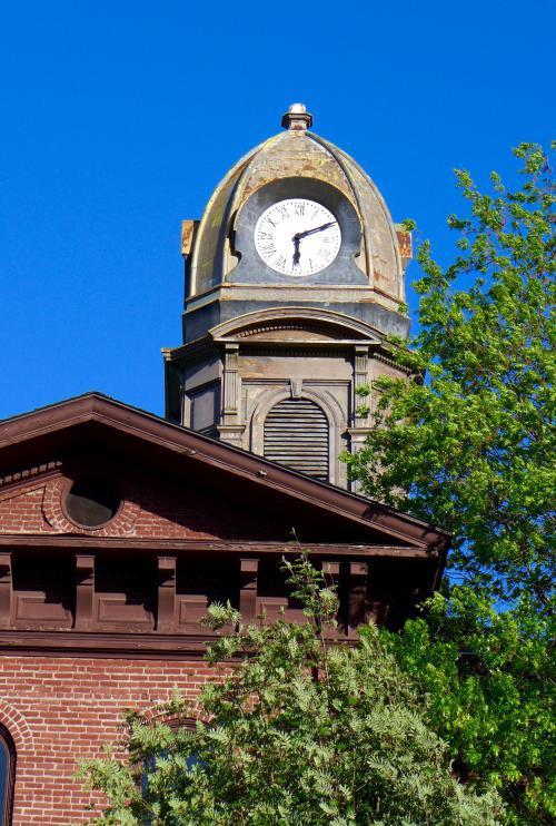
We've never stayed overnight in The Dalles before this. We've picked a busy time to show up - the annual cherry festival is on, and first street is jammed with booths, vintage cars on display, carnival rides, and crowds. For dinner we splurged at Baldwin Saloon, a beautiful old place with a colorful, risqué history. Great place to eat, and fun to wander through and explore between courses.


| Heart | 1 | Comment | 0 | Link |


| Heart | 1 | Comment | 0 | Link |
Day 3: To Maupin (58 miles)
It was 36 this morning, but the forecast for the day was fine and expected to warm up quickly. By 9:30 when we left our room it was in the high 40’s, sunny and comfortable. We departed on the happy news that Stewart had reported in from Nepal again and that their crew were all still safe, well, and planning out their return to the now functioning Katmandu airport and home. He said they were lucky to be in the Goldilocks spot – not too close to the Everett base camp, not too close to Katmandu.

| Heart | 1 | Comment | 0 | Link |
The day’s route began with a ride to Dufur, 1500’ above the river. This is country we’re well familiar with – the area southeast of The Dalles has some of our favorite cycling roads in the region. We took a pretty direct this morning up Eight Mile Road and then the Boyd cutoff, and were in Dufur basking in the sun on a sidewalk bench before noon.
Beyond Dufur was all new country for us though. Our road began with a long, gradual climb up Old Dufur Pass road, finally cresting at the summit of Tygh Ridge, where we stopped by the roadside for a picnic lunch in a lovely spot overlooking the top of the ridge. The climb up was a bit of a tease – there are two elevation markers on the way up that look like summit signs, but are not; and the final four miles seemed like a continuous false summit, with each bend in the road looking like it must be at the crest but revealed yet another rise when we rounded it.


The final half of the day was a fabulous ride. It began with a very fast (and today anyway, very cold) drop off the ridge to Tygh Valley, 1600’ below. From there we turned east on empty route 216 for the 7 mile ride to Sherars Falls on the Deschutes. Before arriving at the river though we stopped in to visit White River Falls state park. How have we lived in Oregon for this long and not yet come to this lovely spot? It is a beautiful falls, wedged between dramatic cliffs. At the base of the falls are the ruins of the hydroelectric plant that served power to the region in the first half of the last century before it's shutdown in 1960.
| Heart | 1 | Comment | 2 | Link |
2 years ago


| Heart | 0 | Comment | 0 | Link |

| Heart | 0 | Comment | 0 | Link |
The highway crosses the Deschutes at Shearars Bridge, just below the falls (not much more than serious rapids, actually). It continues on to Sherman County, and we’ll be back this way tomorrow morning for our ride to Wasco. Tonight though we biked the idyllic, recently paved BLM road that traces along the cliffs on the east bank of the river to Maupin. This surely must be one of the best 10 mile road rides around.
We ended the day hanging out in the park by the river until time for dinner, enjoying perfect weather conditions – the day has turned warm, there is a mild breeze, it is sunny. We ate in the Imperial River Lodge at a table looking out at the river and enjoying the early evening breeze wafting in the open doors. After this, a 2 mile climb up the other side of the river in the dusk took us to our motel for the night. There's no doubt that we’ll be back to ride this road again before long.


| Heart | 1 | Comment | 0 | Link |


| Heart | 1 | Comment | 0 | Link |


Day 4: To Wasco (70 miles)
This was another long but very beautiful day cycling on remarkably empty roads, mostly in sparsely populated Sherman County. It seems almost no one lives here - it's towns are few and far between, and there's not much there there when you pull up in one. Our innkeeper cautioned us in planning out our route to watch out for construction when we pass through Biggs Junction tomorrow - it's under construction for a landmark upgrade - they're installing the first stoplight in the entire county! Better visit before its all spoiled - strip malls can't be far behind, I'm sure.
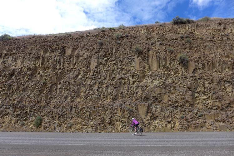
The ride back down the Deschutes to Shearers Bridge was every bit as beautiful and serene as the ride up. From there we turned east onto highway 216 again (the route we followed in from Tygh Valley yesterday) and followed it into a lateral dry gorge and slowly climbed out of the canyon to the top, opening onto the vast, open plateau that forms most of the county. The views from the top of the gorge are truly stunning, with Mount Hood and farther to the south Mount Jefferson gradually rising above the canyon walls. A bit further up the road, Mount Adams and finally far off Mount Rainier rise up above the wheat fields as well, giving us a volcano panorama that takes in a third of two states.


| Heart | 0 | Comment | 0 | Link |

For the next hour or so we rode across this high plateau through rolling, treeless wheatfields and enjoyed a huge, unbroken vista. We had the world to ourselves - for most of the day we passed perhaps one or two cars per hour. For lunch we stopped in Grass Valley, a small community that feels like it is slowly working its way toward a ghost town designation. It has a nice small park though, and an informative plaque that discusses the Barlow Trail that passed through here and along much of the route that is now Highway 216. It gave perspective to our descent to and climb out of the Deschutes canyon to imagine traversing this landscape in covered wagons.


| Heart | 0 | Comment | 0 | Link |


Toward the end of the day we dropped into the windmill belt. A huge wind farm now covers the plateau east of Moro and Wasco. We've ridden through here several times, and each time we pass through the forest is noticeably denser. Today it must really be loading the grid - a strong east wind picked up in the afternoon and the huge blades complete a full rotation in about 3 seconds. As we cycled below them I was mentally calculating how fast the tips of the blades must be moving, based on an estimated rotor length of 30 feet. In fact they're much longer than that, as I found out when we passed a few lying on the ground. They must be more like 75 feet long, and their tips must have been moving well over 60 mph this afternoon.


Toward the end of our ride we turned west for Wasco, and flew directly downwind for the final miles of the day, racing down hills and effortlessly rising up the next one under the force of this great wind. We arrived just in time for dinner, and after quick showers we headed out to the friendly and satisfying Goose Pit Saloon.
Day 5: To Roosevelt (58 miles)
We wouldn't have thought anything could top yesterday's fine ride, but by day's end we thought today's was even better. We ended it feeling that today was the best of what has been an almost unbroken string of great rides in this series of forays east of the mountains.
The day began with a ride north to the Columbia on Scott Canyon road, yet another almost empty traverse through striking terrain. After rolling its way up and out of Wasco for a bit, it drops into the canyon and snakes it's way rapidly down to the river, opening out at Rufus. It is very beautiful on this fine spring morning - the young, bright green grain fields contrast sharply with other freshly plowed pastures; to the west are of course fine views to the nearest volcanoes; and straight ahead loom the Goodnoe Hills, the massive ridge on the Washington side of the river that we'll be traversing later in the day.

| Heart | 0 | Comment | 0 | Link |


| Heart | 0 | Comment | 0 | Link |

At Rufus we turned west and followed the Columbia downstream for a few miles to Biggs Junction and the bridge to Washington. This stretch of the river is an uncharacteristically straight shot, rimmed on the south side by an unbroken wall of basalt cliffs. I marveled at the occasional homesteads we passed and their surrounding boulder-strewn pastures - all the homes were sited up close to the cliff face - and wondered that their owners didn't feel they were tempting fate a bit.
From Biggs Junction we crossed the river on US 97. It's not the most cycle-inviting bridge in the gorge, having only two lanes and no shoulder or sidewalk on either side - but today at least the traffic was minimal in our direction so we had an easy passage. We were helped out by the construction work to install the first traffic signals in the whole county, which nicely grouped traffic and gave us a very large window to cycle within.
Across the bridge, we dropped through the tiny community of Maryhill and then climbed steeply up past the Stonehenge replica to highway 14. From there we climbed up onto the plateau on the delightful corkscrew Maryhill Loops Road. I'm not sure this is a completely kosher route option, so use your own judgement. The road is barred from cars but open to bikes, but the at the top end it degenerates to rotten asphalt and finally ends at a locked gate just below the highway. We had to let our bikes over, and were relieved that no one showed up with a shotgun and ordered us to bike down again the way we came.


| Heart | 0 | Comment | 0 | Link |
Once on top, we followed highway 97 for a mile or so and then turned east on Hoctor Road. Once we got a few miles from the highway, this one turned into yet another remarkably quiet, ideal cycling route. It gradually climbed for miles before finally cresting in a thicket of windmills before plunging downhill - first through the ghost community of Goodnoe Hills, and then down to the bottom of Rock Creek - the same creek we had dropped into and climbed out of a few days earlier on our ride from Bickleton. The views of the gorge from the top of this ridge extend far up and down river and deep into Oregon. This is as fine an overlook of the gorge as we've seen anywhere.
Finally, we arrived back at the river again, and were blasted back to Roosevelt and our car on a pure 20 mph tailwind. It made an exhilarating and uplifting end to a wonderful short tour.


Today's ride: 303 miles (488 km)
Total: 937 miles (1,508 km)
| Rate this entry's writing | Heart | 1 |
| Comment on this entry | Comment | 0 |