February 11, 2016
Rio Gallegos: Route 3, km2639 to 2534.
| Heart | 0 | Comment | 0 | Link |
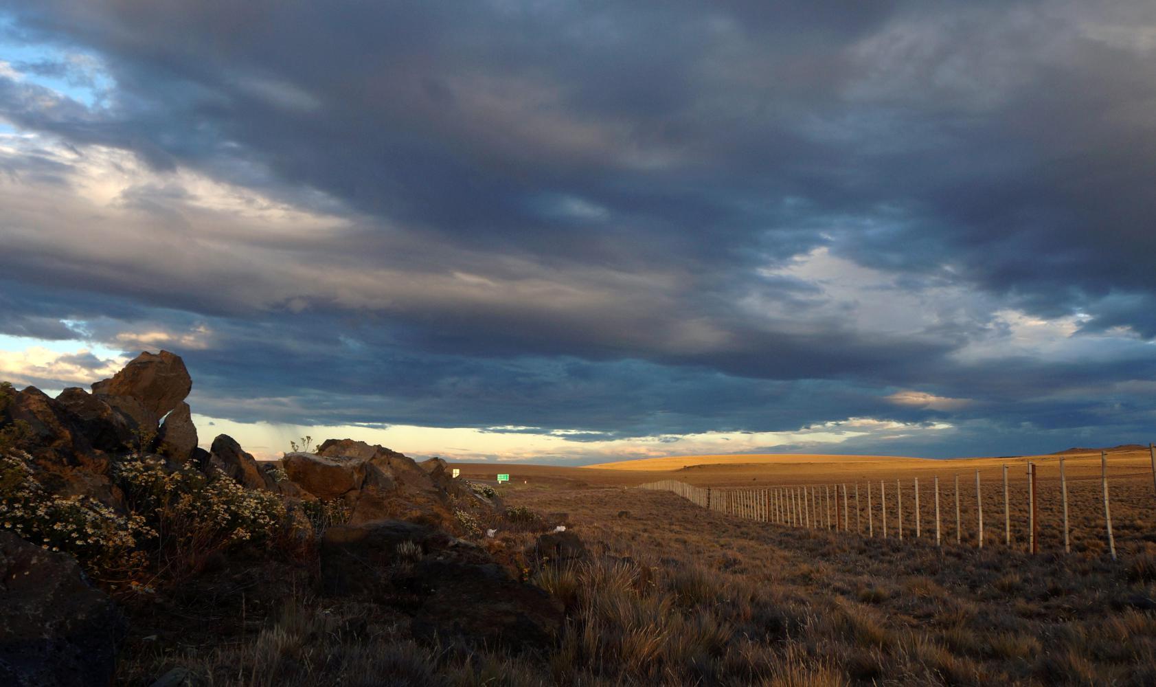
Already it feels warmer. Not so much because I've come north, but more because I'm back on continental South America and am moving inland. It shows where I've camped there's a greater array of wild flowers.
I'm up with the sun and just have tea for breakfast. On the road the other side of the mound of rocks I'm hidden behind, lots of touring motor bikes pass in twos and threes, on the road early to beat the wind on the way south to Ushuaia. For me its thirty kilometre north to Rio Gallegos, where this morning I will stock up for the next leg to Piedra Buena, the only town for 240km further. Also, I need to stock up on cash. The next city on route 3 with a bank machine I can use is Comodoro Rivadavia, 780km north. Then, pray the wind doesn't make the 25km on from Rio Gallegos, going directly west against the prevailing wind, impossible. Thereafter the road swings north east and continues so, meaning most likely tailwinds from that point on.
A bright blue sky sunny morning soon turns to business as usual southern Patagonia, as midnight blue sheet cloud move in, turning it dull and rain like with rising icy cold wind straight from the south west. I fear I spoke too soon earlier with regards escaping the cold. In any case it's a long dreary ride into the city, perhaps the biggest city this far south and the capital of the province of Santa Cruz. Eventually I'm riding along Avenue San Martin, then come to an intersecting main shopping street, called Avenue Nestor Kirchner: former president and dead less than ten years, yet immortalise in what was his hometown. Incidentally, his wife was elected president too and caused an international fury over some small islands in the South Atlantic.
I ride the whole of Nestor Kirchner, until I come upon a Banco Patagonia, the one bank where the ATMs reliably work with international cards. Then return to a Carrefour I passed, which has a panadaria (bakery) alongside where I breakfast on empanadas and facturas (custard and jam pastries); shop in Carrefour; then find a café with wifi.
It takes many tries getting the computer to connect. Every time I click on the cafe's network a message pops up saying I cannot connect, five times in all. I'm about giving up, assuming its a problem with the computer and will need to be taken for repair, when it connects with one last try.
I am there until one, by which time it really is a dull old grey afternoon, with spots of rain as I ride out of town on a service road to the side of an autopista (motorway) with no cycling signs. Eventually, the service road runs out and I've to ride on the vehicle wide motorway shoulder until pass the airport, I pass under a sign signifying the end of the motorway, but the road continues as dual-carriageway, luckily, as there is strong crosswind and I've the whole of the vehicle wide paved shoulder to be pushed sideways in a slow grind taking most of the afternoon.
About 25km I pass a sign "Control Policial y Sanitario 1km". Oh no. Sanitario? Does that mean I won't be able to take my newly purchased cheese and fruit and veg beyond that point. I passed through one such sanitary control in the province of Buenos Aires, where I wasn't allowed to take meat, dairy produces, fruit and veg pass, and don't tell me this is another such control which will empty my food pannier of all worthwhile food, leaving me hungry for the next couple of days. When I get as far, the "sanitario" part is toilets and I'm waved through without delay.
A few kilometre further I come to the bridge over Rio Gallegos, a not very big river, but there's a huge recreation area with fogones (barbeque fireplaces) on its banks and a campsite further in by the row of barrancas the road has run parallel with all afternoon. I ride off and continue in from the riverbank, where some of the fogones are built inside bus shelter size houses, just the place to take refuse from the cold wind. Even inside though I have difficulty sheltering the stove to boil water for tea.
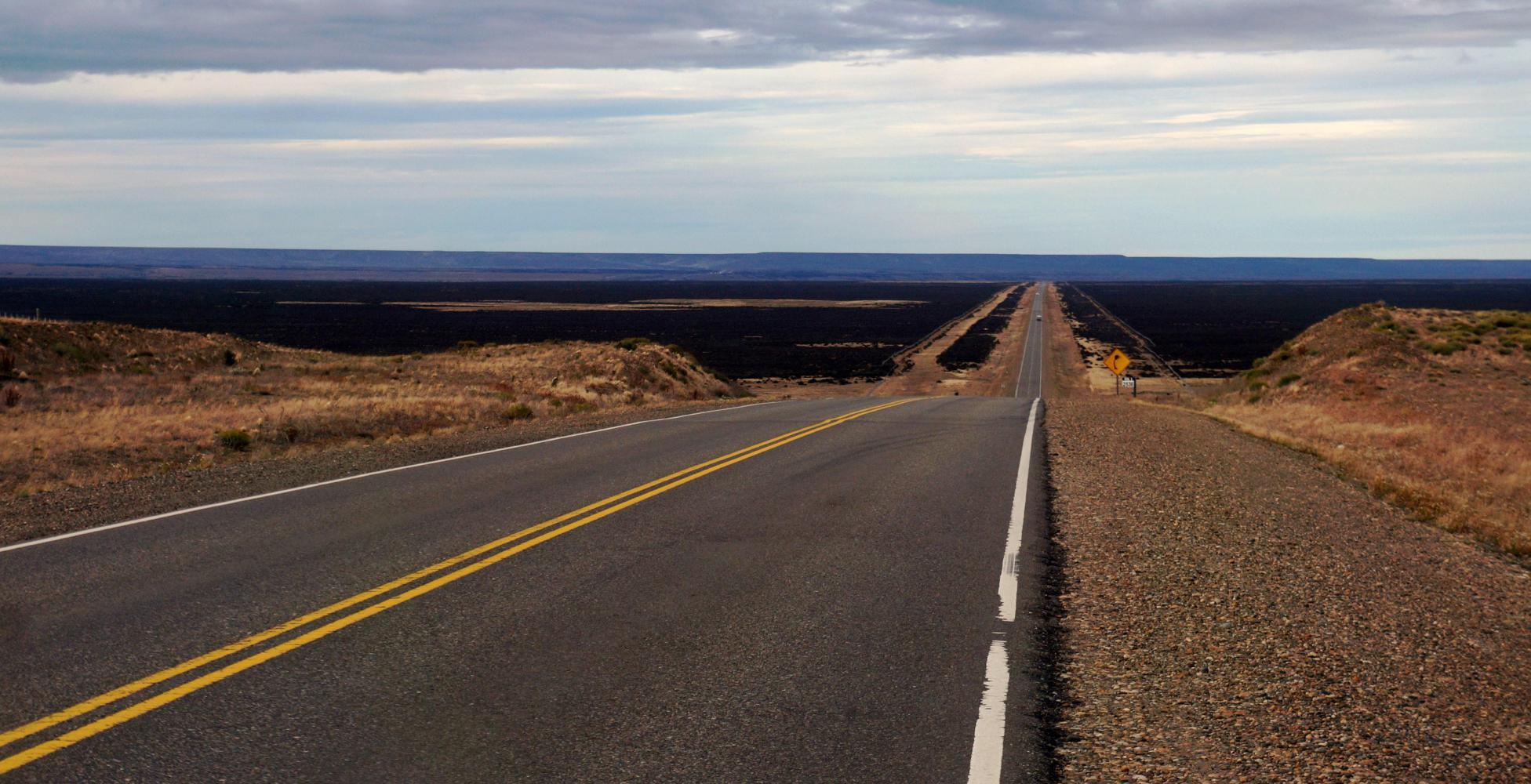
I could camp here but it is only five and would prefer making a dent in the 210 kilometres to the next town. It is only a couple of kilometre more until the road swings right and the wind turns to tailwind as the road goes into a narrow valley in the barrancas, where route 5 for Calafate splits off on the right up the hill as route 3 shortly veers right, passing underneath route 5, to climb a long hill up out of the valley out upon open plain. There's yellowish white dry grassland for a bit, then a black low scrub covers everything on the huge expand toward a horizon consumed in dark blue shafts of rain. Just the thing I need when I'm trying to make progress, to camp early because of rain. Though, not much shelter from the furious tailwind to camp should I need.
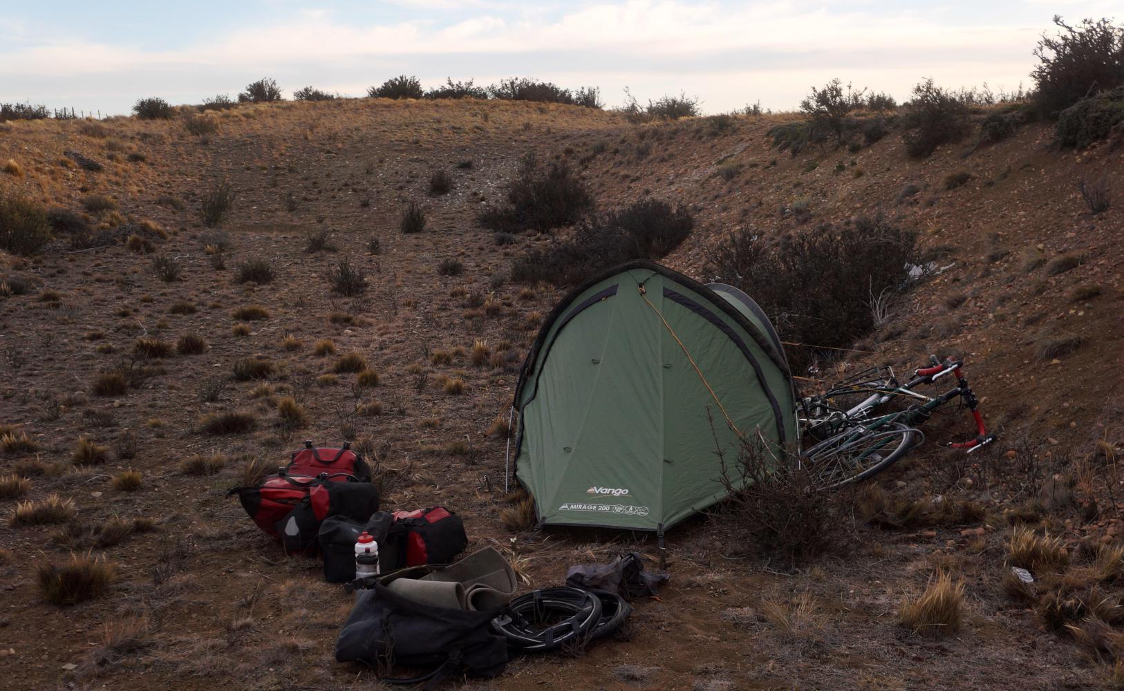
The rain remains well ahead of me on the road and further moves on to the east, leaving clearer looking weather ahead in it's wake. Relief soon come to the flat monotomy when I climb a gentle rise and cresting it, a drop down to a shelf with a further drop many kilometre ahead to a valley, with brown barranca slopes of a valley's far side perhaps 15km distances. Just down this first downhill though, I come to a dugout pit to the right of the road with bushes on it's roadside rim. Below is well sheltered, level and hidden from the road, so I pitch the tent.
Today's ride: 105 km (65 miles)
Total: 5,329 km (3,309 miles)
| Rate this entry's writing | Heart | 0 |
| Comment on this entry | Comment | 0 |