January 10, 2016
Paine: near Torres del Paine to Puento Weber.
| Heart | 0 | Comment | 0 | Link |
| Heart | 0 | Comment | 0 | Link |
It is a hard struggle with headwind and loose gravel the remaining fifteen kilometres from where I'd camped to the national park entrance, a distance that took me three hours to achieve. Then once I've departed with the entrance fee and received a map and the girl behind the desk in the park office has pointed out details on the map like campsites and I ask the distance of the road through the park to the far entrance, in which she tells me 47km, a good bit less than I thought, I have to sit in the shelter of the building for half an hour to rest before going further.
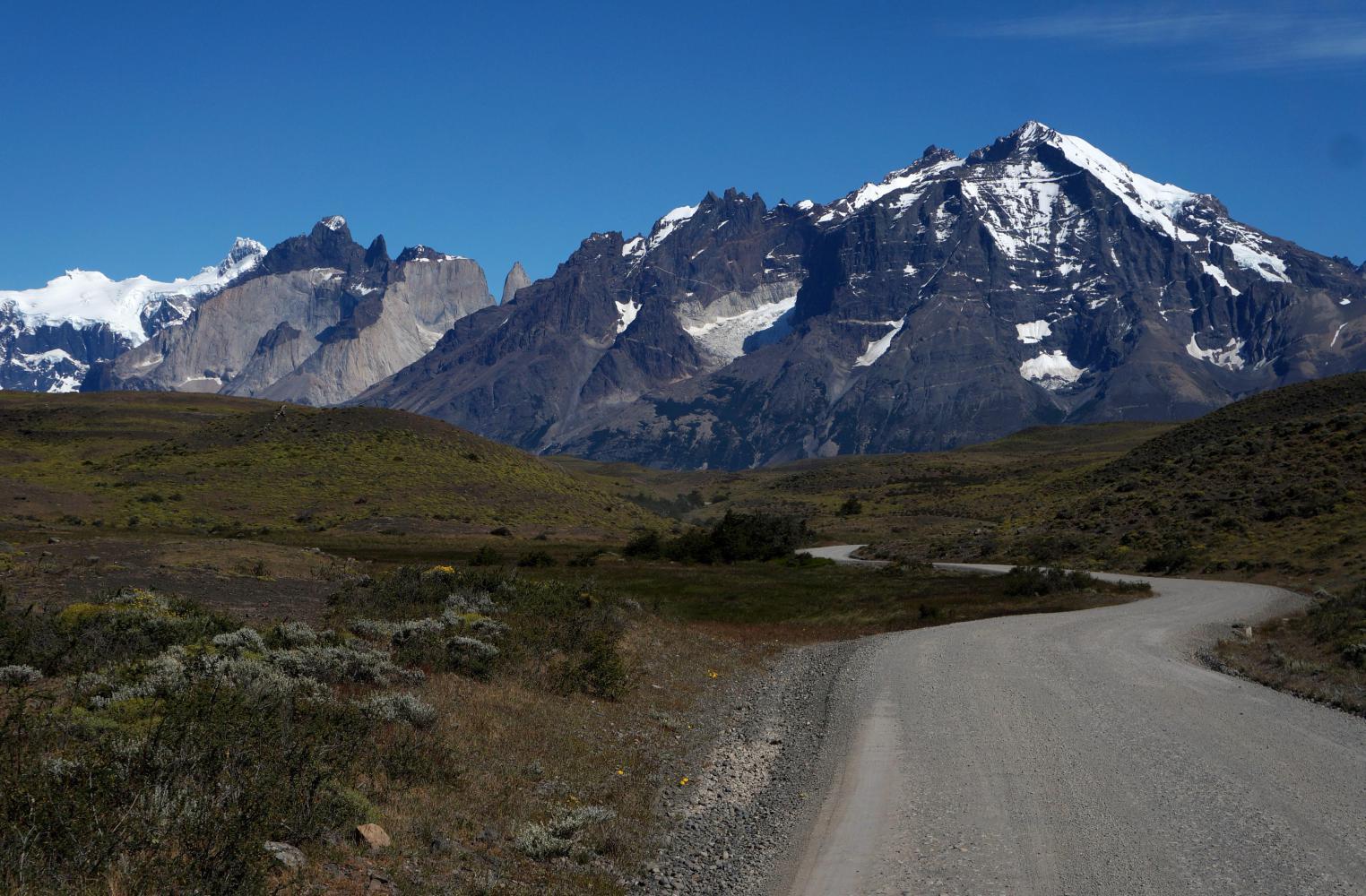
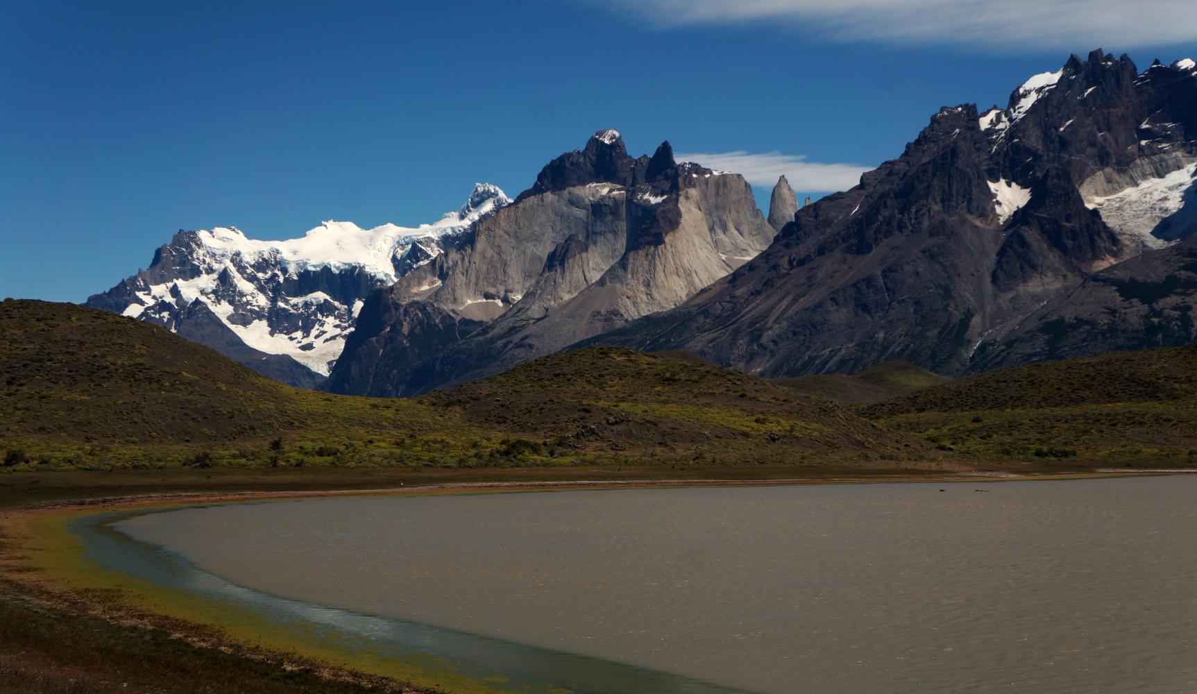
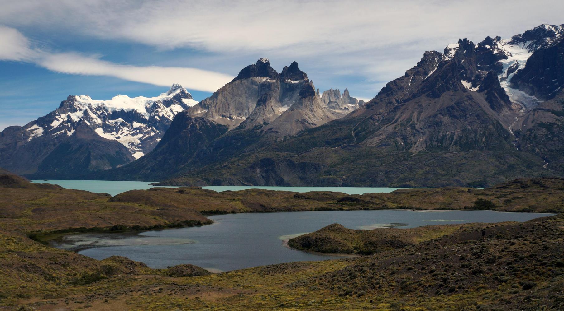
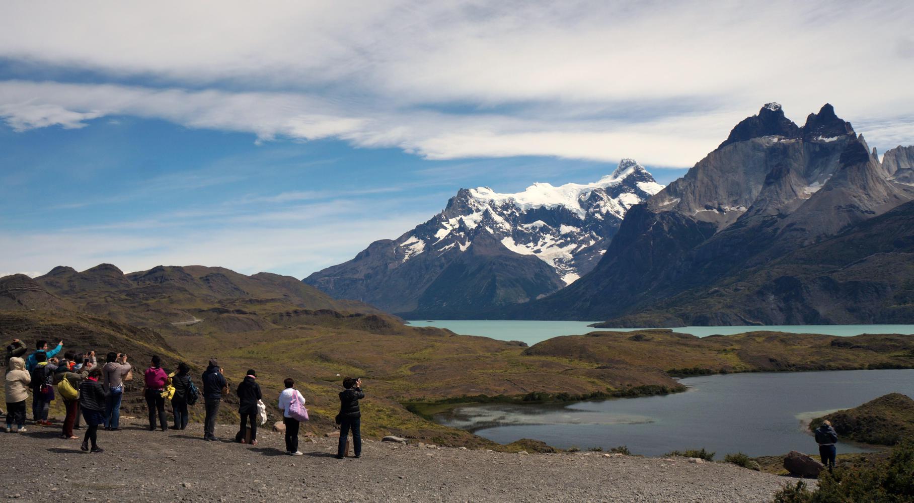
Straight on the road ascends a steep hill where I struggle to avoid smooth rounded stones strewn over the track against wind now halfway between head and crosswind. Then having crested this initial hill, the road ascends in a more sensible three or four per cent gradient having adopting a meandering zig-zag fashion through rounded hillocks of yellowish tussock grass with Torres del Paine mountain-massif rearing up close by on the right, a view which would remain the same for the entire day.
Before long though the easy gradient come to an end with a ridiculously steep descend into a pocket between hills, only to immediately go straight up a following hill. This would be how the road would continue for near enough the whole day, coupled with the large number of tour buses that tended to come along when least needed; either, during difficult loose stony climbing, where I'd be forced off the best line up the hill and consequentially grind to a halt in un-rideable loose stones, while they pass showering me in grit and leaving a cloud of lingering dust, or, a steep downhill where I brake and ease down slowly to avoid the wheels skidding out from under me on stones. On one such downhill, I've a moments lack of concentration, whereupon the front wheel runs on a stone that instantly turns on it's side sending the wheel out from under me. My reflex are lighting fast planting both feet firmly on the ground to save me falling, but not quick enough as the handlebar turns round trapping my right leg between it and top-tube and I fall anyway, ending up on my side upon the ground. Fortunately there's no damage. I pick myself up and be more careful going downhill the remainder of the day.
Around three I reach a café on a lake shore a kilometre in off the main through road with a kilometre further up a steep hill to a lookout over a waterfall called "Salto Grande". A climb too much for me just to return back down. Instead I lunch at a picnic table in the cafe's garden, glad to have bread and salami and wine to drink. A windy spot, the hedge round the garden not providing much shelter. I lay on the bench and sleep a while and awake shivering with the windchill.
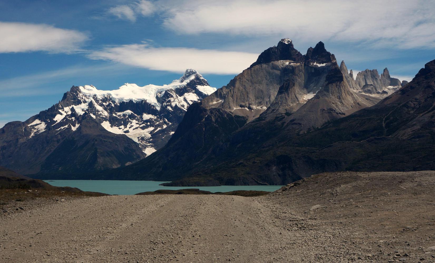
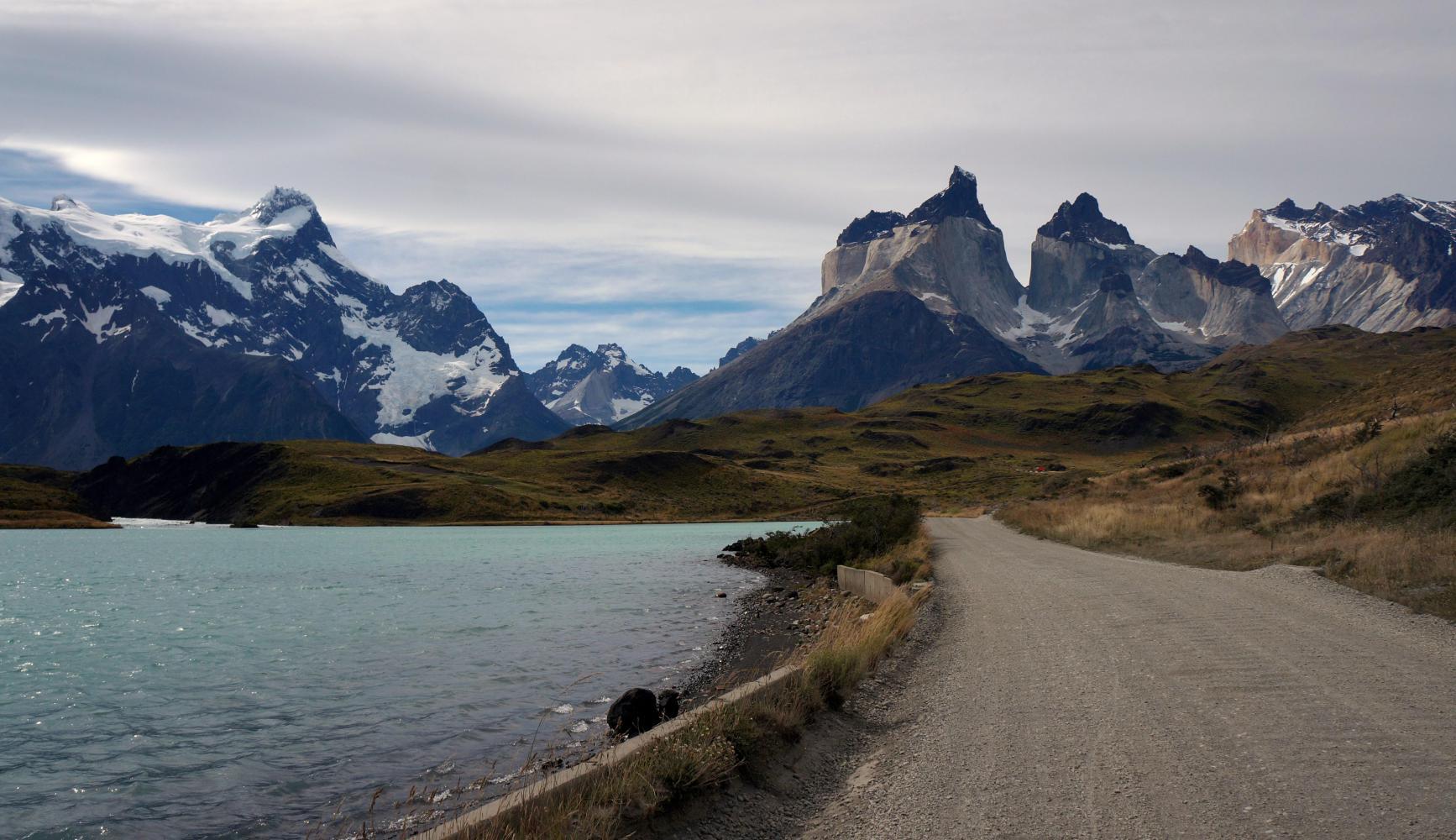
The way on follows the lake shore, which further on becomes a river. It is worth saying that from the lunch stop, I've turned a corner and riding south with a tailwind, which should mean an easy ride if not for the stupid route the road takes. From looking at the lakeside then riverside, there was nothing stopping the roadbuilders following close to both most of the way; but instead, the road turns inland up every hill protruding out, only to go steeply down to the water's edge again. A steep climb followed by a steep descend repeated over and over again.
I reach a shop with a campsite attached, which I'd been wishing to stop the night at. Outside I meet a friendly German hiker who picks up his backpack to go set up camp. I ask how much it is to camp. He tells me, nine-thousand (£9). I exclaim, I'm out of here. I do buy a coke and rest for fifteen sat on their balcony before going further.
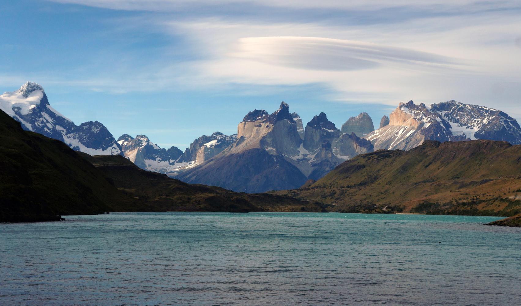
I had been wishing to exit the park and then find a camp spot, but all this climbing is taking it's toil. Then I descend and cross a bridge with the stone approaches on either river bank to an earlier wooden bridge no longer there a little upstream. A place with a great view back up the river to Torres del Paine and the extensive level riverbank all along a great place to camp, if only camping outside of authorized campsites isn't forbidden. However, I have a good scout around and find a well hidden place enclosed on all four sides in lengue trees. And more than a hundred metres off the nearest riverbank track. The theory being that car occupants don't walk more than a hundred metres from a parked vehicle. And it now late all cars have headed home for the night, so I considered my campsite watertight.
| Heart | 0 | Comment | 0 | Link |
| Heart | 0 | Comment | 0 | Link |
| Heart | 0 | Comment | 0 | Link |
Today's ride: 58 km (36 miles)
Total: 3,904 km (2,424 miles)
| Rate this entry's writing | Heart | 0 |
| Comment on this entry | Comment | 0 |