April 29, 2025
Tri-State "Cornerstone" Marker
Meeting Spot of West Virginia, Maryland, and Pennsylvania
Somewhere out there in the hilly and wooded countryside, three state borders meet in a spot marked by an old concrete monument. Originally placed by surveyors Mason and Dixon, the marker has withstood hundreds of years of weather and human incursions. At this spot, the counties of Fayette (Pennsylvania), Preston (West Virginia), and Garrett (Maryland) converge. It lies on the Eastern downslope of Laurel Ridge. The nearest towns of any significance are Markleysburg (PA), Bruceton Mills (WV), and Friendsville (MD). But none of these are close to the marker. The area is remote, the road to the spot is rough, and the marker itself may lie on private land, depending upon who one might speak with.
At the Bike Expo, in Philadelphia (3/8/25), I learned that a fellow by the name of David Landis has developed a route through Preston County (WV) and may make the marker a stop on a scavenger hunt as part of the ride. My quest today will be to get to this remote spot and find the marker while also exploring the challenging countryside that surrounds it in all three states.
The route is of my own making. Any resemblance to Mr. Landis' route is purely coincidental as I already had my route drawn up on RWGPS before I ever knew he and his route existed. Mr. Landis is certainly a talented and hard working individual who has carved out a wonderful niche for himself. I wish him nothing but the best. I hope in some small way, my little adventure can be of assistance to him, if he ever stumbles upon this journal. This trek has been on my to do list for quite sometime.

| Heart | 0 | Comment | 0 | Link |
The ride began at Curt's Family Restaurant, on the National Pike (US-40), in Henry Clay Township near the village of Flat Rock, Markleysburg, Pennsylvania, 15459. I found that getting to the marker is an adventure unto itself. Afterwards pausing there, I continued on with a ride that sampled slices of life of all three states.

| Heart | 0 | Comment | 0 | Link |
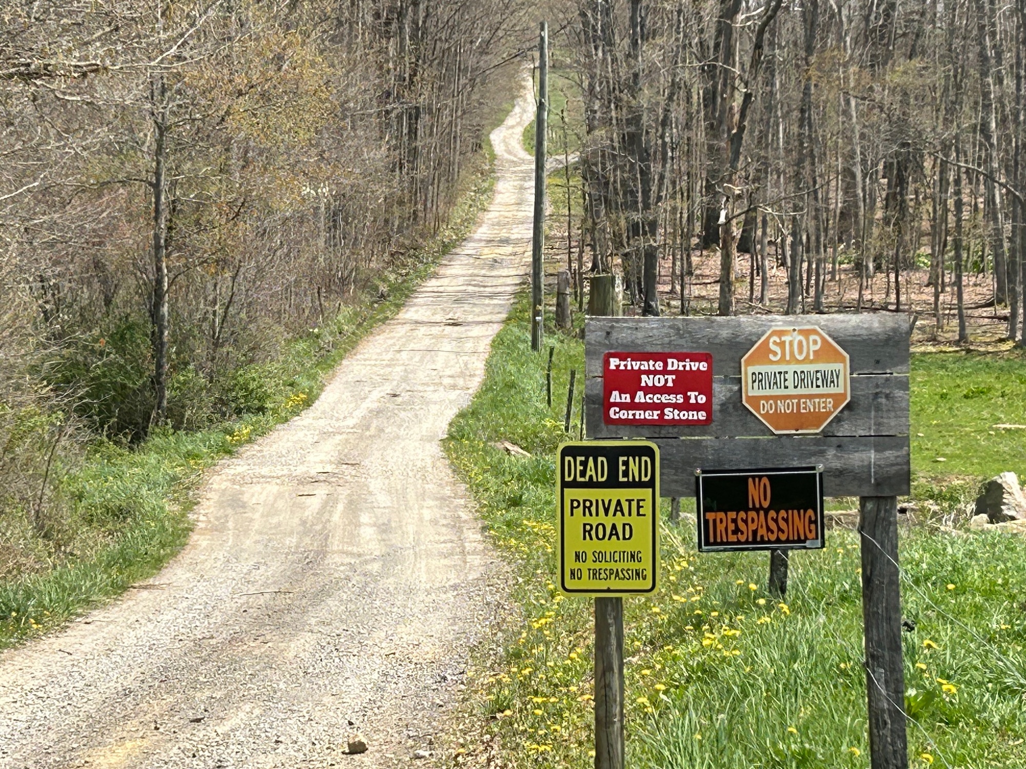
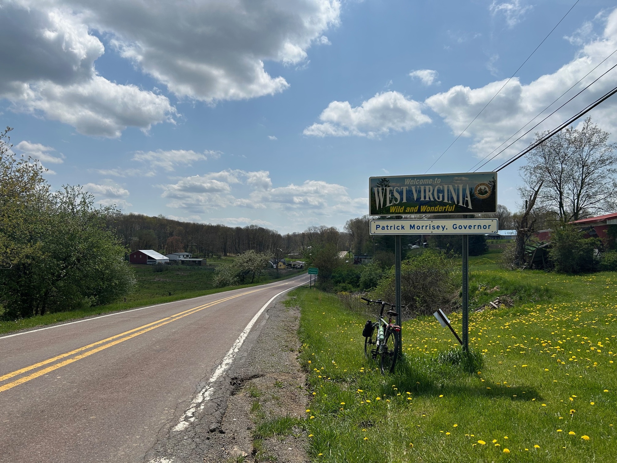
From Curt's, I headed West to the first turn onto Flat Rock Road (FRR). A few rolling bumps in the road and the emergence of Skunk Cabbage, in the low and wet areas, highlight this part of the ride. From FRR, I turned left onto Thomas Road (T-315) and then left again onto Bruceton Road, which led me to the West Virginia Line. There lay the gravel Virginia Road that had been identified as my path to the marker. However, once arriving there, signs indicated it was private property and not an access point to the "cornerstone." With nowhere else to go, I headed back into Pennsylvania. A short distance away I spoke briefly with a woman who was cutting her grass on a lawn tractor while her daughter was pulling weeds. Although she was local, she did not then seem to know how to get me to the marker.
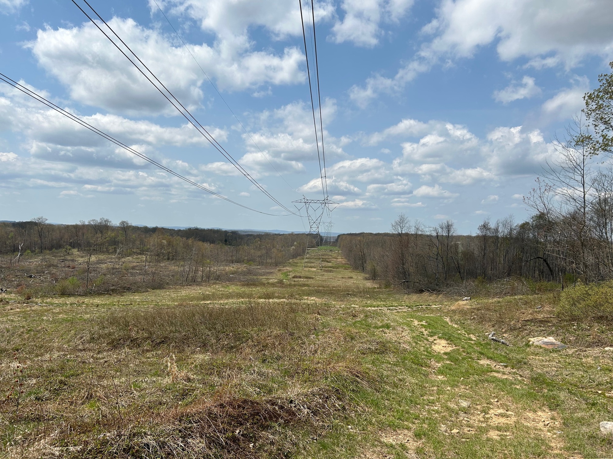
Fortunately, I had identified two possible routes before having come down here. My second and least preferred choice did not look like a road at all. It was more of a meadow created by clearing an area as a right-of-way (ROW) for large power lines.
Indeed, upon getting back to the marker, there was a rough pathway that required walking with my bicycle. If you try this, continue to follow the pathway. It is very rough, wet, involves fording (carefully stepping over) at least one small stream, and trekking up one decent rise in the landscape.

| Heart | 0 | Comment | 0 | Link |
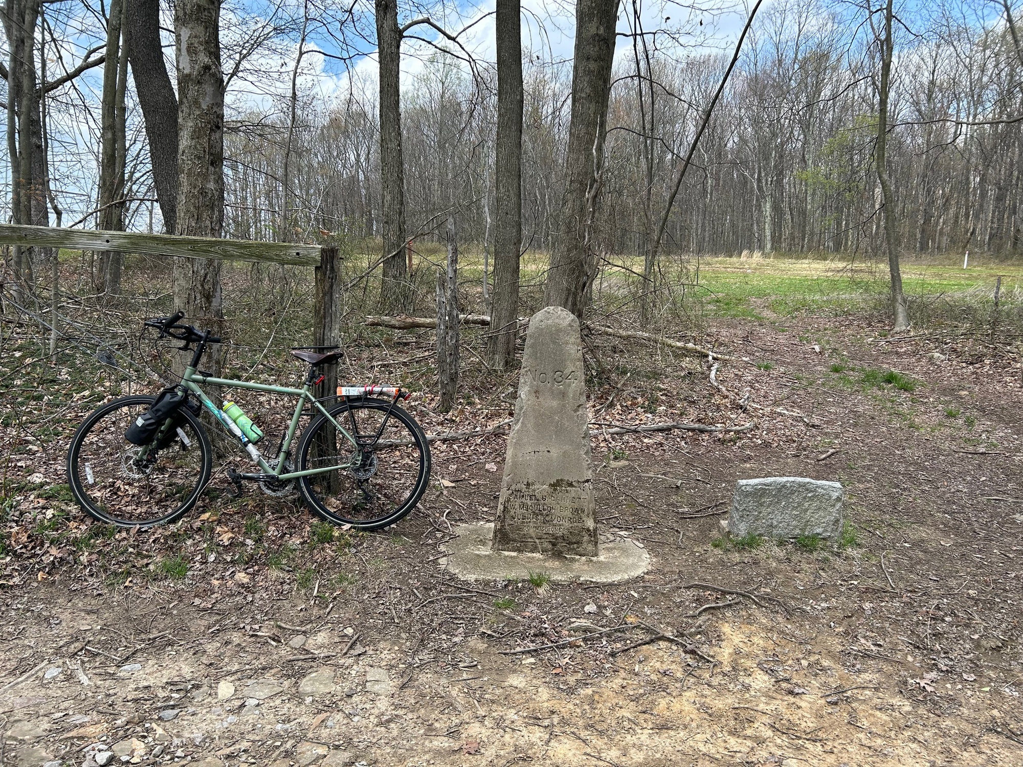
Upon cresting the rise, the Powerline ROW makes a big sweeping turn to the left. There is a metal pole with the top painted orange. Looking to the right, there is a pathway into the woods and a private barn can be seen.
At first, I didn't think that was the way to go but upon closer inspection, the cornerstone and a small plaque came into view. I had arrived! My GPS was on and appeared to have me standing directly on the right spot.

| Heart | 0 | Comment | 0 | Link |

| Heart | 0 | Comment | 0 | Link |
| Heart | 0 | Comment | 0 | Link |
Carefully, I made the hike back to the road in order to continue the planned 3-state ride. If you try this, keep an eye out for ticks. I knocked several of them off my clothes. As I write this journal summary, I am still not sure that one of them is not on my body somewhere. But that is one of the risks that must be taken in order to reach the convergence point of three states. I suppose it is preferable to the risk of being shot or arrested for trespassing. That risk I avoided by staying off Virginia Avenue and not crossing any adjacent landowner fencing. The pathway along the power lines did not have any prohibitive signage whatsoever.
Back on the road, I stopped again to tell the lady on the lawn tractor that I had found the spot. Turns out, she does know of another path to get there. She and her daughter were out taking care of the lawn. They seemed to be nice folks occupying the last house in Pennsylvania.
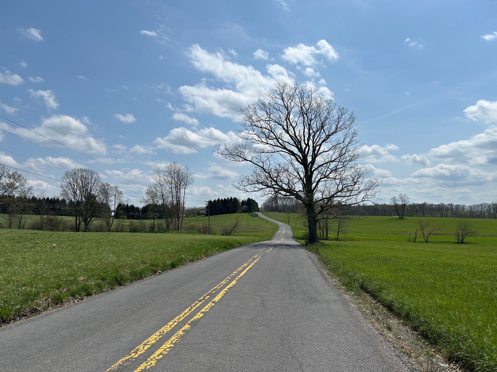
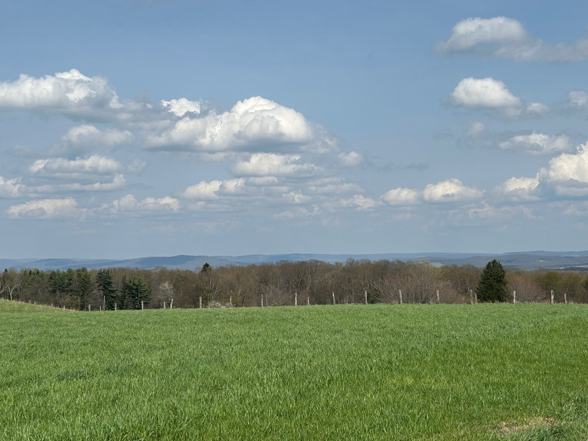
In West Virginia, Bruceton Road became SR-26. The traffic was almost non-existent. The road passes through rolling farmland with a few decent climbs but nothing that would cause an extreme degree of agony. Further on was a left hand turn onto Glade Farm Road (GFR). A church on the corner is a landmark but ample signage helps to insure that one does not miss the turn. I had ridden here before on a couple of occasions as part of an exploratory ride for a cross-country route and then on the actual ride itself. The area is peaceful, pleasant, and there is very little traffic. If one would continue on SR-26 to Bruceton Mills, traffic increases. I believe it is because there is an entrance/exit for I-68 there.

| Heart | 0 | Comment | 0 | Link |

| Heart | 0 | Comment | 0 | Link |
GFR becomes Hazleton Road, crosses I-68, and reaches the very small village of Hazleton, West Virginia. It seemed that I was the only one out there for most of my ride today. A very small number of vehicles passed me in either direction. Hazleton is home to a huge lawn-and-garden supply firm and also to a very large federal prison complex. With all that going on in the area, it still seems to be a very quiet little place with a sense of humor, as indicated by the sign on the side of the Hazleton Church.

| Heart | 0 | Comment | 0 | Link |
Hazleton Road continued Southward to an eventual left turn onto Mountaindale Road. The popular Big Bear Lake Campground can be accessed in this area but it was not on my itinerary today.
A left onto Keener Glade Road involved a couple miles of gravel, most of which was rather smooth. There were a couple of areas of rougher stone, which I walked to prevent potential pinch flats. I'm going to have to switch over to either a tubeless set-up or put cush-core inserts into my tires in order to create peace of mind on these gravel roads. Fortunately, I came through without incident.

| Heart | 0 | Comment | 0 | Link |
Eventually, the gravel led me to the paved Hazleton Line/Maryland Line Road, across I-68 again, and into Maryland. The road composition changed but the peaceful pleasantry and low traffic character continued in the Old Line State.
After a long downhill cruise, a big climb to Asher Glade was the one of the most difficult parts of the ride. Luckily, it didn't last long. While passing a very nice home and property, I remarked to the fellow sitting in a lawn chair that he has it made. He waved, smiled, and said, "So do you." I suppose he is right. I get to do this stuff and that is very much a blessing.

| Heart | 0 | Comment | 0 | Link |
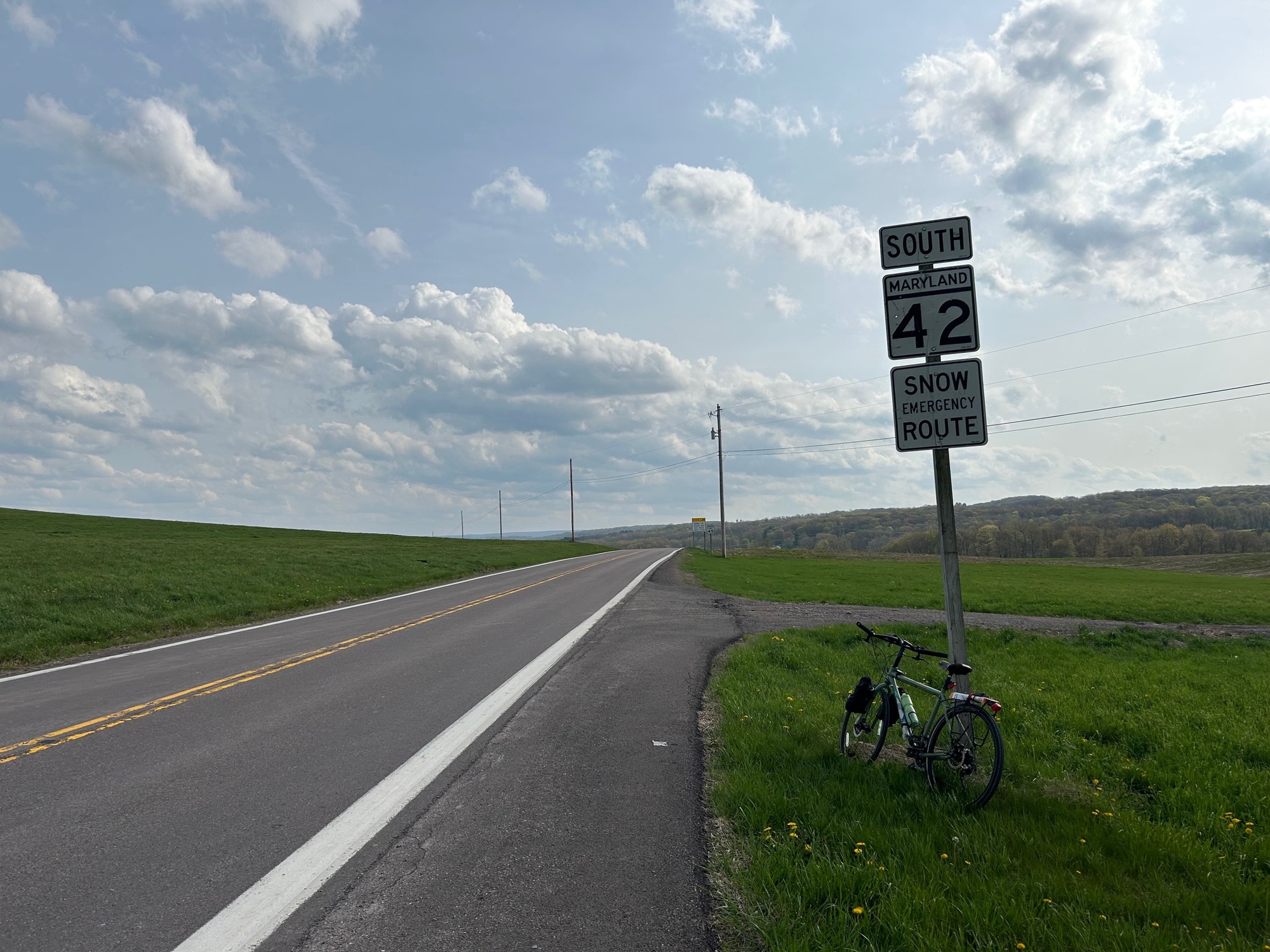
Asher Glade Road merged onto MD-42, a rolling state road that headed North and back to Pennsylvania. Since it was nearing 5:00 PM, there were a few vehicles passing me but nothing to get worked-up over. The road surface was great. There were a few gently rolling rises and the surrounding landscape was beautiful.
Once back in PA, the same surrounding landscape character continued all the way to Markleysburg. In town, I stopped at the Family Dollar Supermarket for a cold drink. The day had been rather warm and my water supply was nearly depleted. While standing out front the lawn tractor lady and her daughter pulled up. We exchanged greetings again as they went inside.
I got onto PA-281, headed out of town, and eventually to US-40 West. There was only about a mile and a half to go but much of it was a huge climb. It surpassed the little steep climb to Asher Glade with its length being the deciding factor in my informal degree of difficulty rankings. Fortunately, there was a shoulder with rumble strips to keep me safe. I made it back to my vehicle, which was parked at Curt's and had remained undisturbed during the nearly 4 hours that I had been out riding. A big storm was brewing but I got all packed-up and inside before it hit. This was a wonderful day and a great ride. If you do it, I don't think you will be disappointed.
Today's ride: 32 miles (51 km)
Total: 901 miles (1,450 km)
| Rate this entry's writing | Heart | 0 |
| Comment on this entry | Comment | 0 |