May 31, 2025 to June 27, 2025
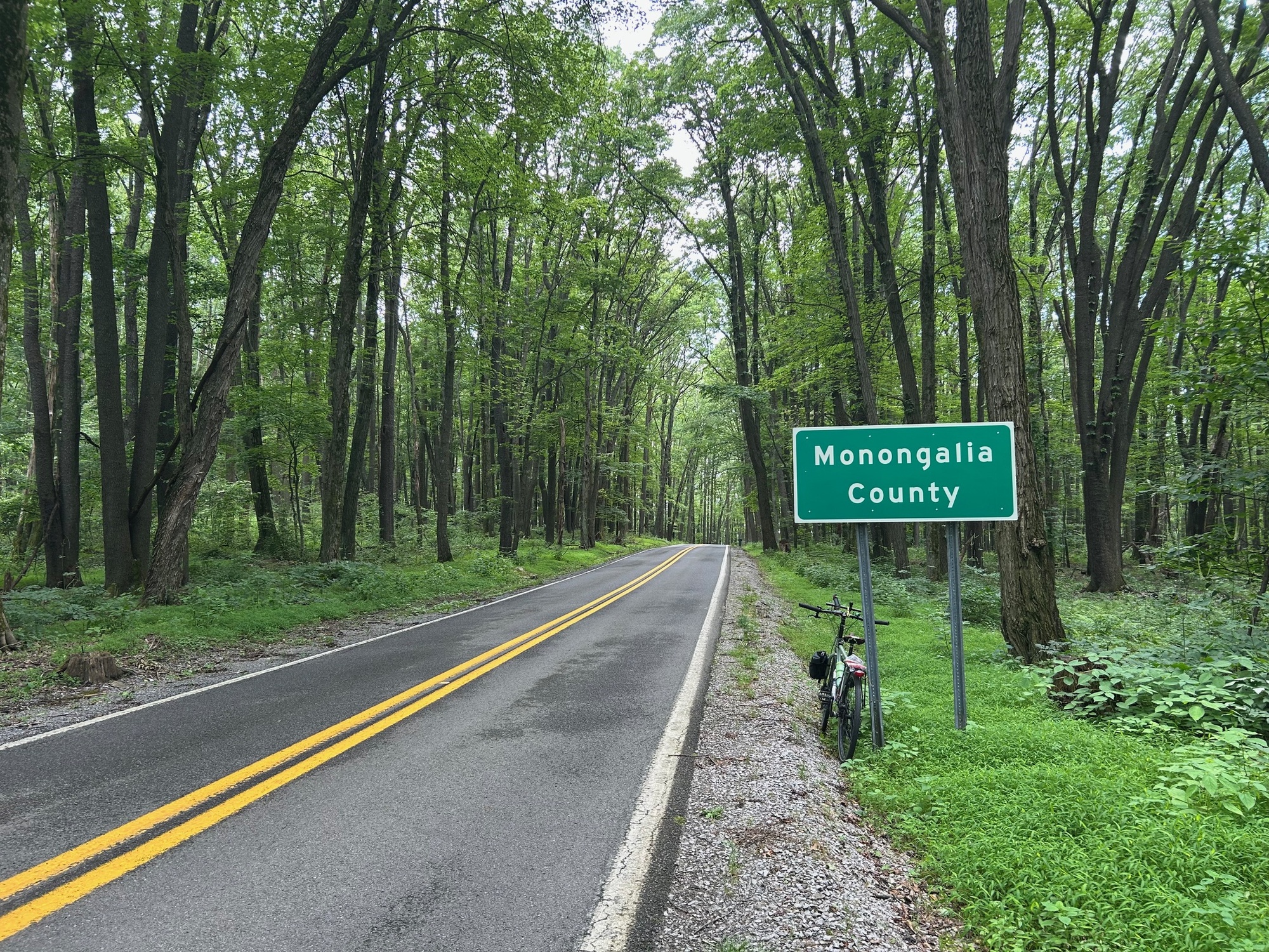
Cheat Lake, Chestnut Ridge, and Coopers Rock
Tough Riding But Worth It
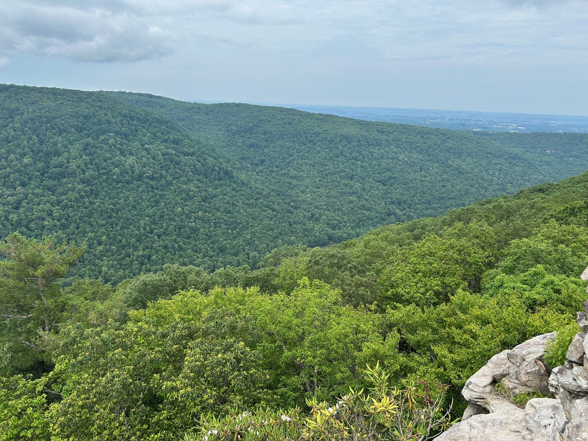
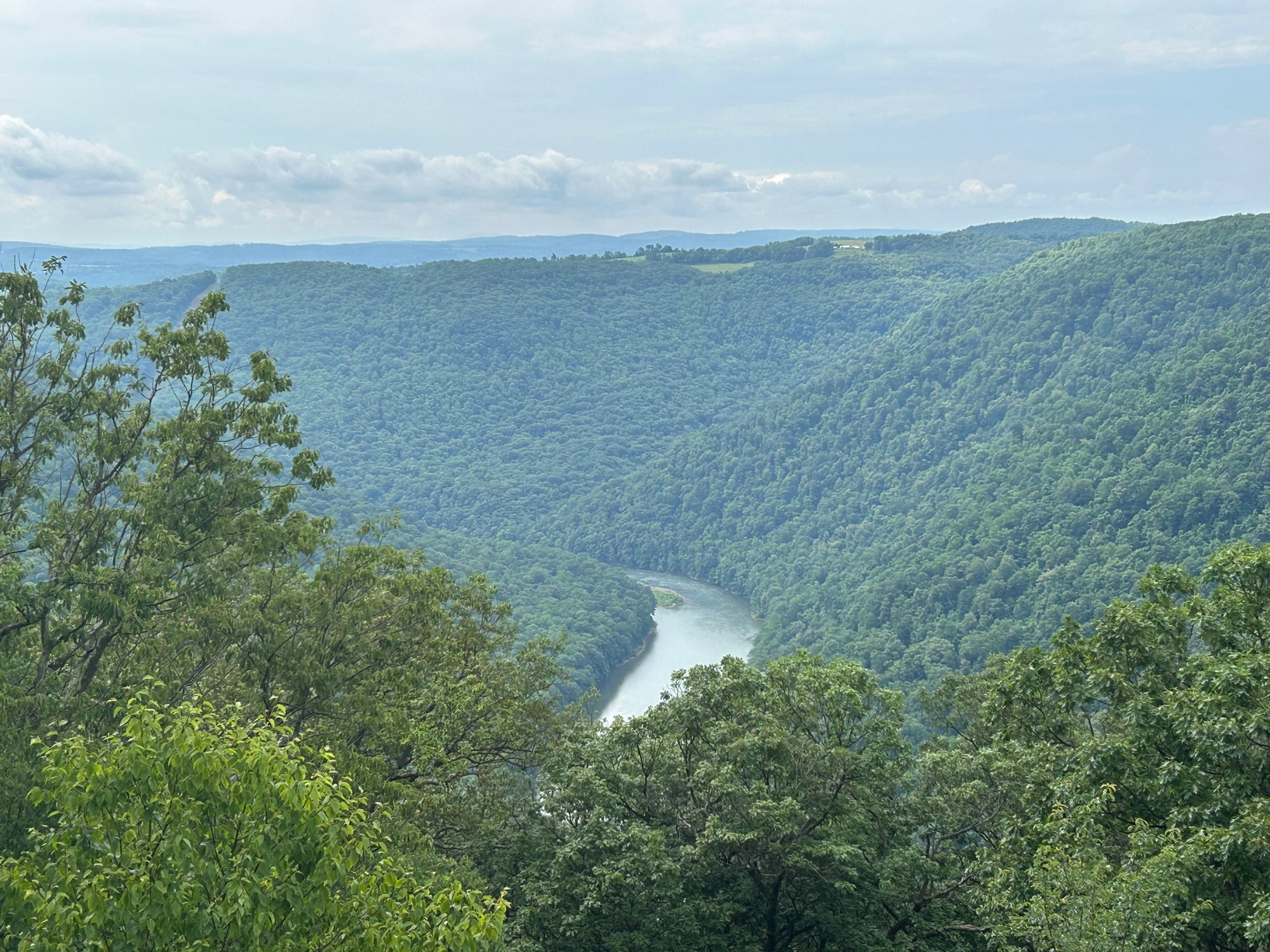
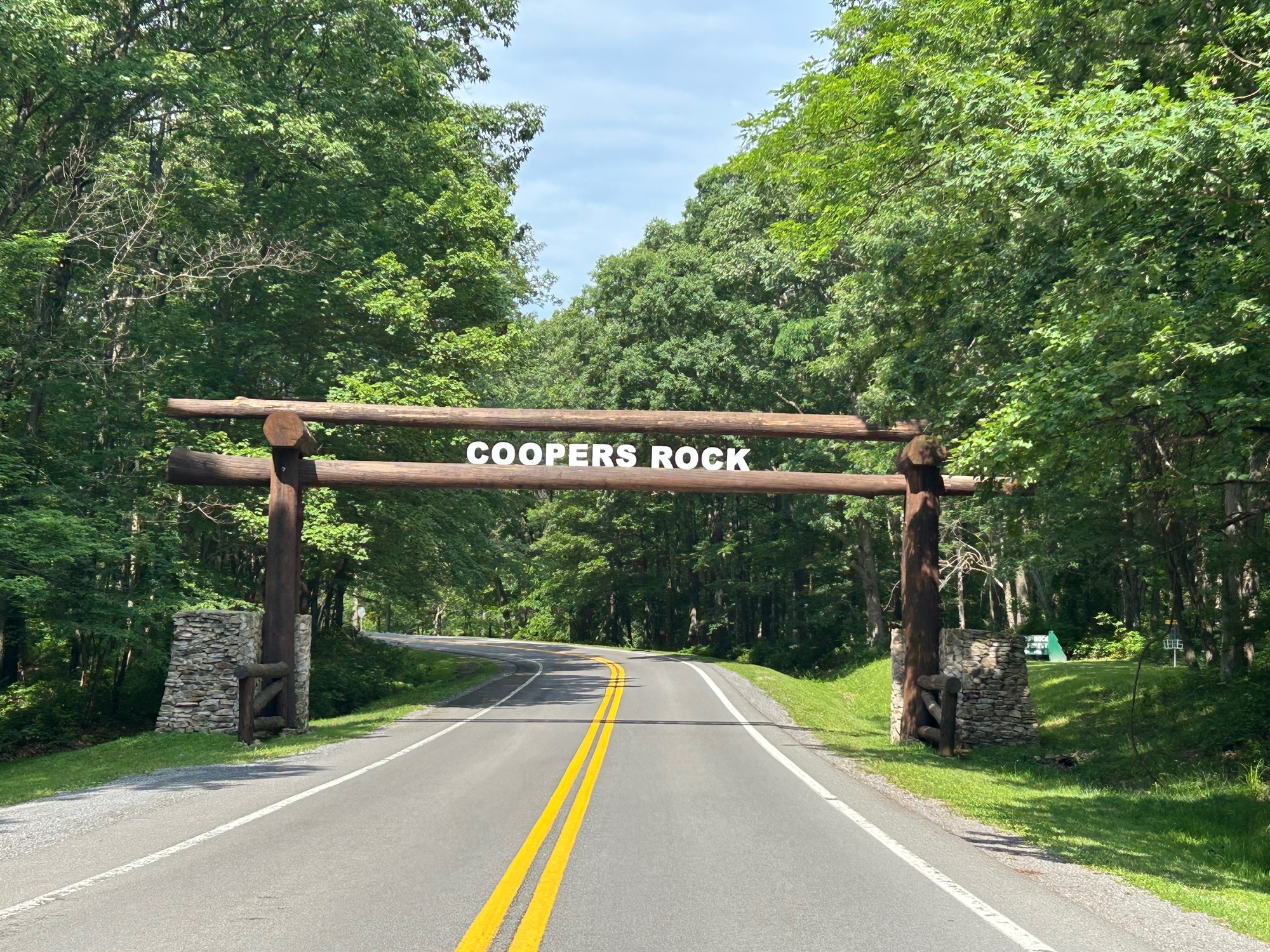
If you could only see one thing in the Mountain State, a strong case could be made for a trip to Coopers Rock. The view of the mountains and the Cheat River Valley below is quintessential West Virginia and one that I never get tired of seeing. Recently, I took a couple of friends there who had never been before. These were two pretty sophisticated individuals who "have been around the block a few times" in their lives. They were taken by the beauty of the spot and loved it.

| Heart | 0 | Comment | 0 | Link |
Statistics and Rationale:
Due to heavy rains in the area resulting in road closures and detours, along with the usual tough climbing, my time was compromised. Therefore, this difficult ride was broken up into three (3) parts.
5/31/25-Point Marion (PA) to the Summit of Chestnut Ridge (Preston County, WV) - 41 miles;
6/2/25-Morgantown, WV to Point Marion, PA via the Caperton, and Sheepskin Trails - 24 miles;
6/27/25-Coopers Rock, Sand Springs, and Bruceton Mills, WV - 28 miles.
Descriptions of the Rides:
5/31/25 - As the month of May drew to a close, the area was hit with wind, cool weather, and multiple heavy rainstorms. My plan was to start in Point Marion (PM), ride to Morgantown on the trails system, and ride back to PM. Then I would head over to the Cheat Lake Trail, continue on to the summit of Chestnut Ridge, over to Coopers Rock, and then head back to PM once more. It would have been an ambitious ride under normal circumstances but with downed trees, closed roads, and flooded roadways it became an impossible quest to finish in daylight.

| Heart | 0 | Comment | 0 | Link |
No sooner had I crossed the line into the Mountain State and had passed the locks and dam complex, two large downed trees completely blocked the trail. After scoping out the situation, it was determined that getting to Morgantown on the trail today was not going to be possible, for me. A group of cyclists that I saw earlier may have made it through but climbing with my bicycle through brush and Poison Ivy were not on my to do list for today.

| Heart | 0 | Comment | 0 | Link |
After deliberating a bit, I decided not to climb through the branches of two downed trees (another one was right behind the one you can see in the photo above) with my bike. Rather, I headed back to PM to continue the ride from there.
The Sheepskin Trail is interrupted briefly when leaving town but then resumes its course along Nilan Road (NR) and heads toward West Virginia. This newer section of trail continued to a point past Nilan Hill Road where one must leave the trail again.
Shortly thereafter, NR made a bend to the right and down a slope. Normally, I would have been able to go that way but a road closure sign indicated otherwise. I went down anyway to see what was going on and encountered a roadway flooded out with fast moving water. This situation required me to turn around and ascend Nilan Hill Road (NHR).

| Heart | 0 | Comment | 0 | Link |
Nilan Hill Road (NHR) was long, steep, and required significant distance for me to get back on course. The total detour involved climbing NHR, using US-119 for about a mile, and then turning onto Lake Lynn Road (LLR) to get back to the point where NR would have led without so much climbing and distance required by the detour.

| Heart | 1 | Comment | 0 | Link |
Lake Lynn Road (LLR) eventually became a long downhill, which was nice until I realized it would have to be climbed on the way back. Perhaps NR would be opened back up by then, I told myself with a bit of wishful optimism.
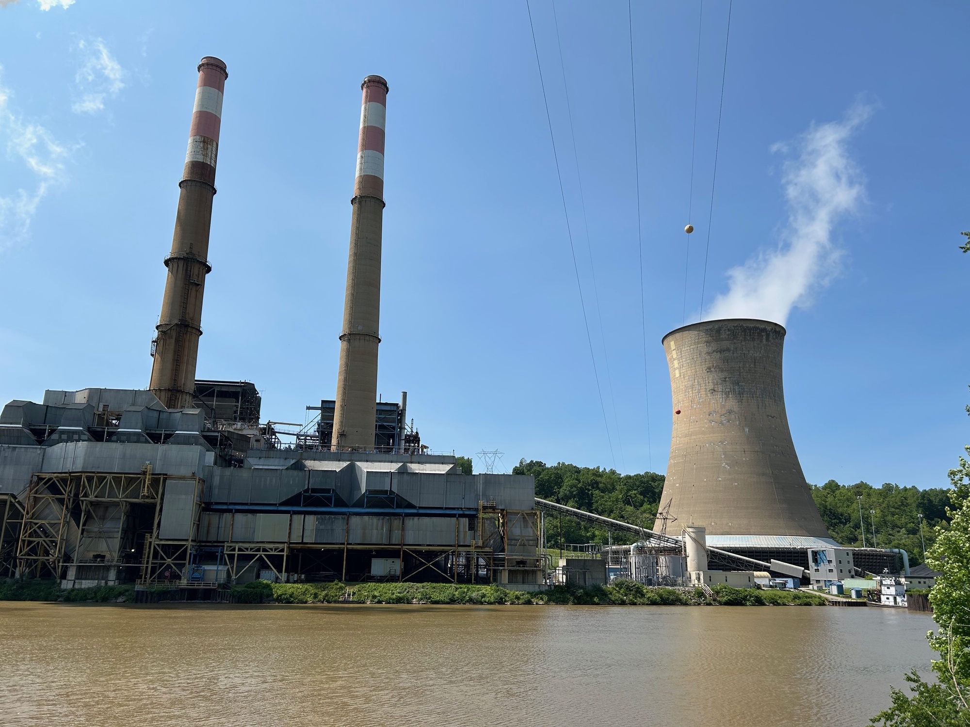
LLR continued to a point where one comes face-to-face with the front side of a huge hydroelectric dam. I've been to the Lake Lynn Dam before when it was dry but today, water was pouring over the top with such force as to be loud and to create a mist as it hit the river below. It was awesome to have such a close view without anyone else being around.

| Heart | 0 | Comment | 0 | Link |
A steep climb awaits a cyclist who rides past the dam and into the Mountain State. At the top is a rough parking lot that doubles as the trailhead for the Cheat Lake Trail. Cheat Lake is formed by the pool created from the dam that holds back Cheat River waters. The lake is a popular destination for boaters, fishermen, and vacationers with resort homes lying along its shores. The trail runs for several miles along the eastern shoreline. However, to reach it from the trailhead, one must shoulder the bike and descend 88 steep concrete steps. Since the dam complex is off limits to outsiders, one must climb the hill and descend the steps instead of being able to pass through and stay roughly at the same elevation.
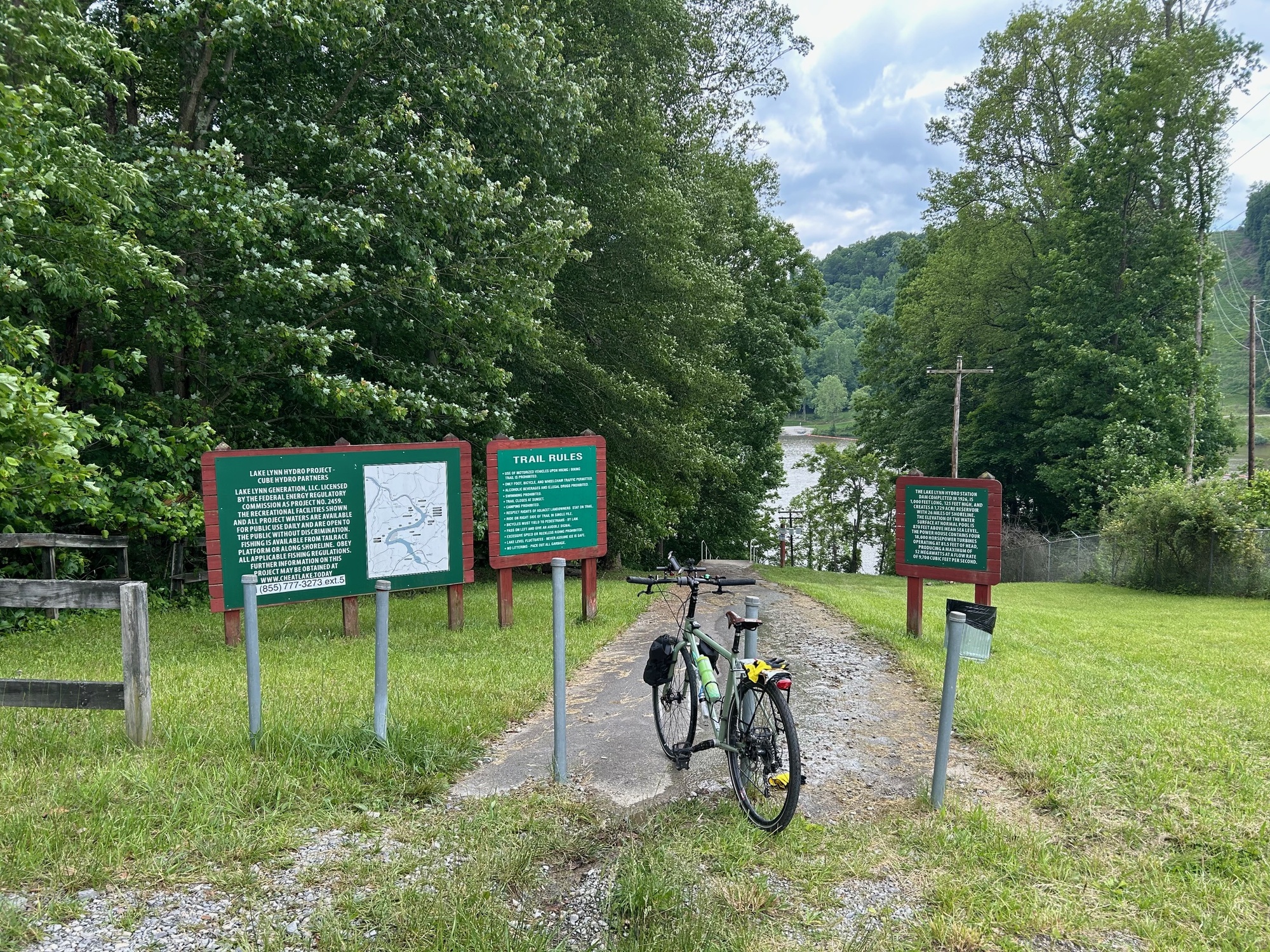

| Heart | 0 | Comment | 0 | Link |
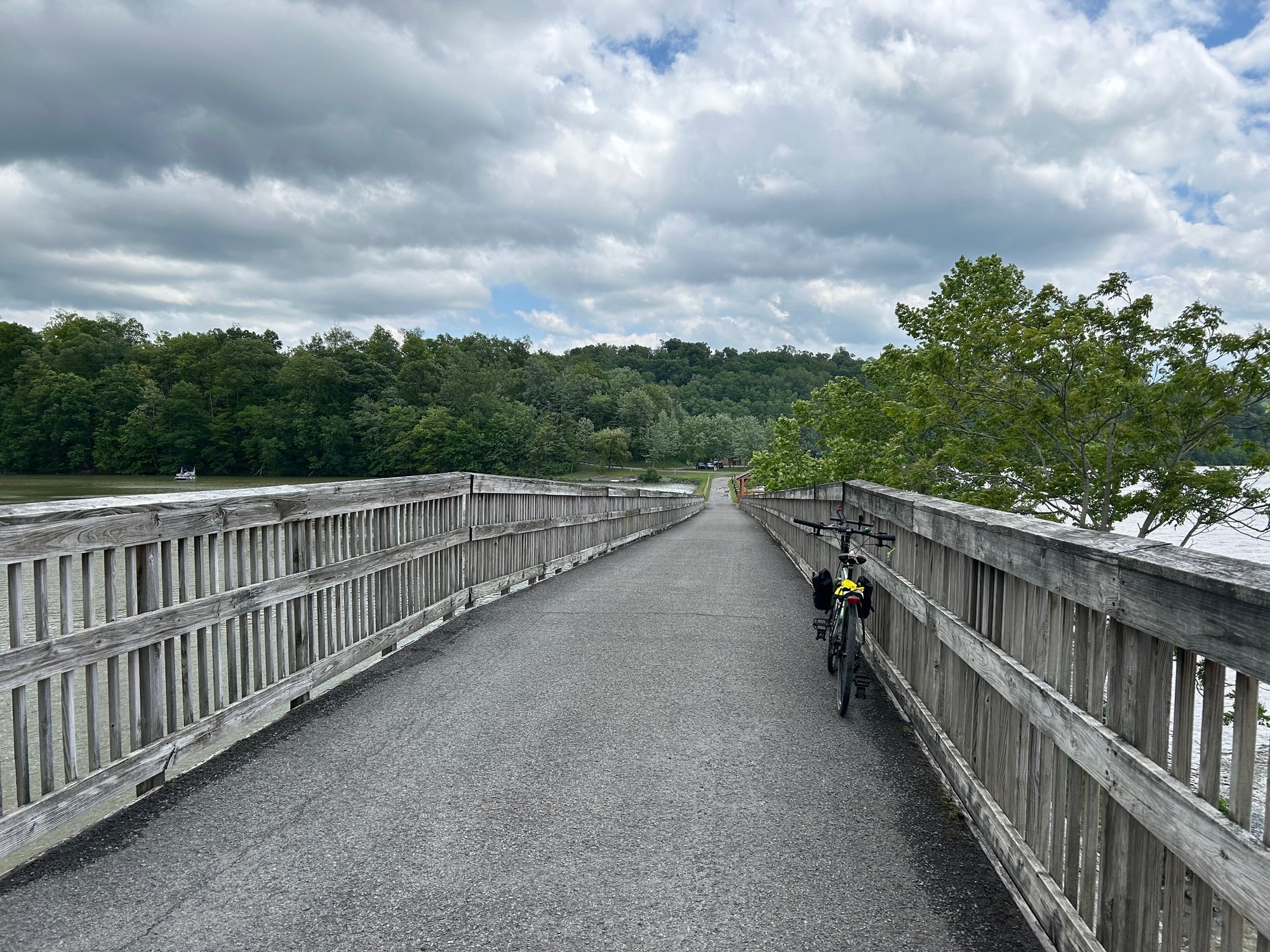
Once down to the trail, the gravel surface remains level and offers beautiful views of the lake and surroundings. On this day, the trail was wet in spots with significant puddles and mud in some places. Since it was windy and cool at times, the trail was not crowded and very few people were out on the water. Usually, at this time of year, it is warmer and the area can be crowded. My trail ride continued to the picnic area at Morgans Run Road (MRR), where I got back on the roads.
Morgans Run Road (MRR) climbs steeply to Fairchance Road (WV-857), where a right turn was made to continue this quest. WV-857 has a bit more traffic than some of the other roads but I did not feel endangered at any time during the ride.
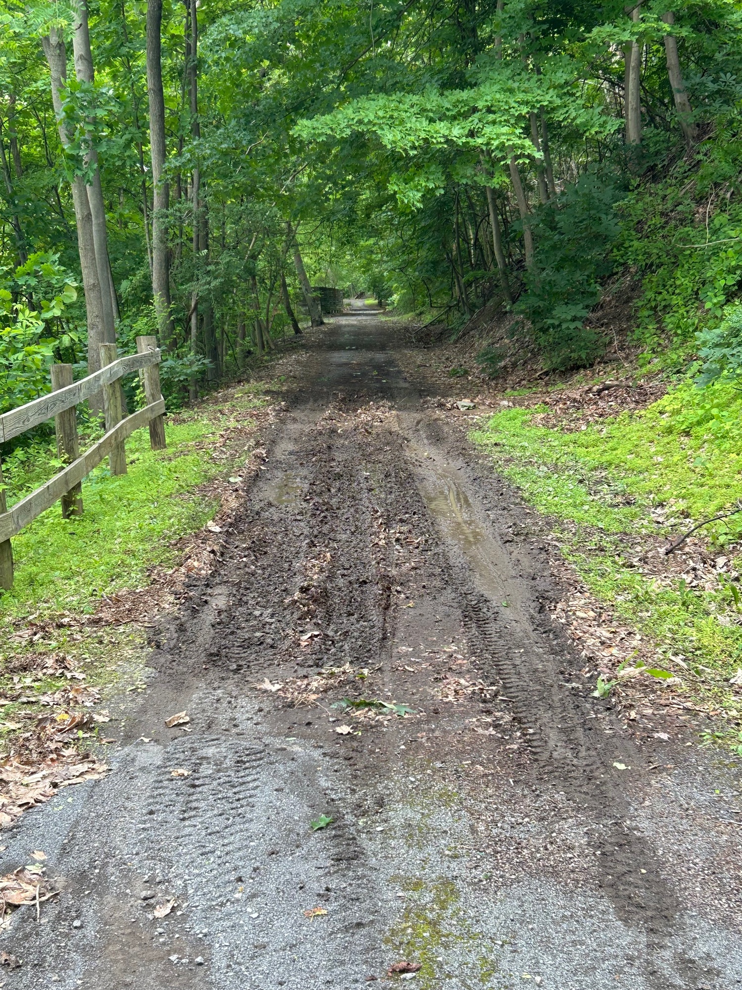
A left turn onto Quarry Run Road (QRR) was the beginning of a steep and nearly 2-mile climb that did not relent. About a half mile from the summit, the surface turned to gravel. On top was a "homestead" of sorts that seemed to span both sides of the road. Its threatening signs of warning to would be trespassers should be heeded. I would imagine that a person could disappear up there without too much trouble. I kept on moving to the downhill portion of QRR, which led eventually to Old Route 73. Portions of the loose surfaced descent on QRR were so steep I got off and walked a bit to avoid an unplanned spill.

| Heart | 0 | Comment | 0 | Link |
At the bottom, the final portion of the climb of Chestnut Ridge, via Old Route 73, began. This was a 2-stage climb of 3 miles in length. The first and longer stage ended at the I-68 interchange for the Coopers Rock exit. The second, steeper, but shorter stage brought me to the summit of Chestnut Ridge, which is reached shortly after the left turn leading to the Sand Springs Campground (SSC). Because the road to SSC appears to climb even higher than the road summit, be forewarned if you plan to camp there. If you're not completely "out of gas" and/or funds, after reaching the summit, it might be better to ride the long descent east from the summit to the small town of Bruceton Mills and stay at the little motel (The Maple Leaf) in town.
Side Note-On a return ride in the area, the climb up to the summit and onto Sand Springs Road was not as difficult as it seemed on 5/31/25. This was because I had not ridden all the way there from Point Marion, which required several long and difficult climbs.

| Heart | 0 | Comment | 0 | Link |
At this point, I was flirting with the approaching sunset so I decided to re-trace my route back to Point Marion. I hoped to be able to call it a day before having to ride in darkness. As it turned out, the tougher part of the ride was the out-portion, which I had already done. The back-portion of the ride had more descending of hills, making my return much quicker and less difficult. The out-portion involved significantly more climbing than I had realized.
The Lake Lynn Road climb, on the return to Point Marion, was tough but knowing that I was close to the finish gave me the motivation to tackle it without much difficulty. There were some beautiful vistas to distract from the climbing.

| Heart | 0 | Comment | 0 | Link |
Instead of taking Nilan Hill Road, I stayed on US-119 and enjoyed a long descent into Point Marion. Back in town, the Brass Rail looked pretty crowded on this Saturday evening. Since it is a smoking establishment, and since they smoke heavily in these parts, I decided to avoid inhaling all of the second hand smoke and keep my recently expanded lungs clear of all but the fresh mountain air they had been enjoying all day. That kind of scene reminds me of a line from one of my favorite movies, "My Cousin Vinnie." Vincent Gambini (played by Joe Pesci) walks into a very smoky bar and says, "Are these people aware of the ongoing cancer problem in this country?" Cracks me up every time I hear it and/or whenever I encounter a smoky situation. Unless you smoke, the Brass Rail is better experienced earlier in the day.
Once back to my vehicle and with the bike loaded up, I headed out of town. A good meal would have to wait until i got to a place where the air was cleaner. The rest of this ride would have to wait for another day.
6/2/25 - After the long and tough ride on May 31st, I took June 1st off before continuing my quest to complete the route I had laid out. This portion of the ride began on the Caperton Trail at Milepost 10 near Hazel Ruby McQuain Park (HRM, the person and HRMP, aka the Ruby Park) in downtown Morgantown, West Virginia.

| Heart | 0 | Comment | 0 | Link |
HRM was a businesswoman and philanthropist in Morgantown. She and her first husband, J.W. Ruby amassed quite a fortune. After he passed away, she took control of the business and prospered. Later, she remarried to J. B. McQuain. Unlike myself, she was good at marrying partners with a few dollars to their names. Ruby was also an excellent businesswoman in her own right.
HRM is credited with making generous donations to establish Ruby Memorial Hospital in Morgantown. The park, consisting of green space and a large amphitheater overlooking the Monongahela River, is named for her. The trail (also described in Chapters 10 and 21 of this journal) runs through the park and beyond.

| Heart | 0 | Comment | 0 | Link |
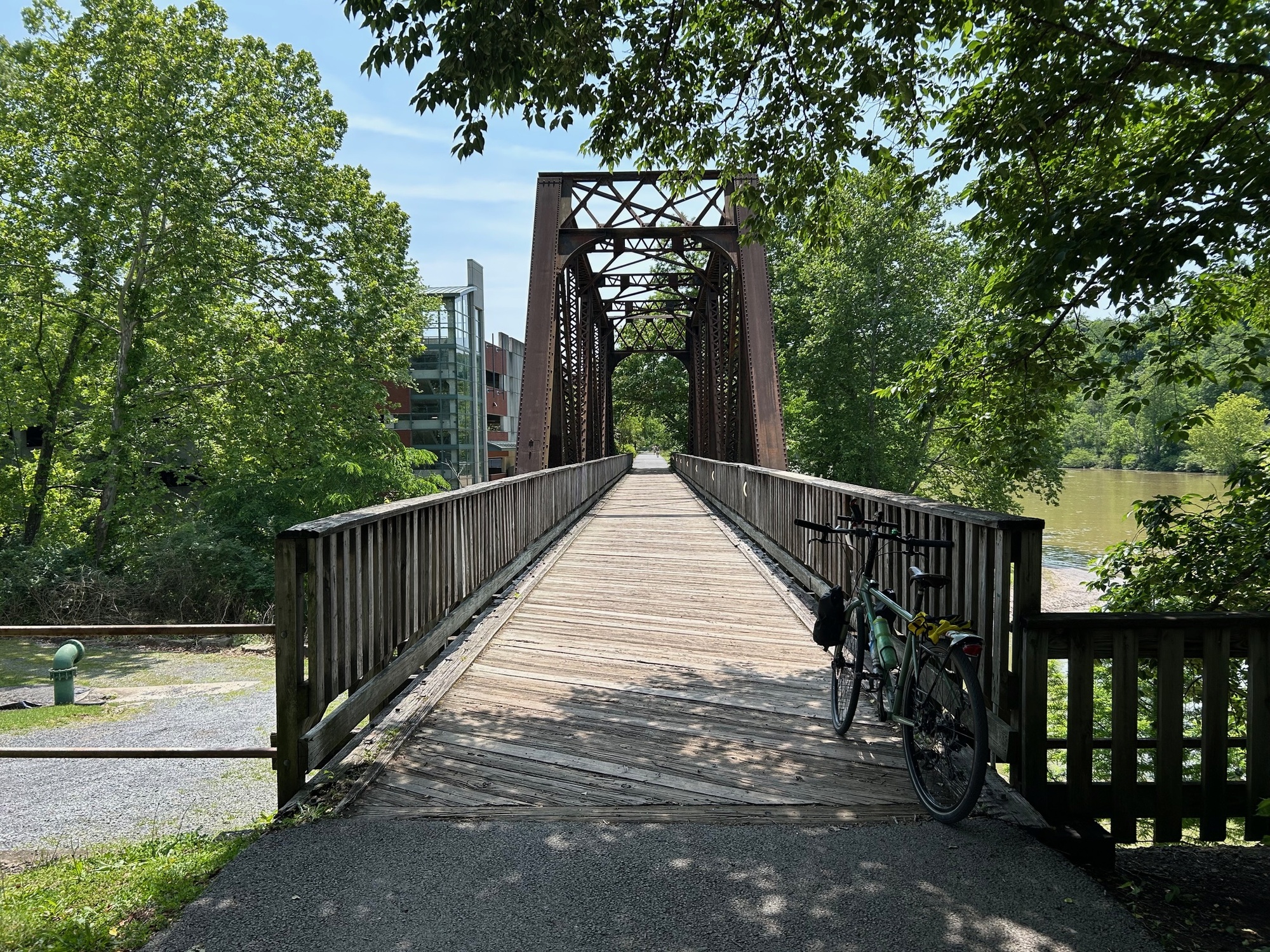
The Caperton Trail runs Northward for approximately 10 miles, until it reaches the state line. Once there, it is called the Monongahela River Trail and then the Sheepskin Trail upon reaching the state line. Approximately 6 miles from the state line, the pavement ends and the trail surface becomes packed crushed limestone.
In Morgantown, the trail is mostly open with good views of the Monongahela River on one side and the city on the other. Upon leaving the city, the surroundings become decidedly more wooded, with a canopy of trees overhead. This helps keep things cool, especially during the warmer summer months.


| Heart | 1 | Comment | 0 | Link |

| Heart | 0 | Comment | 0 | Link |

| Heart | 0 | Comment | 0 | Link |

| Heart | 0 | Comment | 0 | Link |

| Heart | 0 | Comment | 0 | Link |
Upon riding to the end of the Sheepskin Trail in Point Marion, I turned around and re-traced the route back to my vehicle in Morgantown. The weather on this day was much warmer and more pleasant than it was on the windy, cold, wet, and rainy day I experienced two days ago. The terrain was much gentler, as well. This was a very pleasant ride that I recommend highly, if you happen to be in the area with your bicycle.
6/27/25-Due to various commitments and other factors beyond my control (like the 70th wedding anniversary celebration for my parents) it took some time for me to get back here and complete the 3rd leg of this ride. But today, the schedule opened up and I found myself back in West Virginia, with my bicycle and ready to ride.
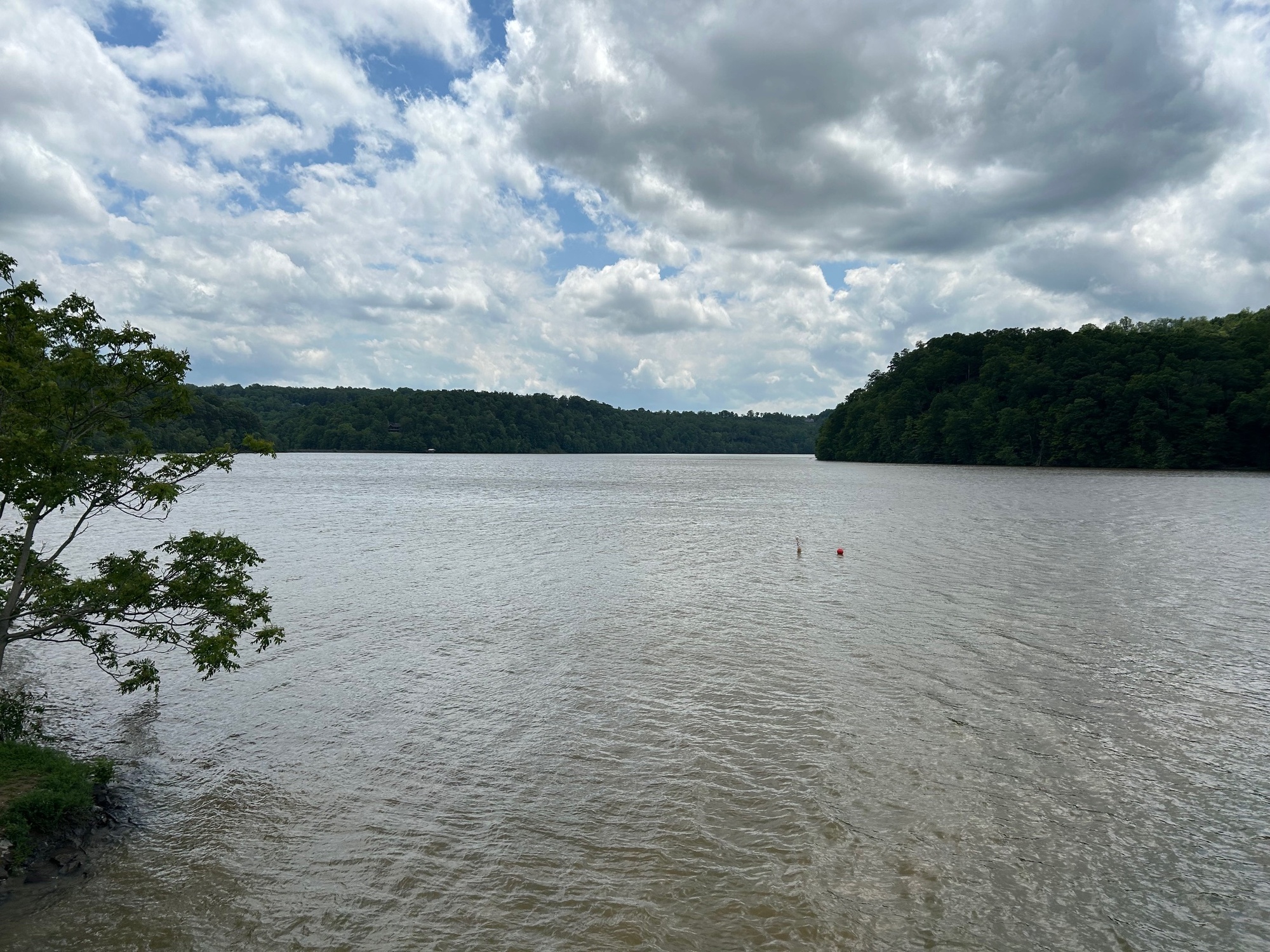
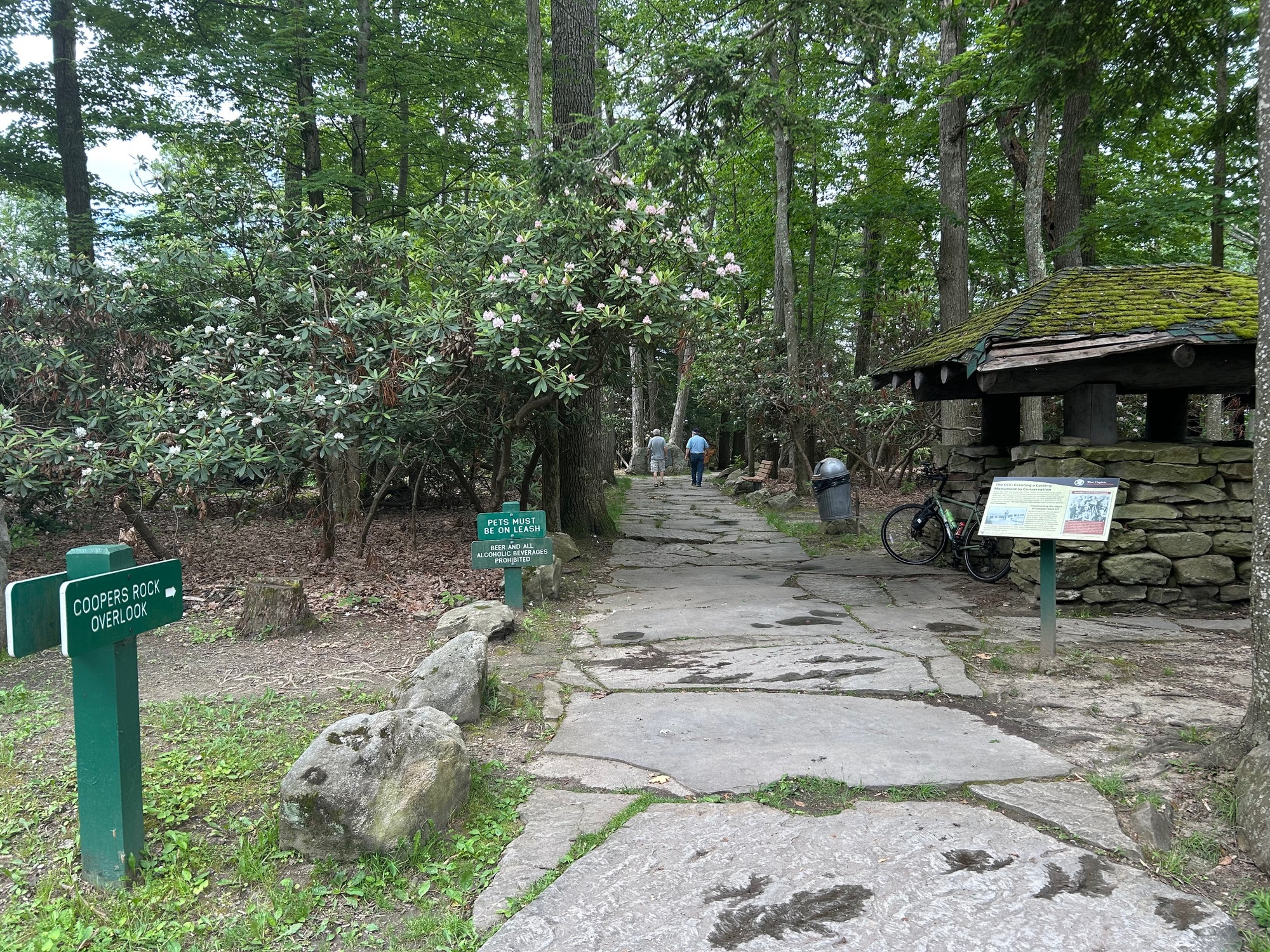
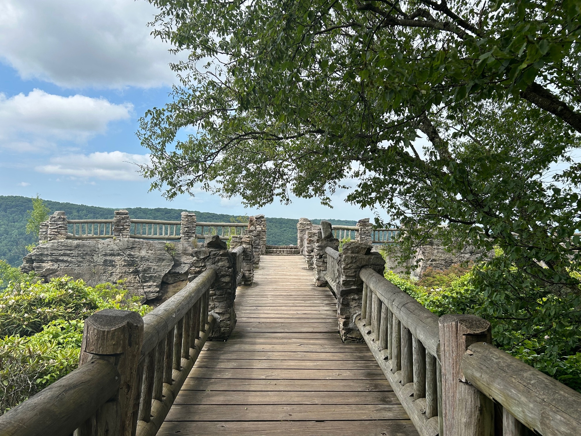
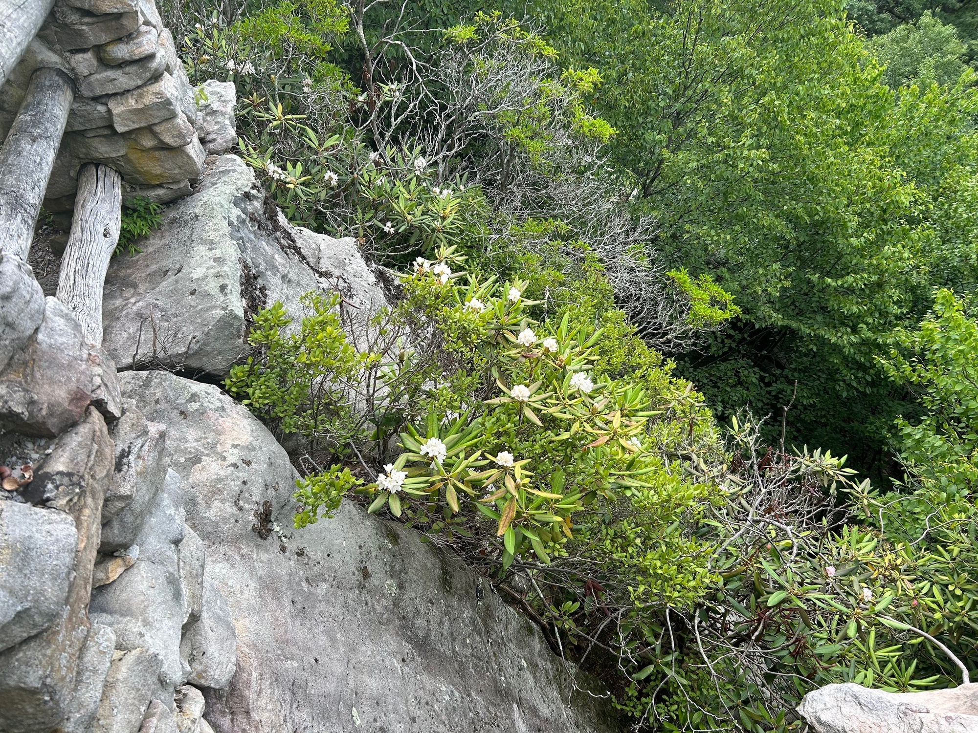
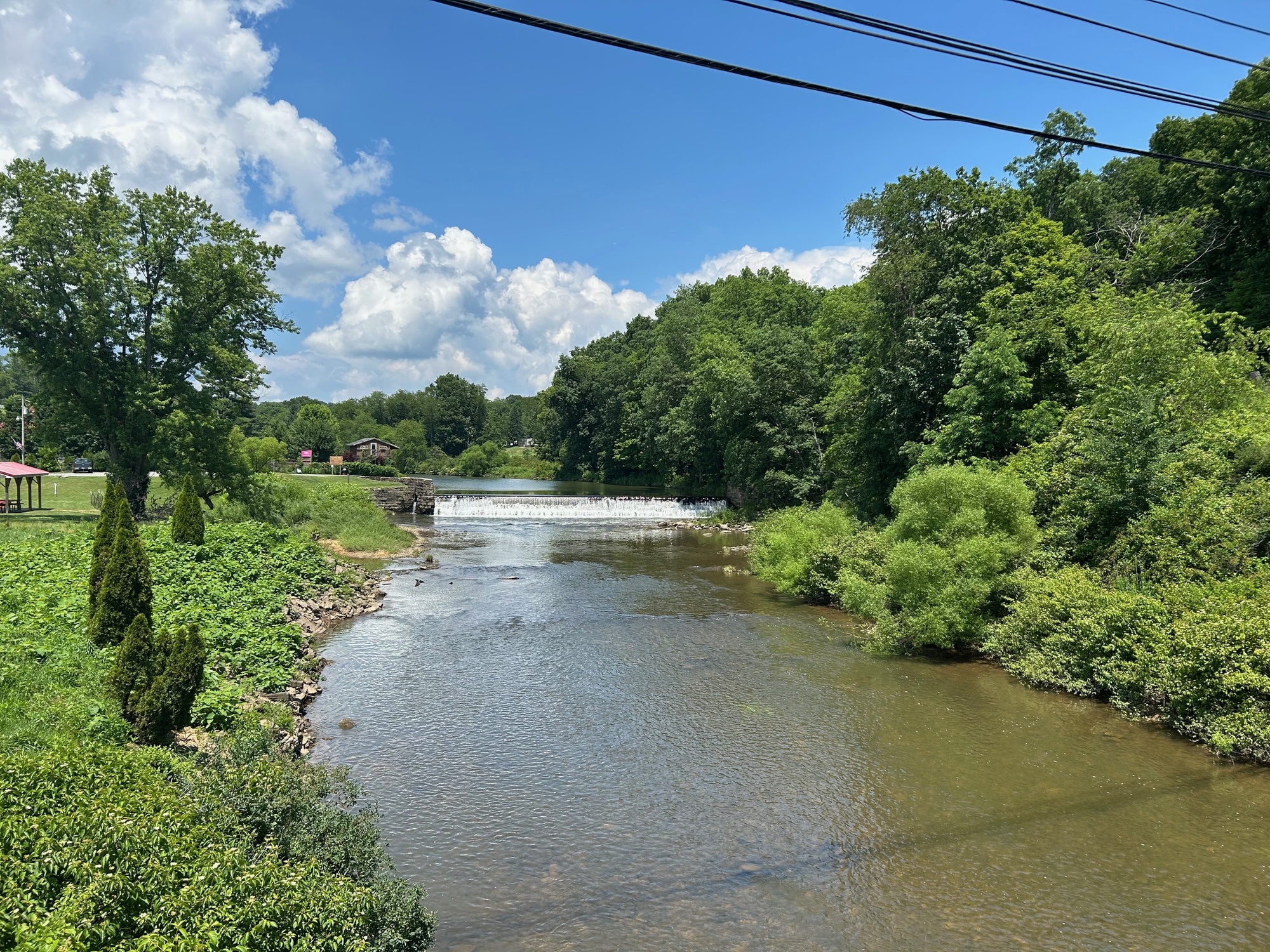
After a brief morning shower that cooled things off a bit, the sky brightened and the stage was set for a good ride. Starting from the lot at the overlook and trading post, the first order of business was to get a view from the rock itself. The view of the Cheat River Gorge and the ridges that flank it is absolutely spectacular.

| Heart | 0 | Comment | 0 | Link |
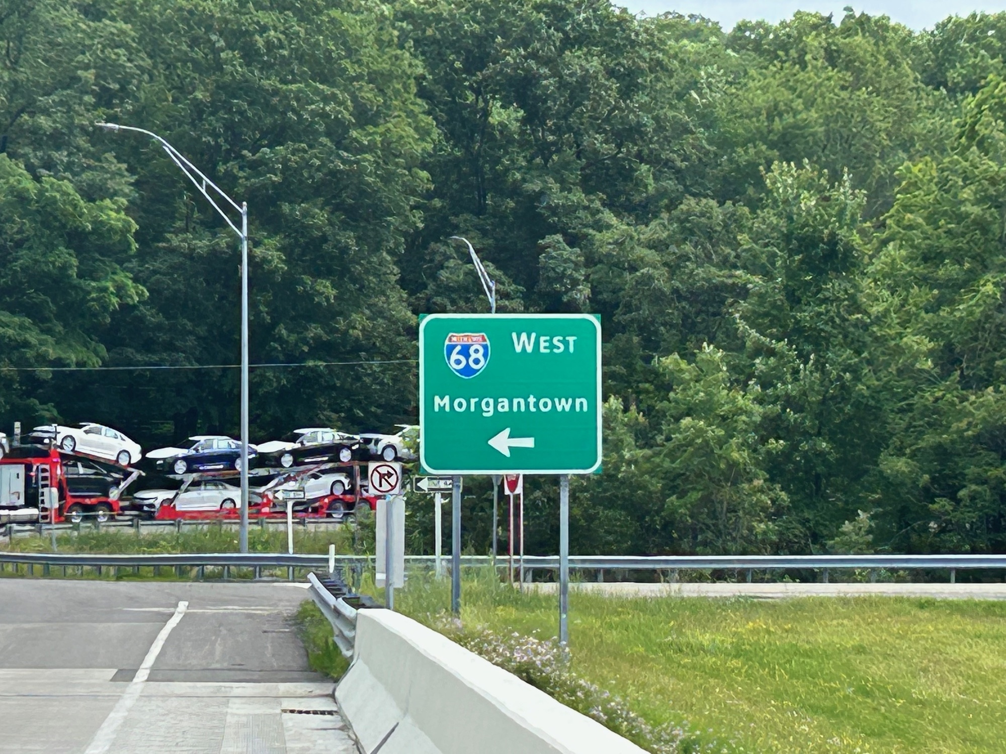
From Coopers Rock, it is a little over 3 miles to the intersection with I-68 and Old Route 73, where I left off on my May 31st "adventure... or mis-adventure, as the case may be." The climb to the road summit of Chestnut Ridge did not seem as difficult today as it did back on the 31st. No doubt, after all of the climbing that I had to do to get there before, the little extra seemed much more of a chore than it did today when I was fresher. Once there, I made the turn onto Sand Springs Road. It too was nowhere near as tough as it seemed before. A few photos of this portion of the ride follow.

| Heart | 0 | Comment | 0 | Link |
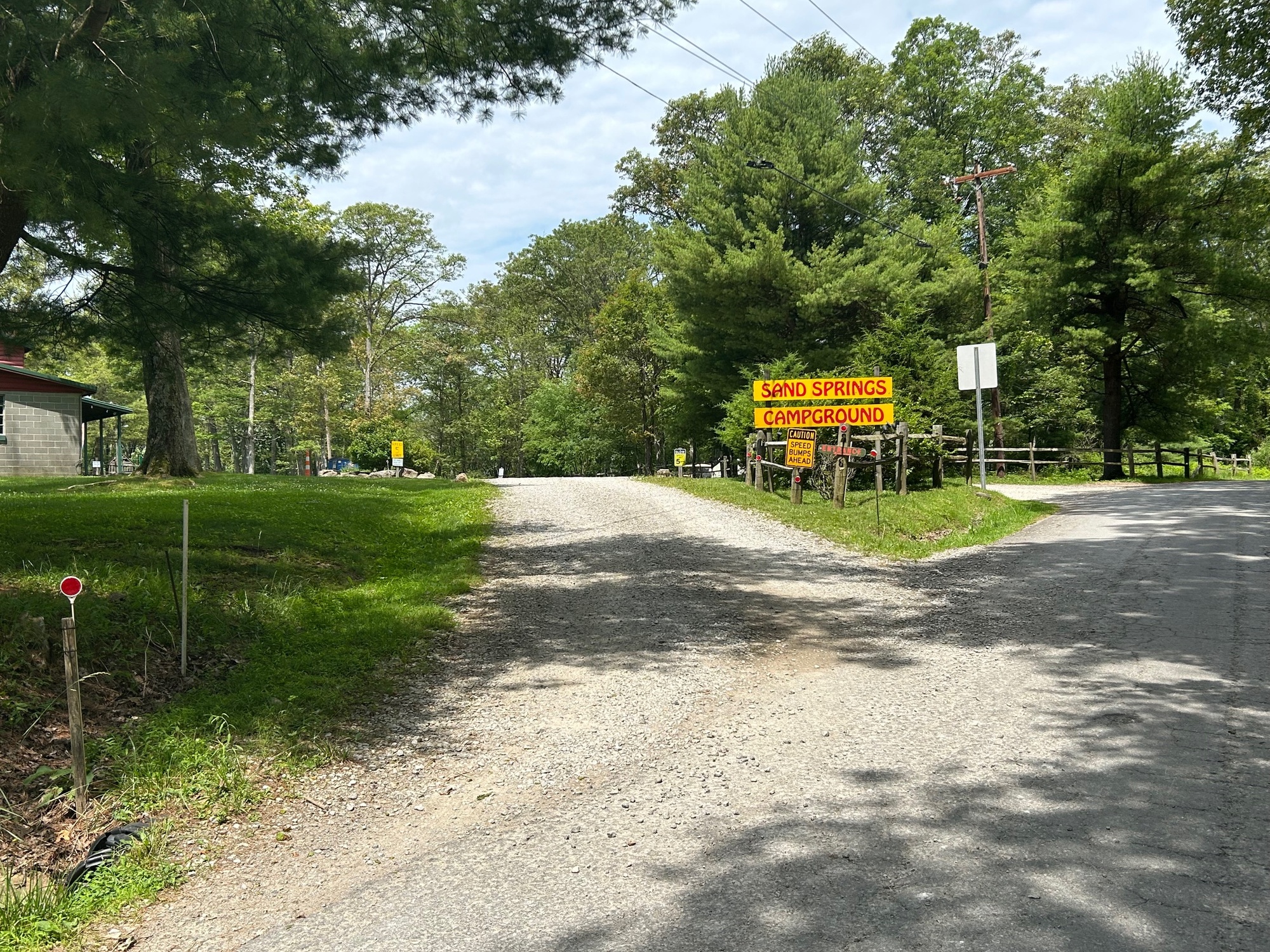
I turned onto Sand Springs Road (SSR) because I wanted to see the campground of the same name. Back in 1984, a school colleague and I camped there one September evening. We had the place to ourselves. On the following day, we did some climbing and rappelling at Coopers Rock. The memories of that evening and next day have stayed with me for all of these years. It was good to see the place again.
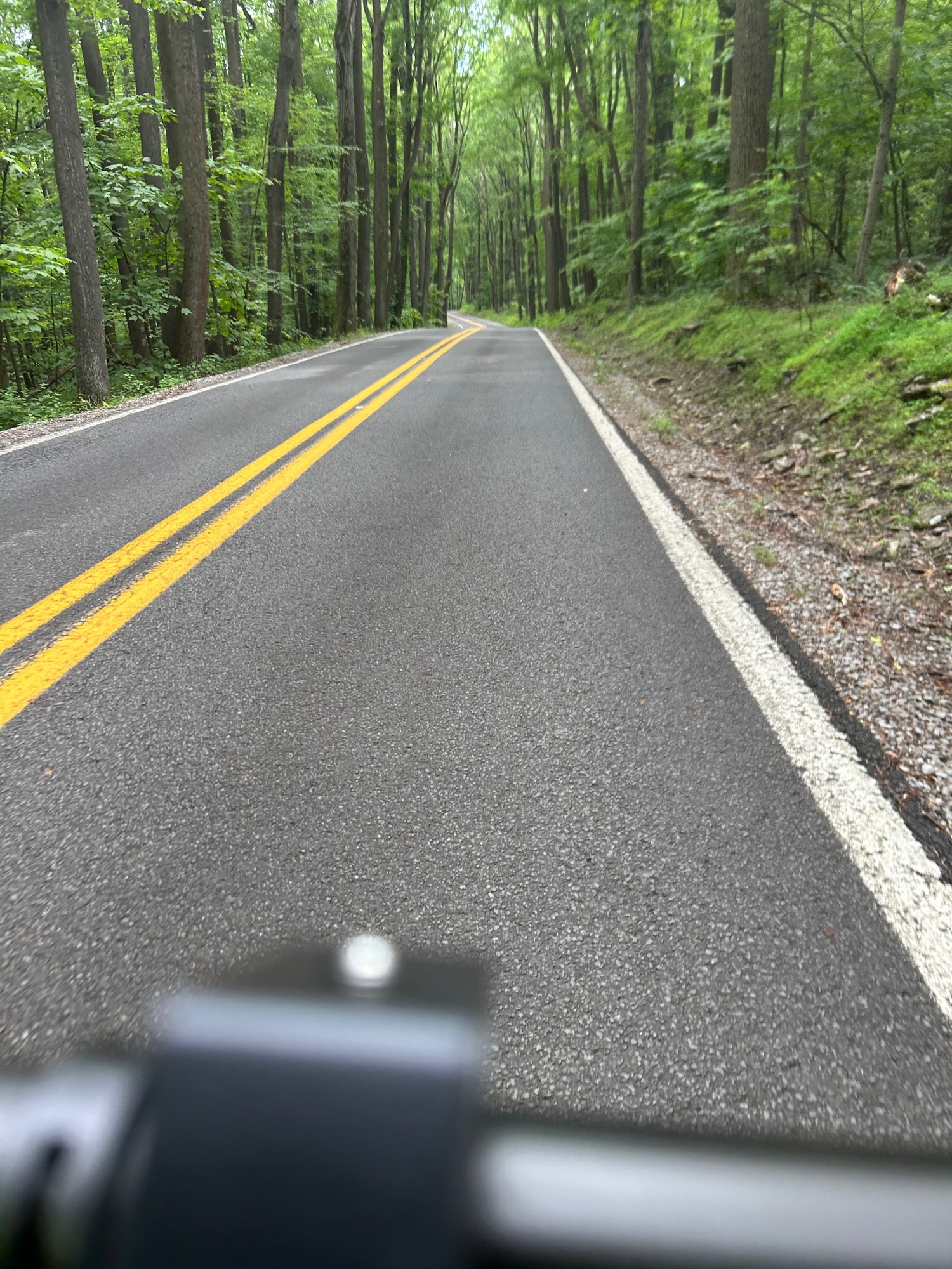
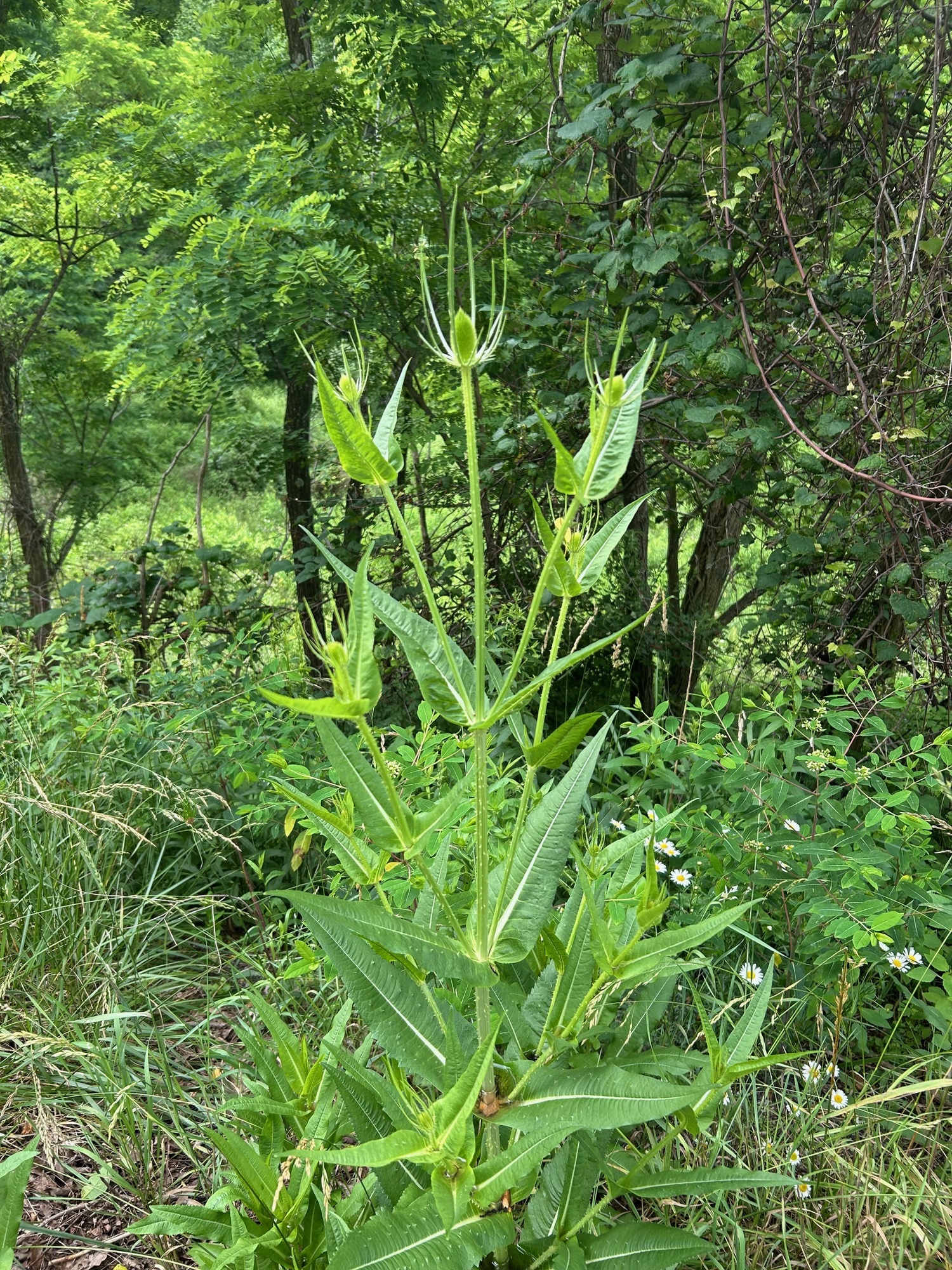
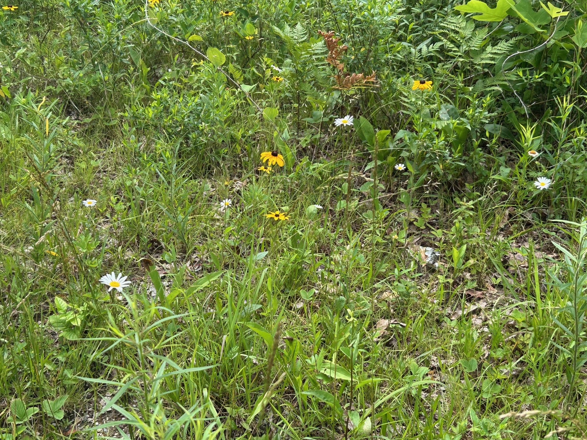
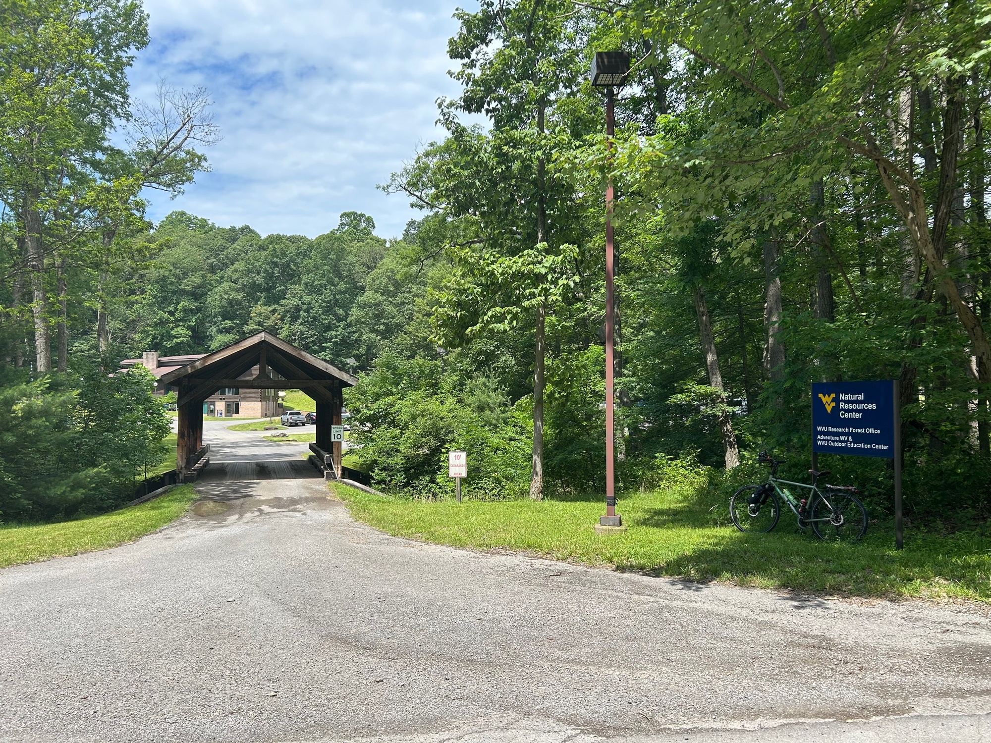
SSR rolls along, without very much traffic, past a research center for WVU and Chestnut Ridge Park before finally arriving to the campground. There, I went into the office/store, bought a cold drink, and took a short break before moving on. This whole portion of the ride was scenic and peaceful. A few photos of this segment of the ride follow.

| Heart | 0 | Comment | 0 | Link |

| Heart | 0 | Comment | 0 | Link |

| Heart | 0 | Comment | 0 | Link |

| Heart | 0 | Comment | 0 | Link |

| Heart | 0 | Comment | 0 | Link |
After my break, my "steps" were re-traced back to Old Route 73 and the road summit of Chestnut Ridge. From this point, 2.5 miles of downhill ecstasy ensued.
Side Note-Despite my use of the word ecstasy, one should be careful when descending because portions of the road are rough. A spill, caused by a bump or a pothole, could result in a bad case of road rash... among various other possibilities, none of which are desirable. Fortunately, yours truly didn't have any such experiences.
The 8 miles on Old Route 73 to Bruceton Mills are mostly downhill. However, there a few rolling bumps in the road, with which to contend. A lot of the landscape is forested but there are also some farmlands, especially when approaching town. This was a pleasant ride with very light traffic. When I got to town, my stomach was letting me know it was empty, so the Little Sandy Truck Stop became part of the itinerary for the day. Some photos of this portion of the ride follow.

| Heart | 0 | Comment | 0 | Link |

| Heart | 0 | Comment | 0 | Link |

| Heart | 0 | Comment | 0 | Link |
After some good nourishment at the truck stop, I had to face the return trip to Coopers Rock and my car. This meant climbing back up the 8-mile descent from which I had recently come. The ambient air temperature seemed a lot warmer than it had been when I stepped inside the air-conditioned diner.
Oh well, what comes down must go back up. In retrospect it wasn't really all that bad. I had figured on 90 minutes of riding to get back to the summit but it only took a few minutes more than an hour. It was warm but there were significant shady areas which really helped to keep the temperature comfortable. Traffic was light too. When I reached the summit, I felt pretty good. My shirt was wet with sweat but I felt fresh and like I still had a good bit of reserve in the "tank." A few photos of this portion of the ride follow.

| Heart | 0 | Comment | 0 | Link |

| Heart | 0 | Comment | 0 | Link |
From the summit, there was a nice downhill ride to a stop sign. I recommend stopping because there is an access road for trucks that have pulled off of I-68 to take a break. If one of those big boys is coming through that intersection when you and your bike get there, it won't be pretty. I stopped and the trucker made a point of waving to express gratitude. Perhaps some of my bicycling colleagues whiz right through.
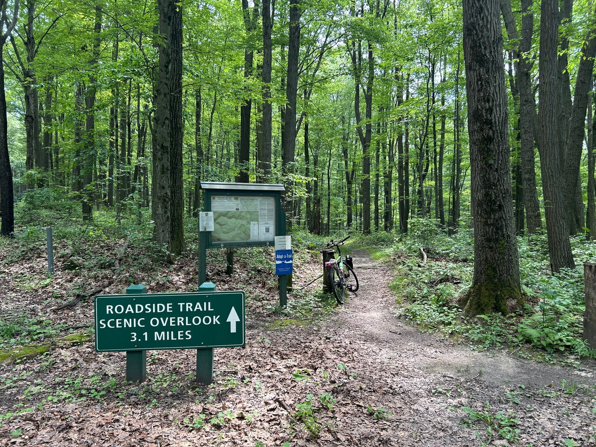
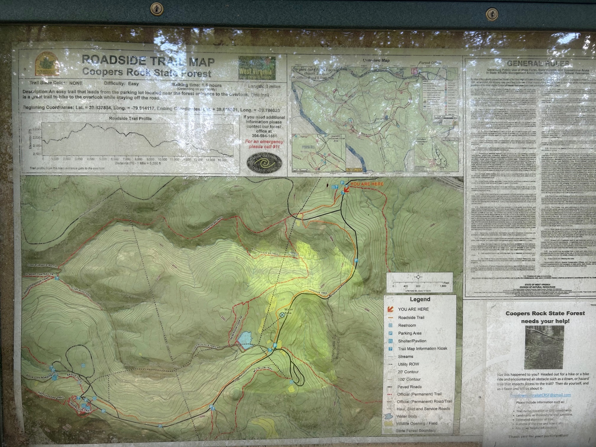
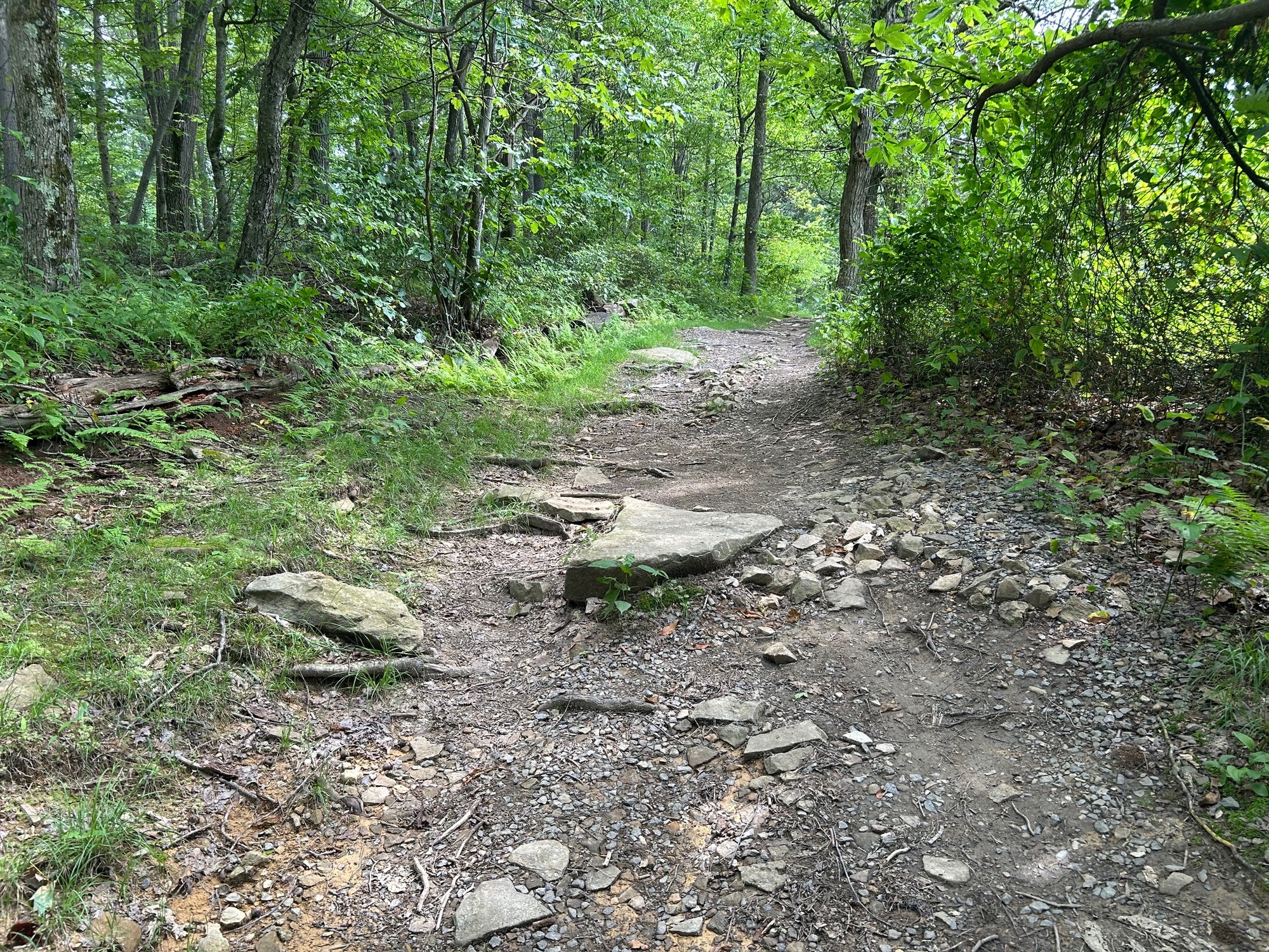
Shortly thereafter, there is a left turn that goes past the I-68 interchange and continues into Coopers Rock State Park. A roadside trail exists as an alternative to riding on the road. I tried a half mile of it but then got back onto CRR (Coopers Rock Road) because the trail was a bit rough for my touring bicycle. However, it was very pretty while I was on the trail.
I made it back to the parking lot without incident. There, I went into the trading post for a cold drink and to look around a bit. They have some nice souvenirs to commemorate one's visit to Coopers Rock, if so inclined. In all, this was a challenging ride but the hardships were offset by tremendous vistas, beautiful landscapes, and a good meal in Bruceton Mills. A final few photos follow.
Today's ride: 93 miles (150 km)
Total: 1,143 miles (1,839 km)
| Rate this entry's writing | Heart | 0 |
| Comment on this entry | Comment | 0 |