Drive Home
I had breakfast at the Quality Inn in Twin Falls, then pedaled 0.7 mile on a busy highway to the Enterprise Rent a Car office. I arrived just as they opened, but it took a few minutes to be waited on, a few minutes to sign forms and get possession the car, and a few minutes to load the bike.
I drove a Mazda CX-5 one way from Twin Falls, Idaho to Roseburg, Oregon. The bike was a tight fit inside. The passenger seat couldn't fold down flat, so chainrings, a crank and pedal protruded between the two front seats.
Driving time is about 1.5 days, but before the tour I planned 3 tourist stops near Twin Falls to make it a 2-day return trip. All places I had never visited.
1. A soak at Miracle Hot Springs, a commercial soak north of Buhl, Idaho.
2. A 2.5 mile canyon/waterfall hike at Box Canyon Spring Preserve southwest of Wendell, Idaho.
3. A short hike on the rim at Malad Gorge northwest of Tuttle, Idaho.
The first stop was at Miracle Hot Springs, a 30 minute drive west of Twin Falls. I drove through the town of Buhl on the way to the hot spring 4 miles north of town in a canyon that has no wireless service. I paid for a day soak and stayed for about a hour. They gave me the senior rate, over 60 for them. Most of the customers were seniors like me.
The hot spring has four pools with different temperatures. The hottest pool is 106F, under the elevated deck in the photo below. The soaking pools in the foreground are about 102 and 100F. The swimming pool in the distance is 96F. The water is very alkaline slippery. Feels good on skin. Little or no sulfur smell. It's a good soak. Air temperature was 75F when I arrived, 80F and rising rapidly when I left. I came here first because it's not an appealing soak in hot weather. The hot spring also has many private drain and fill tubs behind the doors.

The source spring is 140F and is cooled by piping varying amounts of hot spring water through Salmon Falls Creek to achieve the desired temperature.

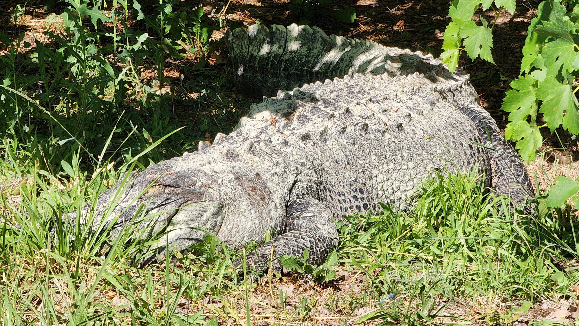
A previous owner of Miracle Hot Springs attempted to run an alligator farm. He didn't make a profit but the present owners still keep an alligator around. It's huge, probably very old, lives in a pen with a private hot spring pool.
| Heart | 1 | Comment | 3 | Link |
6 days ago
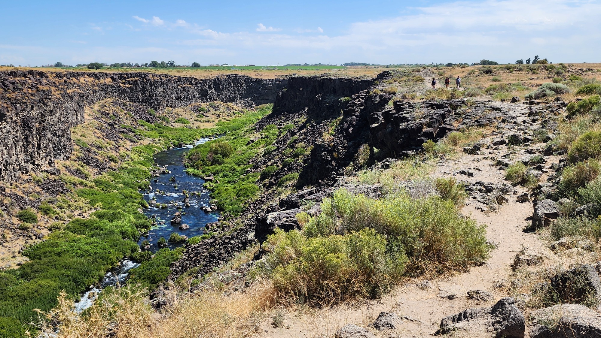
After soaking for about an hour I drove 30 minutes to the day's main attraction. Box Canyon Spring Preserve. I parked in the large parking lot and walked 2.5 miles round trip to the waterfall and back. It was hot but that didn't deter the many hikers on the trail.
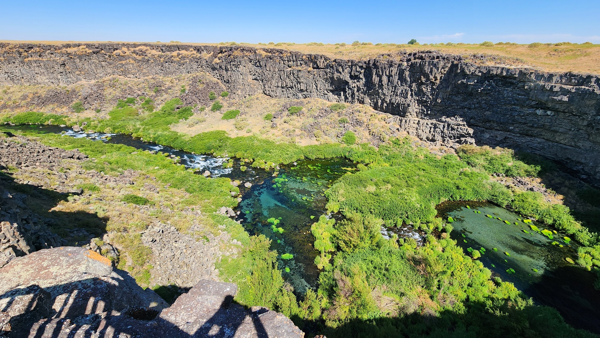
Box Canyon Spring is shown in the lower right corner of the photo below. A sign says it flows 180,000 gallons per minute. I converted that big number to a stream flow of 401 cubic feet per second. A small river flows below the spring in an otherwise arid canyon. Southern Idaho has many big springs emerging from fractured basalt canyons.
| Heart | 1 | Comment | 0 | Link |
The first time I saw a river appear out of nowhere was Big Spring in Missouri, during my 2014 Steel City to Cow Town bike tour. It's in the Ozarks region which is a karst landscape of porous soft yellow limestone. Very different from here where the water flows out of cracks in extremely hard gray basalt.
I've also seen spring fed Burney Falls in California which has a larger flow than Box Canyon Spring. But I think Box Canyon Spring has more WOW factor because it's in a desert environment. Big Spring and Burney Falls are in forested environments where water is less rare.
| Heart | 1 | Comment | 0 | Link |
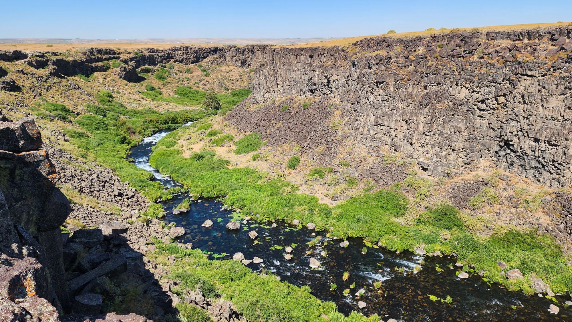
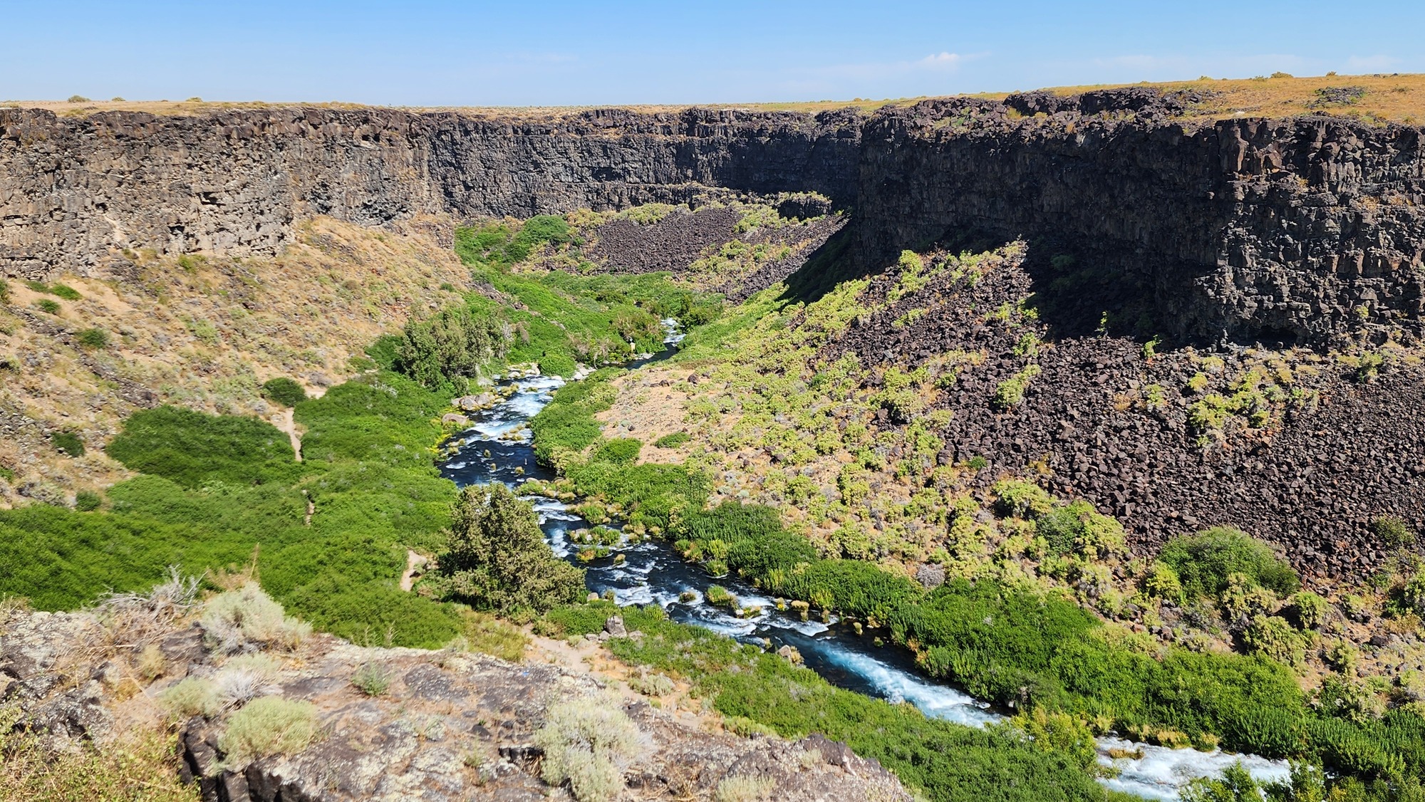
The trail goes downstream, west, along the rim of the canyon for about half a mile before turning north and steeply descending 300 feet into the canyon. Then 1/4 mile downstream to the 20 foot waterfall.
| Heart | 1 | Comment | 0 | Link |


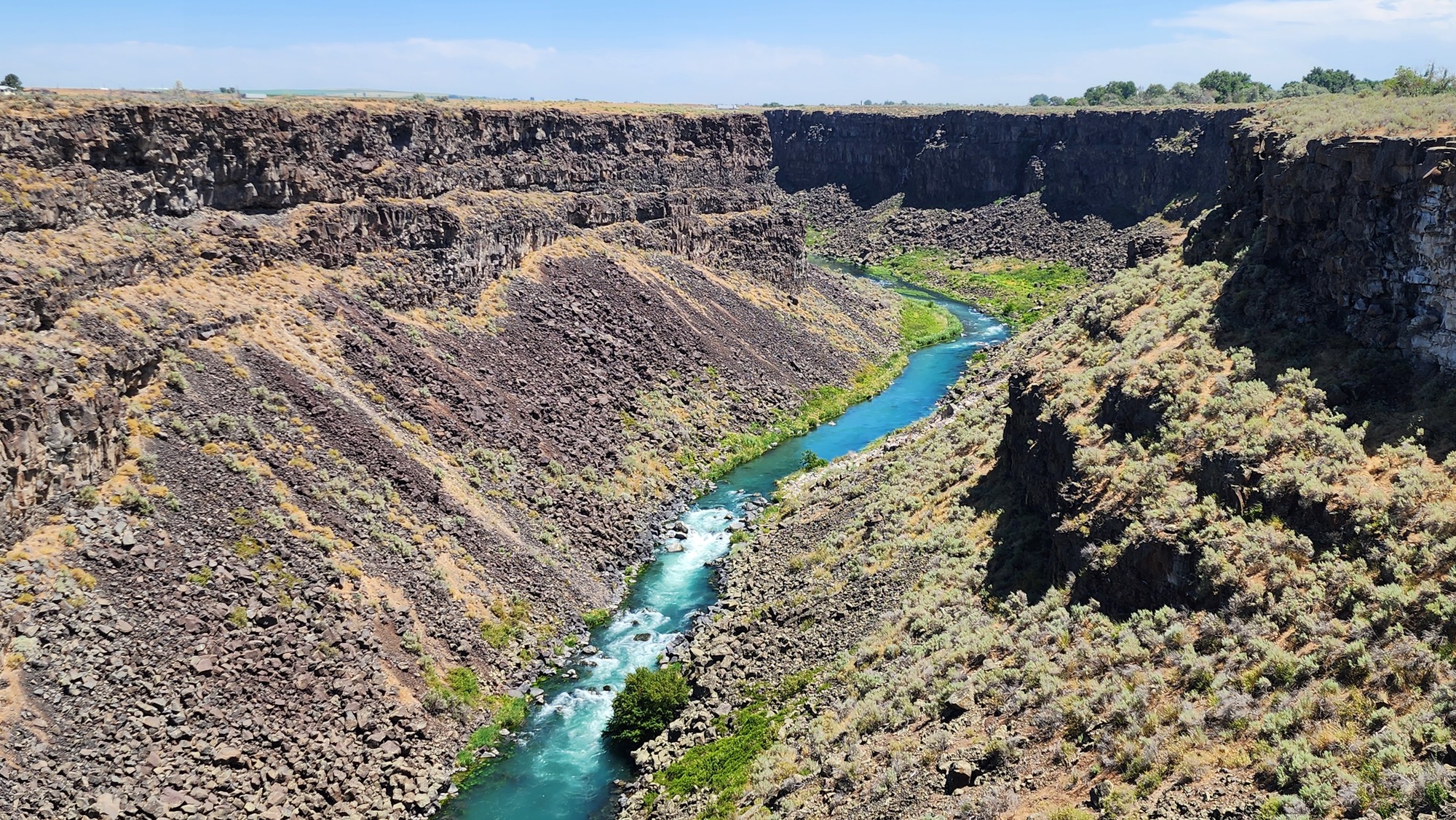
I walked the trail a couple minutes past the waterfall views and didn't see anything interesting, not even good water access. So I turned around to see the excellent canyon views again. The steep climb to the rim was very hot with no shade. It helped to stop a few times to take photos of the canyon view looking upstream towards the spring. There is no trail to the actual spring. It's probably a sensitive wildlife habitat.


| Heart | 1 | Comment | 0 | Link |
After the Box Canyon Spring hike I drove a few miles to Hagerman for lunch at a Mexican restaurant. It's near the Snake river with many irrigated farms that hire Mexican workers. Buhl and Hagerman are prosperous "magic valley" farm towns. The name was coined after Milner and Minidoka dams were constructed on the Snake river in the 1900-1910 time period. The dams and associated irrigation canals "magically" transformed uninhabitable desert into productive irrigated farms. Every town in the region was founded during that time period after irrigation water became available.
After lunch I drove a few more miles to the final tourist stop of the day, Malad Gorge. The official name is Thousand Springs State Park Malad Gorge Unit. The park roads are all east of the gorge, but most of the hiking trails are across the footbridge on the west side of the gorge. I hiked about a mile. All level, but in intense heat.
| Heart | 1 | Comment | 0 | Link |
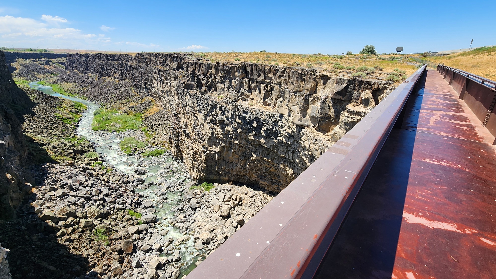
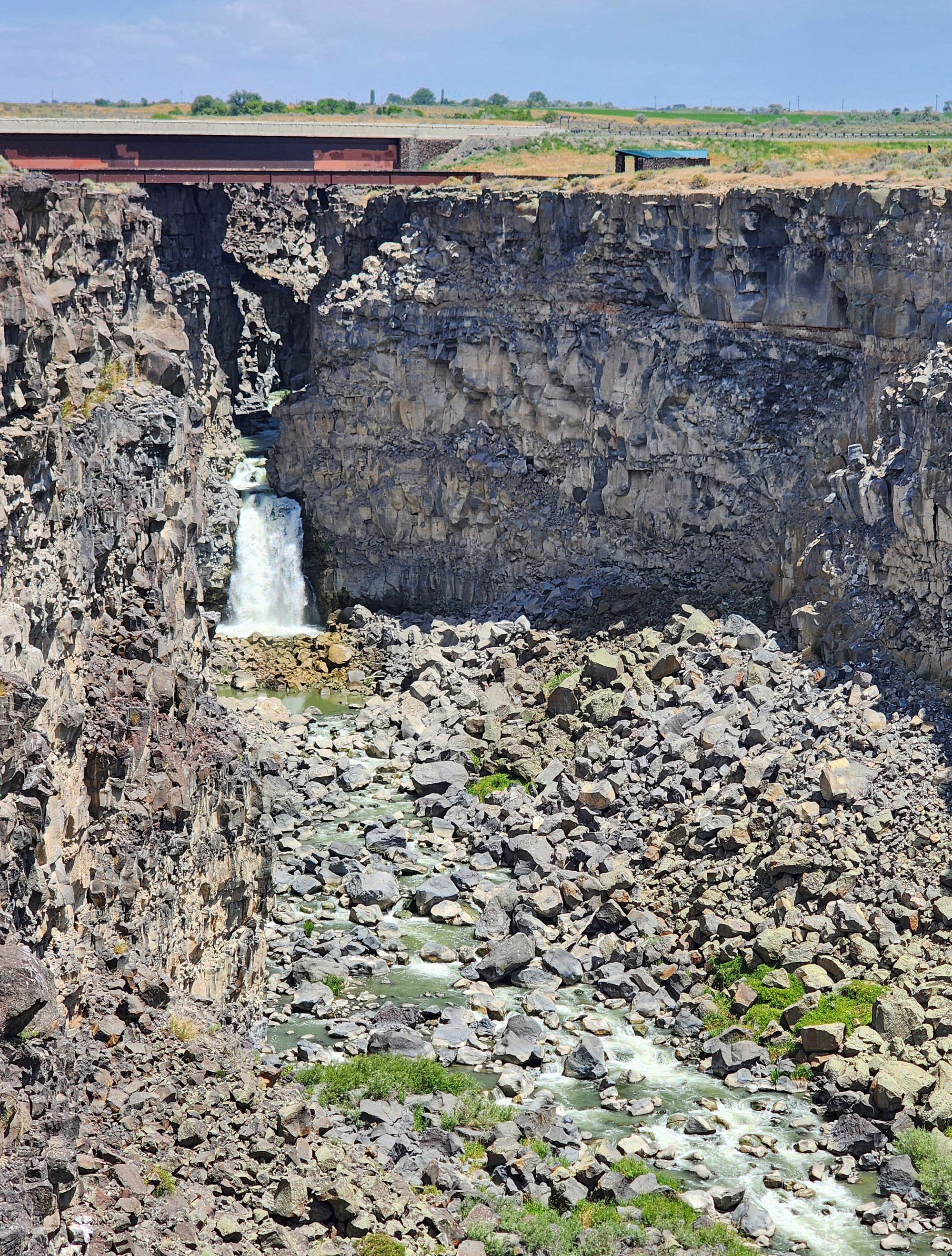
The Malad Gorge footbridge is about 100 feet south of a higher I-84 bridge that spans the Malad Gorge narrows. I-84 motorists can see into the narrows for a split second from the bridge.
| Heart | 0 | Comment | 0 | Link |
I never saw Malad Spring. It's somewhere above the Narrows.


I walked a trail downstream 1/4 mile to an overlook and looked back to discover that the foot bridge is directly above a 60 foot waterfall at the mouth of the narrows. The park brochure says the waterfall has retreated 2.5 miles upstream since the canyon was formed. The bottom of this retreating cataract is known as the Devil's Washbowl.
| Heart | 1 | Comment | 0 | Link |
Combined with the Snake river canyon that I saw yesterday, Box Canyon and Malad Gorge gave me a good sample of the many basalt canyons in southern Idaho. The basalt canyons add to the volcanic theme of the second half of the bike tour.
After the tourist stops I drove west on I-84 and US 20 and spent the night at Rory and Ryan's Inn in Burns, Oregon. It was a hot day. 102F when crossing the Snake river in Ontario, Oregon. 94F in high desert in Burns.
On July 2 I continued driving west to get home. In Bend I was disappointed that the Pilot Butte road was closed July 2-5 to stop morons from setting the city on fire. The volcano panorama from Pilot Butte would have been awesome with a good sun angle and cloud-free sky. I could have walked the trail if I wanted it badly enough.
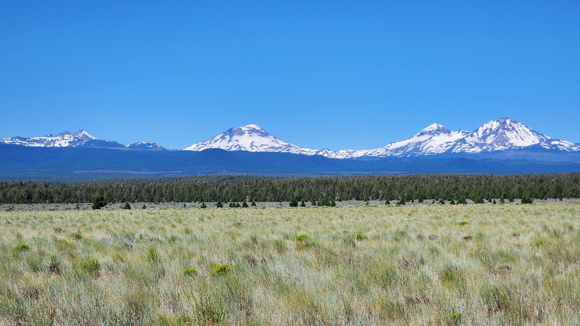
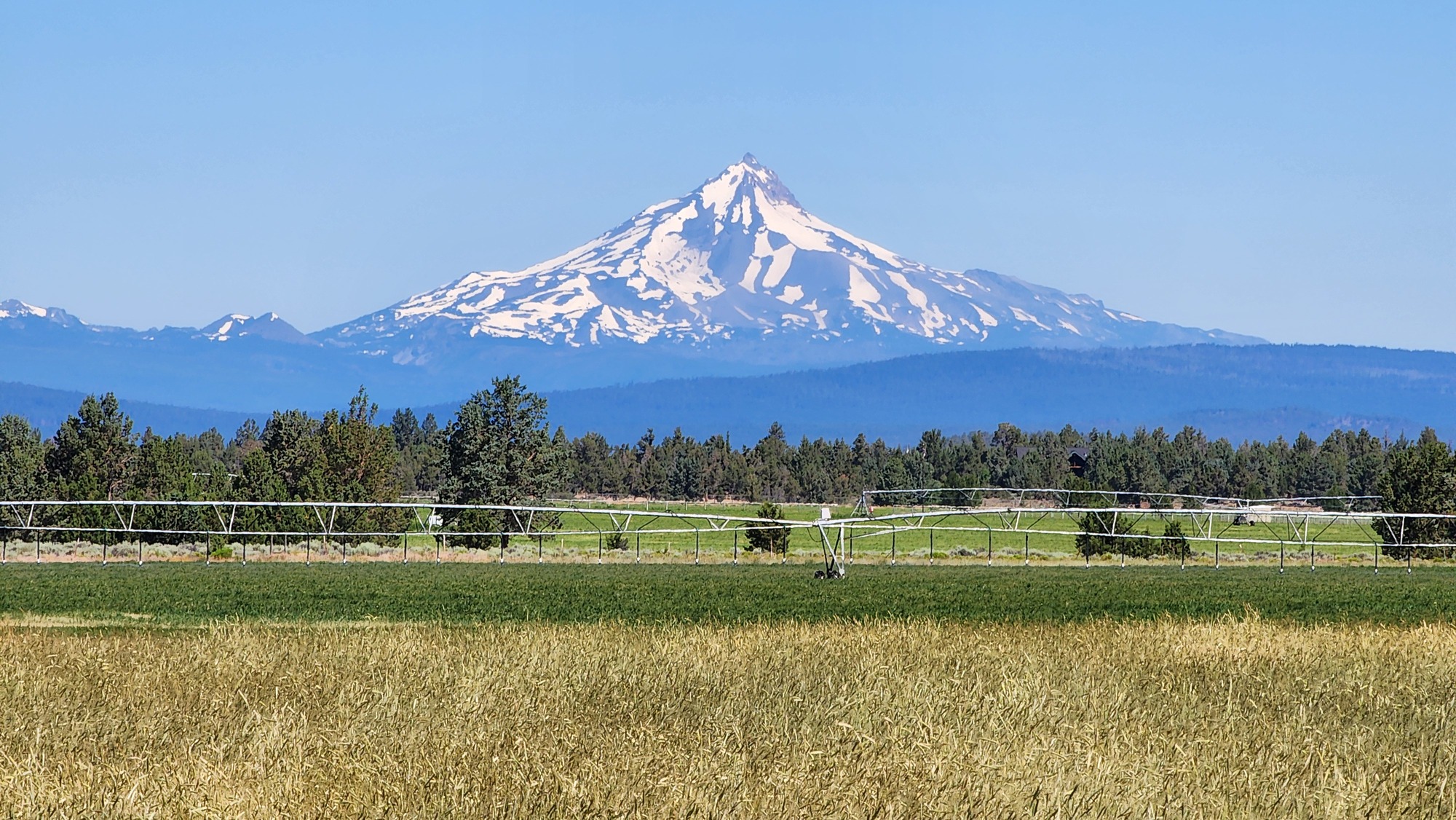
I felt better about volcano views after stopping at the roadside viewpoint near Sisters. It had a good view of the volcanoes to the west, plus an astonishingly clear view of Mt. Jefferson to the north. It's very far away but also very big.
| Heart | 1 | Comment | 0 | Link |
| Heart | 1 | Comment | 0 | Link |
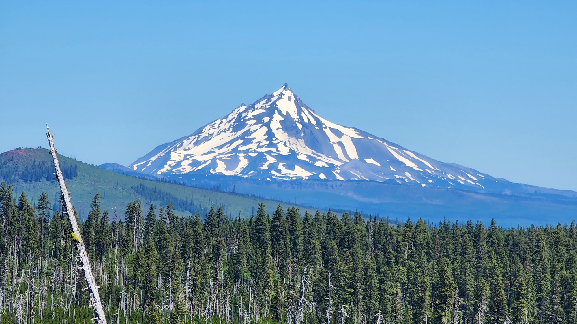
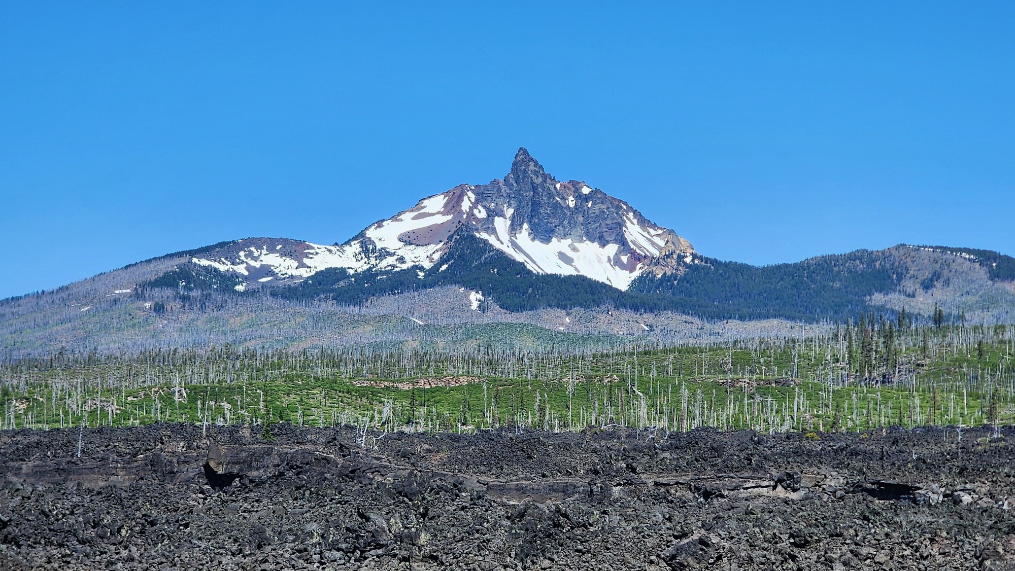
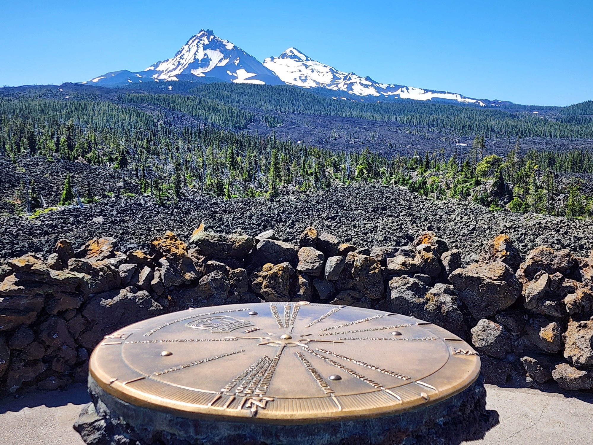
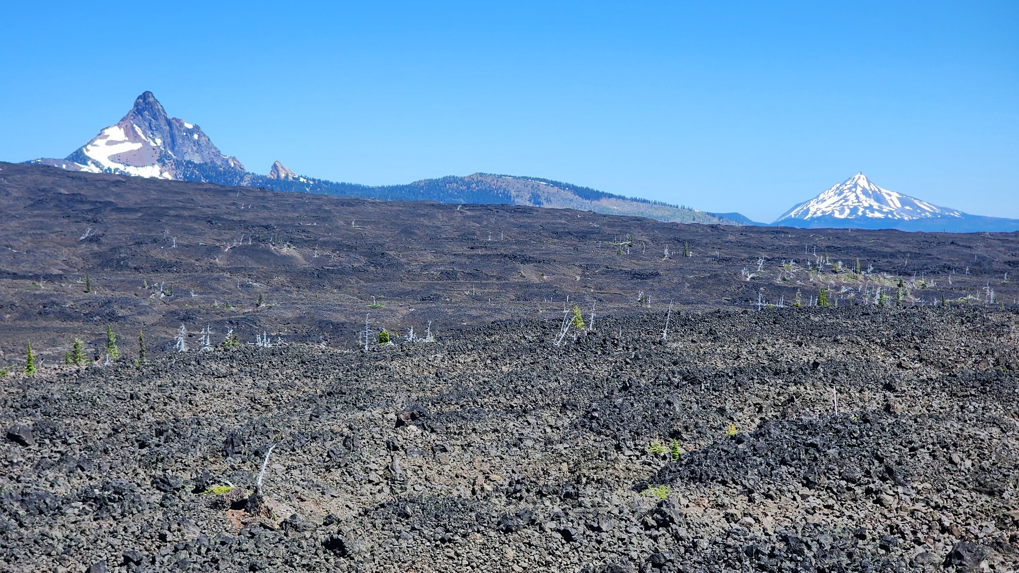
In Sisters I turned off US 20 to drive the McKenzie Pass scenic route instead of Santiam Pass. The Cascade Range volcano views were awesome, adding still another volcanic experience to a very volcanic bike tour.
| Heart | 1 | Comment | 0 | Link |
| Heart | 1 | Comment | 0 | Link |
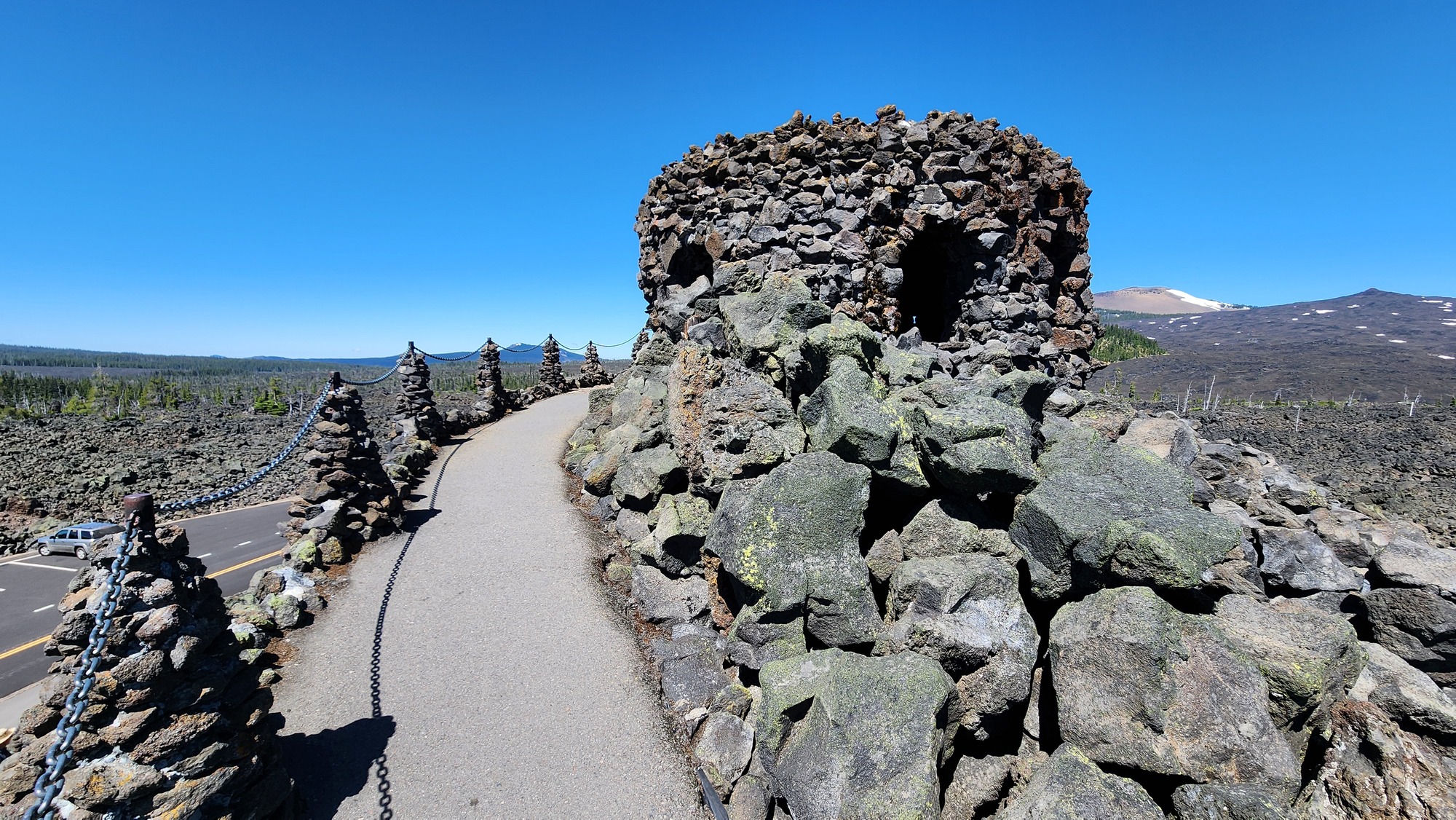
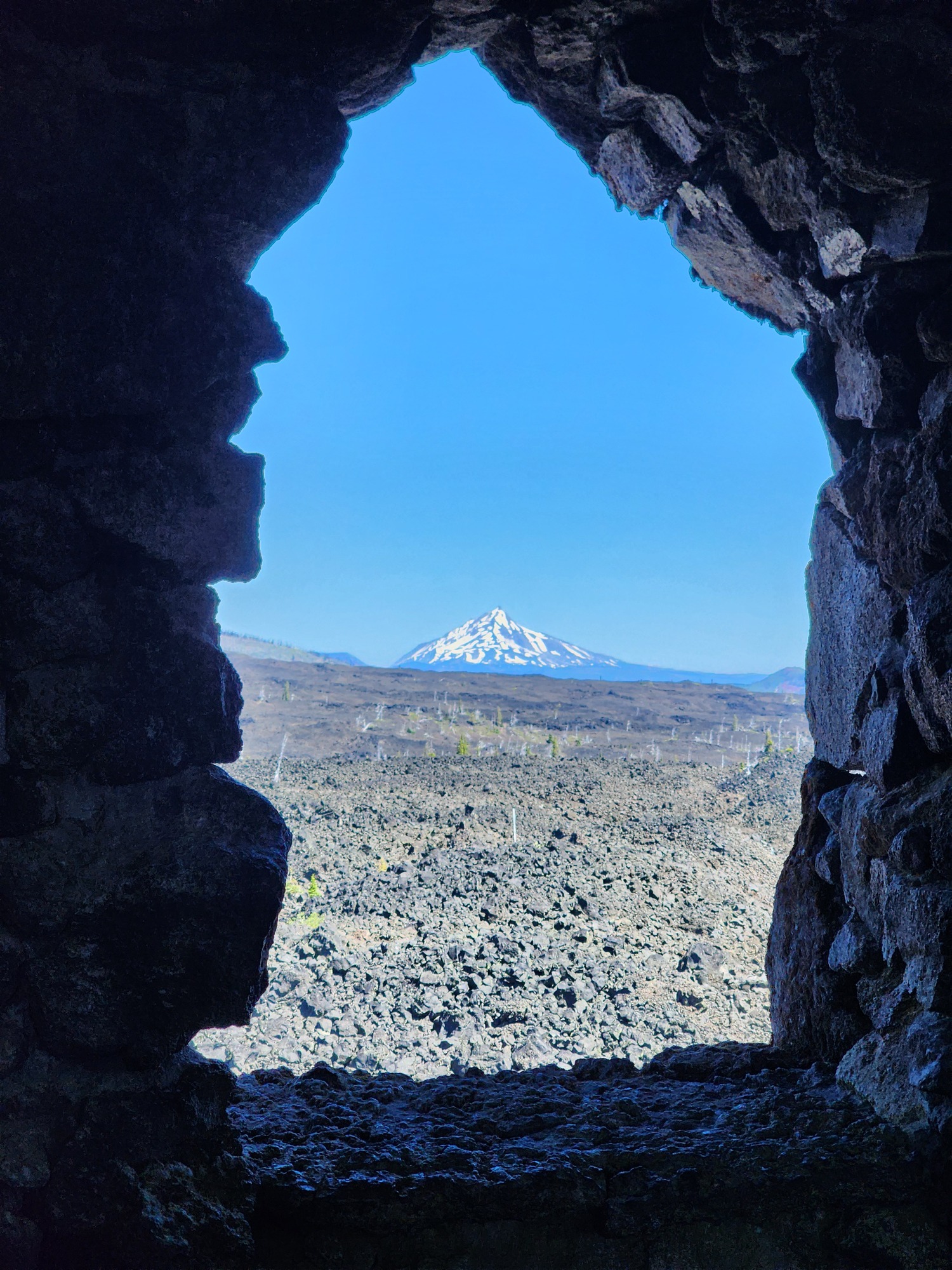
I stopped at 5325 foot McKenzie pass to visit the observatory. I pedaled here during my Florence-Missoula-Salt Lake City bike tour and several times on day rides. It was only my second time to drive to McKenzie pass-I drove my parents here once.
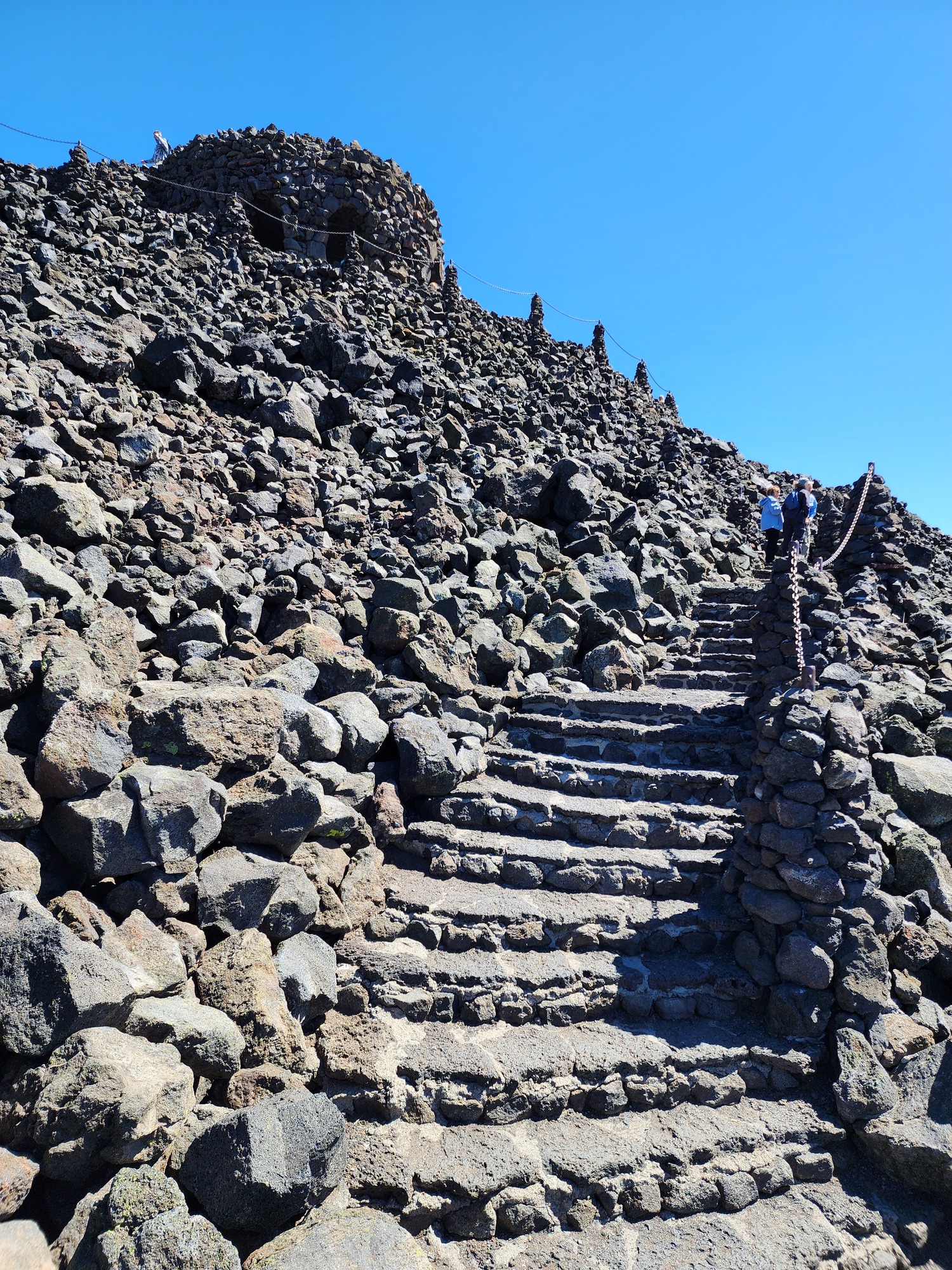
| Heart | 2 | Comment | 0 | Link |
| Heart | 1 | Comment | 0 | Link |
The McKenzie Pass scenic drive is also the TransAmerica Bicycle Route. I saw several day riders from Sisters, but no loaded cross country cyclists. Eastbound cyclists are long gone and westbound cyclists haven't arrived yet.
| Heart | 1 | Comment | 0 | Link |

| Heart | 0 | Comment | 0 | Link |
| Heart | 1 | Comment | 0 | Link |
I didn't take many pictures when descending the lush west side of McKenzie pass. But I had to stop when driving through a bear grass super-bloom that I had never seen before.
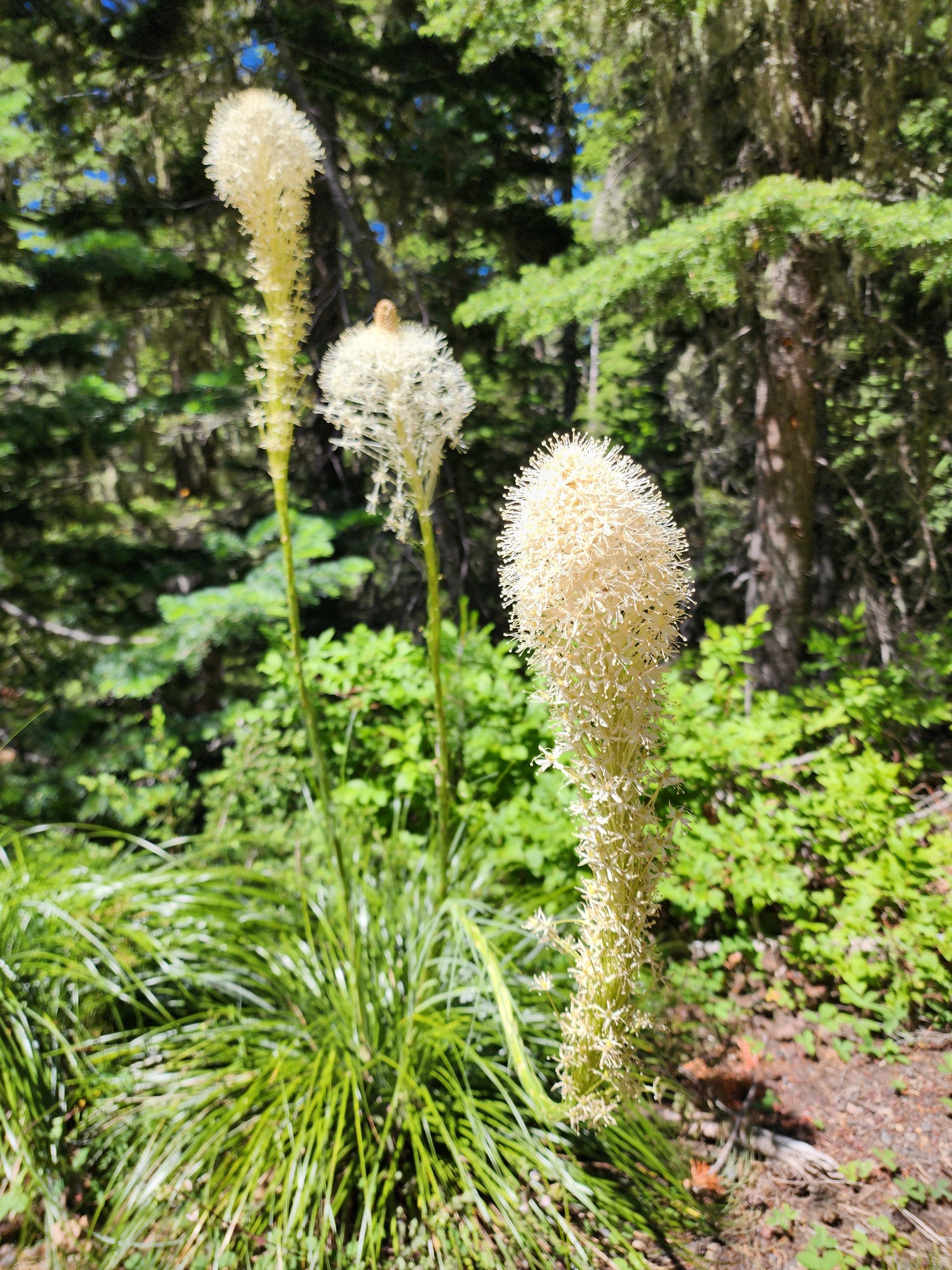
| Heart | 2 | Comment | 0 | Link |
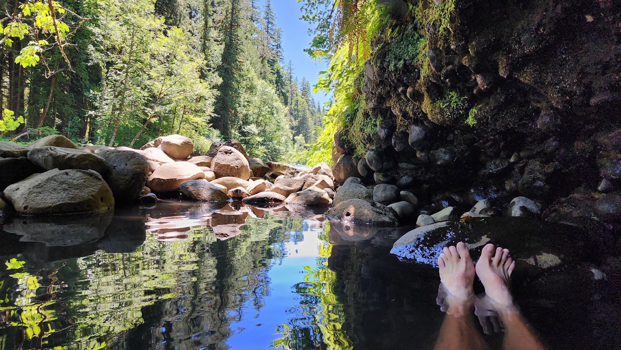
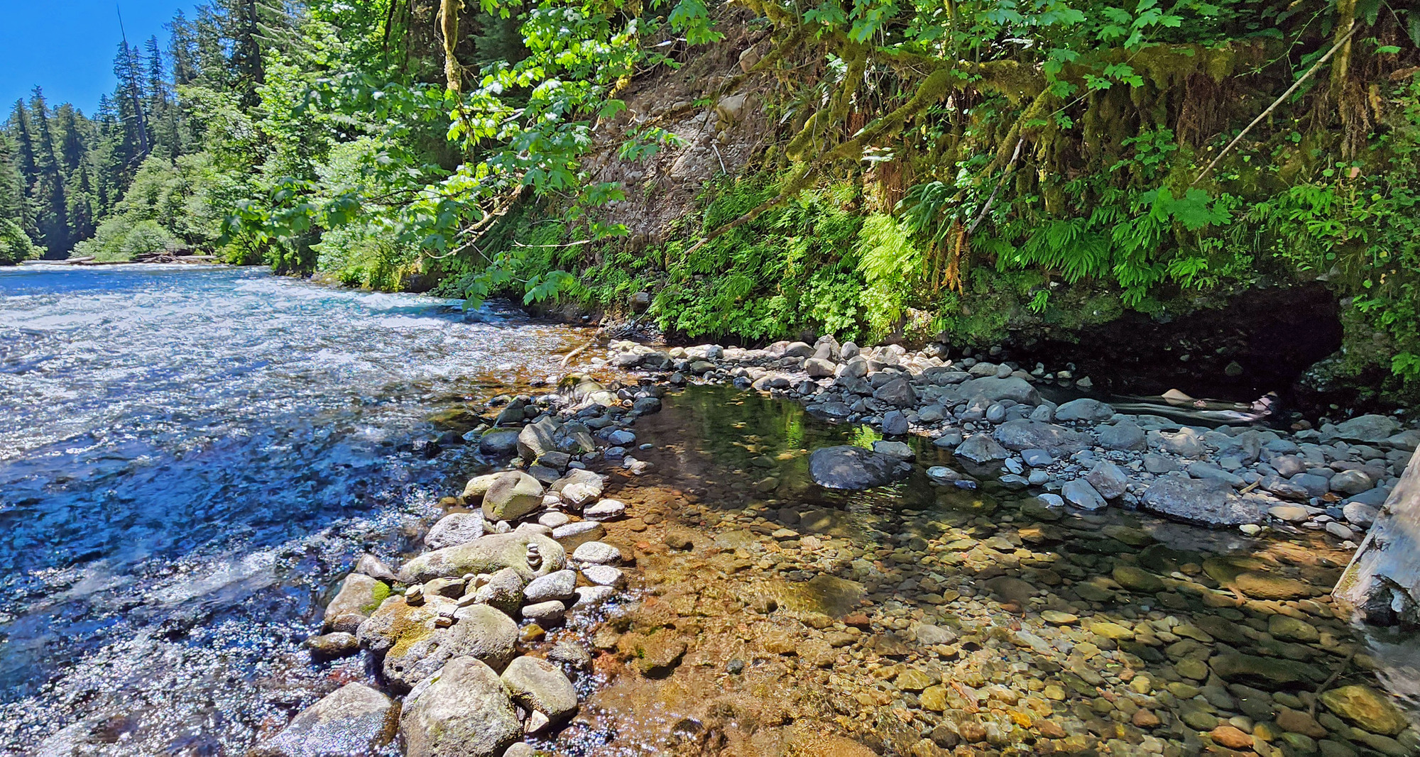
I took a short detour to soak at Deer Creek hot spring along the bank of the McKenzie river in dense forest at 2000 feet elevation. It was a great welcome back to green western Oregon.
The hot source is deep in the cave. Water temperature is about 100F in the cave, but a few degrees cooler outside the cave. I soaked in the cave. Air temperature was 75F and the pool was in the shade. The pool gets warmer in the sun and on warmer days. I soaked for about 45 minutes.

I had the hot spring to myself for the first 5 or 10 minutes. Then another couple arrived. They got naked and poked around the river in the sun, but didn't go to the hot spring. They were waiting for me to leave so they could get in the cave. I soaked for another 30 minutes.

| Heart | 1 | Comment | 0 | Link |
Just before I left I asked the extremely attractive 30-something naked woman to take photos of me. I closed my eyes and she took several photos. This is the only one that might be suitable to share.

| Heart | 1 | Comment | 0 | Link |
I returned the rental car in Roseburg, Oregon at 4 PM on July 2. My wife met me at the Enterprise office and drove me and the bike home from there.
I successfully avoided the Independence Day holiday travel rush. Tourist traffic was light both days. The narrow McKenzie Pass route was almost deserted on a Wednesday morning. The 2-lane highways were a nice change of scenery after driving the I-84 route six times in the last two years.
The drive home was vastly more fun and scenic than the drive to Missoula, which featured a multi-hundred mile detour because of a wildfire in the Columbia gorge.
Altogether this was a 22 day trip:
1.5 day drive + 18.5 day bike tour + 2 day drive
| Rate this entry's writing | Heart | 6 |
| Comment on this entry | Comment | 1 |