June 25, 2025
Day 14: Challis to Stanley
Today will be a very long day, so I tried to get an early start. Up at 6:45. Went to the Village Inn restaurant when it opened at 7. Service was fast, but I didn't like my extremely greasy omelet and hash browns. On the road at 8:08, not too bad.

The day starts on US 93 going south from Challis. It's far above and away from the river for the first 3 miles. Then a brisk descent to connect to the river again. I turned right onto ID 75 which goes west, upriver, to Stanley. US 93 goes south to Idaho Falls.
I had an extremely strong headwind for a couple miles when entering the canyon. Progress was extremely slow. Fortunately the wind got much weaker when I entered the serpentine canyon. I had a couple other short segments of strong headwind later. I had a headwind all day. Maybe 10 mph most of the time. It kept me cool but definitely slowed me down.

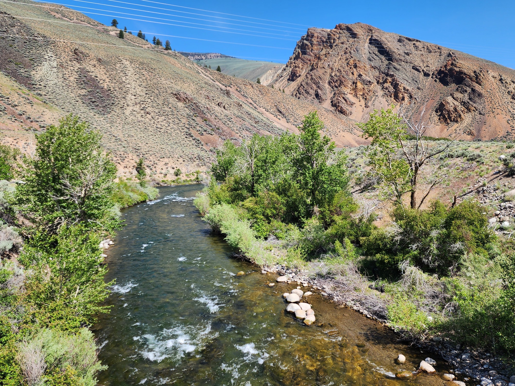
I rejoined the Salmon river at 5100 feet elevation. Relatively high, but I was surprised to see extremely barren slopes. ID 75 stays close to the river with almost nonstop river views.

I enjoyed the scenes during the morning. Sunshine. Multi-colored volcanic formations. Irrigated fields. A bit of snow in the distance.

I stopped to take a picture where ID 75 crosses over the East Fork Salmon river just before it flows into the Salmon river. Then just ahead I turned into the East Fork campground to rest in the shade. I remember camping there in 2008.
| Heart | 0 | Comment | 0 | Link |
Traffic was about the same as yesterday. Light to moderate, almost entirely recreational traffic. ID 75 has little or no shoulder.


I stopped in the village of Clayton to look at the museum area. Not much going on in Clayton. No services other than a bar.

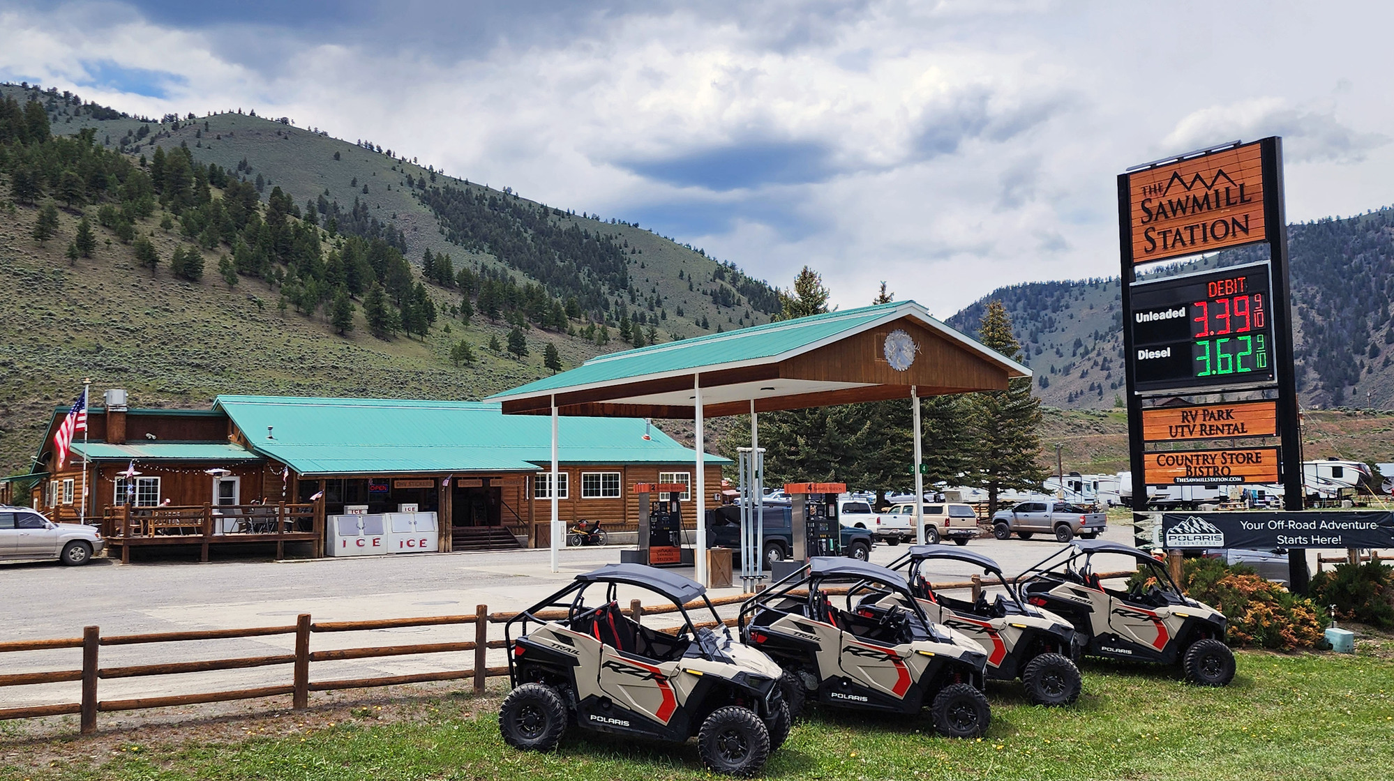
Two miles past Clayton I took a long stop at a large resort to have fish tacos. It has a store, restaurant, RV park, and ATV rentals. I had pedaled 29 miles. It's near the halfway point of today's long ride. I was grateful to find a restaurant on today's super long ride.
I wish I could spend the night here to split this long day into two days. I didn't see any cabins for rent, but the RV park might have a trailer for rent.
| Heart | 1 | Comment | 0 | Link |
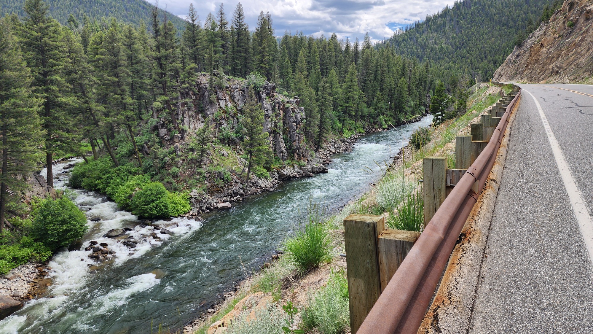
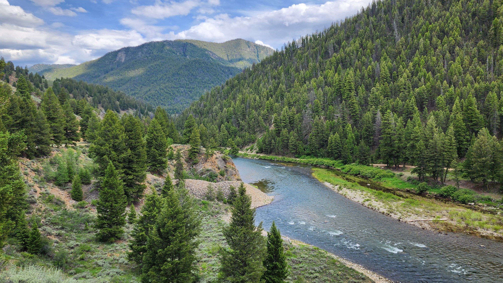
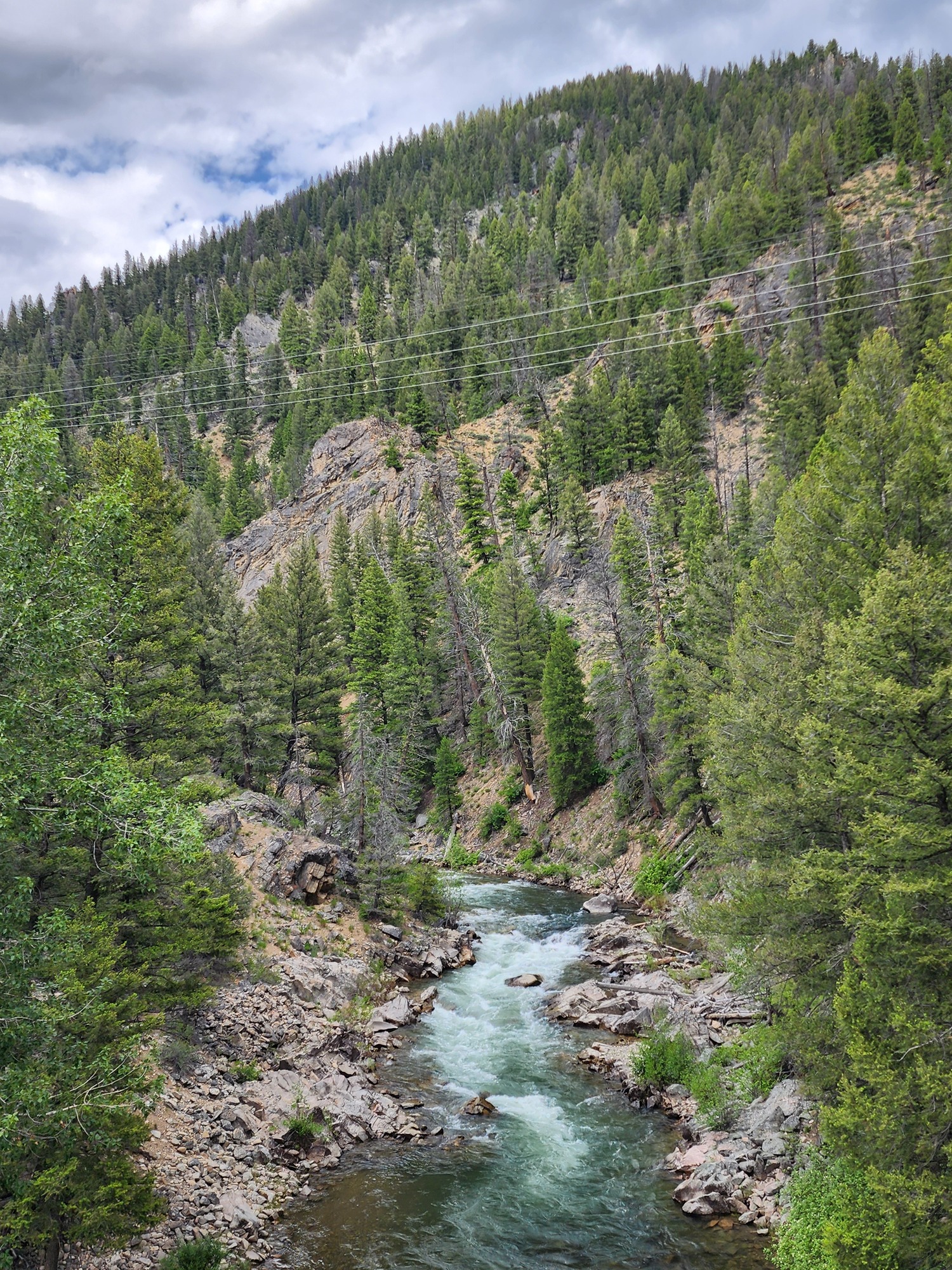
Trees become more common as I pedaled upstream from the resort. I'm nearing 6000 feet elevation.

I enjoyed the sudden and scenic change in environment. The trees seldom obstructed my river view.


| Heart | 2 | Comment | 0 | Link |
| Heart | 3 | Comment | 0 | Link |
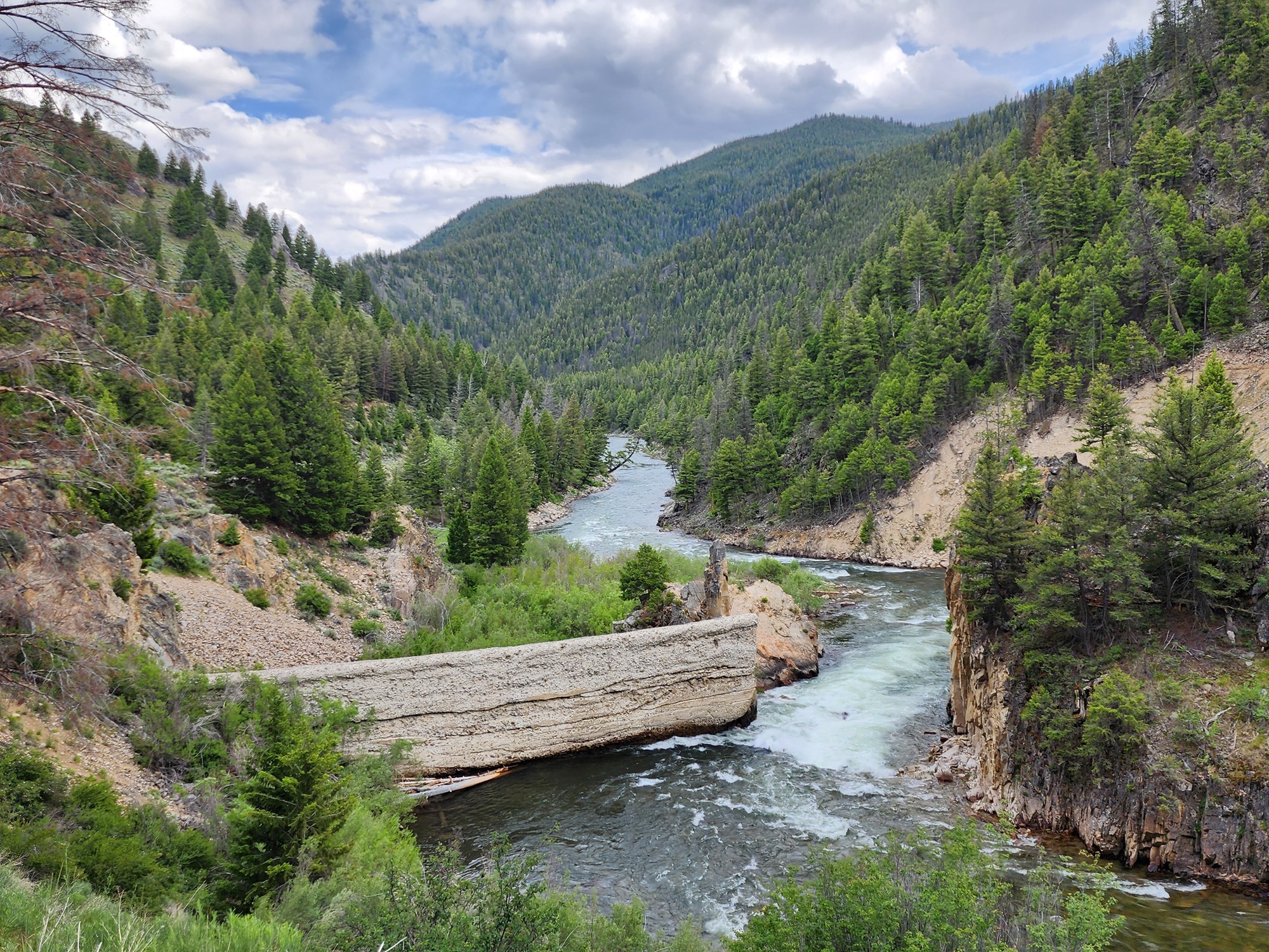
I stopped on a bridge to take a picture of the Yankee Fork just before it flows under the bridge into the Salmon river. Challis was founded to supply gold mines far up the Yankee Fork.
| Heart | 0 | Comment | 0 | Link |
I also stopped to look at the ruins of a 35 foot dam that was built in 1910 to supply power to the Sunbeam gold mine. The mine was not successful, so the company went bankrupt and abandoned the dam. The state dynamited the dam in 1931 to restore fish passage. Now the Salmon river is the longest undammed river in the contiguous United States.
| Heart | 2 | Comment | 0 | Link |
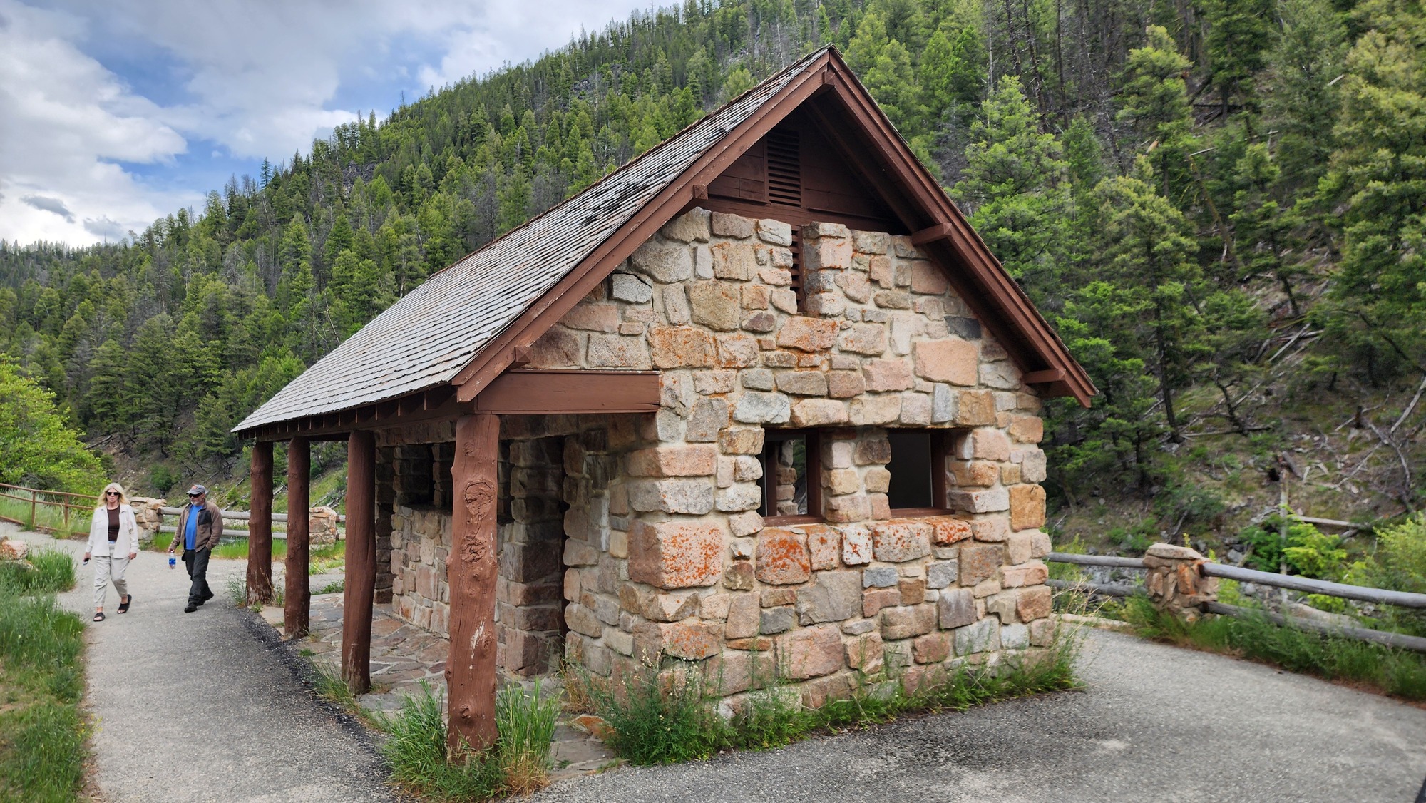
I stopped to look at Sunbeam Hot Spring, a National Forest recreation site with a big sign and big parking lot. It was quite busy. I could smell sulfur from quite a distance.
First I walked past the 1937 bath house built by the Civilian Conservation Corps. A very sturdy building that can withstand floods. I don't know how many years it operated as a public bath house. Now the structure has no tubs and no evidence of plumbing.

I didn't even consider soaking at Sunbeam Hot Spring because it was so late in the afternoon. The main soaking pool was crowded.

| Heart | 1 | Comment | 0 | Link |
A few miles past Sunbeam Hot Spring I had the first view of the Sawtooth mountains ahead. Unfortunately I was looking into the late afternoon sun. Very bad sun angle.

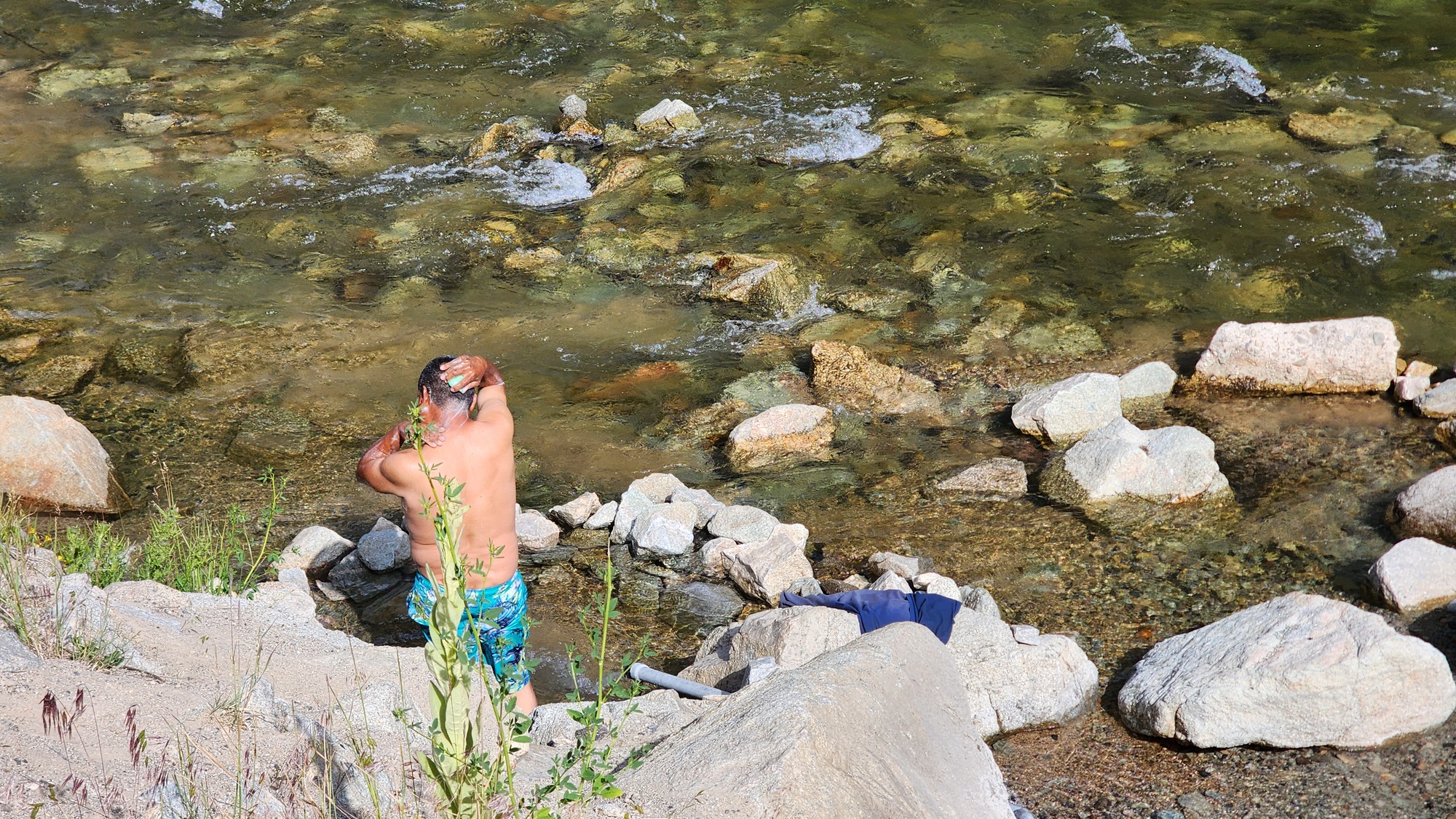
I also noticed the site of the former Boat Box hot spring which once had an enormous metal cauldron for soaking. I guess it got washed away by a flood. Two Spanish speaking guys were there to have a bath, with soap. That's not recommended. I passed several hot springs today but didn't soak in any of them.
| Heart | 0 | Comment | 0 | Link |
The Sawtooth mountain views are excellent for the final 3 miles into Stanley. But the sun angle was awful.
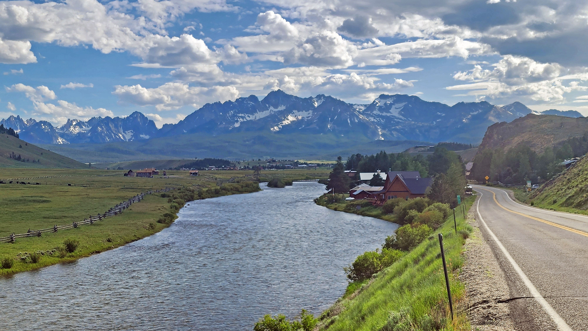
| Heart | 2 | Comment | 0 | Link |
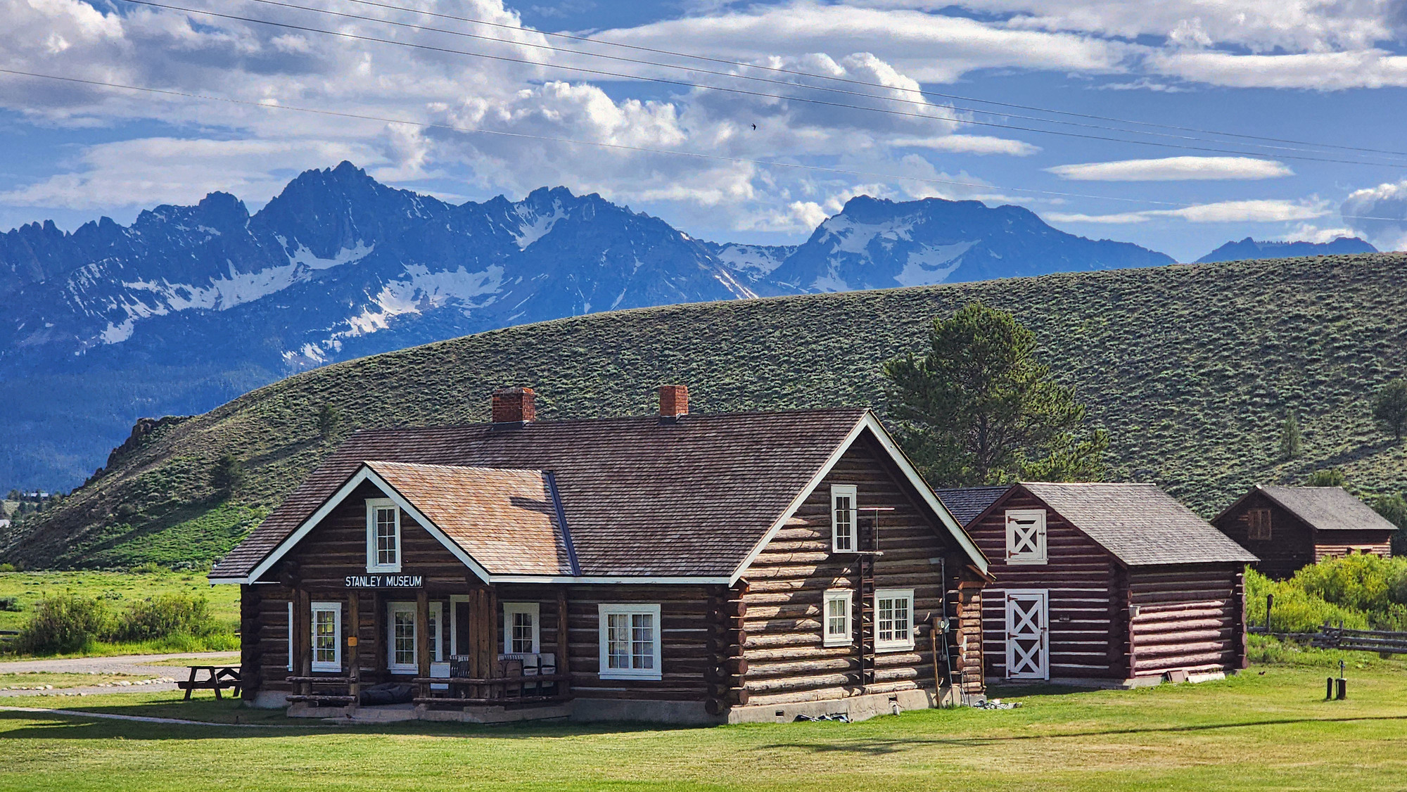
I stopped to look at the impressive log structure that is now Stanley Museum. It was built in 1933 as a National Forest ranger station.
| Heart | 2 | Comment | 0 | Link |

I arrived at Village Inn at 6:25 PM. It took me more than 10 hours to pedal from Challis to Stanley. I'm thoroughly exhausted, glad to have a rest day tomorrow. When checking in I signed up for a 10-11 AM soak tomorrow morning in the shared hot spring pool.

My room has no A/C but I should be okay. Today had a high of 77F.
I had dinner in the lodge's restaurant. No long walk needed. It was pretty good, with extremely large portions.
It was a very long day. Upstream all day. Upwind all day. Much longer than I prefer. I succeeded, but am in bad shape. It could have been worse. At least there were no steep grades.
Distance: 59.4 miles
Average Speed: 8.0 mph
Ascent/Descent: +1974/-917 feet
Today's ride: 59 miles (95 km)
Total: 479 miles (771 km)
| Rate this entry's writing | Heart | 6 |
| Comment on this entry | Comment | 0 |