April 14, 2015
A Wutherering Heights is Me: near Norcia to old quarry campsite.
| Heart | 0 | Comment | 0 | Link |
This is not a tale about Kate Bushes' seventies hit song; nor even a nineteenth century vicar's daughter that wrote the masterpiece novel in the song; nor, sheep and new born lambs. Though there are connections with spring and high windswept regions. And you'll soon see what I mean.
I am eating biscuits for breakfast. They are sweet, yes; and with tea, they'll keep me going an hour or two, then I'll be really hungry mid morning. I bough them because yesterday, there wasn't porridge oats in the supermarket and most other cereals are bulky to carry and poor value for money. Porridge is for sure the no nonsense breakfast, if you can find it. In Italy porridge is hard found and the couple of times I have seen porridge upon Italian supermarket shelves, it is in a fancy box and costing near enough four euros.
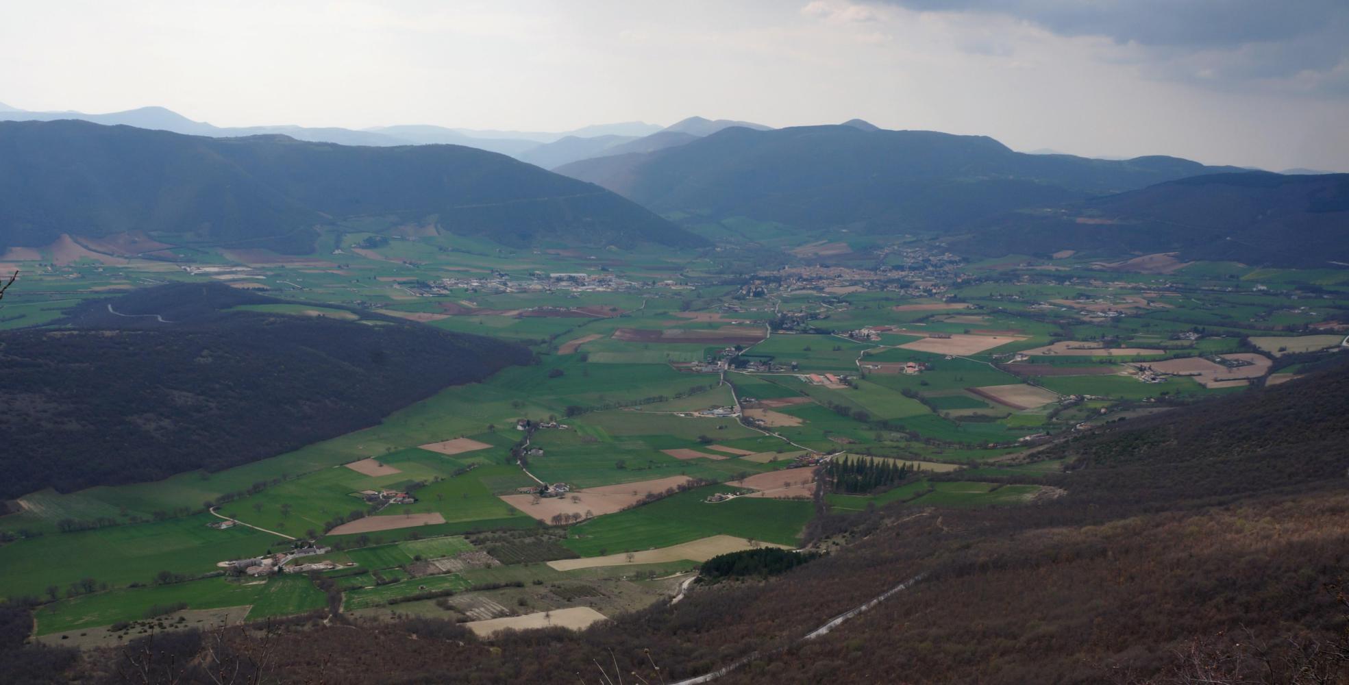
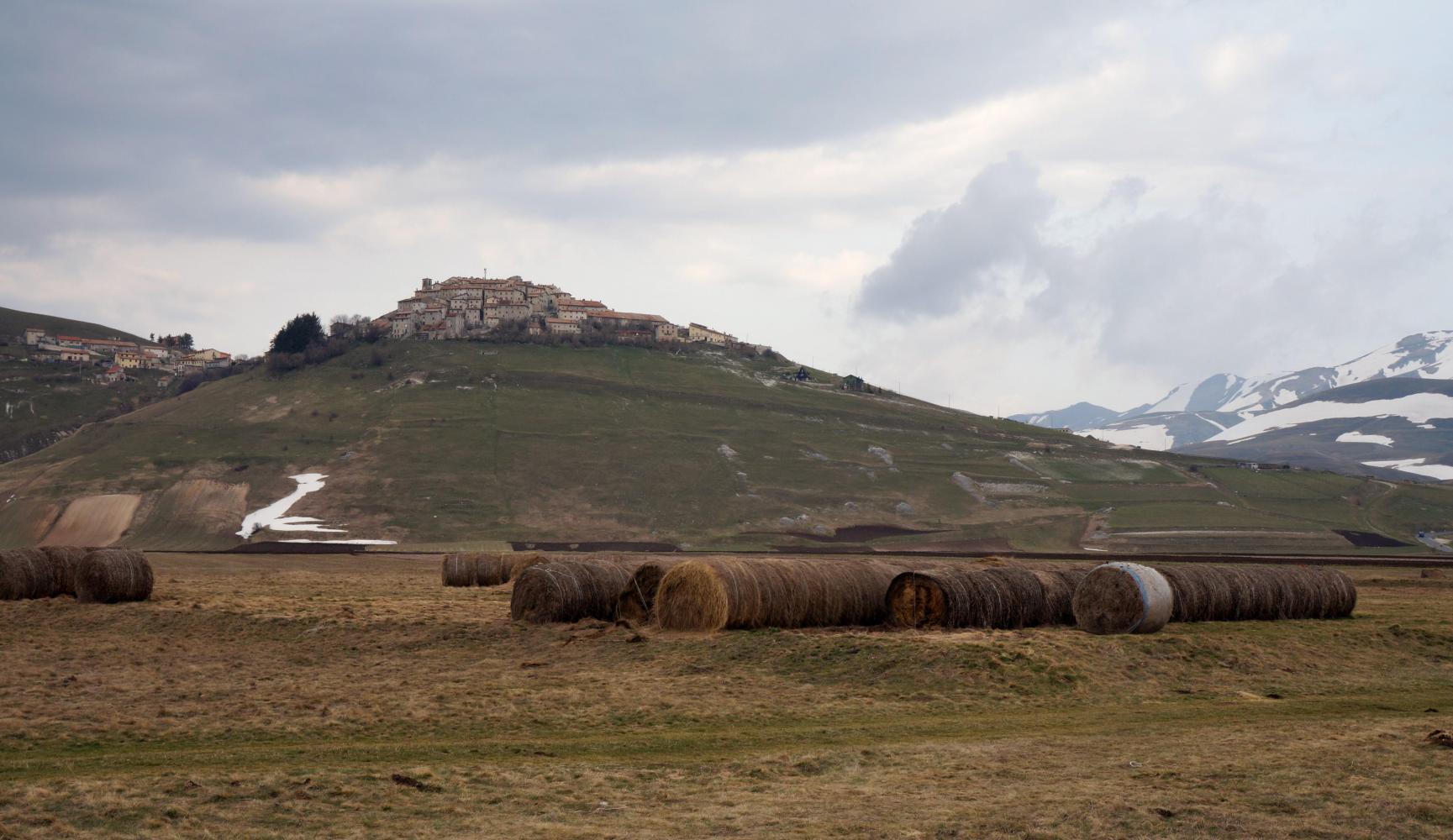
I descend to Norcia, a walled citadel and quite sizable town, which must have visitor attractions as I pass a hostel, but I only stop long enough to stock up at the supermarket.
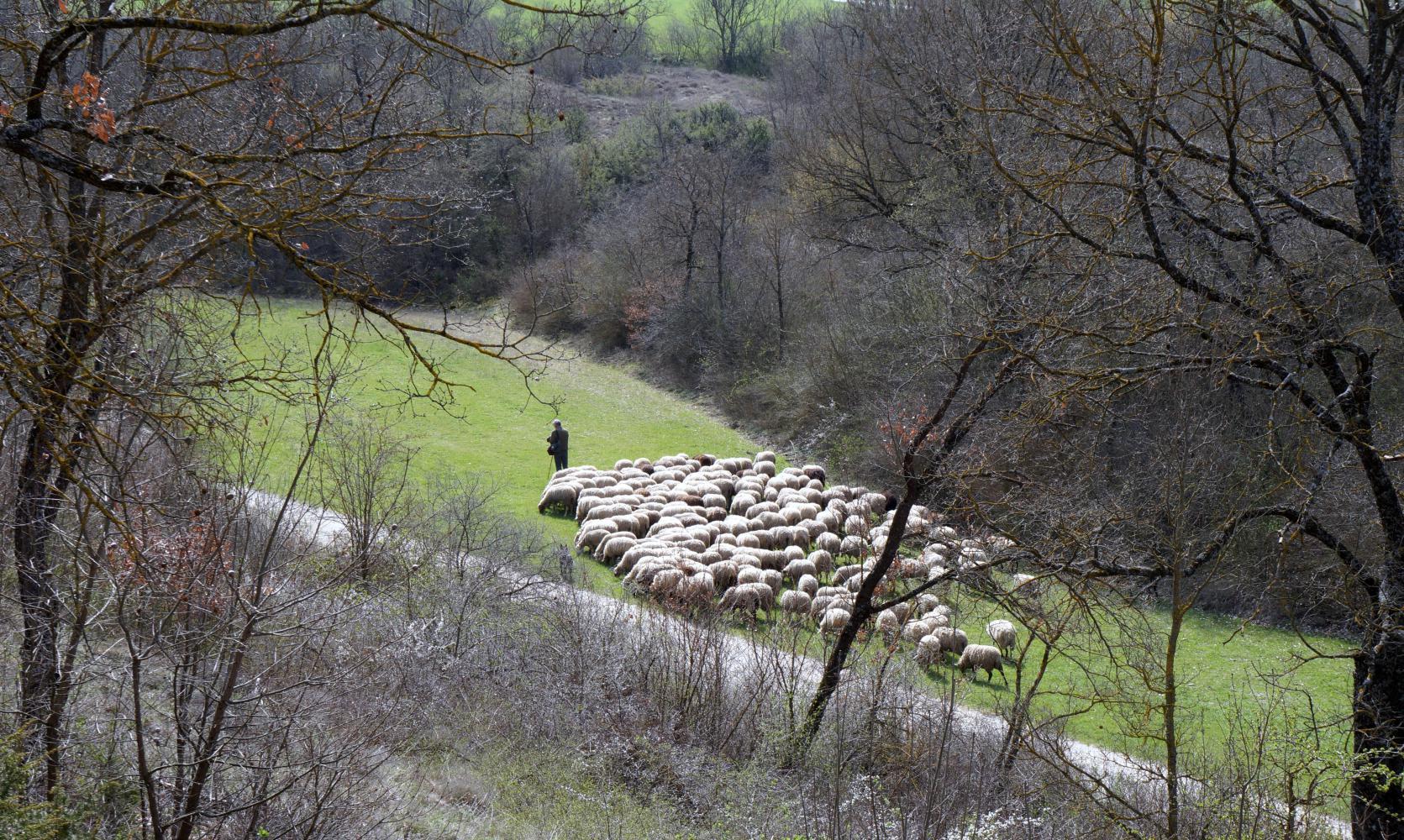
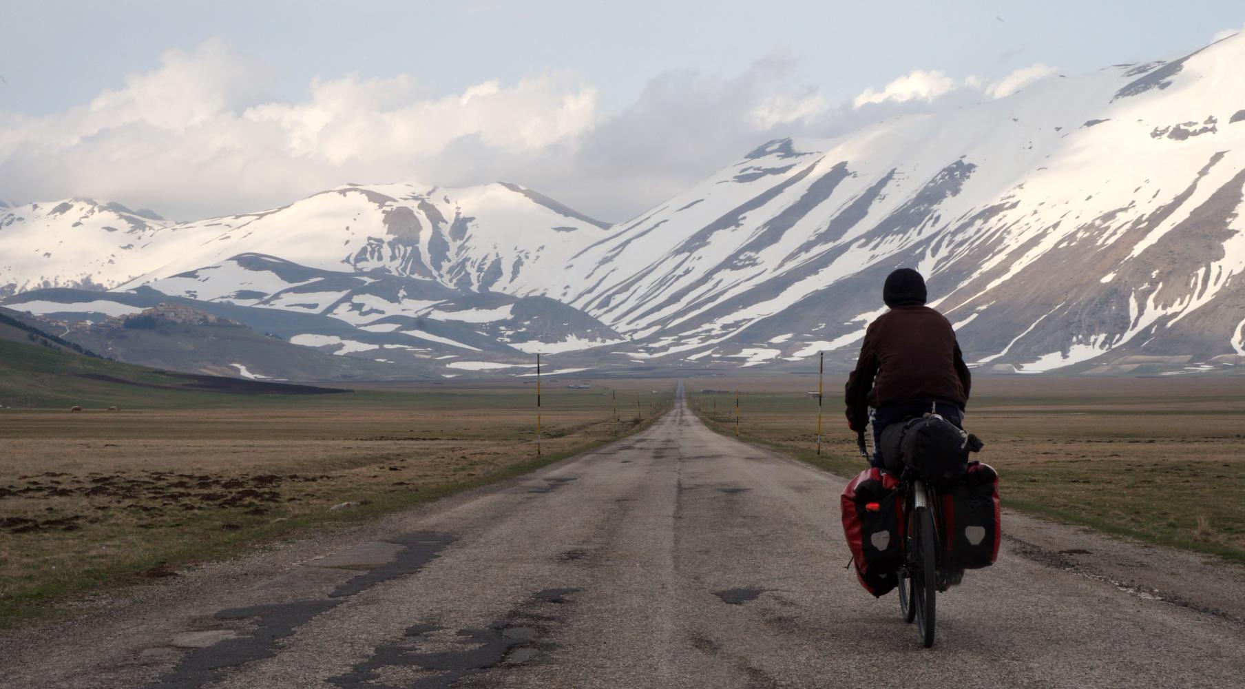
Coming down the mountain, I could see the town spread out in the near corner of a great flat basin, walled in by snow-capped mountains on all four sides. The road onward is dead straight with open farmland, large squares of lush green either side. The flatness is deceptive though, as my chain is running on the second largest sprocket at the rear and I struggle to hold the speedometer at 12: a gradual rise, all but invisible; until five kilometres out of town, where the road to Ascoli Piceno, my planned route, splits off on the left by an isolated hillock: here the road can be seen to climb stiffly up alongside and around the hillside. Shortly I spot below, through a gap in trees to the side on the slope down, a farmer moving sheep, walking in front with his dog leading, rather than herding the sheep from behind. Pastoral harmony.
Further round the hill, the way ahead can be seen as a line across the mountainside headed toward impossible high peaks for a road with so many trucks passing. A lot of climbing, but the map shows a tunnel.
The road descends from the hillock and there's a roundabout at the foot of the mountain with a small road off to the left signposted to a ski-resort, but continuing over the mountains according to the map; a longer way, so I continue right and start climbing across the mountainside. When I come to the tunnel, the lined off shoulder there is now may continue through the tunnel, or there may be an old road round the outside.
The road is an even gradient until a summit and a turn round a fold in the slope into a valley between two mountains, which ahead close in to a narrow gully, where it isn't possible the road can climb up through. I already see a thin white trail up this gully. Then rounding another fold, the dark tunnel mouth comes into view by the bottom of the trail.
When I get there, there's a road-maintenance cruise on a layby by the tunnel mouth. One of the men waiting for a mini-digger to be loaded onto a trailer looks at me in exasperation, perhaps because he thinks I intend riding into the tunnel. There is a no-cycling sign and I wouldn't want to ride further: there is no shoulder. The only thing to do is wheel the bike up the trail at the side; or push, as when I start, I find it steeper than it looks. It seems foolish now, because there is no way of telling how far up I'll have to haul the bike before the trail levels out and goes down, or will it be possible to come down to and re-join the road by the tunnel exit the other side. Also there was no board by the mouth saying how long the tunnel is. A long tunnel, which it appears, will mean this is a long trail and perhaps impassable to hail a loaded touring bike across.
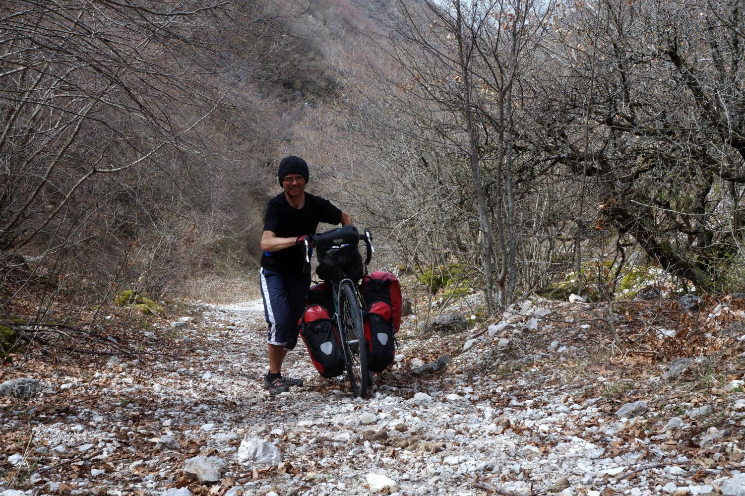
In the beginning I could keep going up with my cycling shoes awkwardly rolling and sliding on fist size stones littering the trail, for quite a way before pausing to rest, but I'm stopping more often now, as my arms tire. It had been a horse trail and there are balls of horse dung from perhaps a horse trek last summer. But any way each bend reveals the trail up through saplings to have no end.
I am hauling for over half an hour more when the way levels out into a rough grassy valley, where snow is still lying in shaded areas and a birch forest beginning on a slope ahead is still wintry bare. Worst of all, the way on is unclear; it could be straight on up the side of the birch forest, which is very steep; or, to the left, grassy and around rock outcrops before rearing up to a near vertical slope, clearly impassable to haul a loaded bike up; but, above, near the top is the terrace of what looks to be a road, so if I got that far I'd be home and dry.
I lean the bike and have a scout around; first up the side of the birch, where the trail of horse dung continues, but find it too steep; then, returning to the bike, I walk across tusks of grass to the first rock outcrop before standing still and looking up at the impossible slope and realising how hopeless it is, decide to return down the trail to the tunnel mouth and take the road via the ski-resort. It may be longer, but at least it'll be rideable.
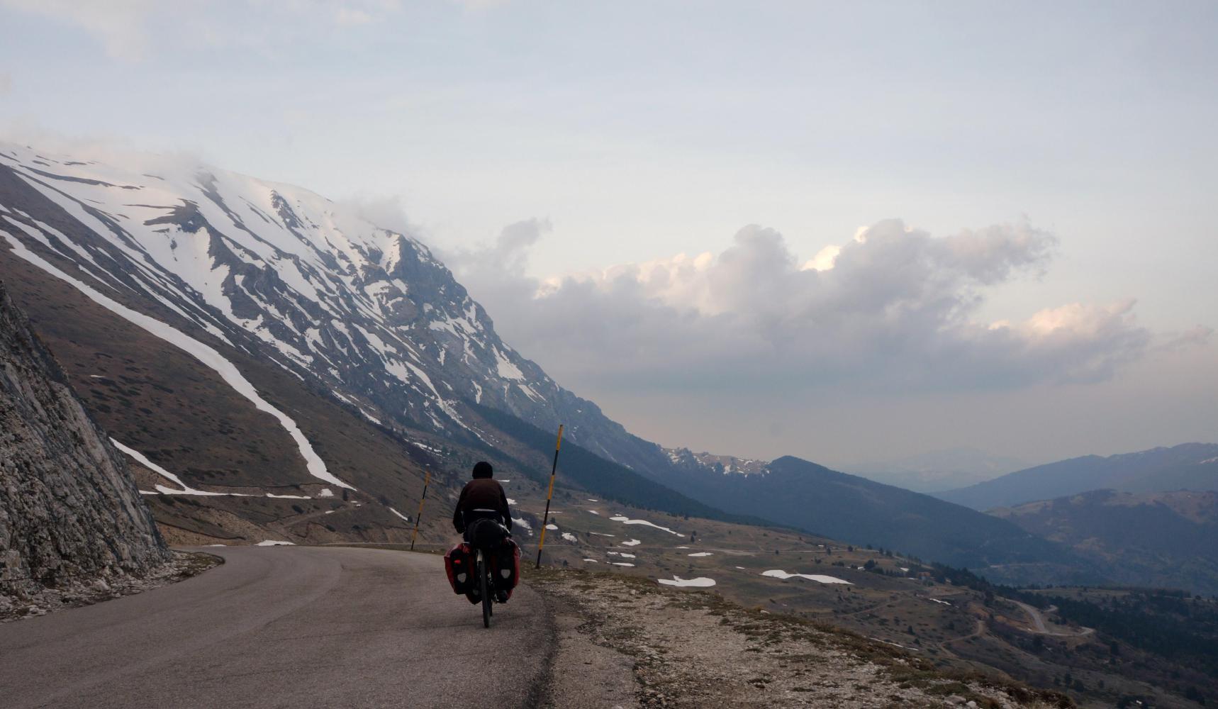
The road via the ski resort climbs steadily for a kilometre from the roundabout across a wooded slope, before turning back on itself at a hairpin bend. Here I stop and lunch leant against the black and white arrows sign intended to warn of the coming bend. It is really warm sitting in the sunshine and I wish I'd chose to sit in the shade of bushes to the side. The way on gains quite a lot of height and the warm sunshine soon turns to dark clouds and a chilling breeze.
There are a few more bends and upward straights, pass a restaurant boarded up, it being out of season; and rough pasture grazed by hardy upland cows. The road has banks of snow along most of it now and after passing the turnoff for the ski-resort it begins levelling out with snowy escarpment peaking up above the brow of the hill from the valley beyond.
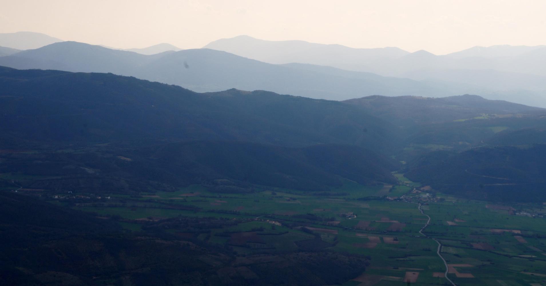
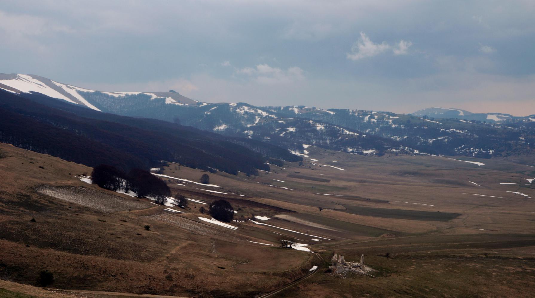
The way down is one steep and short ramp to a broad basin about six kilometres across and longer off to the right; perfectly flat and barren, growing yellowish-brown mountain grass bend in the breeze, and waterlogged in places; closed in on all sides by formidable slopes and the snowy peaks seen before cresting the hill. Presently the road levels out turning right toward said peaks and continues dead straight.
| Heart | 0 | Comment | 0 | Link |
Today I feel like I've turn back the clock a month or two, going from spring back to winter in this windswept region where it looks like it could rain or snow any moment.
The place looks empty, apart from a clatter of houses on a hillock ahead to the left; until, I see horses on a fenced plot to the left; then a corrugated iron hut and more isolated huts with bales and flocks of sheep nearby; and further, there are more signs of farming in big black plots where tractors can be seen ploughing.
Drawing level with the hilltop village off on the left, ahead the ground is nearly all dismal long strips of black: the new furrows turned over in the wake of the plough's mouldboards have a rich earthy smell.
| Heart | 0 | Comment | 0 | Link |
My road splits off on the right and I pass a sign informing drivers winter tyres and snow-chains are obligatory from November to April on the stretch ahead. More climbing in store. Though when I get as far, it is only a short rise until a deep valley lays below me.
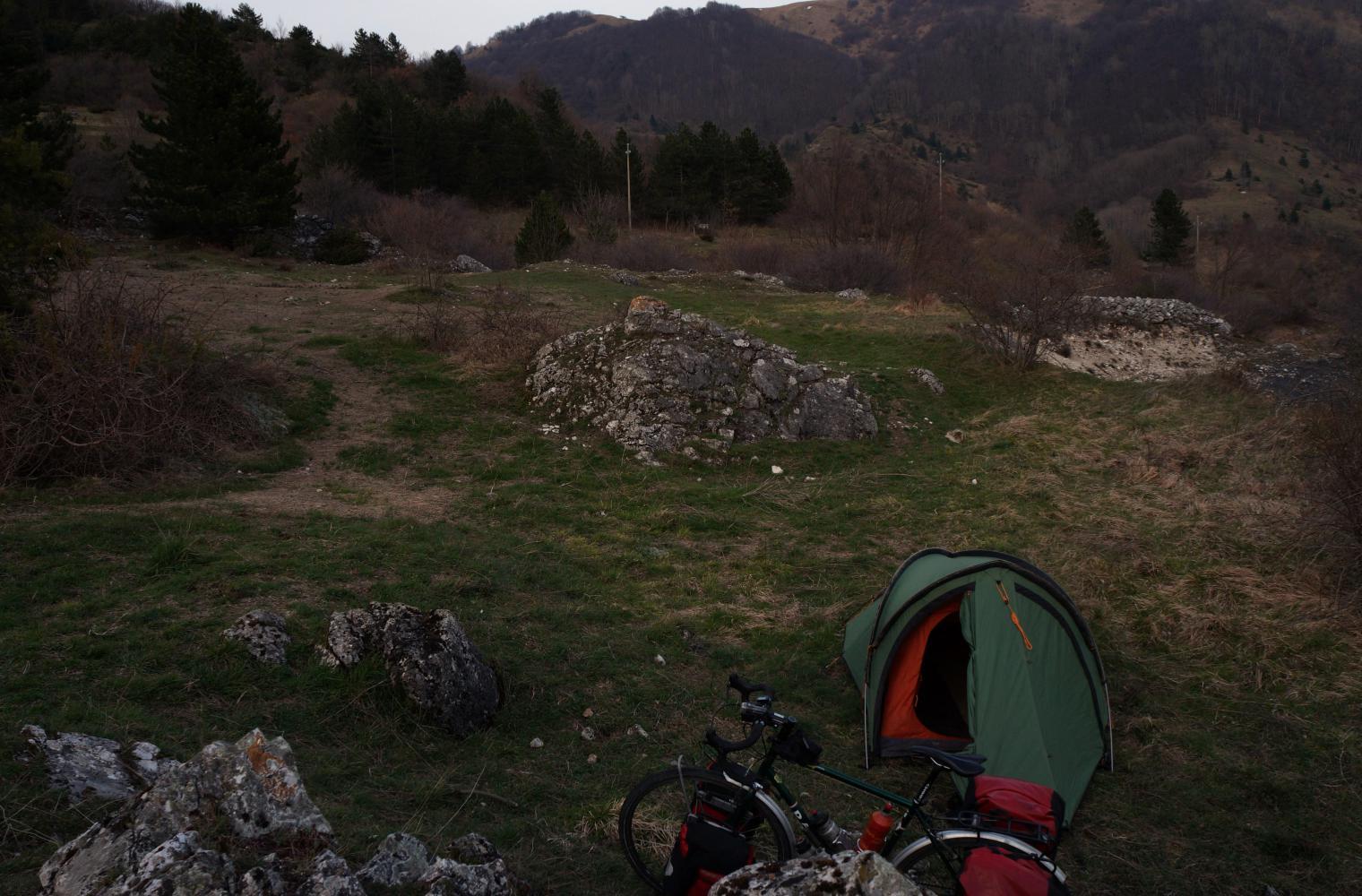
I drop down a long way from cold barren mountain back to spring. And decide to find somewhere to camp before reaching a village, there being ample pine forest with open grassy areas between. I come to an old disused quarry by some historic stone tower and picnic tables; not a bad place; I push the bike up above the excavated hole and find a level area to set up camp for the night.
Today's ride: 58 km (36 miles)
Total: 2,728 km (1,694 miles)
| Rate this entry's writing | Heart | 0 |
| Comment on this entry | Comment | 0 |