September 9, 2011
Sending him up.
The further south I cycle and the later in the season, the shorter the hours of daylight. Sunrise is now at seven thirty; though this morning was overcast, at lease it meant the the tent was dry. The forest I camped in was only a few kilometres after Yssingeaux, the town starting with Y which I couldn't see the rest of the word last night. You see I was looking at the map in the dark using the head torch for light and it's therefore next to impossible to see print on a map in such light with my eyesight. On the map too, the road that I began on this morning was two parallel lines with white in between, usually the most minor of roads; but no, this road had a steady flow of commercial traffic, trucks and white vans. Just as much traffic as an autoroute; at lease an autoroute would've been safer, what with it's hard shoulder, whereas this road had none. It was frightening, but it wasn't long until I came to a turnoff, for a place called Tence, the next town on my planned route. It took me away from the heavy city of Valence bound traffic, along a quiet rural road.
Not having had a shower since I left Rennes, which is ten days ago, I am therefore beginning to suspect that I smell not so good. I smelt the slurry that a farmer has spread on a field, but I think the smell actually may be me. Is it me? I ask. The smell of slurry lingered and wouldn't pass. Eventually though, the smell faded, and then, I was passing plastic rapped round bales, whereupon the unpleasant smell was replaced by the sweet smell of fermenting grass silage. I thought then that perhaps I smell not so bad after all. I suppose in any case at a distance of one metre, which is the distance I back off-not allowing anyone to get any closer, people cannot smell a thing.
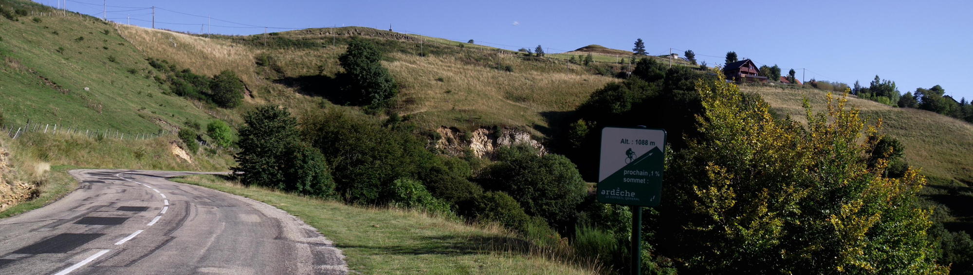
The white yellow topped pillorbox kilometre markers, whereon is the road number, D105, and the number of kilometres from a given point, here too they have the altitude (Alt). The pillorbox before the town of Yssingeaux yesterday had Alt829 and now I've passed a pillorbox with Alt1020, that is higher than any mountaintop in Ireland; but here, a thousand metres over sea level, unlike a lower though bleak mountaintop in Ireland, is pleasant rolling landscape with copses of trees. I imagine though that winter is long with a fair covering of snow.
I descended down to Tence, which at first looked like a quiet village, entered by an old stone humpback bridge, where an old stooped woman, the only person I saw in the street walked towards me. I turned left before the woman got so far, and cycled along a narrow street enclosed by houses of three or four stories with shuttered windows. I stopped at the boulangerie, and when I'd done cycled on to where the street led to a busy town centre, wherein I stopped and sat on a bench outside the Maire (townhall), and ate a second breakfast of pain au raisin. There were the usual cafes with seating and parasols outside on the pavement; warm sunshine caused me to move to shade; and a backing delivery truck, with a spoken warning punctuated by a high pitched bleep, blocked the street and held up traffic.
Leaving town, the road when steeply uphill again, and straightaway, there was a big supermarche at the side, where I went to buy drinks for the day as it was going to be a warm day. It was already warm as I drank a treat of a cool Belguim beer outside the supermarche after I'd done; and also, this evening I would have to make do with bread and jam as I had finished the gas this morning.
The ride onwards, up the hill, continued on a quiet rural road, pass haymaking and pass curious brown and white milking cows. I saw a herd of milking goats strip grazing a lush pasture. Goats aren't farmed much commercially in Ireland, which is a pity, as.the cheese is nice and I like goat meat too.
I passed a sign marking The department boundary, whereby I passed from the Department of Haute Loire into The Ardech, and a kilometre further stopped at the information welcome board, whereon a map of the department, there were lots of skier icons marking location du ski: as already said, I can imagine that much of what I'm looking at is regularly covered with a thick blanket of snow come winter.
In early afternoon, I cycled through a deserted village, Saint Aguiere, and turned for a place called Le Cheyard, whereupon followed a long swoop down into a deep gorge: Sharp lefthand bend was followed by sharp righthand bend, I let the bike go pretty fast, riding a straight line through the wrong side of the road on bends as there wasn't much chance of meeting a car on this quiet road. Turning a bend, I saw a village with it's church spire below amid the pine trees. Freewheeling down into the village, pass the church door, I saw that this church like many in France had a water tap and picnic table for the weary traveler. I sat down to lunch and pondered the milk of human kindness that I feel is so present in France, these facilities at churches are but one example. A woman walked round the corner of the church and pass saying a friendly bonjour. The bell clanged half past one and then I packed away; cycling further through the empty village street and continued descending into the gorge.
I eventually reached Le Cheyard where I turned right toward Valon Les Bain and a road that would inevitably climb again; also, a road that had a green cycle route sign pointing ahead. Leaving town and already riding uphill, pass old derelict bars with fading advertisements from yesteryear on gable walls, when I saw coming down the opposite side of the road, a heavily leaden touring bike, shortly followed by a second. The front bike was piloted by a small guy and the following bike a tall guy, neither seemed happy and neither of them nodded nor did they look the type to crossover and chat.
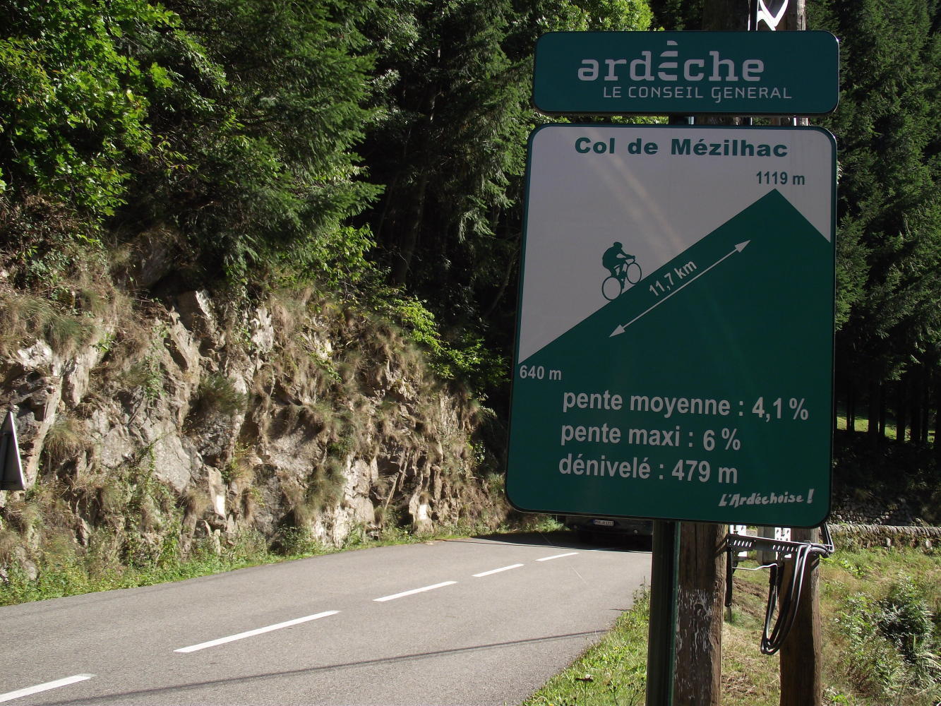
The occasional green cycle route sign pointed ahead; the road was slightly uphill, cut across a near vertical wooded slope facing a wall of patchy wooded hills opposite. The road got steeper though with nowhere for the road to go at last but up; thereupon at the first steep straight, was a large green board sign for cyclists, whereon was a green pyramid representing the hill with a little cyclist going up it; and numbers, indicating the gradient, the altitude and the number of kilometres to the top. It was eleven kilometres, from an altitude of 640m to 1119m; I thought this longish climb would be a good test for the single-speed gear, but as the gradient wasn't greater than six per cent which is hardly anything, I could turn the gear with ease, and also I stopped awhile to take photos of myself riding uphill, making it look hard. The board signs continued at every kilometre, counting down the kilometres left to the top, and a kind of an aid at pacing myself.
This evening I've camped a little down from the summit, having come upon a track opened by forestry machinery alongside a stream, in off the road from a hairpin bend, to a clearing with stacks of logs.
| Heart | 0 | Comment | 0 | Link |
| Rate this entry's writing | Heart | 0 |
| Comment on this entry | Comment | 0 |