April 28, 2007
The Mississippi River Levee Trail
I had to come back.
The solo bike tour I had taken along the Gulf of Mexico coastline in April of 2006 was an experience that had a profound effect upon me.
This time, an old friend and cycling partner, Stan, decided to come along. Our tour started in Kenner, Louisiana, a western suburb of New Orleans. It is also where the Louis Armstrong International Airport is located. We would be taking several days to get to Pensacola, Florida. All of the pre-planning details had been worked out and were falling into place nicely. The evening before our tour began, Stan and I had a fun dinner at a local restaurant/bar located near 32nd Street in Kenner. The parking lot was made up of oyster shells, the food was good, and the people friendly. The trip was starting off well!

| Heart | 0 | Comment | 0 | Link |
The next morning, we rode over to the Mississippi River Levee Trail (MRLT), which has a grand trailhead and park in Kenner. Our plan for this first day was to ride the portion of the MRLT in the Greater New Orleans Area. There, the trail is mostly on top of a levee protecting riverfront communities from the mighty Mississippi, when Mother Nature decides to make the river mightier than usual.
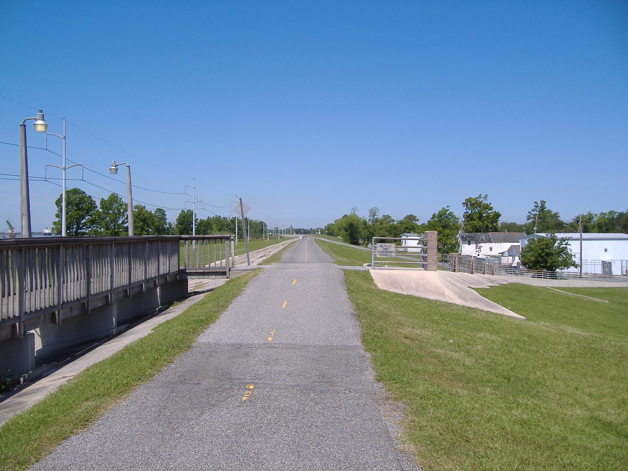
From the Kenner area, the trail is mostly paved going East toward New Orleans. Heading West, the pavement turns to gravel. We began our day by heading West. I wanted to go as far as where I left off in 2006, which was near the town of Luling. We ended going a little further to an industrial area called New Sarpy. We went that far and then turned around to began heading East. Our loose goal for the day was to make it to the areas in and around Audubon Park in New Orleans. From there, we would head back to our hotel in Kenner. The journal for this day will describe the ride from West to East, even though the actual ride was made up of two out-and-backs from Kenner.
| Heart | 0 | Comment | 0 | Link |
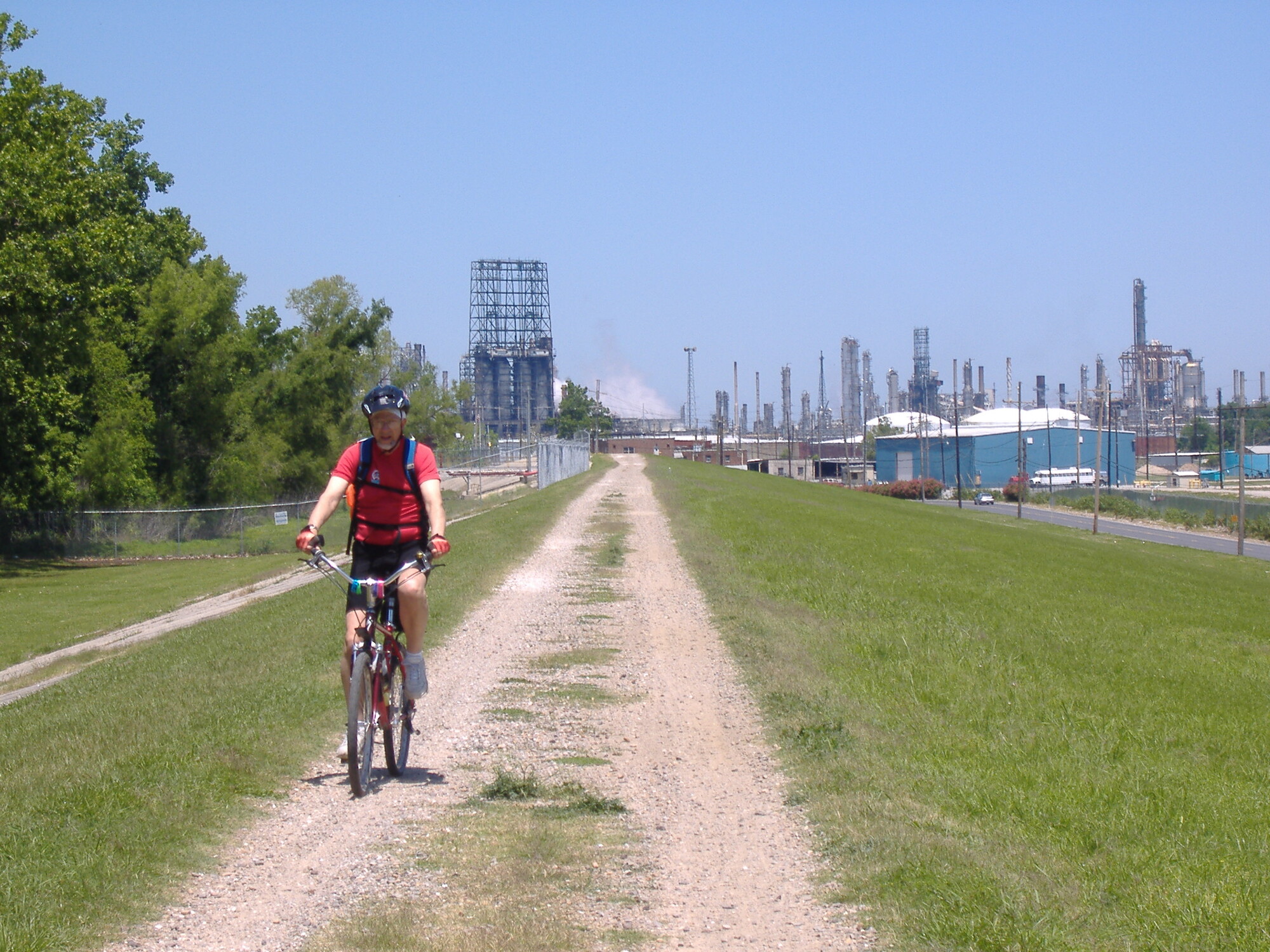
The trail was gravel in the Western portion that we rode. We were riding hybrid bikes, which came in handy because there were some rough sections. We passed under the I-310 Bridge, at Luling, where the 2006 tour had concluded. Although I mistakenly rode on I-310, last year, it is illegal. Since I wasn't going to repeat the error this year, we did not cross the bridge into Luling.

| Heart | 0 | Comment | 0 | Link |
On the opposite shore from Luling, are the towns of Destrehan and Saint Rose. From the levee, they appear to be a pleasant, tree-lined communities. What struck me is the Mississippi River surface is at least level with them and might even be slightly higher in elevation. This levee is vital to their survival and to that of several other communities along this path. A fellow we met told us that during Katrina, the river was near the top of the levee. To have seen that must've been terrifying!
The Destrehan Plantation is beautiful and is seen along Louisiana Route 48, the road that runs below and parallel to the levee. Seeing it took my mind off of the horrible vision of the river flooding the town.


| Heart | 1 | Comment | 0 | Link |
Kenner is the next community reached along the trail and was where we started out on this ride. It too seems to lie below the river level. I would feel vulnerable living in such a place but there are many people out in these river towns, going about their business. I suppose when living in such places, you take the precautions you can control and then get on with your life. The area is active and there seems to be ample employment with the heavy industry, the airport, the river, the railroad, and service industries.
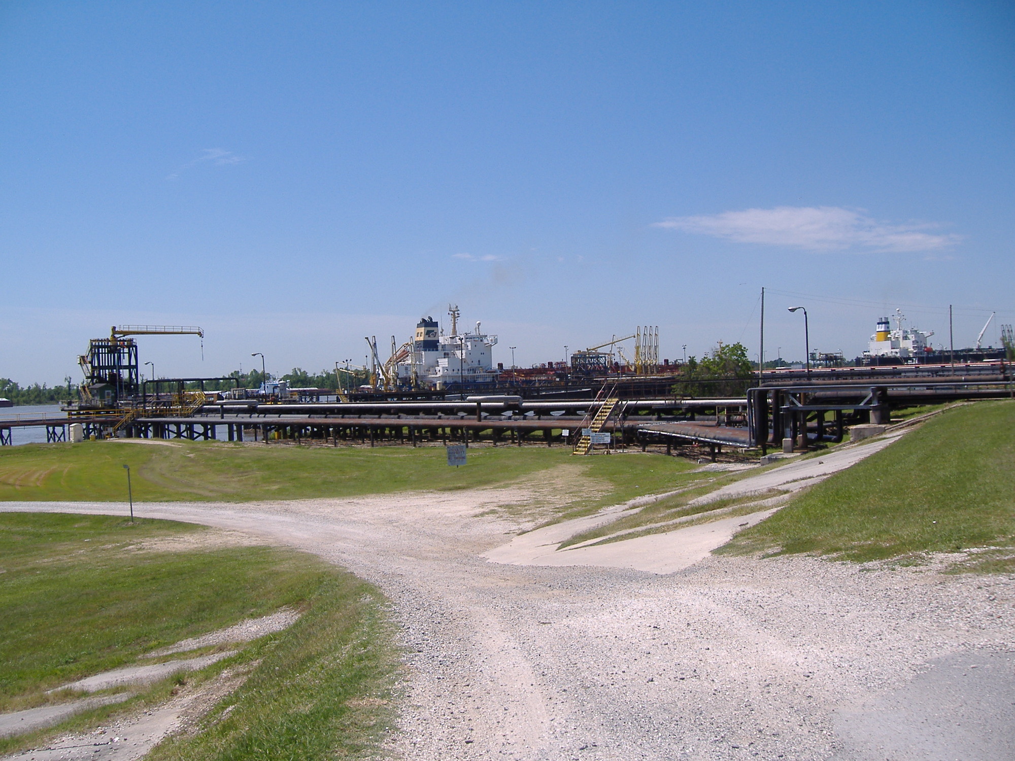
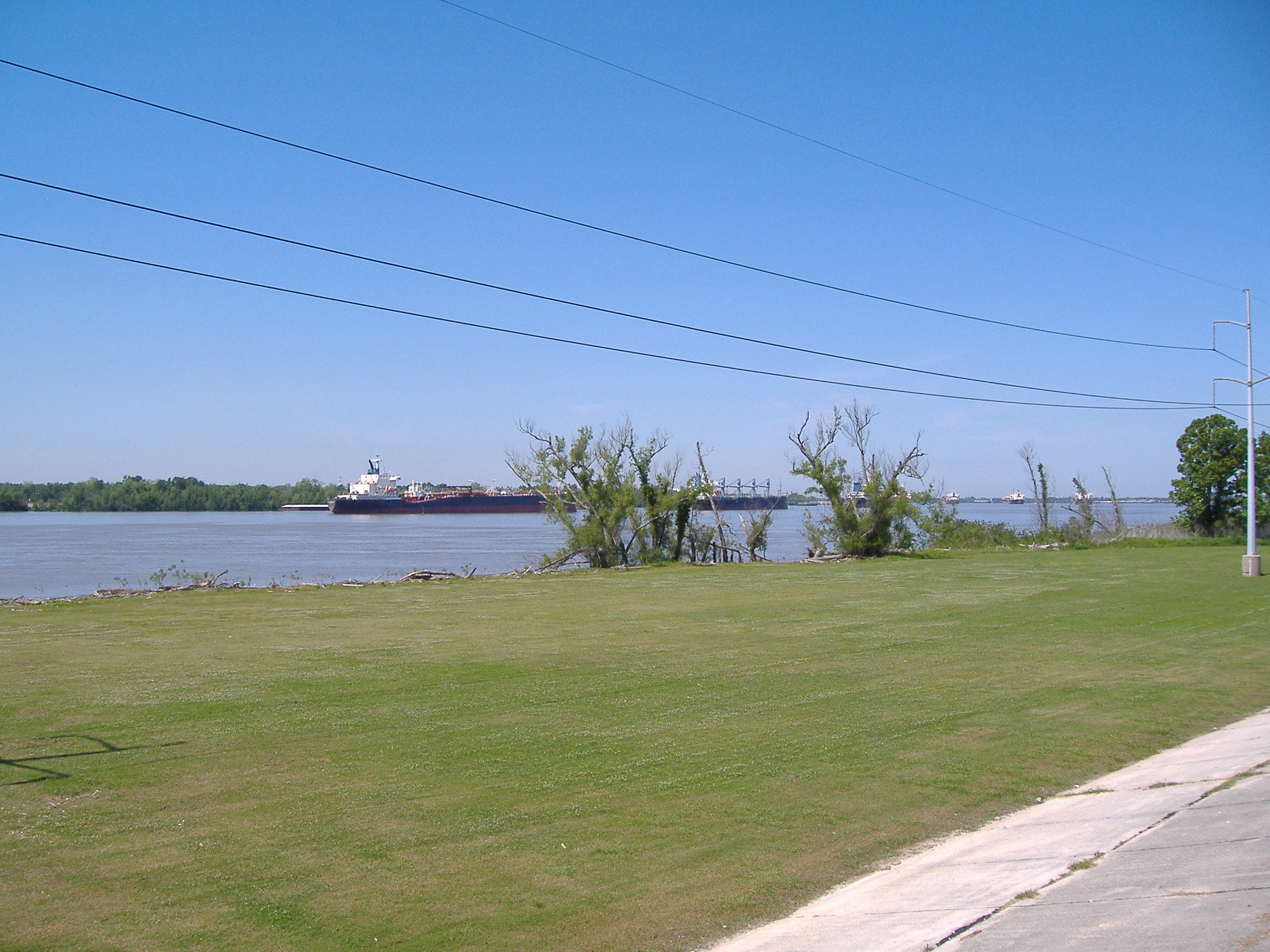
The Mississippi is a wide and deep river here in Louisiana. After having drained most of the Eastern Half of the United States, the river here is getting close to its mouth at the Gulf of Mexico. Huge ocean-worthy vessels are seen frequently and they are keeping up a good pace. One passed me as I was riding along the levee. I sped up but couldn't catch it.
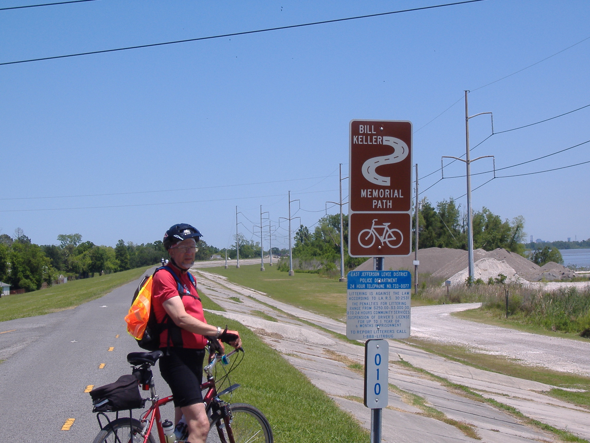
The levee trail is actively used. We routinely saw walkers, dog walkers, runners, and other cyclists. At least part of it is called the Bill Keller Memorial Path.
Spring was just coming about when we left Pittsburgh, but here in Louisiana, flowers were everywhere along the trail. I was excited to see them and took a few photos.

Huey Long, the Kingfisher, was colorful, controversial, and a former Governor of Louisiana. In Jefferson Parish, a massive bridge over the Mississippi River is named for him. The trail passes directly underneath the structure that carries motorized vehicles and trains. I'm not sure how much steel it took to build it but I'm certain it kept a blast furnace roaring for a good while.

We passed an Archer-Daniels-Midland (ADM) grain terminal where there was a constant fine mist of water spraying over the storage structures. A shipping agent was standing nearby and we struck up a conversation. He recounted the Westwego Disaster that occurred here in 1977.

| Heart | 0 | Comment | 0 | Link |
It seems that when storing grain, a fine, dry, and highly flammable powder fills the air. The disaster happened when the powder ignited and a huge explosion killed people and destroyed property. Since that time, the water sprays are employed to keep the dust down and to prevent such events from occurring.
The trail continues along, passing beside and above communities on what I would call its Eastern Shore. Which direction the compass needle might've been pointing could have varied widely with our position along the big bends in the river. We could see people's homes, businesses, communities, and activities. At one place, there was another plantation. We even saw a Saint Patrick's Day Float that was still decorated even though all of the green beer had been consumed approximately 6 weeks before our arrival.

We eventually reached the end of the trail and got onto roads through what is called Audubon Park. The area was beautiful and did not appear to have been significantly damaged by Hurricane Katina. It was a nice day and people were out and about in the park. Tulane University is nearby and it appeared some students were relaxing in the park as well. We cruised around on several roads and paths in the park, not exactly knowing what we were seeing. Several times, we crossed paths with another cyclist and we stopped to ask him questions. He was gracious and knowledgable about the area. After several such encounters, Jim decided to ride with us. He had a wealth of information, which he shared as we rode through the park, out onto Magazine Street and then back to the levee trail. He rode most of the way back to Kenner with us before turning around for home, in the city. We enjoyed his company, thanked him, and wished him well.

| Heart | 1 | Comment | 0 | Link |
After that, we returned to our hotel, got cleaned up, went out for another meal of local cuisine, and then back to our room to prepare for the morning. It was a good day and a great start to our tour.
Today's ride: 56 miles (90 km)
Total: 56 miles (90 km)
| Rate this entry's writing | Heart | 2 |
| Comment on this entry | Comment | 0 |