November 22, 2013
Maps (or not)
From the point of view of figuring out which way to go, this trip compared to others ought to be pretty simple. For one thing, the U.S. has a lot fewer towns and roads than what we have been wending through recently in Europe, and the roads tend to be fairly long and straight. Next, there are the famous Adventure Cycling (ACA) maps for the Southern Tier. Just get on to those and in principle you are away. So how can it be that I am writing a whole page about maps, and casting a shadow on it with the suffix "(or not"?
The starting point is the fact that our starting point does not correspond to either St. Augustine or Ft. Lauderdale, which are terminal points of the ACA Southern Tier and Florida Connector routes. Also, while the Florida Connector "connects" to St Augustine, if you are starting in Key West (south of Ft Lauderdale), heading to St Augustine does not seem a very efficient way to get going toward San Diego.
For those familiar with Florida, this is all pretty obvious, but anyway, here is a map view of the situation:

| Heart | 0 | Comment | 0 | Link |
The green line from Key West all the way up the east coast is part of the ACA Atlantic route. From around Miami and zooming over to the west side at Fort Meyers, then back across to around Jacksonville is the Florida Connector. And from around Jacksonville and heading to Gainsville and Tallahassee is the eastern bit of the southern tier.
It does seem like ACA has Florida pretty well covered! But still, we were not happy. Rather, we consulted the almighty Google, and accepted a route straight up the middle. You can see it, starting at Key West, going up west of Orlando, and hitting the ACA near Gainesville.
OK fine, so we're going that way. But we don't have the ACA Atlantic maps (which cover part of the way) and as I am saying, we are not generally following ACA in Florida.
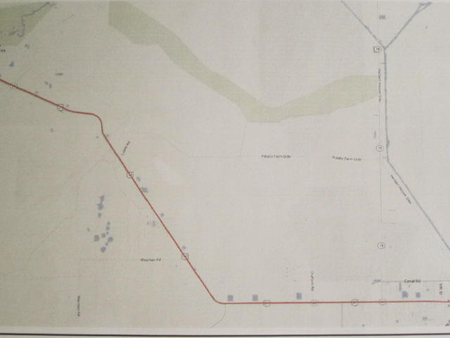
What we do have for a map is the Automobile Association road map (got these for all the states we will pass through). It's a good map, but despite the earlier disclaimer that the roads are few and straight, there are actually a few hundred turns involved when you get down to it. That requires better maps than just a statewide road map.
So how about screen prints of the same Google Maps that supplied us with our cockeyed route in the first place? Well, as we have found in past years, Google Maps do not print worth a darn. Even as you zoom in, place and street names remain tiny, and are basically unreadable on paper when the map is otherwise at a sensible scale.
So we went ahead and bought another mapping solution, something put forward by National Geographic, sold by REI and available at alltrails.com. This is billed as the "Ultimate Outdoor Map Kit". It is supposed to make "planning your next adventure with maps easy and fun"!
There are quite a few mapping applications around, from Mapmyride to Garmin Basecamp to GPSies, etc. What attracted us to Alltrails was the claimed focus on printing high quality maps, and the inclusion in the package sold at REI of weatherproof printer paper.
Unfortunately, Alltrails turns out to be based on Google Maps, and the printed products are equally unreadable! One thing Alltrails can do, though, is to both import and export GPX files. Exported GPX will show routes that you can enter by clicking them in, point by point.
| Heart | 0 | Comment | 0 | Link |
So what we did, aside from printing out the inadequate maps, was to click in the Google route and then export that to the Samsung S3 that will be sitting on Dodie's handlebar and serving as a GPS.
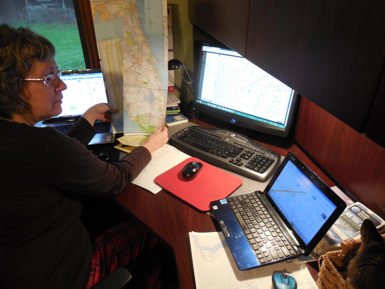
What all this means is that instead of watching Christmas specials on the TV and waiting for the arrival of the family and the holidays, we are sitting in front of not one but two or three hot video screens, fooling with paper maps, Google maps, and GPX tracks. When not doing this, we are reading Crazyguy blogs written by clearly much more easy going cyclists, who are just cruising up and down Florida seemingly without a care!
Here is the view from (our) home:
| Heart | 0 | Comment | 0 | Link |
Once we leave Florida, one would think any mapping trauma is over. Not so. It turns out that Dodie has a mega aversion to maps where north is not up. Aversion is actually a mild term. We almost have Dodie pacing around carrying a sign that could read "Up with North". With ACA, unfortunately, they try to put north up, while fitting each map into their standard 3x6 inch format. Often they are not successful, and sometimes north is even pointing down.
I suggested to Dodie that we could fix her problem about where North is by confiscating her compass. Needless to say, this did not get a favourable reception! Instead, we are scanning the ACA maps and often reprinting them with the orientation changed so that north points at least vaguely more up.
There are 107 maps in the Southern Tier. When did we say we are supposed to leave on this trip?
| Rate this entry's writing | Heart | 0 |
| Comment on this entry | Comment | 0 |