January 2, 2016
Port Charlotte to Sarasota
I woke at a reasonable hour, 7:30 or so, but took my time getting ready to hit the road. It was overcast and cool out, so I decided to wear a long-sleeve base layer as my jersey. Good call, as it turned out. I pushed off late . . . 9:30 or so and headed straight for breakfast, which was not far off the planned route, Cozie Cafe, just a little over a mile down the road!
It was a good, hearty breakfast and perfect for the day's ride. In particular, the home-fried potatoes were excellent. Again, I took my time, as today's ride promised to be long but easy, without the hassle of riding on a major highway for too long. The first 20 miles would be on mostly residential streets that paralleled US 41, and then 10 miles on US 41 (there were no reasonable alternatives) before picking up a bike trail that would take me within 10 miles of Sarasota. Easy riding the whole way.
So off down Edgewater Drive I went, a very quiet road with lanes wide enough to cycle comfortably. And everything was fine until I hit my first roadblock!

| Heart | 0 | Comment | 0 | Link |
Closed roads (and bridges) don't bother me much. I recognize that they can often be negotiated around or over. Road closures are for cars! Of course, sometimes that is not the case, but this one I could clearly navigate by bike or foot. After all, there was construction equipment parked on it! But before I went too far, I checked Google Maps for alternate routes through the neighborhood. Many of these communities have waterfront access, with lots of canals and waterways . . . hence the name of the street: Edgewater Drive. But few bridges!
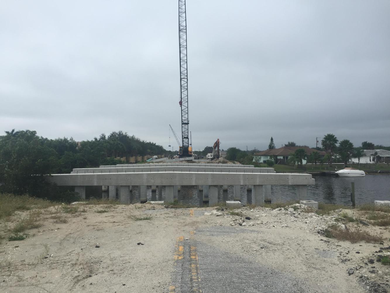
So my research indicated that, yes, I could cross this bridge and still find an alternate route through, even if the next crossing could in fact, not be crossed. And it couldn't be!

| Heart | 0 | Comment | 0 | Link |
| Heart | 0 | Comment | 0 | Link |
This was a larger bridge and in full reconstruction mode, something I suspected when I saw the tall cranes up ahead. So backtrack I did, but only half a mile at most. But the next crossing was on US 41! Boo. But it proved pretty painless, as I was only on it for a short distance before returning to my residential neighborhood. Cochran Boulevard turned out to be relatively bike-friendly and led me straight to Route 776, Veteran's Boulevard, and my route recovery at Fleming Boulevard, only half a mile away.

| Heart | 0 | Comment | 0 | Link |
| Heart | 0 | Comment | 0 | Link |
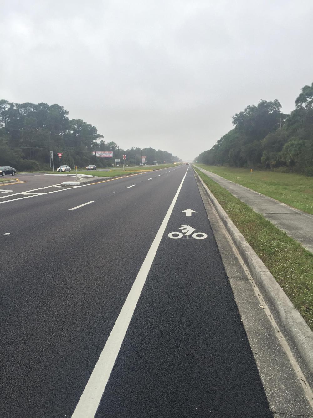
I was a little worried about Route 776, but as you can see, it had a nice bike lane. And after a short distance, I turned off onto Biscayne Drive, which I followed for a good long ways, maybe 6-1/2 miles, through mostly nice residential neighborhoods as well.
At some point, it started to rain. I don't recall when it started or when it stopped because it was so light. So light, in fact, that I didn't bother with a rain jacket. It was also much warmer now and humid. Although my Garmin says otherwise (it indicates it was now in the low 60s). I suspect it was just the heat generated by the cycling.
At the end of Biscayne Drive, it was back on US 41. I had approached from the south side and discovered a nice sidewalk/bike trail that was offset a good distance from the mainline lanes and jumped on it.

Normally I don't like riding on sidewalks, but this one had long runs with few breaks. And the breaks were at major community developments with little traffic, not a street grid system where you have frequent interruptions. And there was no rush today. As you can see in the photograph, even the rain had stopped.
Unpredictably (of course), the south sidewalk/trail ran out, and I biked the north shoulder for about three miles before discovering a parallel sidewalk/trail on the north side. And discover is the right word since the pedestrian facilities are hard to see from the mainline shoulder.


| Heart | 0 | Comment | 0 | Link |
This improvement is part of the adjacent development's contribution to making US 41 more accessible. Unfortunately, it starts in the middle of nowhere and ends in the middle of nowhere. The connectivity will need to wait for either more development or more state and/or local funding!
The good news was that I was getting close to Venice, Florida, and the area was getting a bit more "urbanized," and a bike lane reappeared! After another three miles and turning onto US 41 Business, I accessed the Venetian Waterway Park and 12 miles of leisurely riding into south Sarasota.
| Heart | 0 | Comment | 0 | Link |

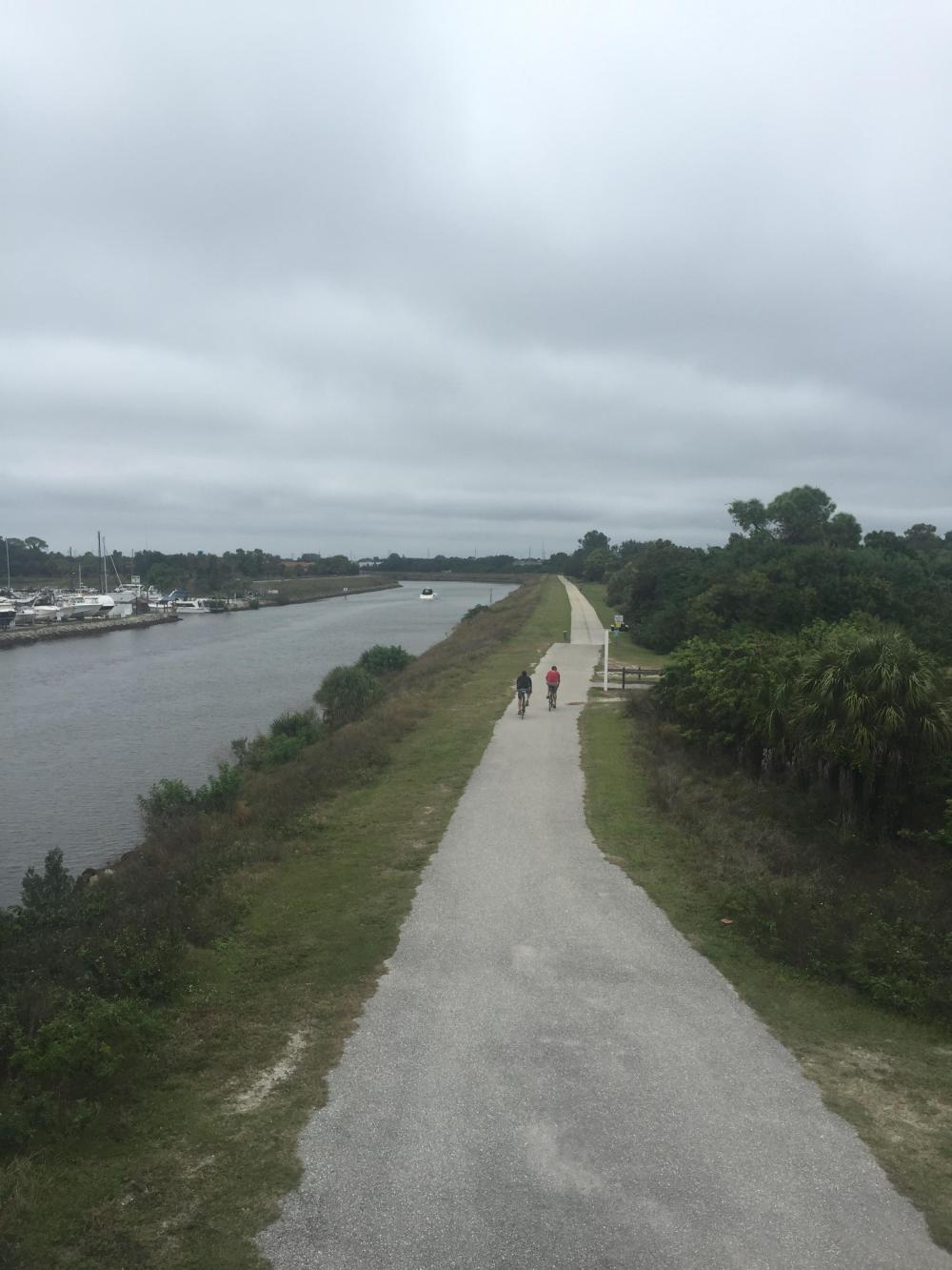
After a short distance, the Venetian Waterway Park connected to The Legacy Trail, a rail trail that is nearly complete. I exited just before Culverhouse Park and the current terminus of the trail. It's a nice facility and well worth a ride if you are in the area and so inclined. Eventually it is planned to extend it a further eight miles into Sarasota!


| Heart | 0 | Comment | 0 | Link |

| Heart | 0 | Comment | 0 | Link |
Exiting at Culverhouse Park placed me on local roads in the southern suburbs of Sarasota. Mostly they were fine, and as I approached closer to the city center, there were plenty of bike lanes to use. Sarasota looked interesting on the way in, and I will have time to explore as I meet my friends here, and we are staying here for a week of local cycling! I arrived at 4:30 or so, but they do not get in until after midnight! I will be well asleep by then!
Today's ride: 57 miles (92 km)
Total: 374 miles (602 km)
| Rate this entry's writing | Heart | 1 |
| Comment on this entry | Comment | 0 |