June 30, 2015
New London, NH to Chester, VT
It was bright and sunny and in the low 70s when I headed out for breakfast at 9:00 AM. Another sleep-in, but I was only doing 50 miles today, so no rush. Breakfast was at MacKenna's Restaurant, only 1/2 mile down the road in the direction I was headed. So all was good.
| Heart | 0 | Comment | 0 | Link |
Most of today would be on NH-11 and VT-11. But there would be a few diversions. Traffic was OK and got better once I passed the I-89 interchange. I was also in the Lake District, so there was lots of nice lake scenery.

Shortly, after about 13 miles, I arrived in Newport, NH, a quaint little village with a nice town center.

| Heart | 0 | Comment | 0 | Link |
I then made my way to the Sugar Rail Recreational Trail that would take me all the way to Claremont, a ten-mile distance. I could have continued on NH-11 but, so far, had good experience on the rail trails in New England (northern Maine being a major exception) and wanted to give this one a try. Unfortunately, it was not to be. I should have known that when I reached the trailhead.

| Heart | 0 | Comment | 0 | Link |

| Heart | 0 | Comment | 0 | Link |
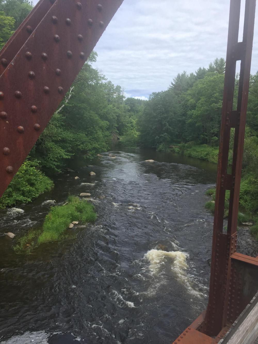
The trail looked a little rough but manageable. And it had just rained a bit, so I continued. I had ridden rough trails before, and the day was turning out beautiful, and this trail followed a river. But I didn't go too far before I hit my number one problem. Sand.

| Heart | 0 | Comment | 0 | Link |
I don't understand the thinking here. There were places where the sand was so deep it was impossible to ride a bike. There was serious risk of slipping, sliding, and falling. So I kept my left foot unclipped. But the riding was painfully slow, and even when I was able to pick up speed on the good sections (usually on the outside edge of the trail), I had to keep my attention focused on the trail, looking for sand patches, ruts, and gravel. Why? Observe this sign for permitted uses:

| Heart | 0 | Comment | 0 | Link |
Mixing mechanized vehicles with hikers and bikers is never a good idea (IMHO). Mechanized vehicles tear up the trail. And some, I suspect, enjoy a torn-up trail since it is more challenging and fun. So constant maintenance is required. And with limited funds, good maintenance seems to be lacking. While this is advertised as a trail for bikes, they should be more upfront about trail conditions. That said, there are great views along the way.
| Heart | 0 | Comment | 0 | Link |

| Heart | 0 | Comment | 0 | Link |

| Heart | 0 | Comment | 0 | Link |

| Heart | 0 | Comment | 0 | Link |
Eventually, the trail put me in Claremont, NH. From there, I returned to NH-11 and followed it mostly downhill to the Connecticut River and the border with Vermont!

| Heart | 0 | Comment | 0 | Link |

| Heart | 0 | Comment | 0 | Link |
From there, it was an easy ride to Springfield, only four miles down the road. And most of that was on a bike trail . . . a PAVED bike trail. And from Springfield, only eight miles to Chester. But I was also hungry, so I stopped at a Subway (all I could find) and chowed down. Just long enough for it to start raining! But that was OK. I had a paved path to Springfield!

Finally on to Chester, which was all uphill. But mostly gentle climbing. Except in Springfield, where I had routed myself over the inside bend in the river, and the climbs there were very steep. But back on what was now VT-11, it was pleasant riding, and I covered the last seven miles pretty quickly and effortlessly.
Chester is a cute town, and the Fullerton Inn was a good choice and well located.

So after getting settled in, I wandered down the street to the local pub to relax and enjoy the evening. Getting to Chester had taken a bite out of the climb over the Green Mountains, and tomorrow would be a relatively short day, 30 or 35 miles, and then I was done! Time to relax over the July 4th weekend and enjoy my visit with John and Randy.
Today's ride: 47 miles (76 km)
Total: 3,434 miles (5,526 km)
| Rate this entry's writing | Heart | 0 |
| Comment on this entry | Comment | 0 |