July 26, 2025 to July 27, 2025
Vallum Lodge to Alston and a bit about Hadrian’s Wall
| Heart | 0 | Comment | 0 | Link |
Everybody comes to this area for one of two reasons: (1) the walking along Hadrian’s Wall and/or: (2) the Roman History associated with the forts.
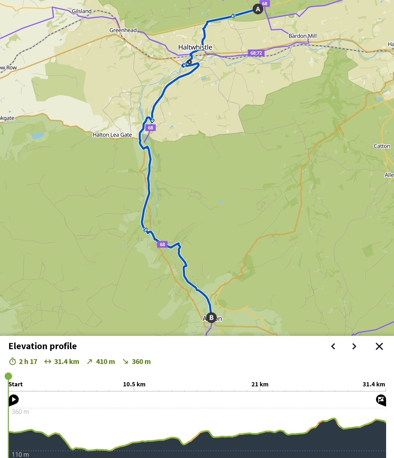
Although there is a Hadrian’s wall cycle route, you can’t really cycle along it (it wanders in and out) and so if we wanted to see the Wall we realized we would have to make a specific effort. Accordingly, at the Sill Center yesterday we asked about the easiest way to do that. We learned there was a nice 2 mile walk from the Sill Center, so that sounded like the ticket.
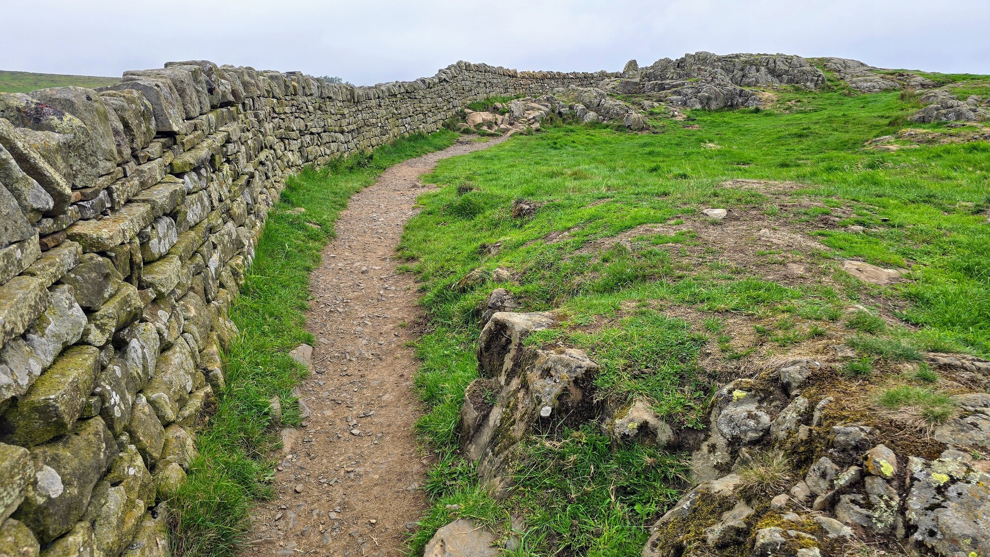
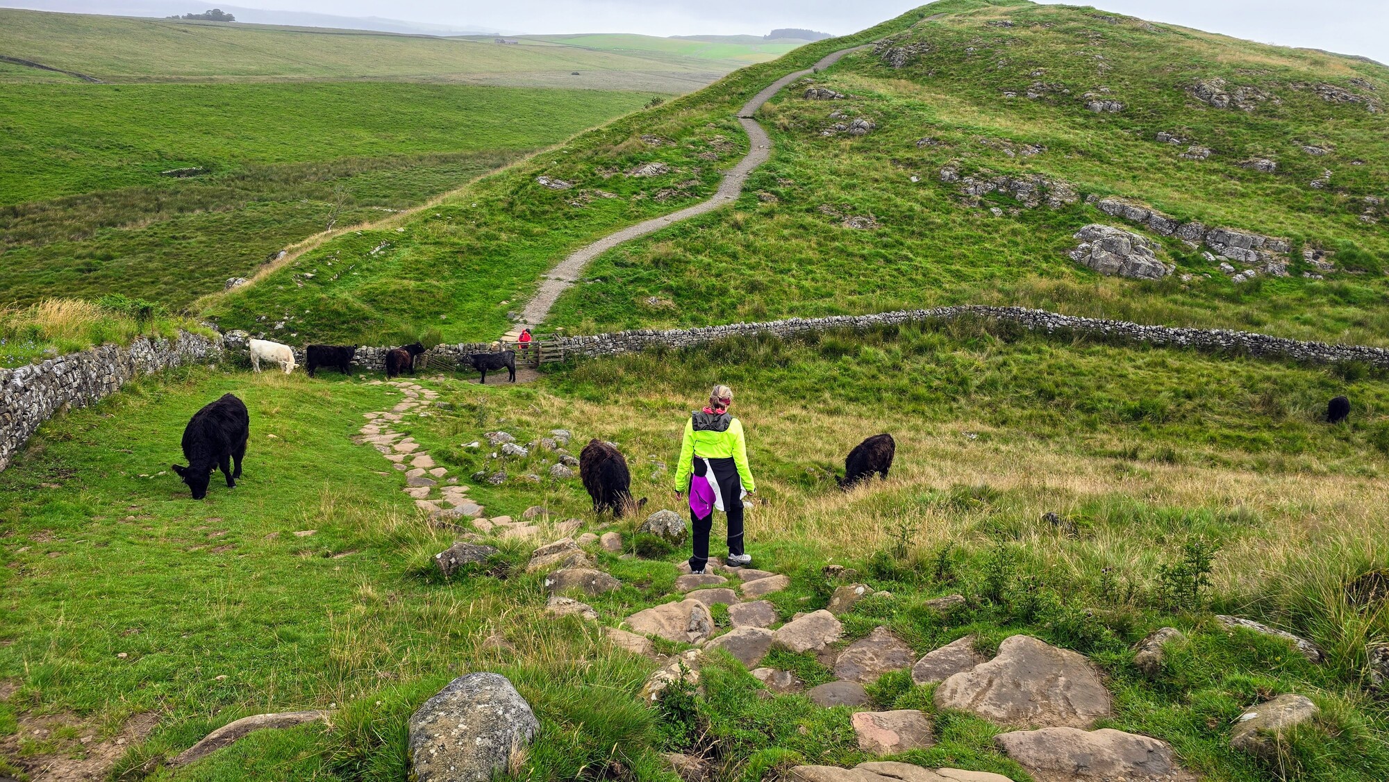
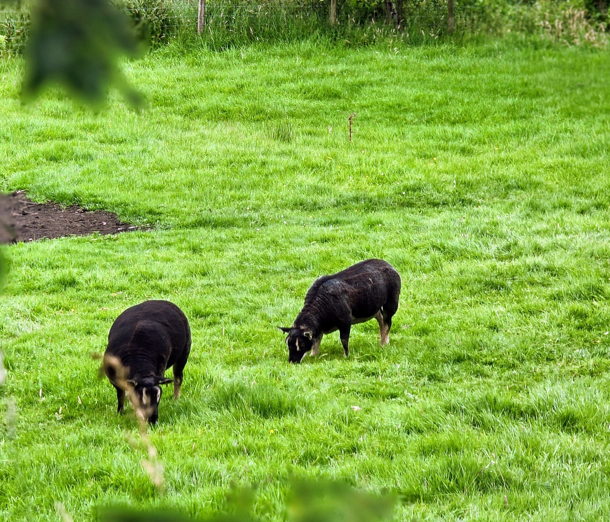
The walk was considerably more demanding than described, it being immediately uphill along a road to reach the escarpment where the Wall begins. We maneuvered through two gates (a common occurrence here in Britain) and then some steps up that were on a pretty stiff incline. The cows were communing along the path and at the various gates and we had to work around them and their fresh cow chips. The weather had deteriorated so it was windy with a few rain splatters - the usual British weather. We did get to see Hadrian’s wall, and it was pretty cool.
| Heart | 0 | Comment | 0 | Link |

| Heart | 1 | Comment | 0 | Link |

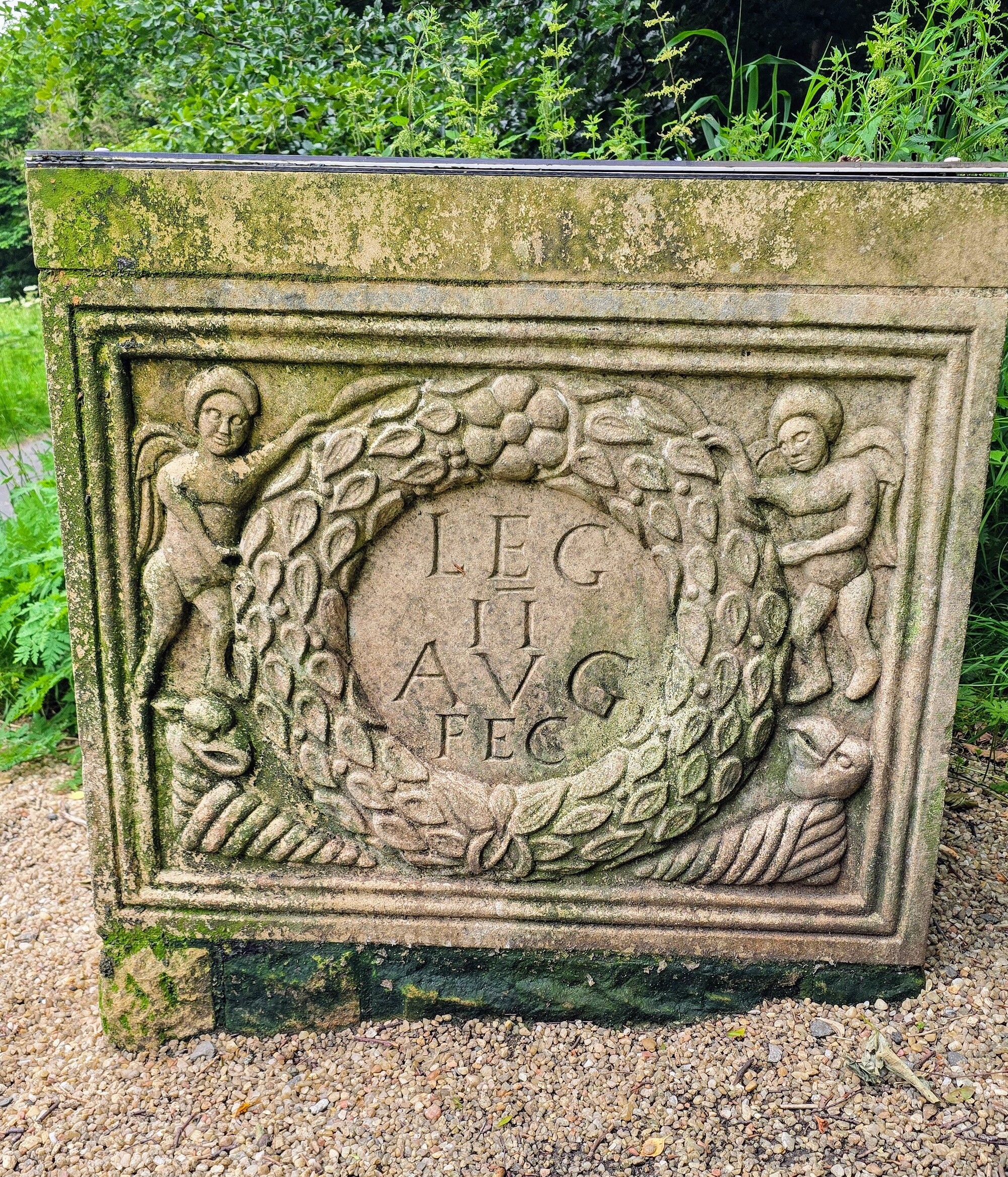
So what is the fuss about Hadrian’s Wall? Hadrian was the emperor of Rome from AD 117 to 138 at a time of increased turmoil in Britain. The southern Briton tribes were pretty docile to Rome’s rule, but not so those ornery Scottish tribes in the North. On a visit to the area, Hadrian surveyed the scene (historians think he stayed at Vindolanda) and determined a 70 mile stone wall should be built across the center of Britain as a defensive measure. (There is speculation that he had heard about the Great Wall of China).
It seemed like a monumental task but it was accomplished in six years, and the work was done by Roman auxiliaries stationed at the various forts nearby - such as Vindolanda and Housesteads.
During Roman times the wall was 7 to 9 and a half feet wide and between 12 to 15 feet high. Along the wall were a series of forts, milecastles and turrets, where Roman soldiers lived to defend the wall and the frontier.
What remains and what we could see are portions of the wall, but John (the archeologist we met at the Pheasant Inn a few days ago) said the walls we see are actually reconstructed; the stones were used originally in the Wall but fell over and they were “put back.” Along with that reconstruction, the top stones were added to discourage people from walking on the wall. Honestly, we couldn’t tell much difference between Hadrian’s Wall and the zillions of stone fences in the area.
| Heart | 0 | Comment | 0 | Link |
A few years later the next Roman Emperor Antoninus Pius built the Antonine Wall between the Firth of Clyde and the Firth of Forth, far to the north, in today’s Scotland. One month ago (on June 27) we came across a piece of the Antonine Wall on the day we rode the Firth and Clyde canal towpath from Glasgow to Bo’ness. We took a picture of the plaque, thinking to look it up and learn about it. I forgot about it and seeing Hadrian’s wall reminded me to do so!

| Heart | 1 | Comment | 0 | Link |

The Antonine wall, constructed of turf, on stone foundations, was intended to supersede Hadrian’s Wall but was abandoned only eight years after its completion. Hadrian’s Wall on the other hand, served as a defensive barrier for the Roman Empire in Britain until the fall of Rome in the fourth century.
After that, much of the wall was scavenged and the stones were used as building materials for medieval builders, including by English General Wade when he directed the construction of military roads north to Scotland to quell the Scots after the Jacobite unrest in the 1700’s. (See my entry dated July 3, 2025; Alyth to Braemar, Item 64). Those military roads now form the backbone of the roads through Cairngorms Park.
In the 1930s it was recognized that whatever was left of Hadrian’s Wall should be saved so there was an effort at conservation. Okay enough history.
We are heading to the Lake District and will be taking three days to ride there. After breakfast we took off at 10:30 with our ultimate destination being Alston, a 1100 person village in the North Pennines National Landscape (another AONB). I had scheduled two nights there, on my campaign to minimize stress on Dave's knee and take it a little easier (for Jill too).
We continued on cycle Route 68, the Pennines Cycle way, and it continued to be very good with small roads, no traffic and near the end of the ride, we encountered a long gravel trail (in mostly good condition) called the South Tyne trail. There were many gates to manage, a British phenomena. Those of you who have ridden in Britain know what I mean!

The one exception to the goodness of the route was a 5 km stint outside Lambley Viaduct. I read that the landowner would not allow cyclists through his property, so the route goes back on the road (slightly busy but not too bad) and peels around to rejoin the gravel after Lambley Viaduct. It made me wonder how the cycleway was created - it sounds like eminent domain (or compulsory purchase, as its called in Britain) was NOT used, because an easement to allow cyclists to ride through could have been acquired that way.
| Heart | 1 | Comment | 0 | Link |
Midway through the ride we had our first flat of the trip. My front tire acquired a thorn. It was a relatively drama-free repair. We were on the gravel trail with no traffic and could easily pull over and manage the change. Nor was it raining or any of the other things that can make a fixing a flat annoying.

Shortly after that the gravel trail turned into a laughably narrow path at Slaggyford junction railway station and we had to dismount and squeeze our way through.

We arrived at the outskirts of Alston around 2 pm and since checkin wasn’t until 3pm we decided to ride into the town and book a table for dinner somewhere. My Google search hadn’t been too helpful at narrowing the field so we were more or less starting from scratch.
It’s funny about planning bike travel. When I look at places on the map, especially now with Google maps, I feel like I have a pretty good idea of what I am going to get. And sometimes we are pleasantly surprised… and sometimes we are not.
Alston is in the North Pennines Landscape and the village looked cute enough on google maps; there had been three or four inns that had looked okay and it wasn’t one of those stops I had been worried about.
But, what can I say, as we rode up into town (Alston is on a big hill) we were less than thrilled. It was our first English town that looked quite down on its luck. Many storefronts were boarded up and the place had a bedraggled air. Dave rode all the way up the hill and asked about a place for dinner and was told the Cumberland Pub at the bottom of the hill was a possibility. He rode back down and went in and inquired. Across the street I walked into the Alston Hotel and made the same inquiry. We managed to book one night at the Cumberland Pub and one night at the Alston hotel, but we were definitely feeling like this stay would be a bit of a letdown- sometimes you just get what you get! Neither place looked particularly prepossessing.
We paused to split a pint at the Cumberland and between the chilly weather and the rather blue state of Alston we were feeling a bit blue ourselves.
We traversed back to the Lowbyer hotel, which despite good reviews, didn’t look all that prepossessing either. It dates from 1778 and it looked like it.

Happily for our mood, the innkeeper, a very genial fellow, reported that they were serving dinner at the hotel that evening. Their menu looked more interesting so we immediately decided we would stay in for dinner and our innkeeper kindly offered to call the Cumberland Inn to cancel. In addition, our room, while as usual being at the top of building, turned out to be quite nice, large and with an excellent tub and hot water. There is no doubt the place was old and shabby - but it was much better than we had expected based on our previous hour in Alston.

After long tubs we watched some of Stage 20 of the TdF and then enjoyed a lamb shank and a ginger toffee pudding in the restaurant. Both were really good, but we were the only people in the restaurant….We wonder what the economics are of running a place like this - in a place like this…
Today's ride: 34 km (21 miles)
Total: 3,027 km (1,880 miles)
| Rate this entry's writing | Heart | 1 |
| Comment on this entry | Comment | 0 |