October 17, 2018
Cannero, not Connobio
Today’s plan is a ride to Cannobio, on the northwest coast of Lake Maggiore. I’ve booked us there for two nights, with plans to take a day ride up in the mountains toward Domodossola the next day. I made this reservation months ago, and forget exactly why now. Partly we were stopping in Cannobio because it looked like a reasonable goal for the day after Varenna - we’d bike to Luino on the eastern shore of the lake, and ferry across. And partly I was interested in biking toward Domodossola because I have such warm memories of it from our first tour of Europe.
Because we changed our plans and stayed last night in Morcote, it didn’t make sense to bike directly to Cannobio today, via the ferry - it’s too short. Instead, we picked a longer horseshoe route around the top end of the lake, through Locarno.
We get a reasonably early start, and are on the road by ten. There are towns and villages all along the route, so we don’t bother stopping at a store before leaving town. Also, Rachael doesn’t want to go to the store here anyway, because we’re in Switzerland and she haven’t exchanged for any Swiss francs (though I imagine stores take euros too). Instead, we’ll just stop at a cafe somewhere and have a salad for lunch.
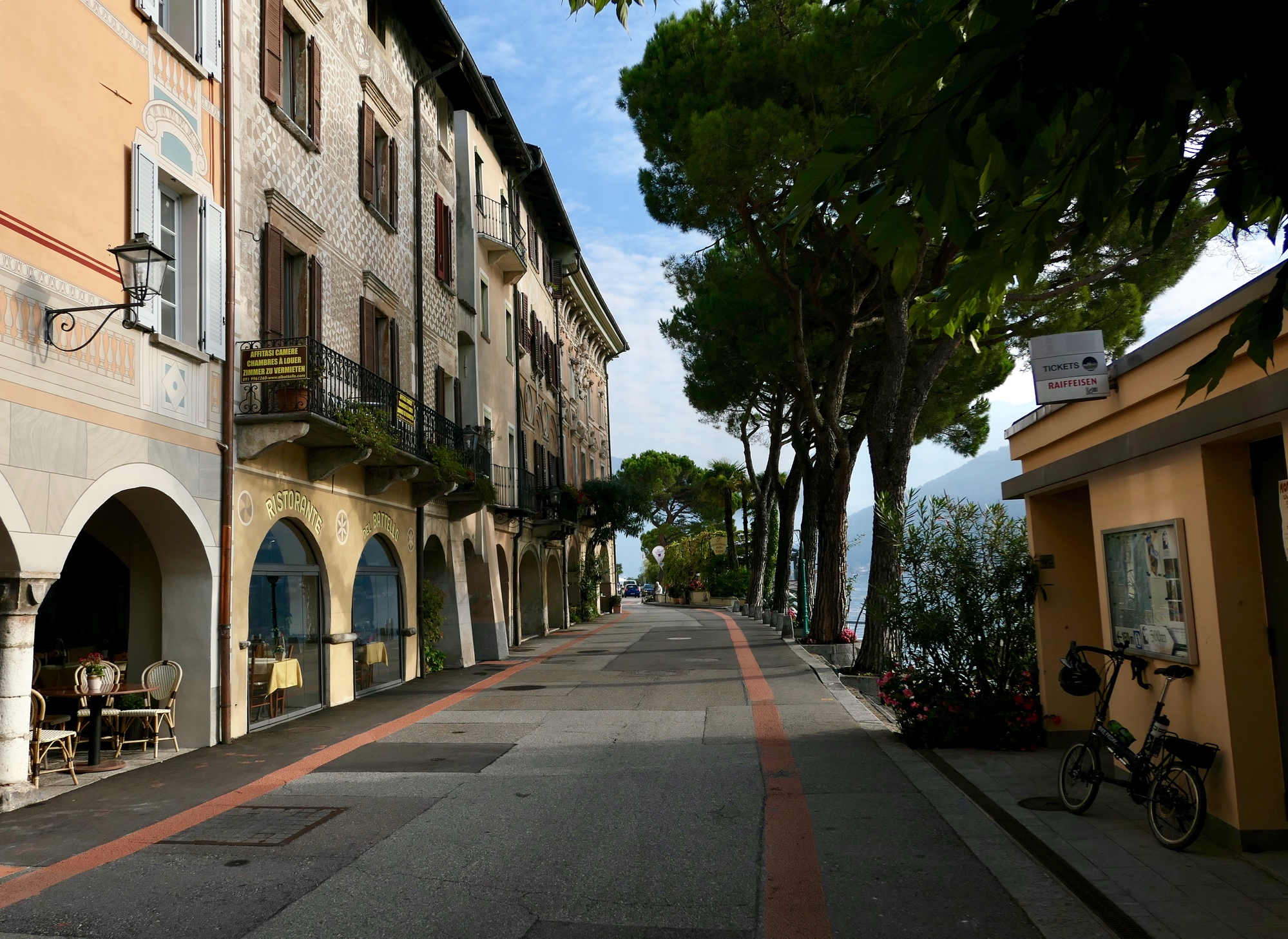
The ride begins with a beautiful eight miles along the shore of Lake Locarno. This road through Morcote is lovely for cycling - flat, scenic, low traffic - pretty unusual for the traffic heavy Lake District. I really like the scenery along this lake, more I think than Como. Maybe because it’s smaller, more intimate, with the far shore not as far off.

| Heart | 0 | Comment | 0 | Link |

| Heart | 4 | Comment | 4 | Link |
5 years ago
5 years ago

| Heart | 2 | Comment | 0 | Link |
Reaching the north end of the lake, we pick up a well marked Swiss bike route and continue north, following a small stream gradually uphill for the next ten miles. This is a pretty industrial corridor, with a highway, a rail line and a long gallery of warehouses and industrial sites blighting the views a bit. It’s great having the bike route to steer us through all this, as we weave back and forth across the creek a dozen times, picking up the quietest (usually unpaved) way north.
As we climb the views north steadily improve, when you can see across the tops of the warehouses. Toward the top, they’re starting to become pretty dramatic - this is really a minor pass we’re climbing. By now, we’re getting hungry and thinking of lunch; but there’s none to be had in the villages we skirt past. Maybe at the top?

| Heart | 2 | Comment | 0 | Link |

| Heart | 1 | Comment | 0 | Link |

| Heart | 0 | Comment | 0 | Link |
Nope. Not at the top either. Looking down though across the broad Ticino valley, it looks like there must be many places to choose from down at the bottom. We drop off the north side of the Pass, plunging a thousand feet through switchbacks and a 10% grade before bottoming out at the river. We use Rachael’s phone to look for restaurants nearby, and find two. Neither is open today.
By now it’s getting near 3, and we’re probably past the lunch window anyway. Fortunately, Rachael has squirreled away a few snack bars that we gnaw on to keep us going, and then bike on. We figure we’ll just hold off for dinner at this point. We have some pound shedding to do anyway, after last night’s blowout.

| Heart | 1 | Comment | 0 | Link |

| Heart | 1 | Comment | 0 | Link |
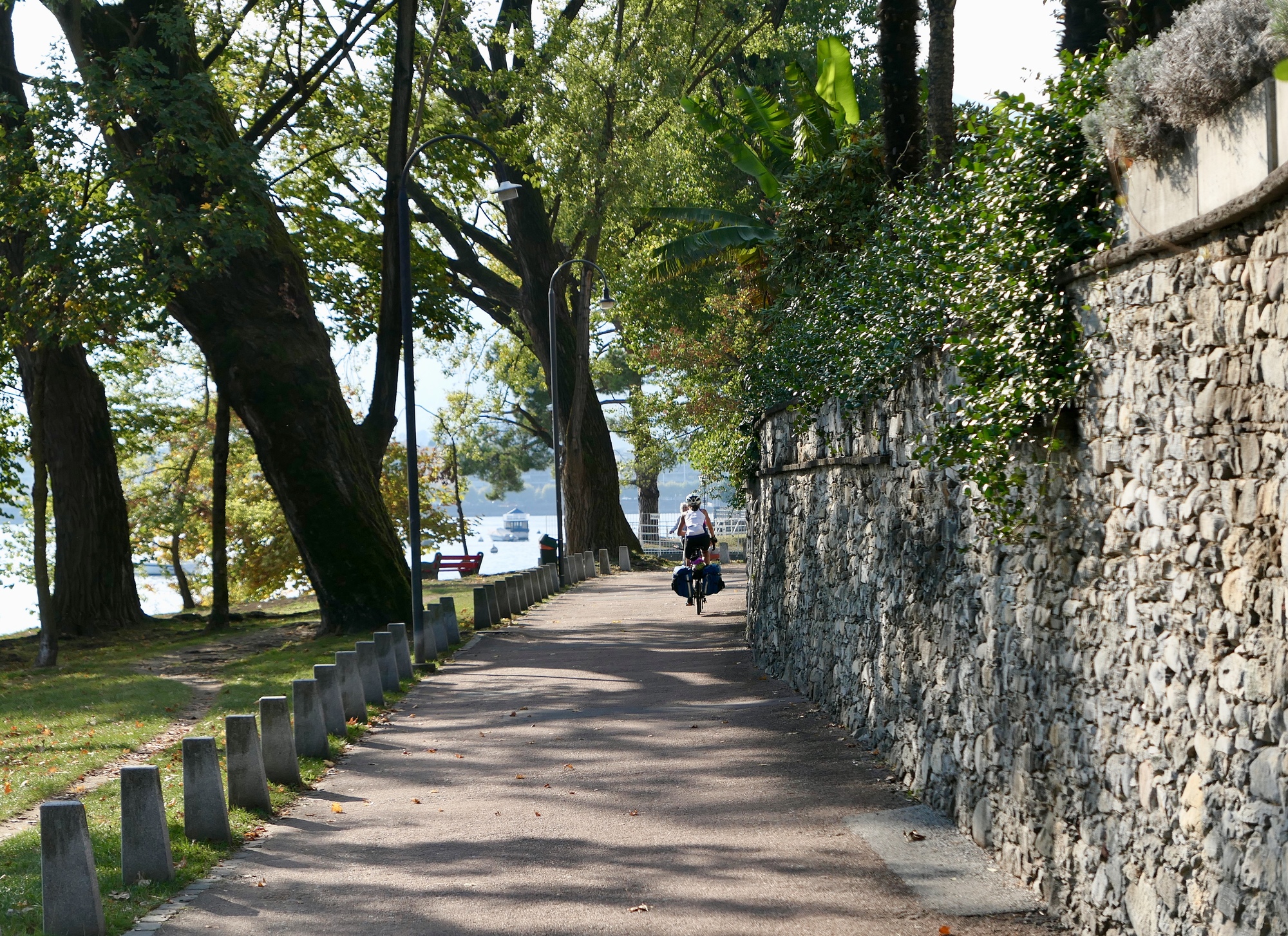
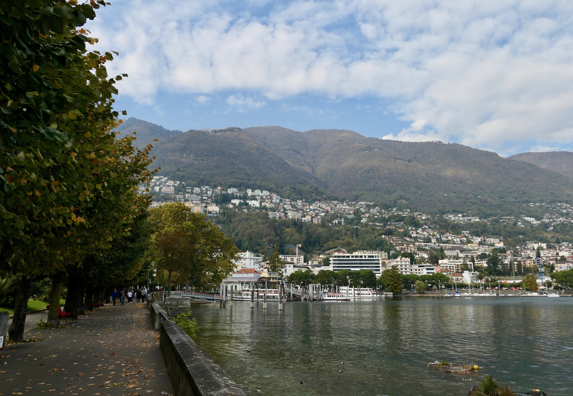
The ride along the Ticino is beautiful, and perfect for our needs. Smooth, paved, flat, quiet, it lets us make good time without burning many calories. Before we know it we reach Locarno, the city at the north end of Lake Maggiore. It’s very bike friendly, at least beside the lake - there’s a pretty, wide paved promenade through the entire city. It reminds me of Lugano a bit, and is another place that seems worth more time than we have allowed.
To our surprise and delight, we pass a lakeside cafe that’s open and serving paninis and quiche Lorraine. We stop in, and enjoy the best quiche Lorraine I remember ever having. That holds us here until four though, with still ten miles of lakeshore riding to go before reaching Connobio.

| Heart | 1 | Comment | 0 | Link |

| Heart | 2 | Comment | 0 | Link |

| Heart | 2 | Comment | 0 | Link |

| Heart | 1 | Comment | 0 | Link |

| Heart | 3 | Comment | 0 | Link |
Ten rather busy, rather unpleasant miles later, we come to Cannobio, and bike to the spot I’ve marked as our hotel. It’s not there. We ask at a bar where Alberto de Sole is, and he points us back north a ways, thinking I must have meant the Sole campground we just passed. Concerned and confused, we pull out the phone and iPad (good thing we have a hotspot with our phone!), consult the maps, and finally find our hotel. It’s in Cannero, not Connobio! We’ve been victimized by a very rare error by the planning team - it has booked us into the wrong town entirely. Those names are so similar though - it’s a mistake anyone could make, really.
Unfortunately, by now it’s nearly five thirty, Cannero is yet another five miles down the road, and the traffic is picking up. Not the best news, whether understandable or not. Nothing to be done but bike on, so we do; and arrive safely at our hotel (which isn’t even in Cannery, actually - it’s a mile outside of town) at 6:15, just as it’s starting to feel dusky. We’re greeted at the front door with the welcome news that dinner is served in a half hour. A good meal heals all wounds, as the adage goes.
| Heart | 0 | Comment | 4 | Link |
Valter
5 years ago
5 years ago
5 years ago
5 years ago
Ride stats today: 52 miles, 2,100’
Today's ride: 52 miles (84 km)
Total: 1,632 miles (2,626 km)
| Rate this entry's writing | Heart | 5 |
| Comment on this entry | Comment | 2 |
5 years ago
5 years ago