We returned from our hike late in the afternoon yesterday, not returning to Revelstoke until almost six. Too tired and hungry to wait for the motel and a shower, we took our stinky bodies straight to Padrino Pizzaria as soon as we entered town. It definitely hit the spot, but we erred in our order and were left with two large slices at the end of the meal. Darn.
Rachael’s hand is noticeably better this morning. The index finger is still badly blistered and miscolored, but the swelling is way down and she can curl her fingers again. We decide that she’s doing well enough to chance a bike ride, so we drove a few miles north of town on Highway 23, the Big Bend Highway, and parked on a small pull-out by the side of the road. There’s nothing around here, and nothing but a few small campsites and parks for the next hundred miles. We don’t have a specific destinatiion in mind, and are just riding until we feel like turning back.
The Big Bend Highway has an interesting history. Completed during the Great Depression, it was the first transprovisional Highway in BC, and followed the great arc of the Columbia River north around the Selkirk Mountains. It was made obsolete with the completion of the Transcanada Highway and the opening of the new, much shorter route east of Revelstoke over Rogers Pass. The portion of the old highway that is now Highway 23 was renamed and redeveloped in the 1960’s, I think in support of the construction of the Mica Creek and Revelstoke Dams that eventually would flood the valley.
Today, what remains is everything you could hope for in a biking highway - at least one with no ongoing destination in mind. It’s 95 miles from Revelstoke to the end of the road at Mica Creek, and in between there is really nothing of note - other than this splendid highway that follows the Columbia River (swollen here into Lake Revelstoke by the Revelstoke Dam) as it threads between the Monashee and Selkirk Ranges. Because there’s nothing out here on this road to nowhere, there’s no significant traffic either. Even better, the highway is surprisingly well maintained, and most of today’s route is freshly paved, smooth, wide shouldered, and empty. Wow.
Not much else to say about the ride today. Conditions were great - cool when we started, essentially windless, and not uncomfortably warm when we returned to the car in mid afternoon. We stopped for lunch at Downie Creek Park, which we hadn’t even known existed until we arrived there - it was pure coincidence that it was right about the point that we planned to turn back. Pretty much a perfect cycling day.
Here we go again. We’ve just left the car at the top of a high spot on the highway, and are starting a two mile coast back near river level.
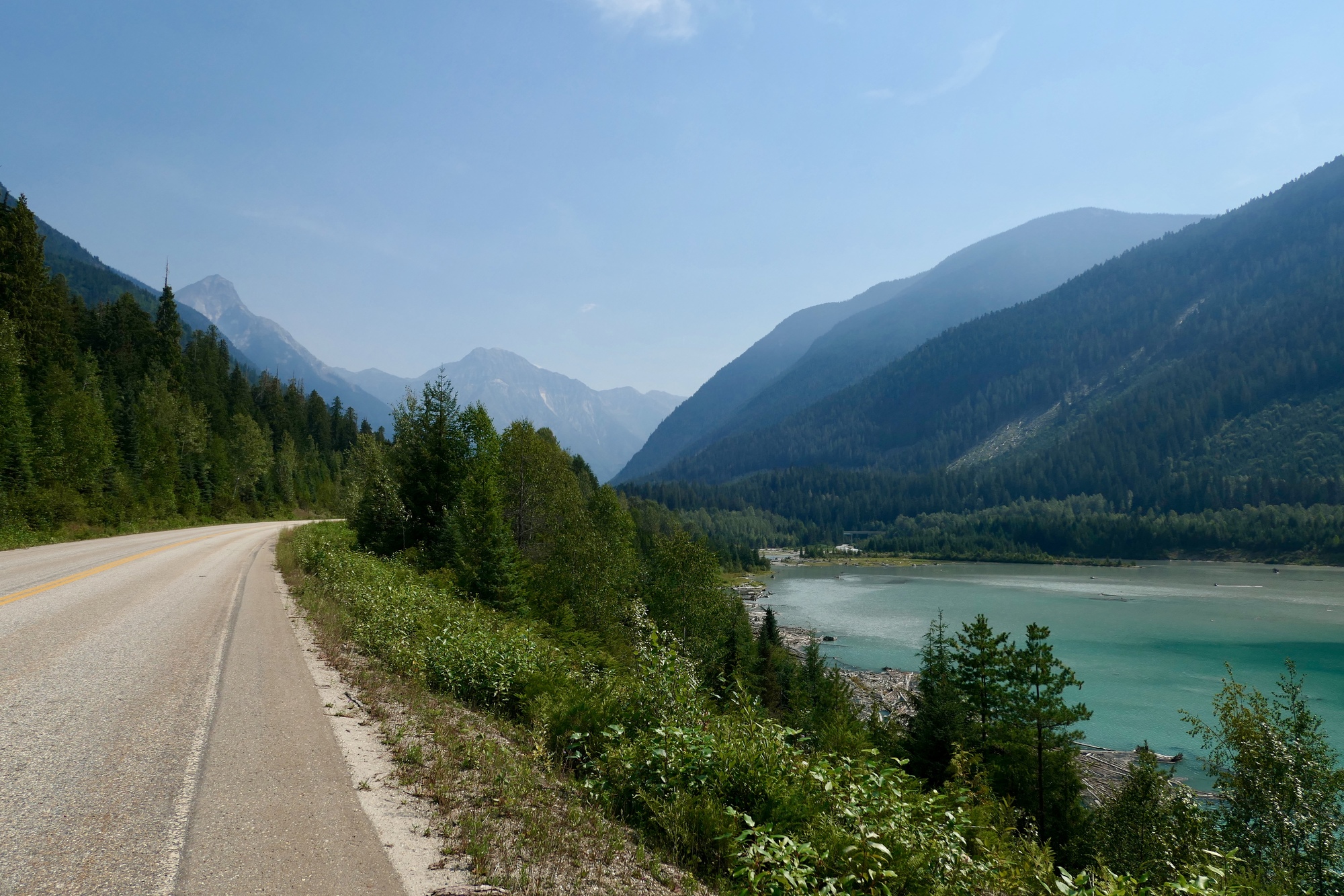
The road looked pretty much like this all day. A car or truck would pass perhaps once every five minutes, and you could hear it coming a half mile away.
Here we’re biking east around a slender finger of the reservoir where the course of Downie Creek was flooded by the dam. Ahead is beautiful Downie Peak, looking a bit ghostlike in the mid morning light,
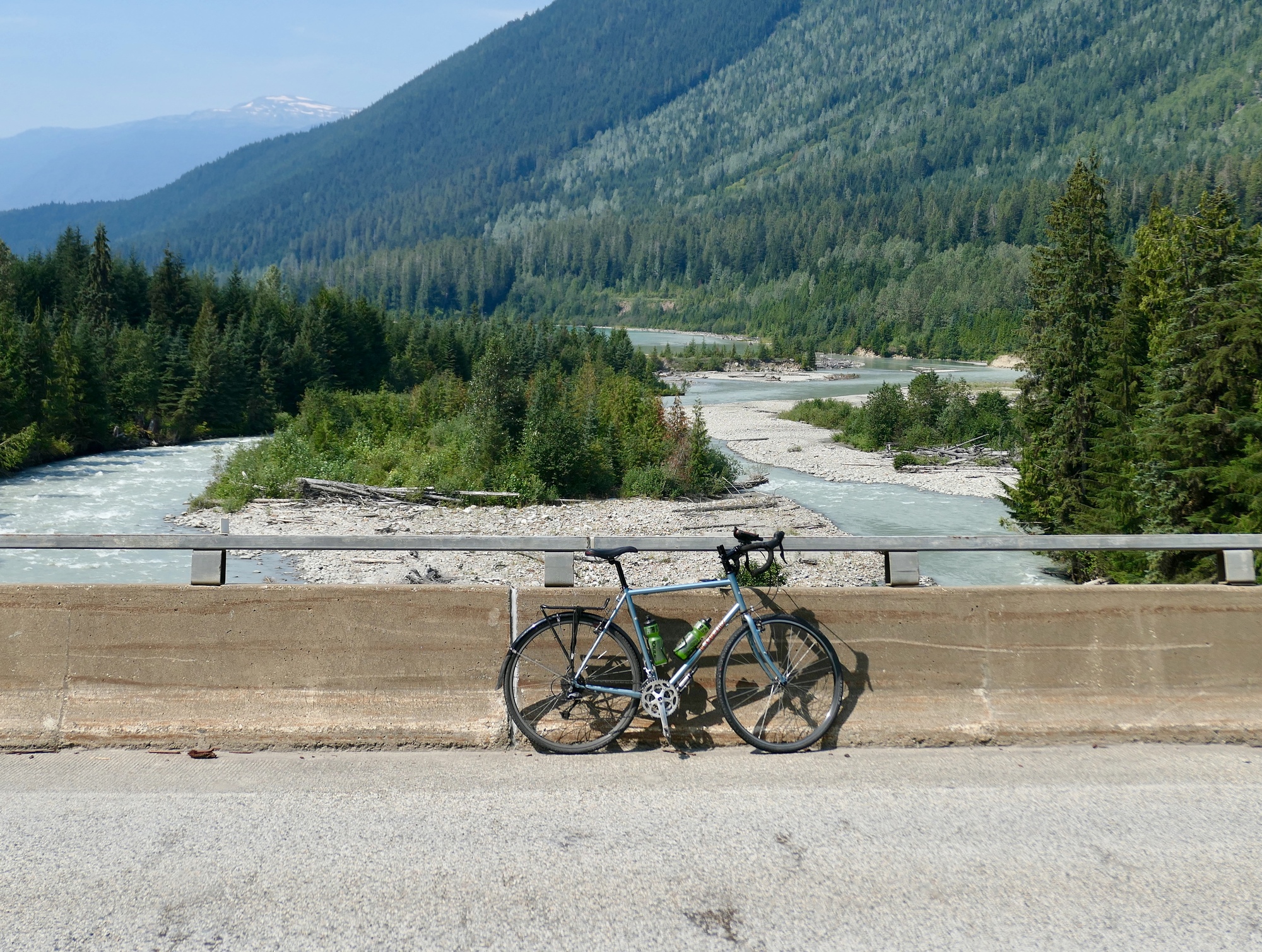
The bridge over Downie Creek. I waited here for several minutes to allow Rachael to get far enough ahead of me so I could take a zoom photo of her in the distance. I’m waiting for her to cross the small clearing where you can see a short span of the highway, directly above the saddle of my bike.
Looking west down the course of Downie Creek. We turned back when we came to the end of this long thumb and reached the main course of the Columbia again.
The point where Downie Creek enters the lake, with the silty river water gradually blending into the larger body. Is there a name for this convergence? It seems a bit like a fresh water estuary.