May 13, 2016
Richmond to Jamestown
Another early day, but we also turned in early as well. I was in bed by 10:00 PM. I need to be as Steve and Pete are up at 4:30 AM or so! Well, I slept through that. Steve drives Pete to work and usually returns around 8:00, which is about when I was getting up for real! Still, try as I might, I did not hit the road until 10:00 AM, mostly because Steve and I had lots to catch up on. Another visit sans bike will be required! Finally I was packed and ready for the nine-mile ride into downtown Richmond and breakfast:

I wandered through several local residential streets on my way downtown, with Wilkinson Road and North Avenue being my primary routes. I eventually crossed Interstate I-95 and entered the real urban core and historic center of the city.

| Heart | 0 | Comment | 0 | Link |

I had identified several places to grab breakfast and settled on River City Diner since it seemed they had good bike parking (thank you, Street View!). Plus, it was close to the trailhead for the Virginia Capital Trail, the stated goal of the trip!


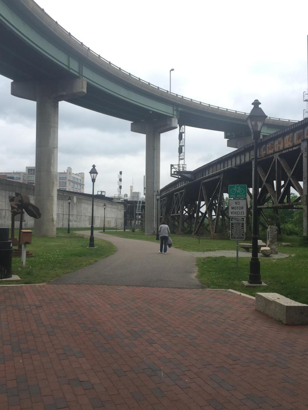
Next stop: Virginia Capital Trail. But I had to find it first! What a chore lol! I have never been as frustrated. I mean, yes, it was mapped on my Garmin but I really thought it would be more obvious . . . but there is no signage pointing the way. There are lots of signs all over for the various destinations and points of interest on the Canal Walk, but not one of them points to the trailhead, which is "hidden" behind the flood wall!

| Heart | 0 | Comment | 0 | Link |

| Heart | 0 | Comment | 0 | Link |
| Heart | 0 | Comment | 0 | Link |
You'll get a better idea of my confusion if you look at the mapping above and the RWGPS tracking link in the caption. In retrospect, it's kind of funny. I'm sure the locals have no problem finding it, but if you are a through-tourer, sort of like me, signage helps!
Regardless, I was finally on my way. On my way along the trail that was the primary purpose of this trip, down the Virginia Capital Trail! And let me say this, right up front, the trail is very nice, even in wet weather (which it was, on and off).


| Heart | 0 | Comment | 0 | Link |

I will stop and make a comment here. There are a couple of locations (besides the trailhead) where signage would greatly improve the rider's experience. And this is one of them. I arrived at this "crossing" expecting to go straight ahead. OK, maybe the orange sign means there is a temporary detour. But wait, what are those "Private Driveway" signs all about? I know. They are hard to read in the photograph, but there are two of them. And why a crosswalk? Crosswalks are used to get to the other side of the road and continue on your way . . . but here it leads straight into a private driveway!
OK, maybe those orange "detour" signs are for the event scheduled for tomorrow (the annual Cap2Cap Ride) . . . do they have an Orange Route? Who's to know?
In fact, on this section of the trail (which is very nice), you are required to make a left and use Kinvan Road for a short distance before recovering the off-road trail again. Signage, similar to what is used to get you over Herring Creek (still ahead of me at MP 33+), would be very useful here (i.e., "Bike Route" and an arrow in the appropriate direction, in white text with a green background!).
OK, rant over, back to the trail . . .

| Heart | 0 | Comment | 0 | Link |

| Heart | 0 | Comment | 0 | Link |
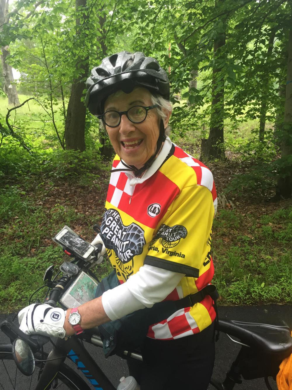
So, as sort of an unexpected way to prove my point, I ran into this woman who was on a cross-country tour with Adventure Cycling. They have already adapted their maps to include the Virginia Capital Trail on the route! That shows you how important a route connection it will become. She stopped to ask for directions, and I was more than happy to help. But it sort of begs the question . . .

| Heart | 0 | Comment | 0 | Link |
I met Jerred much further along the route, after I passed maybe five more participants in the Adventure Cycling tour. Jerred said the total was something like 15 people. They are headed for Oregon! And while they did not plan to take the trail all the way to Richmond (Adventure Cycling routes traditionally avoid large urban areas), they did start in Jamestown and so had ridden a good part of it.
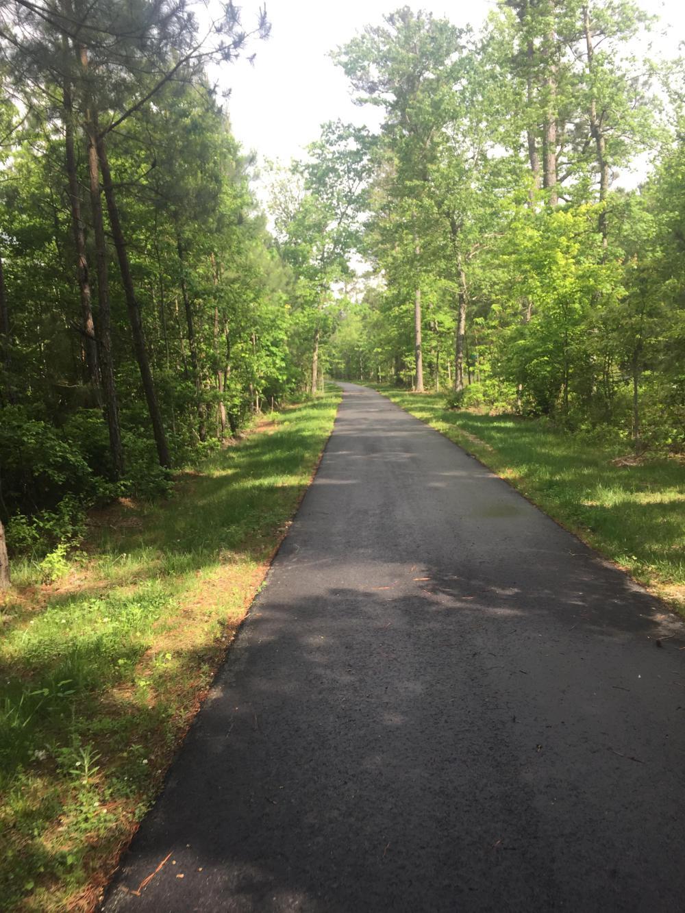
The rest of these are just general pictures I took along the trail:


| Heart | 0 | Comment | 0 | Link |
As you can see, many parts of the trail are set back from the adjacent roadway (Route 5) and screened with vegetation. It seems a lot of care was taken in the route planning in order to create this separation . . . that is a big plus!


I took a personal interest in the river crossing, as I was the project manager for the initial study, which TAMS Consultants did for VDOT in the early 2000s. While not exactly how I envisioned it, it does a great job getting the trail over the river!
As you can see, the sun finally came out. That was a great way to end the day after all of the rain and overcast skies! It wasn't long from the river crossing to the trail's end in Jamestown.

Unfortunately, the trail end (actually, it's the trailhead since it's measured from Jamestown) is really in the middle of nowhere. Except it takes you right to the Jamestown settlement, which appears to be mostly an archeological dig. I did not visit the site . . . it was already late in the day, and my Warmshowers host was still eight miles or so away. When I talked to Nick, he suggested I take the Colonial Parkway, but that would have added several miles to the distance remaining, so I took Jamestown Road instead, a more direct but less bike-friendly alternative. It took me straight into Williamsburg . . . but I kept moving.

| Heart | 0 | Comment | 0 | Link |
After all, there was a cold IPA waiting for me!

| Heart | 0 | Comment | 0 | Link |
And these very cute dogs!

| Heart | 0 | Comment | 0 | Link |
Nick was a great host and very generous. He knows the local beer scene very well, and his dogs were great to be around. Nick is big into dog rescue and has very compelling stories to tell, so I learned a lot about the challenges associated with abused or abandoned dogs. He is also a contractor, and being an engineer, we had a lot to talk about! And he made me a great dinner! Thanks for the hospitality, Nick!
Today's ride: 68 miles (109 km)
Total: 202 miles (325 km)
| Rate this entry's writing | Heart | 0 |
| Comment on this entry | Comment | 0 |