May 11, 2016
Arlington to Fredericksburg
The problem with staying with friends is that you don't get time to update your journal! It was a hard day after all that flatland riding in Florida, and Kristin's driveway peaks at a 22% grade. Ugh! I couldn't keep the front wheel down. But I get ahead of myself . . .
I had fully packed the night before and was hoping to get an early start this morning. That didn't exactly go as planned for several reasons. I had gone out last night with a biking buddy (i.e., drinking), and the weather was not so great this morning — being a bit chilly (just under 60°F), and it was raining. Unfortunately, the weather forecast for the whole trip looked a bit dubious, with things not improving until maybe Friday! But I was set to go, so I made some breakfast and headed out the door.

| Heart | 0 | Comment | 0 | Link |

| Heart | 0 | Comment | 0 | Link |
I didn't don the rain jacket till I was downstairs and in front of the building. From my windows and balcony, it looked like it was mostly overcast and only misty. But there was actually a light drizzle falling. As I have said in the past, I don't mind biking in the rain, but that is usually said on a commuting trip when it is a shorter ride. Today, I was facing 66 miles of riding and almost 4,000 feet of climbing, so some warmth and sunshine would be appreciated. It was not to be.
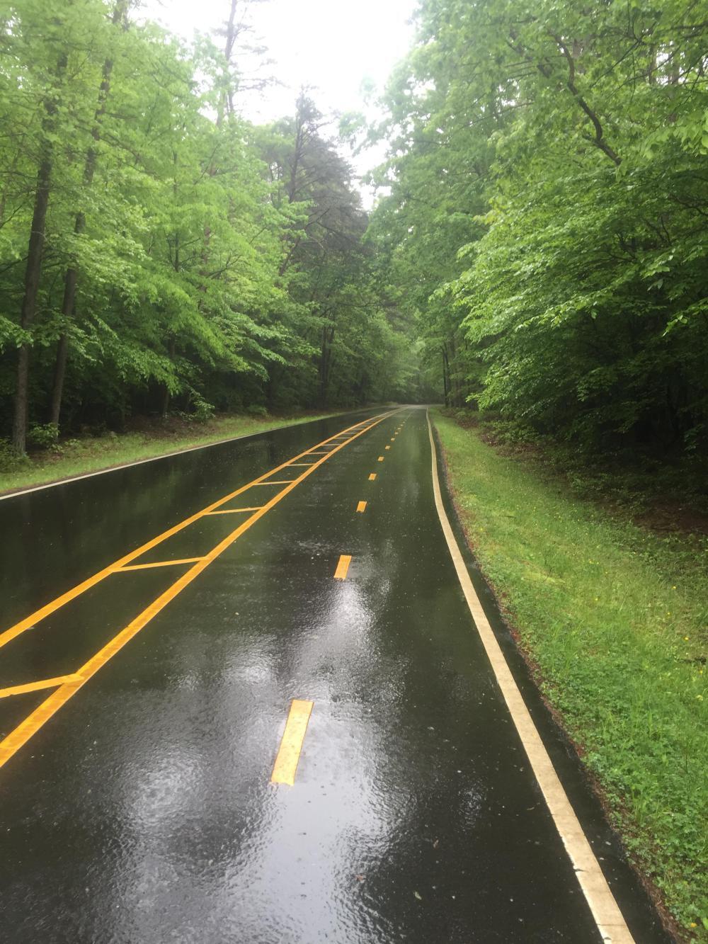
At least the first ten miles of the ride would be in very familiar territory, especially the short section on the W&OD . . .

| Heart | 0 | Comment | 0 | Link |
At East Falls Church, near Benjamin Banneker Park, I left the trail and passed through a nice residential community over to the service road along US-50, and from there onto Annandale Road and Hummer Road into Annandale proper, where I navigated to the bridge over the Beltway.
This was a big mental step, as now I truly was in territory and on roads and trails I had not ridden before.

| Heart | 0 | Comment | 0 | Link |
The odd thing is how poorly signed this passage is. Without RWGPS/Google Maps, I might never would have known about this crossing. But beyond that, the landing on the far side is literally at the end of a gravel road, again with no signage.

| Heart | 0 | Comment | 0 | Link |

| Heart | 0 | Comment | 0 | Link |
But I knew enough about where I was going . . . mostly. My mapping had me going through one of the Park's maintenance yards, which turned out to be a dead end with no access to the trail I was looking for. And the maintenance staff, while wanting to be helpful, were uncertain where to access the trail. Again, a bit amazing. But eventually it was found, and off I went!
I had never ridden the trails I was following, so it was a bit of an adventure. But I was able to follow them all the way across Fairfax County for about 16 miles (with an occasional connection using local suburban residential streets). Trail conditions varied, as you can see in the photographs that follow, with the worst part being along a section around Lake Accotink where the natural trail surface can get pretty rough.

| Heart | 0 | Comment | 0 | Link |
After crossing Accotink Creek, I jumped off the trail, which follows the sidewalk, and rode Danbury Forest Drive to the next entry point. Which wasn't overly bike-friendly.

| Heart | 0 | Comment | 0 | Link |
That led me to the west/south trail around Lake Accotink. In retrospect, the east/north trail might have been a better option, particularly if it is paved (and where I turned, it looked like it was). It leads to the same point on the far side of the lake beyond the dam. The east/north trail would also have avoided the rough section of trail I had to go through to reach the far side of the dam. Headed south, it didn't seem so bad even in the rain. But it was mostly on a slight decline. On the return trip it struck me a little differently (see day six of the trip). It would also avoid the steep decline to the water crossing, and the water crossing itself, which, per the warning sign, could be flooded after heavy rains. Anyway, maybe something to explore in the future.

| Heart | 0 | Comment | 0 | Link |

| Heart | 0 | Comment | 0 | Link |

| Heart | 0 | Comment | 0 | Link |

After the dam, I continued on the trail through some very nice wooded sections. It really feels quite remote, and, being the middle of a weekday with rain, I felt very isolated as I saw almost no one. Eventually, I arrived at another residential neighborhood, which took me to the confluence of probably three of the busiest roads in Fairfax County: Rolling Road, Franconia-Springfield Parkway, and Fairfax County Parkway. None of these are particularly pleasant roads to bike along, but the Fairfax County Parkway has a reasonably good trail that I was about to use, although it needs more attention to maintenance!


| Heart | 0 | Comment | 0 | Link |
That took me to South Run Recreation Center and Mercer Lake and a whole series of trails through various neighborhoods all the way to Route 123, Ox Road. Part of this was on a trail along Giles Run through the Crosspointe development, which was labeled as private property. C'est la vie! Tally-ho, however. If you want, you can exit directly onto Route 123, as it has a bike trail as well that takes you all the way to Occoquan. I used it for the return trip to avoid some of the natural surface trails and the "step" bridge you see below.

| Heart | 0 | Comment | 0 | Link |

| Heart | 0 | Comment | 0 | Link |
Occoquan used to be a quaint, sleepy little town that has now been redeveloped. The crossing used to be further upstream across an old, rickety truss bridge. As a child, I would often fish there. But the old truss bridge is gone, and I used the new highway bridge to cross, which has a very decent bikeway. You can still take the old road if you prefer, and I was tempted to make a detour, but I still had a ways to go, and the weather was not improving dramatically!

| Heart | 0 | Comment | 0 | Link |
From there, after weaving through several more neighborhoods and a work zone that treated me very decently, I arrived on Minnieville Road for the haul to Prince William Forest. I tried to find alternate routes, but the ones available provided little if any improvement and just added miles. At least the first mile or so had a decent trail; after that I stuck to the sidewalk (a la Florida riding). That worked, as there were few, if any, pedestrians. And I turned on my rear, helmet-mounted taillight so that right-turning cars might better see me.

| Heart | 0 | Comment | 0 | Link |
Getting into Prince William Forest was a breeze. The gate was open! There are actually several gates you must pass, and they all have walk-arounds in case they are closed! After the one you see below, which leads to a maintenance area that will be on your right when headed south, you then pass around another gate, which is the actual fire road.

| Heart | 0 | Comment | 0 | Link |
The fire road is one long descent with a stream crossing, followed by one long ascent. All total, a little less than a mile of off-road riding. And again, not really suitable for skinny tires, especially if on a loaded bike. Some sections are pretty rough due to erosion.

But if you make it past the fire road, Scenic Drive is a very, very nice ride. Part of it is restricted to one-way traffic, allowing a two-way bikeway to function on the opposite half.
| Heart | 0 | Comment | 0 | Link |
My next challenge was Quantico National Cemetery. RWGPS/Google Maps did not want to route me through here for some reason, and after arriving at the main gate, I saw why. "No Through Traffic," the sign said. Well, I'm a tourist, so I did not consider myself "through" traffic. I proceeded all the way through without a hitch. It wasn't till my return that I learned bicycling is completely prohibited (see day six). Sometimes what you don't know can't hurt you. I'm not sure what I would have done had I known differently.

Those were my two biggest challenges, both "defeated." I had made it through Quantico. After the cemetery, it was Russell Road and into Stafford County. And from there, it's pretty easy riding on Telegraph Road (although there is a long climb up and over some unnamed hill). But I passed through no checkpoints even though I think most of this is considered part of the military base (per the coloring on the maps).


You do need to weave through Aquia Harbour. But when I got to the main entrance, they just waved me through without asking questions. I did not know it was a "gated" community . . . see day six for some restrictions brought to my attention on the way back!
But after Aquia Harbour, I was still ten miles from the end of today's ride! And there were still more hills to climb! Mostly through Stafford. After that, it was all downhill and pretty much flat to Kristin's house.

The only surprise was her driveway!!!! As I rode down Brooke Road, I could see all the development was to my left and uphill, so I was not too surprised to see Kristin's house at the top of a steep grade. But this steep?? I was determined to give it my best shot . . .

| Heart | 0 | Comment | 0 | Link |
Kristin gave me a warm welcome and a cold beer. And then made a great dinner. All of which was needed and appreciated. After the morning, the rain had come and gone all day, and it never really warmed up much, so I was really looking forward to a warm shower and a good night's sleep. Got both!

Today's ride: 66 miles (106 km)
Total: 66 miles (106 km)
| Rate this entry's writing | Heart | 2 |
| Comment on this entry | Comment | 0 |