August 2, 2009
Day 24: To June Lake Loop
It was 44F in the morning, but I still didn't zip my sleeping bag. I got up early for a hot spring shower because the showers were busy all the time yesterday evening. The shower was pleasantly warm early in the morning. The day before yesterday in late afternoon the shower was a bit hot for my taste (there's no cold water supply).
I got on the road at 9 after a long conversation with Paul the backpacker from Baton Rouge. The temperature was chilly in the shade but it was uphill, climbing 1700 feet to Minaret summit. There was basically no traffic. Maybe one car every 5 minutes.

This time I got to the Minaret Vista much earlier in the day, so had a better sun angle for viewing the Minarets. At the overlook were several roadie cyclists who had pedaled up from Mammoth.

| Heart | 0 | Comment | 0 | Link |
Minaret Vista also has a good view of Mammoth mountain. Two of the ski lifts are plainly visible.

| Heart | 0 | Comment | 0 | Link |
From the Minarets Overlook the road descends steeply towards Mammoth. Just past the main ski lift (before the town) I turned left onto the "Mammoth Scenic Loop". The road climbs a bit then descends 5 miles to US 395. It's not really scenic because it stays in a tunnel of tall trees that obstruct the mountain views. It's actually the alternate evacuation route for earthquake-prone Mammoth. Worst of all, the entire road has terrible "ejection seat" cracks. It was the worst paved road of this tour.

| Heart | 0 | Comment | 0 | Link |
I was back on US 395 north for only 10 miles, then turned left onto CA 158, the June Lake loop.

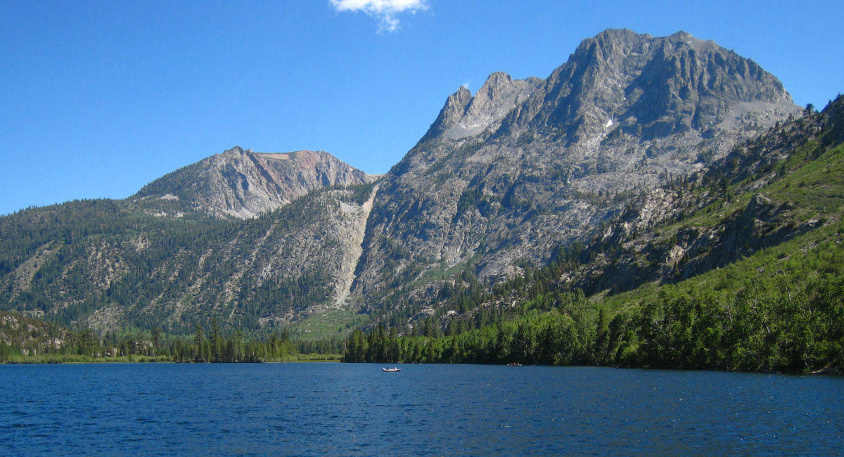
The June Lake Loop goes past 3 lakes and gets much closer to the mountains than US 395. Near the beginning of the loop is the small town of June Lake where I stopped for a late lunch.

I continued past June lake downstream to Silver lake. The area has several forest service campgrounds, but they all seem to be full. It's the weekend.
| Heart | 0 | Comment | 0 | Link |
I filled all the water jugs at the main campground and continued down Rush Creek. I found a very nice free campsite along the creek. It was relatively near the road and signed for Day Use Only, but my sage green tent is nearly invisible from the road. Nobody bothered me.

| Heart | 1 | Comment | 1 | Link |
1 week ago
The weather was sunny all day but it never got hot. High of 82F. I'm camped at 7300 feet elevation but spent much of the day even higher. The evening was pleasant, but boring because it was so buggy that I spent most of the time inside the screen tent. I was able to make a shower in a rocky area that wasn't so buggy. The campsite was scenic but it had the worst mosquitoes of any campsite on this tour.
Distance: 44.9 mi (72 km)
Climbing: 3317 ft (1005 m)
Average speed: 9.6 mph (15.4 km/h)
Max speed: 41.5 mph (66 km/h)
Today's ride: 45 miles (72 km)
Total: 1,057 miles (1,701 km)
| Rate this entry's writing | Heart | 0 |
| Comment on this entry | Comment | 0 |