April 22, 2014
Last Minute GPX-ing
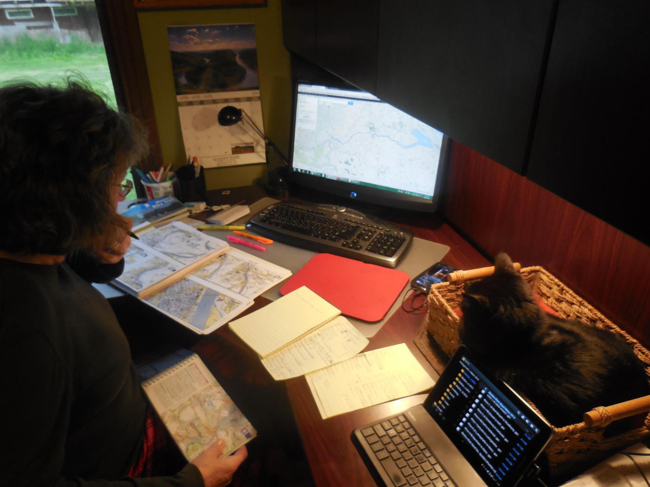
One of the reasons we titled last year's run from Amsterdam to Berlin to Geneva to Bordeaux and suchlike, "Grampies Go in Circles" was that the route followed a giant circle around western Europe. The other reason, though, was our tendency to get lost and wander around the countryside looking for that next bike route sign. So this year we decided to increase our use of GPS and see if it actually is of any help.
In "Grampies Go South" we mounted a Samsung Galaxy S3 in a waterproof case on Dodie's handlebar, and fitted it out with the GPS program Osmand Plus, together with the .gpx tracks supplied by Adventure Cycling for the Southern Tier route. This did turn out to be of use from time to time, though on the Southern Tier you normally do know where you are, the problem is more getting the hell out of where you are!
Now, as Grampies prepare to go "By the Books" we can take advantage of the fact that Bikeline supplies .gpx files for most of their routes. So in principle, all we have to do is pop those files into the S3 and we are done. Of course, readers know that it is never that simple, at least, not for us.
The Bikeline routes, for one, are often not a single route but a set of one or more. Bikeline may be offering a choice of either the left or right bank of a river, or they may have two ways of getting to the same place, or they may simply set out one or more interesting side excursions. Then, when they offer the .gpx they may include several files. These could be segments of a single route, or it could be that plus a left bank/right bank type offering. Sometimes Bikeline includes a "read me" file that explains what they are doing, sometimes not.
| Heart | 0 | Comment | 0 | Link |
So "pop in those files" actually becomes a case of figuring out what all the files actually are. Now, with little time to go, such figuring is kind of stressful. We used a secret weapon to help get this one under control - our German speaking friend Sandra. While we were away frolicking with the kids, Sandra agreed to crawl through, loading each .gpx and figuring out what it was all about. She left us some wonderful pages of notes setting it all out. Then all we had to do was decide which of the .gpx files actually corresponded to where we wanted to go.
In practice, to be honest, it was not really even that bad, since a goodly number of the Bikeline books actually did not offer any segments or any choices, or if they did, at least also had just one .gpx that covered all of the main route. Still, it was work to get this our electonic version of "By the Books" figured out and going.
The second flaw in the hoped for smooth GPS fuelled sailing was that not all of the route we are planning is covered by Bikeline and their .gpx files. From Paris to Metz, Fussen to Innsbruck, Heilsbronn to Rothenburg, and several other significant stretches, we are relying on our own routing, worked out on Google Maps. So where is the .gpx for those?It turns out that there is a way to download a Google Maps route as a .kml, and there is a way to convert a .kml to .gpx. We figured all this out, and could explain it if somebody is interested. But suffice it to say, it's work.So that is the type of thing we are doing, with two days to go.
Oh, did we mention that all our credit cards seem to be expiring in May and June, which would leave us with no ATM access in Europe. We're working on stuff like that, too. If not too distracted, we may also remember to pack our bags as well!
| Rate this entry's writing | Heart | 1 |
| Comment on this entry | Comment | 0 |