July 10, 2020
Day 4: Klamath Falls to Chiloquin via Bonanza, Sprague River
Today is an extremely long day so I got up at 6:30. Big breakfast at Waffle Hut, on the road at 7:45. East through downtown, then south on the A Canal trail to the OC&E Woods trail. The first 8 miles are in towns. Klamath Falls, then Altamont.

| Heart | 0 | Comment | 0 | Link |
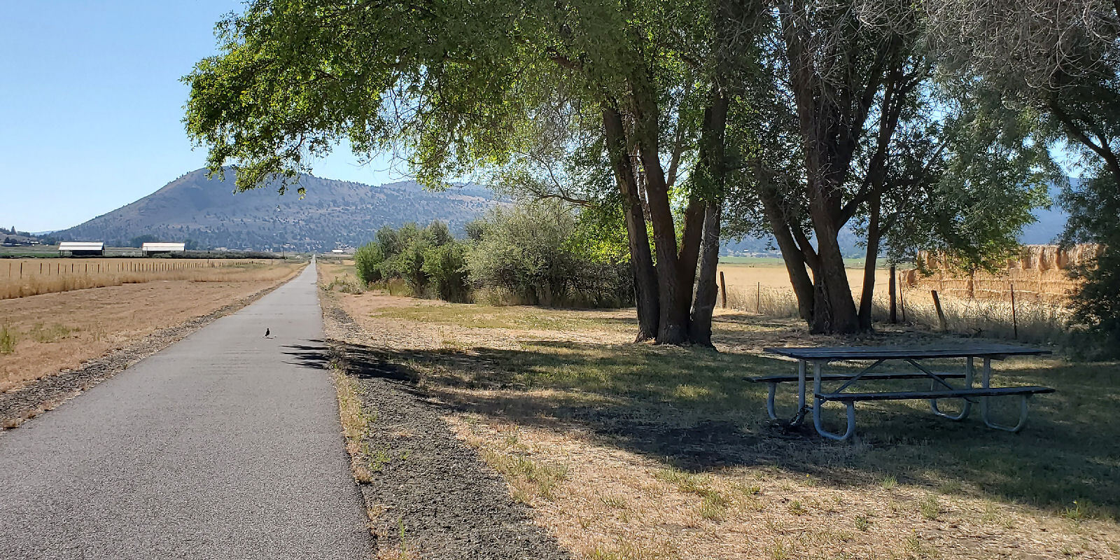
The OC&E trail quickly takes me out of the city and into farms. All in a flat wide river valley well east of the Klamath river. On the bed of a former railroad. I pedaled the trail to the end of the pavement at OR 140. About 10 miles of level bike trails to start the day.

| Heart | 0 | Comment | 0 | Link |
I crossed OR 140 to have a look at the trail farther east. It's all rough gravel, sometimes overgrown with brush. Not something I'm eager to go far on.

| Heart | 0 | Comment | 0 | Link |
Today's route put me on busy OR 140 for 2.5 miles. Busy and narrow enough to make me glad I'm not going a long distance on OR 140.
This segment of OR 140 is next to the Lost river with great views. The Lost river to Bonanza!

Conditions were much more pleasant when I turned right onto North Poe Valley road. Finally a low traffic county road, maybe 2 cars per minute. It follows the Lost River upstream to Bonanza.

| Heart | 1 | Comment | 0 | Link |
I saw many irrigation canals and many sprinklers sprinkling. The Lost river sustains vast acreage of irrigated fields.

| Heart | 0 | Comment | 0 | Link |

| Heart | 0 | Comment | 0 | Link |
Bonanza has the first services on today's route. I stopped for an early lunch at a barbeque trailer. Menu was limited. Ordered a bacon cheeseburger which was cooked on a wood grill outside.

| Heart | 0 | Comment | 0 | Link |
On the east edge of town I stopped to look at Big Spring park. It is a large park with a very big spring. Several cubic feet per second. The park is huge, with many facilities. Hard to believe a town of 421 has such a big fancy park.

| Heart | 0 | Comment | 0 | Link |
I left Bonanza at 12:15 PM. Only 26 miles behind me so far, not even 1/3 of today's miles. 5 miles northwest on Dairy road, then 19 miles north on Bliss road which takes me from irrigated fields to basin wastelands to pine forested hills to the Sprague river. Very good name!


| Heart | 0 | Comment | 0 | Link |
The area is unpopulated. I saw no farm houses. Bliss road is a road to nowhere. But it had at least one car per minute. People are going somewhere...

I enjoyed the long gentle 600 foot climb into a pine forested "sky island" surrounded by high desert. There is no sign at the summit of 5087 foot (1551 m) Bly Mountain pass. County roads and Forest Service roads seldom have summit signs.

| Heart | 0 | Comment | 0 | Link |
The summit is only 2 miles south of the hamlet of Sprague River. A quick descent. The hamlet is of course next to the actual Sprague river.

Sprague River is not really a town. Unincorporated, maybe 20 scattered houses, plus a small store and a small restaurant that only opens for lunch. I stopped at the store and got ice cream. Nothing much else was appealing. The temperature was 86F, warmest day of the tour. I left the store at 4:20 PM, still 28 miles to go.

The Sprague river seems a bit bigger than the Lost river but it seems to have less irrigated acreage. Maybe the valley isn't wide and flat enough for big irrigated fields.

I had a bit of headwind going west along the Sprague river. Downstream but there isn't a huge gradient. Still around 4200 feet elevation.

The Sprague river is noticeably more forested than the Lost river. Only 20 miles north, but greener because it's no longer in the rain shadow of the Siskiyou mountains.

Sprague River road is an awesome road for cycling. Gently rolling hills. Frequent river views. A mixture of pine forest and open valleys. Low traffic. High desert at its best.


Sprague River road ends in Chiloquin, an impoverished Indian town that is home of the Klamath tribes. Mostly boarded up buildings. I arrived at 7:30 PM on Friday night and found that all 4 restaurants were closed (one was open until 7). So I went to the busy grocery store and bought sandwiches and other stuff for dinner. Everybody wore masks. Indian reservations are strict about the health rules.

| Heart | 0 | Comment | 0 | Link |
Then another 2 miles out of town to Melitta's Motel on US 97. Very expensive at $152, with A/C, fridge and microwave, but no breakfast. The adjacent restaurant is closed since the pandemic hit. A restaurant breakfast was included with the motel room when I booked it, but they refused to discount the price now that the restaurant is closed. The room is small and kind of rustic. Very close to busy US 97. Noisy truck traffic until about 11 PM. Easily the worst night of the tour.
Today was a long and exhausting day. On the road from 7:45 AM until 7:30 PM. My longest day (distance and riding time) in several years. Fortunately the climbing was minimal and there were no steep grades. Lack of a satisfying meal at the end of the day made it seem worse.
Today's route is a very good sampler of southern Oregon's high desert. I pedaled the arid Lost river to Bonanza. 19 miles on Bliss road, then the more forested Sprague river to Chiloquin.
Distance: 79.2 mi. (127 km)
Average Speed: 9.1 mph (14.6 km/h)
Ascent/Descent: +2178/-2042 ft. (+664/-623 m)
Today's ride: 79 miles (127 km)
Total: 149 miles (240 km)
| Rate this entry's writing | Heart | 1 |
| Comment on this entry | Comment | 0 |