January 13, 2022
San Manuel
Today’s ride wins the award for the best new ride in the region - new to us anyway. We’ve never been out to Oracle before and wouldn’t be inclined to bike there because the only option is a long stretch on busy Highway 77, which doesn’t look at all appealing.
Looking around for other possible day rides within reasonable driving distance though I find one that looks promising which starts in Oracle. Beginning there it curves east around the north side of the Catalina Mountains before dropping down to the San Pedro River. If you continue on this way it eventually becomes Redington Road, turns to dirt, and thirty-some miles later the pavement returns on Cascabel Road, the same place we biked north from Benson to earlier this week. From the north end, starting in Oracle it’s roughly twenty miles to the point where the pavement ends.
Just right for a day ride, from staring at the map anyway. We’ll go check it out and report back. We load the bikes in the newly shiny Raven (not only did I get a free oil change, they even washed the car when they were done!) and make the 35 mile drive out to Oracle. We park in the empty lot of the small Oracle Public Library, closed today, and start biking east on the somewhat busy Mount Lemmon Highway. Within a few hundred yards we leave this for empty and enticing Cody Loop Road and start climbing.

| Heart | 2 | Comment | 0 | Link |
We climb for roughly two miles, up what must be the northernmost reaches of the Catalina Mountains. At the top we’re up around 4,800’ and for a short ways pass through an oak forest. I hear a hammering up at the top of a utility pole and stop to investigate while Rachael continues on. Research complete I continue on myself, and soon come to the crest of the climb. A massive view opens up to the east, with a long descent ahead.

| Heart | 3 | Comment | 0 | Link |
| Heart | 1 | Comment | 0 | Link |
After steeply dropping for about two miles Cody Loop Road comes to an end at the junction with Mount Lemmon Road. We continue the long descent toward the San Pedro River but in just another mile we come to the junction with Webb Road. Our plan is to continue dropping on Webb Road until the small community of San Manuel and then on Redington Road, but Mount Lemmon Road is still paved at this point and looks so enticing that we decide to follow it for a ways to test it out. In my memory from map reading the pavement extends for a few miles, so perhaps we’ll just go as far as the end of the pavement.

| Heart | 1 | Comment | 0 | Link |

| Heart | 1 | Comment | 0 | Link |

| Heart | 3 | Comment | 0 | Link |
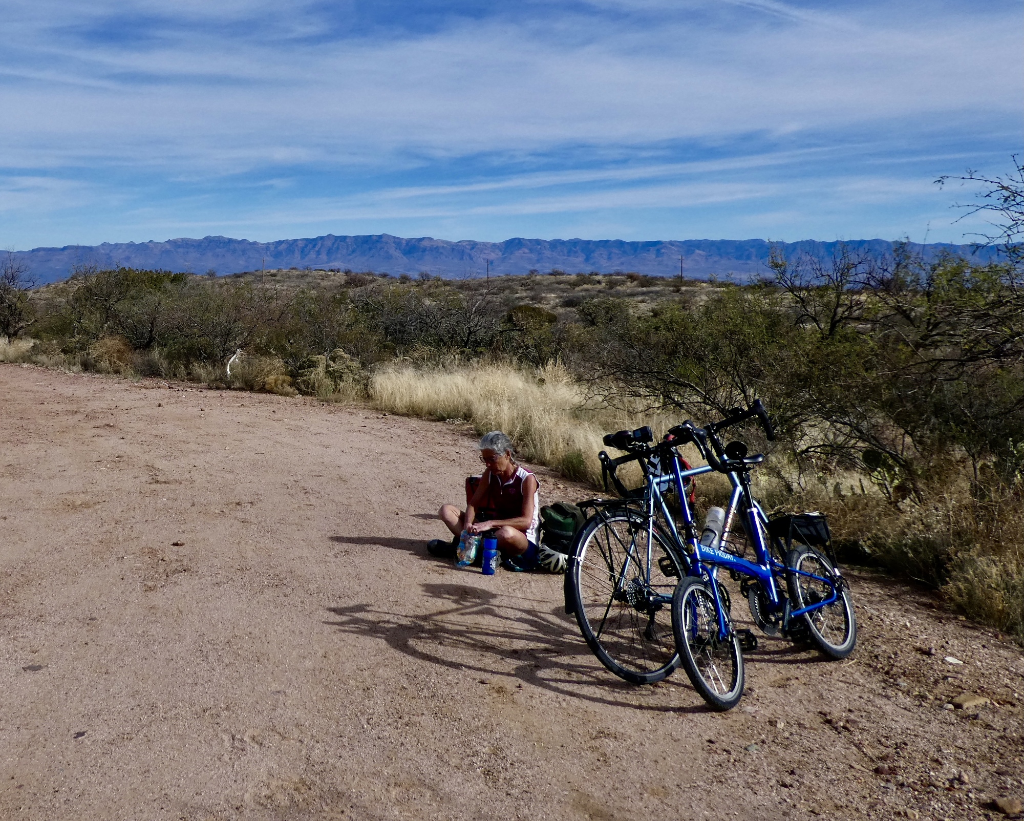
After about three miles the pavement ends, as expected - but as those horse riders said, the surface beyond isn’t too bad. At first it’s actually quite nice, a fairly smooth clay that’s easier riding than a lot of the cracked asphalt we’ve been seeing lately. We keep going for another two miles until it degrades further and becomes rocky before finally deciding it’s time. We’re both really glad we came out this far, because it’s so beautiful and quiet out here, the best part of the day’s ride.

| Heart | 0 | Comment | 0 | Link |

| Heart | 2 | Comment | 0 | Link |

Video sound track: Miles From Nowhere, by Cat Stephens

| Heart | 1 | Comment | 0 | Link |

| Heart | 2 | Comment | 1 | Link |
So we turn back. A mile later Rachael announces that it’s time for lunch so we find a wide spot in the road to squat on the ground and enjoy our turkey and cheese sandwiches before continuing on. A few miles further on we’re back at the junction and turn on Webb Road, back on plan again.
| Heart | 1 | Comment | 0 | Link |

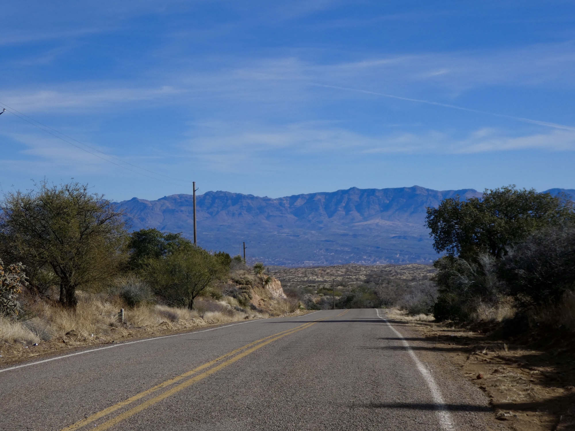
Descending Webb Road is an awesome experience, the road virtually empty and the view spectacular. We continue on biking into this wonderful view for six miles, dropping at a fairly steady five or six percent and trying not to dwell too much on the fact that we’ll be climbing back up in the warmest part of the day before long.


We stop dropping when Webb Road ends at the junction with Veterans Memorial Highway at the outskirts of San Manuel. I’d been curious about what San Manuel is like, envisioning some old desert outpost with character, but from the road anyway there’s nothing so see. It looks from the map like it’s just a small sprawling development in the middle of nowhere. I wonder why it exists?
We ride Veterans Memorial Highway for about five miles as it continues south - a long, straight and fairly uninteresting shot that is more or less on the level, about four hundred feet above the river. It ends at a bend where it becomes Redington Road and drops toward the river. I’d like to continue on down to the river and follow it to pavement’s end, and I imagine we will someday. Today though we’ve squandered our time on that spur out Mount Lemmon Road - and with a long, hot eight mile climb ahead it’s time to turn back.

| Heart | 1 | Comment | 0 | Link |

| Heart | 0 | Comment | 0 | Link |

| Heart | 1 | Comment | 0 | Link |
Ride stats today: 42 miles, 3,400’
Today's ride: 42 miles (68 km)
Total: 1,596 miles (2,569 km)
| Rate this entry's writing | Heart | 7 |
| Comment on this entry | Comment | 4 |
2 years ago
2 years ago