February 8, 2021
That big mountain to the north
Gone to the mountain, mountain come to me
I see the mountain and that is all I see.
The Mountain, Dave Carter
Today’s assault on Mount Lemmon almost gets off to a poor start. As I’m folding up my bike to load it into our new car, I’m chagrined to see that there’s a thumb tack embedded in the front wheel. It’s not flat, but I fully expect it to flatten with a whoosh as soon as I extract the tack. Surprisingly though, the tube is fine. Apparently the tack didn’t fully penetrate the tire. Rah, Schwalbe Marathons!
We’re rapidly becoming quite fond of our newest family member as we gain experience and knowledge. Today’s discovery is how great the sound system is, and that it can be paired with Rachael’s smartphone to play the extensive catalog of favorites she has loaded there. Prophetically, The Mountain comes up as we drive out to the start of the Catalina Highway, the base for our ride. It’s one of our favorite Carter/Grammer songs, and it’s almost revelatory to hear it with such fine sound quality after years of listening through the inferior speakers of the Jetta.

| Heart | 1 | Comment | 0 | Link |
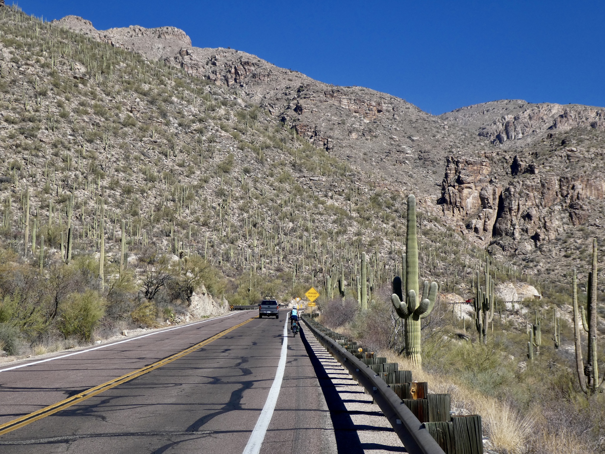
As many of you know already, the Mount Lemmon climb is exceptional, and an absolute delight. Starting at an elevation of 2,500’, it’s 25 miles to the summit. After a generally flat warmup for about five miles, the next 20 climb at a very steady 5-6% grade, eventually topping out at 8,200’. From the summit the road continues for another five miles before the pavement ends, dropping several hundred feet and then rising again.
This is the third time we’ve taken a shot at this climb. The first, in the late autumn of 2016, set the standard for us. Coming the year after our tour of the French Alps, we were probably as strong as we ever were or will be again, and certainly more so than now. We biked to the summit and then a few miles past, on a 58 mile out and back. We thought it was one of the best climbs of our lives, and were surprised it wasn’t harder.
By chance, our second ascent took place exactly one year ago, also on February 8th. This wasn’t by design - I wasn’t aware of this coincidence until writing today’s post. We didn’t climb nearly as far the second time, stopping at the Hoodoo Vista at about 6,800’. It was still the fabulous climb and descent we remembered from three years earlier, but we were held back by colder conditions and because Rachael was suffering from congestion.
We’re open minded today about how far we’ll get this time. We haven’t been doing much climbing at all this year and are short on confidence. We don’t really expect to reach the summit, but we’ll see how it goes.
It’s just past 10 as we roll out of the Safeway parking lot and start riding east. Conditions are perfect - it’s about 60 when we start out, with an expected high of 70 in the city and 50 up top. Winds are mild, and it’s a brilliantly clear, cloudless day.
| Heart | 3 | Comment | 0 | Link |

| Heart | 1 | Comment | 0 | Link |

| Heart | 1 | Comment | 0 | Link |

| Heart | 1 | Comment | 0 | Link |


| Heart | 2 | Comment | 0 | Link |
The climb goes fairly easily for the first 10 miles or so. Traffic is really light today, lighter than on either of the previous two climbs. We both feel stronger than expected, and other than for photo stops there’s no need to break. I’m not even pushed off my large chainring until we come to a steeper stretch at about 5,500’. The remaining miles come a bit slower after that for both of us, and I’m starting to feel the effects of the elevation.
I round the bend just past the stunning San Pedro lookout, and find Rachael stopped on the shoulder snacking and waiting for me. She’s ready to turn back, which suits me fine. We’ve done better this time - we’re three miles beyond where we stopped last time and only two miles from the summit now, but this is enough for today.

| Heart | 2 | Comment | 2 | Link |


| Heart | 1 | Comment | 0 | Link |


| Heart | 2 | Comment | 0 | Link |

| Heart | 3 | Comment | 0 | Link |

| Heart | 1 | Comment | 0 | Link |


| Heart | 2 | Comment | 2 | Link |

| Heart | 2 | Comment | 0 | Link |

| Heart | 3 | Comment | 0 | Link |

| Heart | 1 | Comment | 2 | Link |
It’s cool up here, but not as much so as we expected. We brought long pants and warm gloves just in case, but an added layer is enough. We fly down the mountain for the next hour, stopping only for the snack stop at Windy Point and to shed our extra layer when we near the bottom. It is such an incredible descent. The slope is modest enough that you can just let go, especially being slowed down as we are today by a late afternoon headwind. The views, so amazing on the way up, are even more spectacular whizzing down mountain at 20+ mph. I could never get tired of this mountain, and I hope we make it down this way again while we still have another climb in us.
It’s just coming on four when we make it back to the car, happy to see it still waiting for us in the lot. The timing is perfect - we’re back in town at half past, just as Bacio opens up for the evening. We were thinking of ordering a pizza to go, but with conditions like this it’s irresistable not to sit out on the patio again. And better this way too, because we find we’ve still got room to split a hefty slice of tiramisu at the end.


| Heart | 2 | Comment | 0 | Link |

| Heart | 4 | Comment | 0 | Link |


Video sound track: The Mountain, by Dave Carter and Tracy Grammer
| Heart | 1 | Comment | 2 | Link |
3 years ago
Ride stats today: 47 miles, 5,200’; for the tour: 2,638 miles, 98,900’; for the year: 31 riding days, 1,375 miles, 41,900’, and 2 flat tires
Today's ride: 47 miles (76 km)
Total: 2,639 miles (4,247 km)
| Rate this entry's writing | Heart | 6 |
| Comment on this entry | Comment | 5 |
3 years ago
3 years ago
3 years ago
If/when you make it back to Tucson, you should at least drive up. The views are well worth it.
3 years ago