December 27, 2020
Sasabe Road
We didn’t take our preferred ride today. We woke up wanting to bike out to the East Unit of Saguaro National Park and ride the eight mile loop through it. We’ve ridden it before, and it’s really a magical experience. Then we remembered that it was Sunday, and a poor choice for a visit. Why go out there when the road will be most busy when we can go any day of the week?
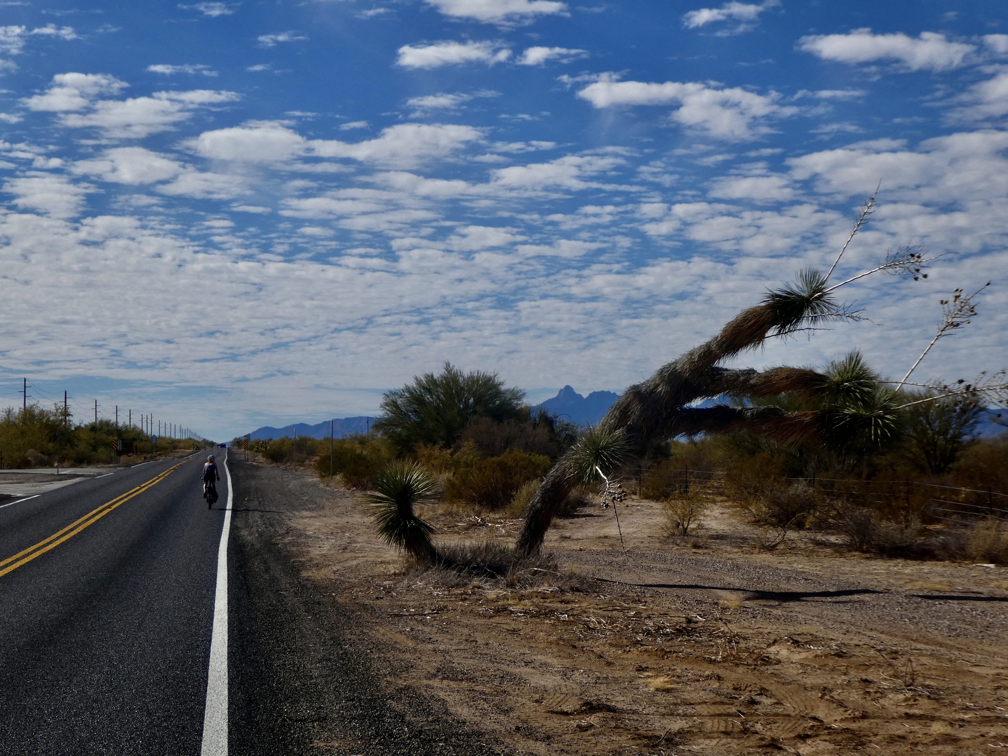
We’re ready for a change from the Loop though, so we scanned our inventory of candidate rides and came up with Sasabe Road. This is a north south minor highway through the desert that ends at the town of Sasabe at the Mexican border. I targeted this road after staring from our lunch stop on Aravaca Road at what we thought (incorrectly, as it turns out) was Kitt Peak off in the distance. Afterwards I went back to look over maps for other roads that would give us a closer look. If you’re fixed on pavement as we are, Sasabe Road is your only choice on this side of that range.
So, as good a day as any. We throw the bikes in the hold and drive twenty miles west out the Ajo Highway to Three Points, the northern end of Sasabe Road.

| Heart | 3 | Comment | 0 | Link |
| Heart | 1 | Comment | 0 | Link |

| Heart | 2 | Comment | 0 | Link |

| Heart | 2 | Comment | 1 | Link |
https://en.wikipedia.org/wiki/Yucca_elata
Nice chainfruit (jumping) cholla off to the right.
https://en.wikipedia.org/wiki/Cylindropuntia_fulgida
And lots of olive drab leaved creosote bushes in the background. One of the most interesting plants around.
https://en.wikipedia.org/wiki/Larrea_tridentata
The little bushes in the foreground might be any of several difficult to ID little desert bushes... (unless they are blooming).
3 years ago
It doesn’t take long to realize that we were wrong last week in thinking we were looking at Kitt Peak. The real mountain is lower elevation, more rounded, and it’s easier to imagine it having a road that you can bike up to the top.
So that’s the big discovery for this ride. That’s about it though. Before taking this ride I did some research and couldn’t find any descriptions of it as a biking route. I think we know why now - it’s not the most interesting ride. 20+ miles of an almost imperceptibly slow climb through barren desert, followed by a matching descent back to the car. Freshly surfaced chip seal, no shoulder, light traffic about 70% of which are Border Control vehicles.
The mountains make a nice backdrop, but are always well off in the distance. No place at all really to pull off and stop anywhere for a break - we had our lunch standing up, leaning against a gate staring at the real Kitt Peak. And almost no bird activity at all - one raven, one meadowlark. One ranch, one horse, three cows.
So, definitely a one and done kind of ride. Not bad, but not compelling enough to come back. I think we would have enjoyed it much more with a smoother road surface, but 40 miles of chip seal does wear on one’s sit bones eventually. It is nice though to know what the real Kitt Peak looks like.

| Heart | 2 | Comment | 0 | Link |

| Heart | 1 | Comment | 2 | Link |
3 years ago

| Heart | 2 | Comment | 2 | Link |
https://www.tripadvisor.com/FAQ_Answers-g60924-d143229-t1377022-What_is_the_difference_between_pipe_organ_and.html#:~:text=3%20answers&text=The%20saguaro%20(Carnegiea%20gigantea)%20is,tallest%20cacti%20in%20the%20world.&text=Saguaros%20grow%20their%20%22arms%22%20high,its%20arms%20from%20the%20base.
3 years ago
3 years ago

| Heart | 2 | Comment | 1 | Link |

| Heart | 2 | Comment | 0 | Link |


| Heart | 2 | Comment | 0 | Link |

| Heart | 1 | Comment | 0 | Link |

| Heart | 3 | Comment | 0 | Link |

| Heart | 3 | Comment | 1 | Link |

| Heart | 3 | Comment | 2 | Link |
And asked me if I like to skate
I got out my board
From where it was stored
In the pannier next to the bait.
3 years ago
3 years ago

| Heart | 1 | Comment | 0 | Link |

| Heart | 1 | Comment | 0 | Link |
Video sound track: Bad to the Bone, by George Thorogood
| Heart | 0 | Comment | 4 | Link |
I'm enchanted with all of the cacti and would love to go back for a visit.
3 years ago
3 years ago
Ride stats today: 44 miles, 1,000’; for the tour: 1,339 miles, 47,500’
Today's ride: 44 miles (71 km)
Total: 1,319 miles (2,123 km)
| Rate this entry's writing | Heart | 8 |
| Comment on this entry | Comment | 0 |