August 23, 2023
Finding the Route
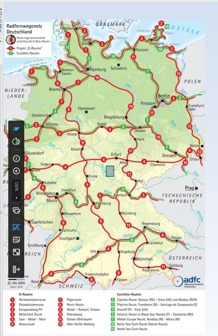
We have been great fans of map books geared to named bikeways, of the sort that usually have signage directly on the route. The most extensive library of these that we know is the "Bikeline" series from the Esterbauer company. Bikeline mostly covers Germany, but does have some titles for other countries, such as the Jakobsweg (Camino Santiago) in Spain. Bikeline's business is in describing existing routes, while someone else (like a state government) is putting up the actual route signs. In recent years, you get not only detailed and conveniently sized maps, but also downloadable GPS tracks. We really loved all this, as evidenced for example by our 2014 Grampies Go By The Books, in which we hop on and off 19 of the darn things, in Germany, Austria, and France.
But wonderful as the themed routes are, they do have a couple of shortcomings. For one, even in Germany, they do not quite go everywhere.
| Heart | 2 | Comment | 0 | Link |
This same type of map for France, for example, would look more sparse again, and for Spain and Portugal, it's thinner yet. This is not to say these places do not have bikeways - there are swarms of them all over - but here we are talking about the long distance, mapped, signed variety.
The second shortcoming is that themed routes often want to stick to their theme. The most common would be a river route. In such cases, the track might be forced to deviate here and there from a river's course, but in general where the river goes is where it is going. Other routes, like the Romantiche Strasse, will be trying to stick to maybe a Roman road, but might also be swayed by a slightly off route town that really wants the tourist traffic.
When a route is sticking to a theme, it may seem to "wander off", if you are actually trying to get somewhere. And it may go up and down mountains, valleys, and headlands for the sake of the theme. In Portugal last time, we struggled with "Eurovelo 1", which had a theme something like "stick to the beach".
Jon Ayling in Bohemian Rhapsody dealt with this in his page "Avoiding the Big Red Cycle Routes", where the Saale radweg tried to run him ragged.
This time around, while not absolutely avoiding the cycle routes, we are finding ourselves more prone to "bushwack", on the regular road network. We got nudged into this early in our route planning when "an alert member of our team" noticed that Eurovelo 2 wanted to steer us through the foothills of the Harz Mountains. The hills did not seem too inviting, but this is also the place where (in the play by Goethe) Mephistopheles took Faust to get corrupted in satanic orgies. Thanks EV2, but we are too old for such orgies just now!
Consequently, we decided to drop by Quedlinburg, on the edge of the Harz, but then to keep farther north, on our way west. The next major route to the north is the Elbe River, but that seemed too far north, somehow. Consequently we decided to "bushwack" between EV 2 and the Elbe.
This decision threw us firmly into the arms of the routing programs (or algogrithms, or apps). The best known of these is no doubt Google Maps. We began by throwing Google Maps an ordered list of all the places we would like to touch, on our general push west, to Valencia on the Mediterranean coast of Spain. Google Maps did this confidently, in a nano second, so we were set - right? Well maybe, but doubts crept in about possible quieter or more interesting bikeways that Google might hide from us, because unlike the themed routes it has no axe to grind and just proposes to get you there quickly, subject to the roads chosen being more or less appropriate for bikes.
That then led us to some other thoughts: What would some of the more popular bike routing sites say about the route? Do they pay attention to things Google might ignore? And anyway, do these sites tend to choose an established bikeway, given the chance? Will they go out of their way to grab one? Can you feel the Grampies now spinning their wheels with respect to routing?
We carried on spinning those wheels, now asking ourselves "which do we mean by the more popular routing sites?", not to mention "how, in detail, do you actually work each one?" and "how much is each one charging, and for which features?".
We limited the sites we looked at to Google Maps, bikemap.net, cycle.travel, Komoot, and Ride With GPS. Fortunately for our sanity, we ignored lots of others - like Strava and bikecitizens.net and mapmyride!
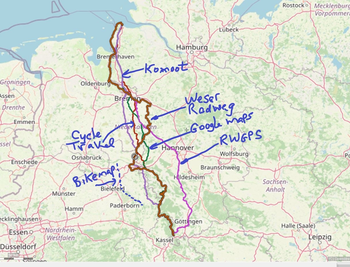
We were also not about to work with five sources second guessing each bit of our Google Maps route. So we cooked up a fairly simple test for them all. As it happens, its not even on our current route, but its close. It's the approximately 365 km run from Cuxhaven - on the North Sea near Hamburg, down to Hann Munden, loosely on the way to Frankfurt. This is the path, more or less, of the Weser river, and of course it has a Weser bikeway. The map below shows how each of the sources handled the route. Bikemap.net is not shown in detail, because they charge for the GPS file. The main things we found were:
- No route planner, except Bikeline, voluntarily used the river bikeway.
- Everyone had a different idea of how to go. The shortest route belonged not to Google but to Komoot, at 353 km. Cycle.travel had the longest route among the algorithms, at 385 km. No wonder none followed the bikeway with Bikeline, since that was 523 km!
- RWGPS inexplicably swung out east, to go straight through Hanover city.
- Bikemap.net curved out west, almost reaching Bielefeld.
It would take a lot more research to decide which algorithm to trust, based on this one sample. And maybe it makes no difference - perhaps all the ways are fine?
We decided on one more, even simpler test. We happen to know that in Portugal, between the towns of Santa Comba Dao and Viseu, there is an absolutely glorious rail trail, loosely following the Dao river. The alternative is the not terrible but quite busy near Viseu highway N2. Would the algorithms find the rail trail? The answer is yes, except for Google Maps, which stuck with the highway. Oh, oh.
Despite the Santa Comba result, we are going to start out with the Google route. If we become unhappy at any point, then we'll call on our friends RWGPS and Komoot to get us out of trouble. We also have the tracks of several bikeways loosely on our way - like EV 3, EV 8, Veloroute du Nord, etc. We may hop on one or more of those at the drop of a hat.
| Rate this entry's writing | Heart | 4 |
| Comment on this entry | Comment | 1 |
8 months ago