June 22, 2013
Day 40 - ending near Harrisburg, NE
Posted via email Sun Jun 23 09:24:01 2013 PDT
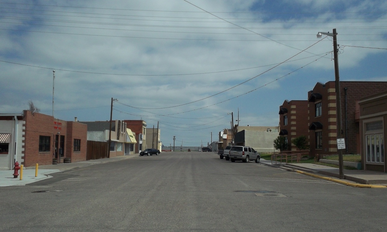
It rained overnight for about an hour, starting at 12:30am. Not too much wind or lightning. Got up at 5:17am. Went outside and wiped the excess water off the tent. Headed off on the empty bike to the west end of town for breakfast. Couldn't find a place open, so went to the Conoco gas station. I asked them if there is a sit-down place in town to get breakfast. They said yes, the Cafe 307 right next door. I'd passed the place, but didn't think they were open, since no cars were out front.
There were just a few customers at the cafe, and an efficient waitress. I had the 2+2+2+2, coffee, orange juice, and a scone (closest thing they had to a sweet roll). I worked on the report there at the cafe, enjoying several refills of coffee. Left there at 7:58am, going back to the Conoco for on-the-road snacks. Made it back to the campground at 8:15am.
The tent was dry now, so got everything packed up. There was a semi-truck parked next to my campsite. Every thirty minutes a buzzer would sound, and the engine would start and run for fifteen minutes. Not sure why. All packed up, I stopped at the camp's laundry room soda machine for one more can of Dr Pepper, before leaving 10:10am.
I was questioning my pre-trip planning for today's route (north first, then east), but decided to go with it. My destination today was Morrill, Nebraska, and I was thinking "motel" rather than camping. At 10:25am, I was at WY-215, ready to head north. Slight breeze from the east, later from the southeast. I stayed east of Albin, Wyoming, arriving at WY-216 at 12:35pm. Turned east toward Nebraska, arriving there at 12:42pm. After I made the turn north on CR-1 is when I noticed clouds to the northwest. They looked to me like they were heading northwest. At 1:17pm, I took a break, eating one of the Clif Bars I'd bought this morning.
I arrived at CR-18 at 1:48pm ready to turn east. The wind was now strong from the southeast, and it was slow-going on this otherwise great dirt/gravel road. After four miles, the road angled northeast into a valley. And what a beautiful valley! It was surrounded by butte-like hills full of trees and meadows. I was glad I came this way.
A little climb out of the valley, then the road turned north for a mile. I stopped at the intersection of CR-18 and CR-15 at 3:32pm, once again questioning my GPS waypoint routing. I took a break, eating a bag of peanuts. Also decided to wait some, because it looked like I was getting too close to the storm clouds to the northwest. Checked the radar using the BlackBerry. Looked like I might get rained on by storm clouds forming farther west. I was thinking about where to stop to wait-out the rain, and decided where I was would work. CR-18 splits here, going straight north to CR-15 for west-bound, and curving northeast for east-bound, making sort of a triangle area in-between. There was a nice view of the valley here, so I could see the storm coming.
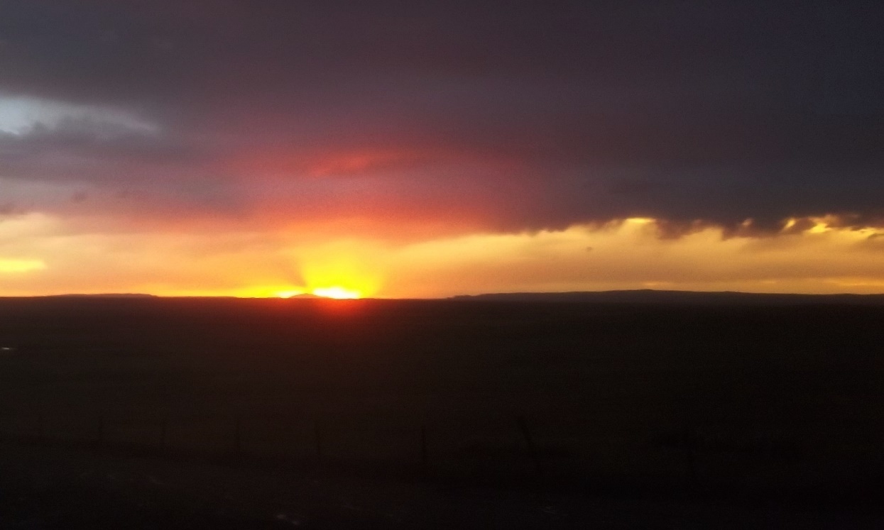
Rolled the bike to a power pole, and covered the cargo with plastic, then strapped the bike to the pole. It now looked like the storm to the northwest was coming this way. I put on my rain suit and boots. An SUV stopped at a pull-off spot at the east-side of the triangle area. A fellow got out and was looking at the storm. I walked over and asked if there were storm warnings out for this storm. He said yes, a tornado warning, and pointed a little south of west. I wasn't sure that was a tornado. He also said the warning included baseball-sized hail. He took off after recommending I keep my helmet on. Two other vehicles stopped by briefly. One driver said the tornado was buried in the rain to the northwest, and was heading this way. The other person who stopped offered to take me somewhere else. At the time, I didn't think that was necessary.
It got very dark as the storm from the northwest approached. I left the bike and took shelter in the road ditch east of the road that curves east. Wind was strong from the west, bringing the rain at 5:00pm. My rain suit was getting all dirty, and I figured out there was as much sand/grit as water in this. I'd squat down after close lightning strikes, but couldn't stay like that for long. There was some hail up to pea-sized, but not much. Finally, the wind-driven rain was over, and I came up out of the ditch. It continued to rain and lightning as the storm would lessen some, then reform. It also seemed to be moving back towards me.
I'm used to standing for long periods of time, but I sure wanted this rain to be done with. Around 8:30pm (still raining) a car slowly climbed the CR-15 hill from the west. It belongs to the County Road Supervisor, who was out checking for washed-out spots on the roads. The roads are too muddy now to bicycle on, so I asked if I may camp here at the intersection, when it quits raining. He said yes.
At 8:45pm, I gave thanks, for the rain had finally stopped. I set up the tent at the northwest side of the 'triangle', and got ready for sleeping. My clothes were wetter than I realized. Glad I have dry stuff along. Hmm . . . I've got grit in my hair again!
Jeff
------------
Spent: $12.59 plus $3 (breakfast) + $9.24 (snacks) + $0.75 (soda) = $25.58.
| Heart | 0 | Comment | 0 | Link |
+ plus signs indicate pictures added after returning home from the trip +


| Heart | 0 | Comment | 0 | Link |


| Heart | 1 | Comment | 0 | Link |

| Heart | 0 | Comment | 0 | Link |


| Heart | 0 | Comment | 0 | Link |


| Heart | 2 | Comment | 0 | Link |

+ Post-trip research revealed that there was indeed a tornado in the storm I stood through: Banner County EF1 Tornado, June 22, 2013 +

Today's ride: 35 miles (56 km)
Total: 1,632 miles (2,626 km)
| Rate this entry's writing | Heart | 2 |
| Comment on this entry | Comment | 2 |