July 7, 2008
Day 3: To Sunset Beach State Park
Today's ride is very different from the previous two days. Traffic! Long lines of trucks and motor homes whizzed by me on Highway 101 as I pedaled south to Coos Bay. The road has a very narrow shoulder in many places.
First I went down the hill to see the Umpqua river lighthouse in daylight. It's hard to get a pleasing picture because it's surrounded by ugly buildings.

| Heart | 1 | Comment | 0 | Link |
Then I pedaled back up the hill to US 101 and headed south through the dunes. Big hills, but almost always a tailwind. The highway stays well inland to Coos Bay.

| Heart | 0 | Comment | 0 | Link |

I stopped and hiked the 1-mile John Dellenback nature trail. Half the trail is in forested dunes and half the trail is on bare sand which is much more work to walk on. The sun was shining and the dunes looked great.


| Heart | 0 | Comment | 0 | Link |

| Heart | 1 | Comment | 1 | Link |
1 month ago
Then onward to the Coos Bay bridge. I biked across this bridge in 1989 on a calm day. This time I have a 40 mph crosswind. It wasn't difficult to bike the narrow walkway on the concrete portion of the bridge. I just had to be careful because the concrete railing is at knuckle level. The 40 mph crosswind was consistent and easy to deal with. But I couldn't ride the narrow walkway when I got to the metal portion of the bridge. The crosswind is too variable because big metal beams periodically obstruct the wind. I walked the metal portion, then resumed pedaling down the concrete section. This is a treacherous bridge when it's windy.

| Heart | 1 | Comment | 0 | Link |

| Heart | 1 | Comment | 1 | Link |
1 month ago

| Heart | 1 | Comment | 1 | Link |
1 month ago
In Coos Bay I stopped for groceries and lunch at a Chinese buffet restaurant. It was mostly sunny and the temperature was 65F. Kind of chilly because of the wind, though. I continued on the bike route towards Charleston.

| Heart | 0 | Comment | 0 | Link |
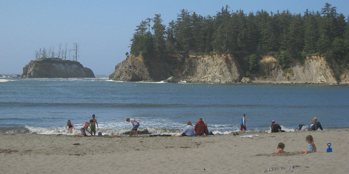
My destination for the night is Sunset Beach State Park on the Cape Arago highway. The park is 3 miles off the coastal bike route on a very scenic cape. I arrived at 3:15 PM and got a $4 hiker/bike campsite. Once again I had the hiker/biker site to myself. Then I went out exploring the area. The first stop was Sunset Beach.

| Heart | 0 | Comment | 0 | Link |
Then I biked to the end of the road at Cape Arago, stopping to hike a couple sections of the coastal trail. The road has good ocean views. The trail has even better views, including a view of the elusive Cape Arago lighthouse.

| Heart | 1 | Comment | 0 | Link |
I went to the end of the road at Cape Arago State Park. I found the trail that goes down to tide pools, but it was nearly high tide. So I headed back to the campsite.


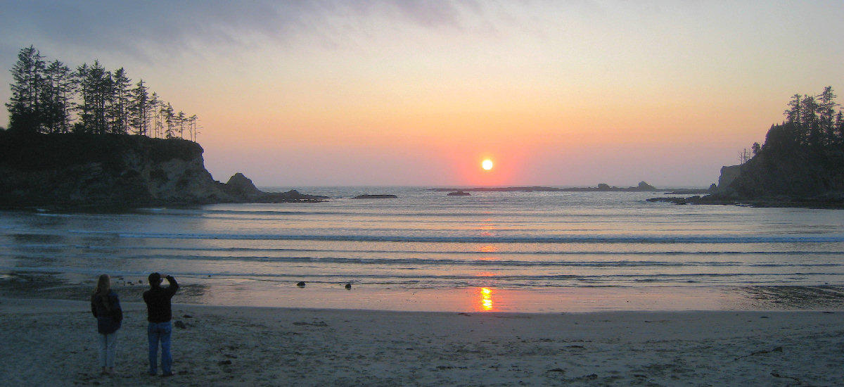
After a shower and dinner I went 1/2 mile back to Sunset Beach to watch the sunset. It was a good ending to a good day. Cape Arago is somewhat of a secret coastal hideaway because it's miles from busy US 101.
Today was unusually windy even by coastal standards. But it was mostly sunny and I had a tailwind most of the time. The high temperature was 65F which is about normal. Mileage was low today but I saw a lot of things and hiked 3 miles.
Distance: 43.4 miles (69.4 km)
Climbing: 1962 feet (595 m)
Average Speed: 10.3 mph (16.5 km/h)
Maximum Speed: 32.5 mph (52 km/h)
Hiking: 3 miles (4.8 km)
Today's ride: 43 miles (69 km)
Total: 172 miles (277 km)
| Rate this entry's writing | Heart | 2 |
| Comment on this entry | Comment | 0 |