May 5, 2020
Almota Road
Today is perfect. Sunny, warm, light winds; a day we should make the most of. With rain and severe winds in the forecast for tomorrow, we opt for a bit longer ride than we’ve been taking lately, knowing that we’ll just be loafing around the apartment tomorrow. We’re going to bike to Colfax, taking the long way around - a nice 47 mile loop with a bit of climbing.
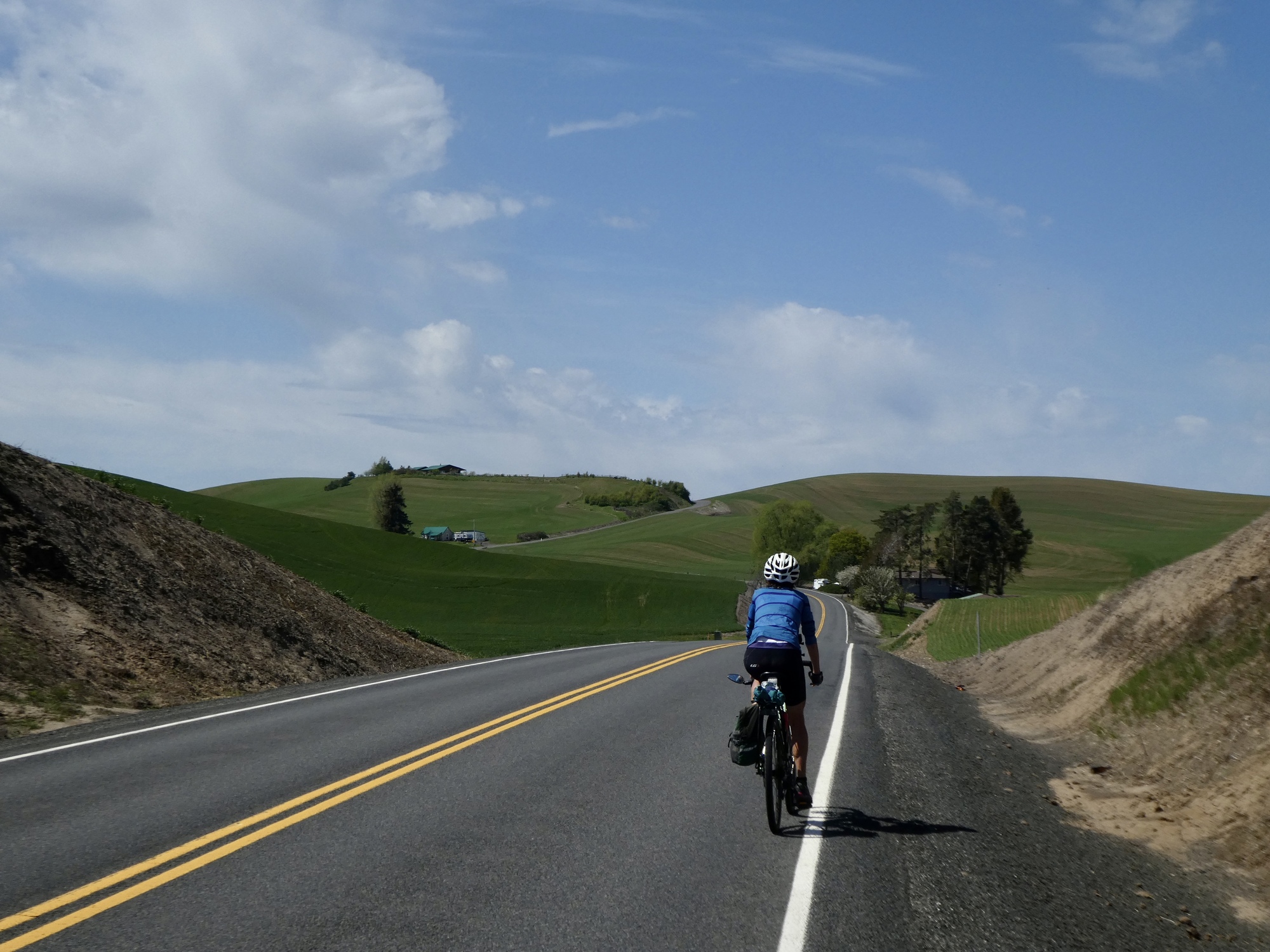
We begin by biking west out Wawawei Road/Route 194, reversing the last part of the first ride we took here, that 25 mile loop through Albion. Wawawei is a beautiful cycling road, especially going in this direction with the open country spreading out in front of you. If you continue on this direction it eventually drops to the Snake River and then continues upstream along the river’s edge all the way to Lewiston and Clarkston. Someday before we leave here, we’d like to make a two day 90 mile loop out of it, biking to Clarkston along the river one day and then taking the high route back by climbing up the fabled Old Spiral Highway.
Wawawai (rhymes with Hawaii), by the way, is the name of a former orchard town. Now 80 feet under water, it was inundated by what is now Lower Granite Lake when the Lower Granite Dam was completed in 1975. The town’s name was originally Wawawa, the Nez Perce word for council ground.

| Heart | 2 | Comment | 0 | Link |

| Heart | 2 | Comment | 0 | Link |
| Heart | 4 | Comment | 0 | Link |
We’re saving that steep 2,000’ drop to the Snake for another day though. About 6 miles into the ride Route 194 and Wawawai Road separate, with 194 turning north toward Colfax. We follow it for another four miles, gradually dropping as we follow slender Union Flat Creek and still reversing our Albion Loop ride. At the bottom we finally leave that route and continue on 194 as it climbs away from Union Flat. From here on out we’re finally seeing new territory.

| Heart | 1 | Comment | 0 | Link |

| Heart | 2 | Comment | 2 | Link |
3 years ago

| Heart | 3 | Comment | 0 | Link |


| Heart | 1 | Comment | 2 | Link |
3 years ago
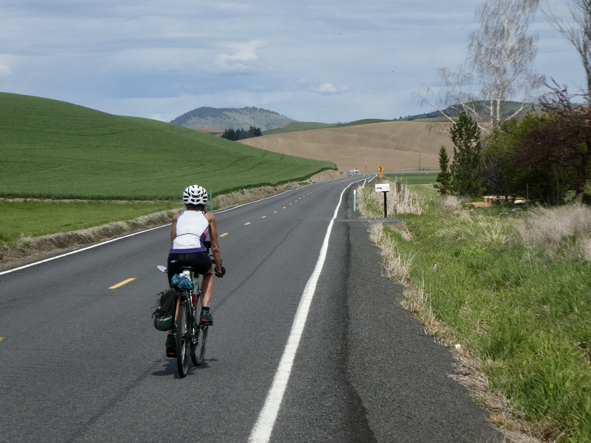
After a short, moderate climb up from Union Flat Creek, we leave the forested valley behind and enter what must be the most breathtaking stretch of the Palouse that we’ve biked through yet - an unending expanse of gently rolling, velvet hills. Freshly plowed earthen slopes contrast with emerald green fields of young wheat. After topping out, we enjoy a glorious coast down through this ethereal wonderland for the next five miles.

| Heart | 2 | Comment | 0 | Link |


| Heart | 4 | Comment | 5 | Link |
Here's a limerick:
Rocky had a friend named Lois
They rode bikes through Palouse on the Loess
A dirty afair, but colorful where
Loess got in hair of poor Lois.
(OK .. it's a stretch, but maybe just a little entertaining?)
3 years ago
3 years ago

Like Wawawai Road, Highway 194 continues on and eventually reaches the Snake River at the small riverside community of Almota. That looks like it would make a fine out and back,so we may be back here again someday soon. Today though, our plan is to bend north on Almota Road and follow it to Colfax before turning back toward Pullman.
Almota Road looks like a beautiful ride also, except for the worrisome roadside sign just before the junction that warns of a highway closure 2-1/2 miles ahead. We’re not even sure which road it refers to - this one, or Route 194; but in either case we continue with the plan. If the blockage is on our route, perhaps it’s passable by bikes anyway; and if not, this will still be a terrific ride as an out and back.
A few hundred yards later, we come to a bend in the road. Torn up, excavation equipment around. So now we know. There’s no one around though and the road is an easy-riding dirt surface, so we continue. A few hundred yards later, we’re back on pavement again. Odd, when the warning sign indicated the closure should still two miles away, but we continue.

Video sound track: Gravity, by Jesse Cook

| Heart | 4 | Comment | 0 | Link |

| Heart | 5 | Comment | 0 | Link |
Two miles on, we come to the real issue. This one stops us cold. It looks impossibly impassible, even by bikes. We don’t even consider asking anyone about possibly letting us through, but I do bike up closer for a photograph. A minute later, a voice pipes up from my left: You’re not thinking of biking through, are you?
The voice comes from a sheriff’s vehicle. I don’t know where he came from, but maybe he’s been tracking us for awhile. I reassure him that we know we’re stopping here, and I’m just getting a photo for the memory book. We chat a bit. He says with luck the road will reopen in late summer, but he’s sceptical. He says if we did try to get through we’d be staring at a six foot cliff we’d need to scale. He also points to the rough gravel side road we could take around the closure - two miles that look like they’d be similar to yesterday’s Saddle Ridge Road. No way, today.

| Heart | 1 | Comment | 0 | Link |
So, we turn back. We backtrack for about two miles and then stop at a church to eat lunch sitting on a wall before continuing uphill on Route 194, not minding at all taking a second pass through this amazing landscape. Seven miles later, we’re back at Union Flat, considering our options.

At Union Flat, we have a choice to make. We could backtrack all the way, past the cute corgis and bald-faced colt again and home along Wawawai Road, but instead we decide to return through Albion, reversing the rest of our Albion Loop ride. It’s hillier and about five miles longer, but that’s the sort of ride we’d signed up for anyway.
It begins by climbing up Harrison Hill, from the much steeper western approach. Once over the top we briefly have a long view east to the tip of what must be Steptoe Butte, and then gradually drop to Albion. Ten miles later we’re back in Pullman climbing up Stadium Road, cursing silently to ourselves for not the first or last time this month our decision to rent an apartment at the top of a steep hill.

| Heart | 2 | Comment | 0 | Link |

| Heart | 2 | Comment | 0 | Link |
| Heart | 1 | Comment | 0 | Link |
Ride stats today: 45 miles, 2,500’
| Rate this entry's writing | Heart | 7 |
| Comment on this entry | Comment | 0 |